
Three Minus One
August 11, 2014
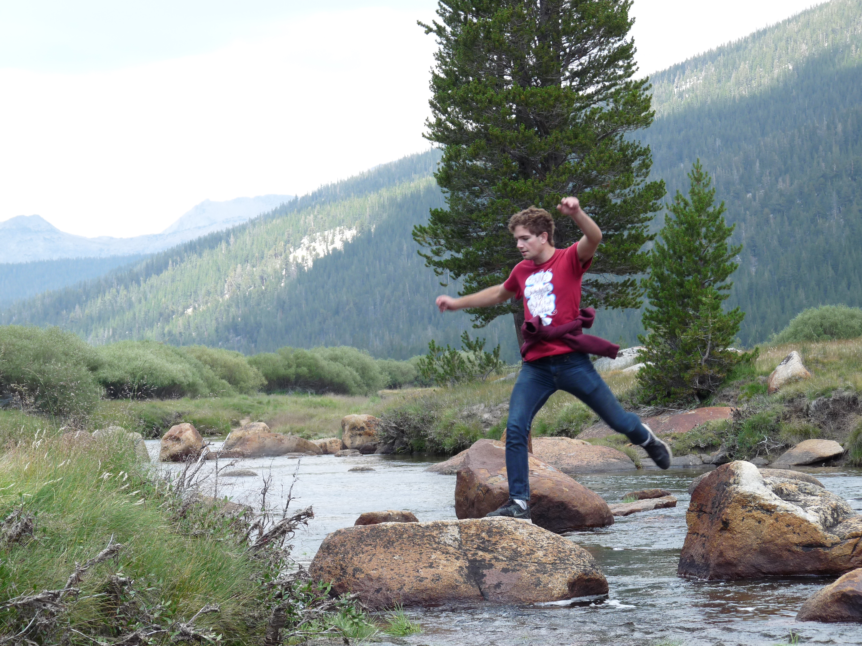
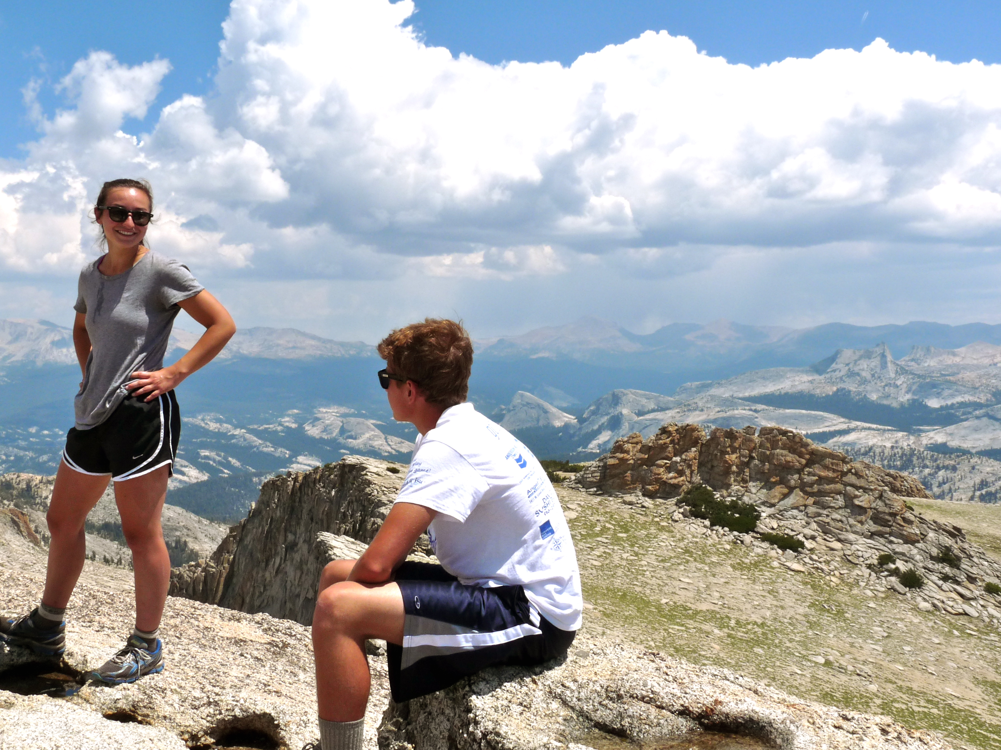
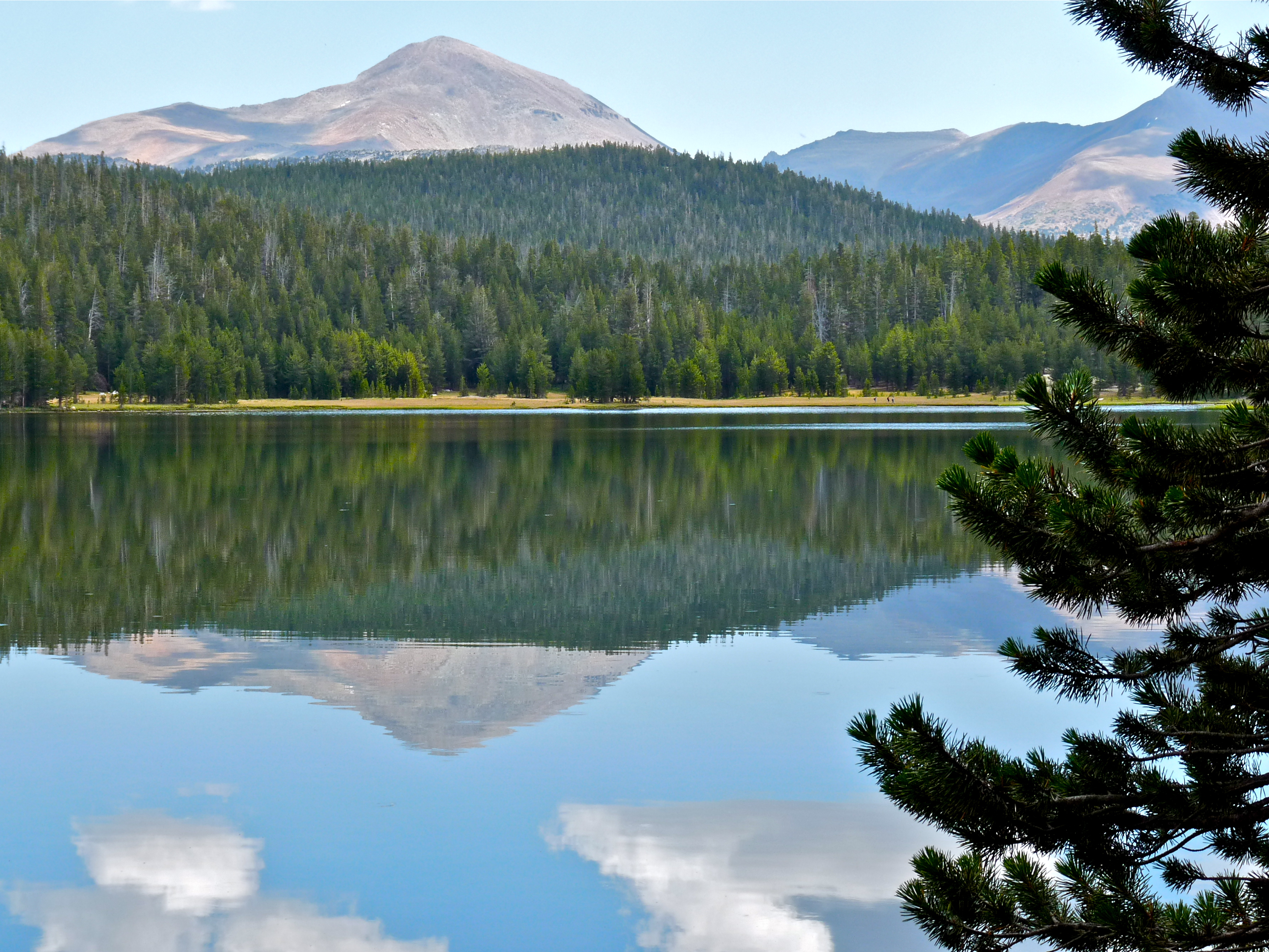
This was our last day of hiking and it was going to be the big one...we saved Mt. Conness for our final hurrah.
We had a couple things working against us, however… injuries and weather. I really wanted to go, in spite of being scared (Mt. Conness has a very exposed section on the final part of the ascent), but finally conceded I was too gimpy to even attempt it. And, the same weather pattern we’d been dealing with all week was still in effect: likely thunderstorms in the afternoon. Since climbing Conness is a full-day thing, that made summiting a little dicey.
I decided to accompany them, anyway, but not on the trail. I wasn’t very happy, but figured I could use the day to edit a manuscript (a draft of Toni’s third book).
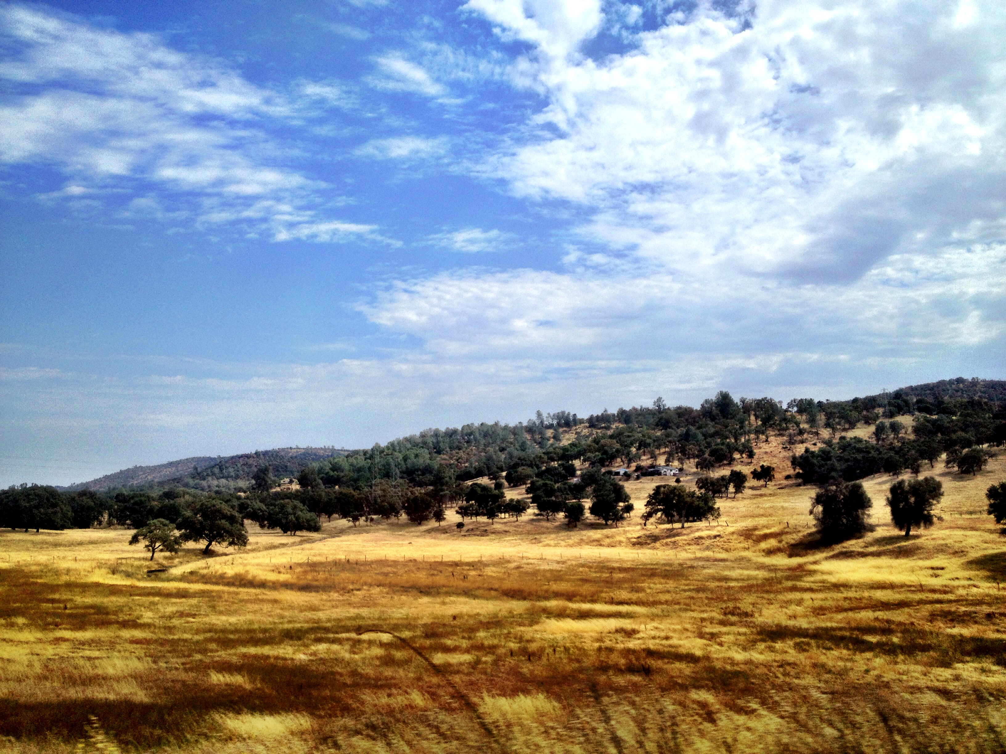
So we drove out of the park and down to the Saddlebag Lake turnoff. I dropped them off at the Saddlebag Lake campground, and then I went back up the road a couple of miles to the Tioga Pass Resort to edit, eat another breakfast (as long as I was going to occupy a table for that long) and drink lots of coffee. They were really nice in there; it was pretty cozy.

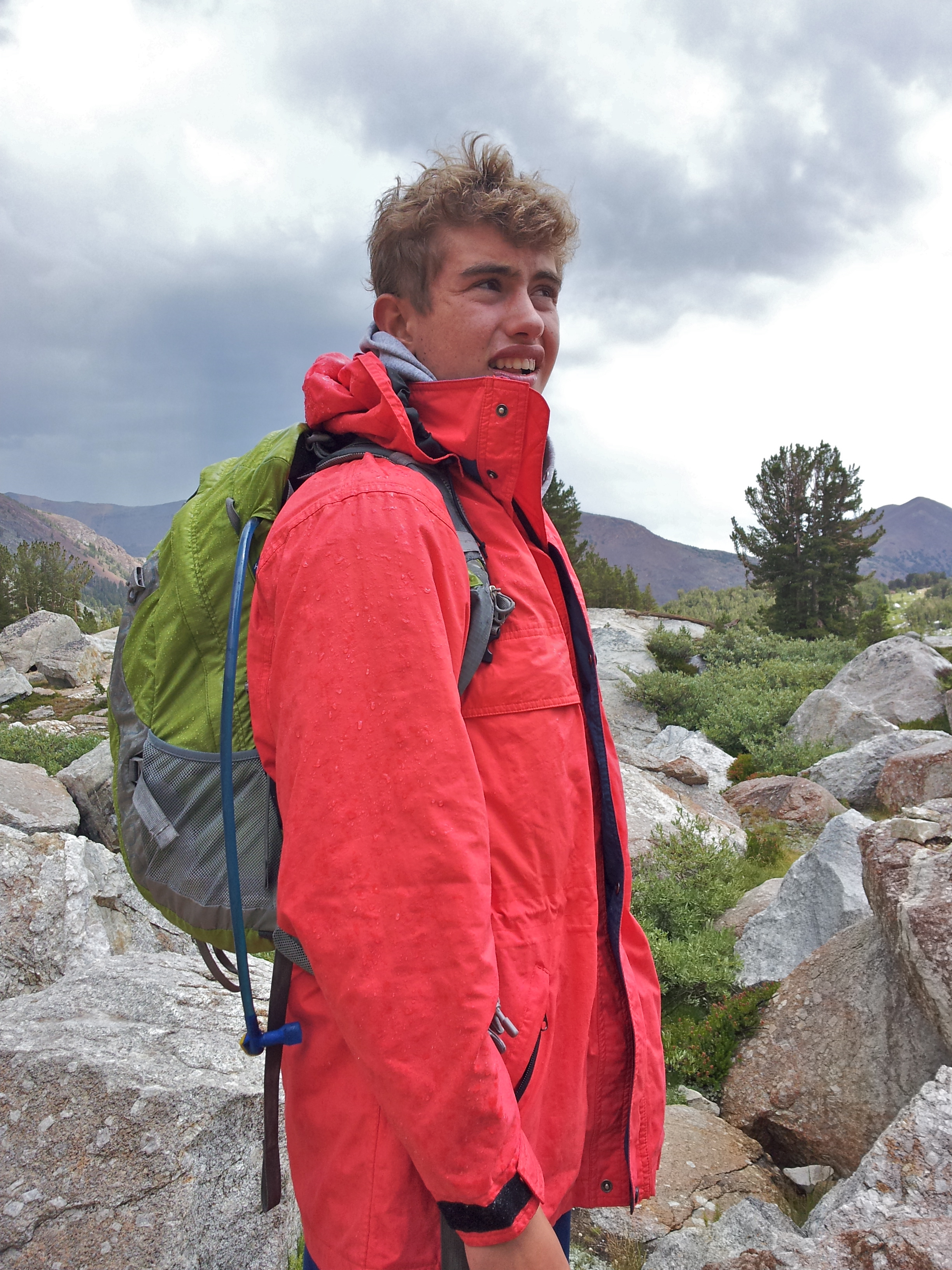
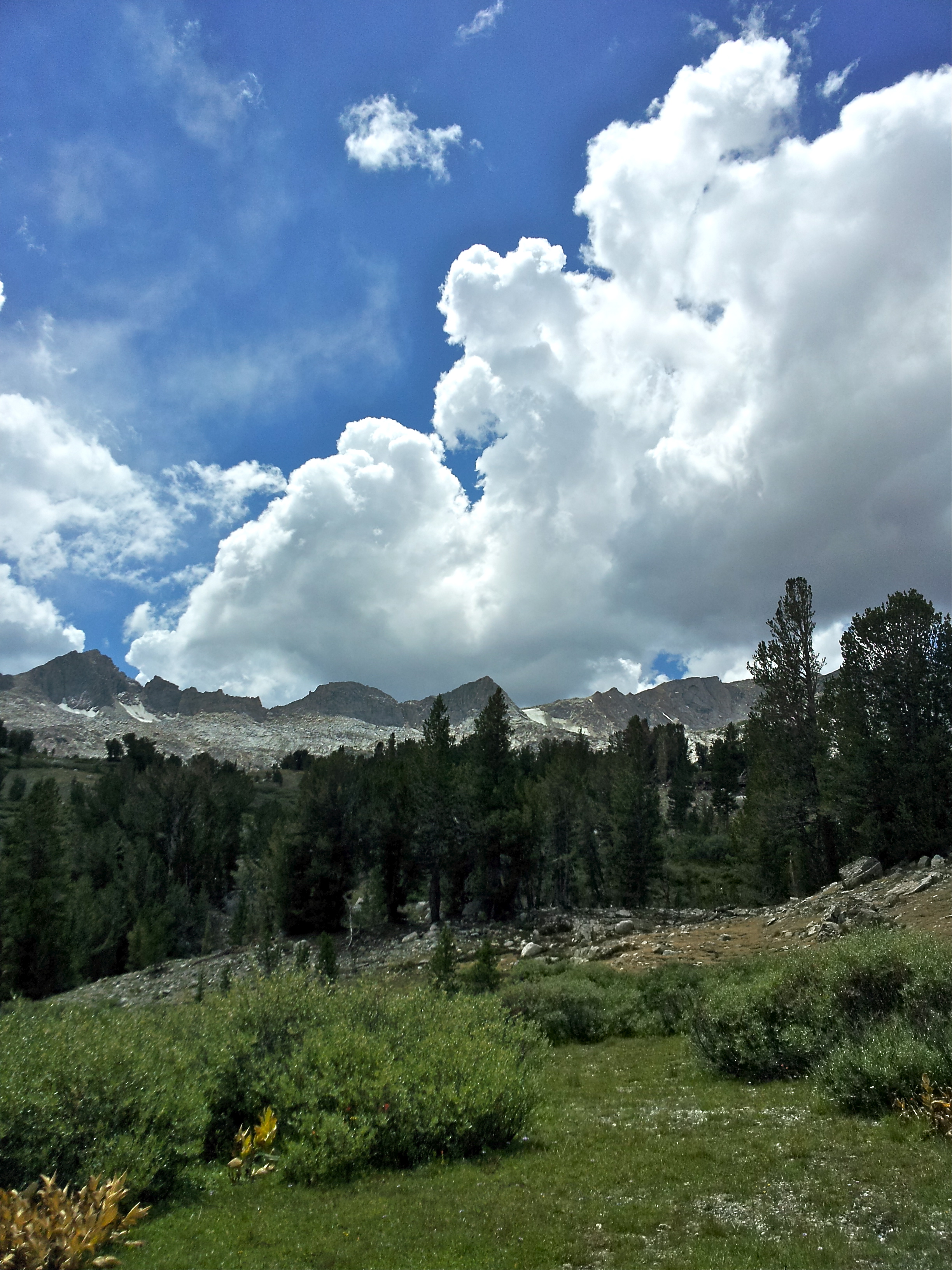
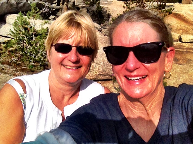
It was also lovely outside, but I was still grumpy:
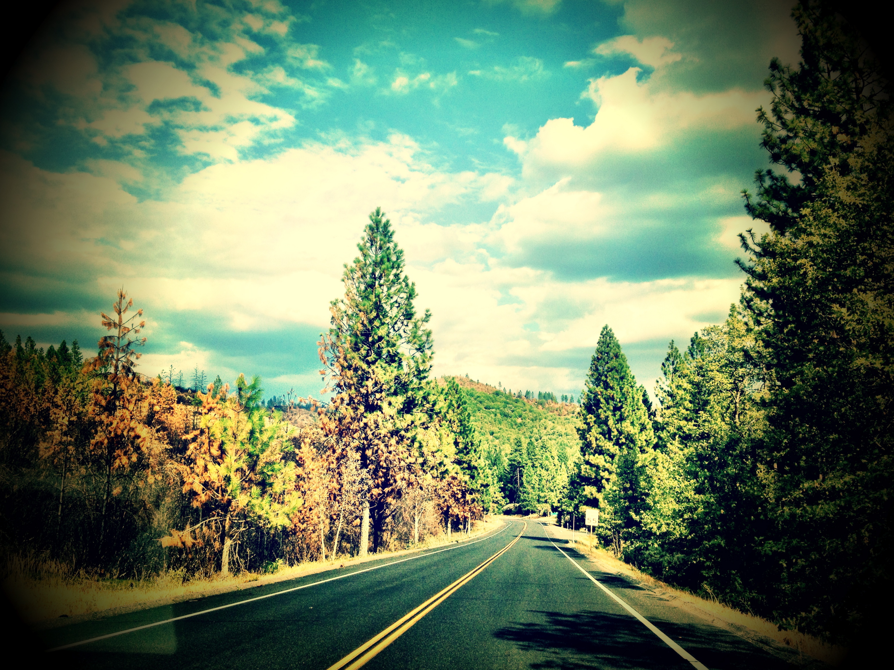
After two hours, I decided to return to the campground and just park and wait for them to return. I lay in the backseat reading and dozing. Much later in the afternoon, I took a walk (mostly to pee) and it rained on me, so I figured they’d be back soon.
Meanwhile, in much, much more exciting news….
Jim and Peter had taken off down the same trail we used the last time we attempted to summit Conness two years ago. Long story, but Jim made it that time and Peter and I did not. That is why we returned.
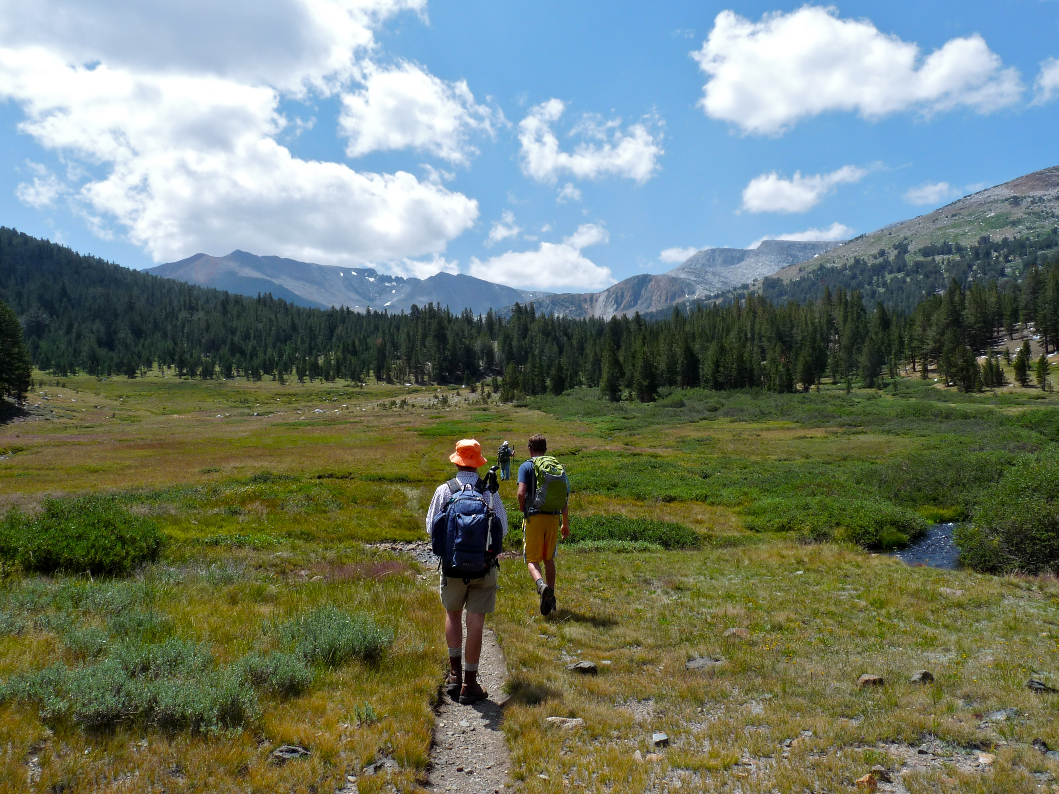
Anyway, the trail starts out solid as it heads up this long and very pretty valley (the pictures from here out are taken by Jim on his Samsung phone):

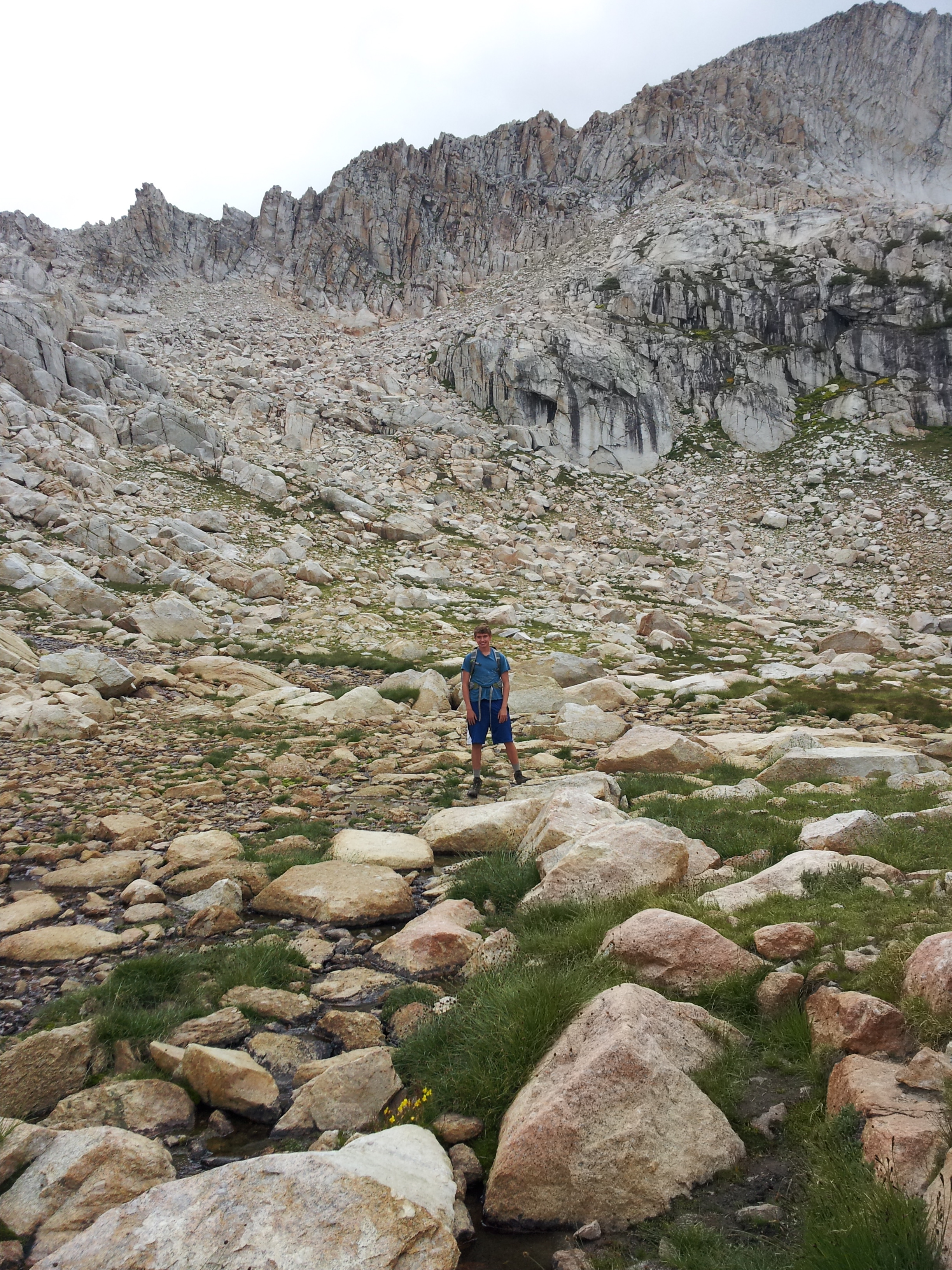
They took the trail to the very end (maybe three miles?) and instead of turning right up the talus bowl like we did last time and contouring around to the other side, they went straight, heading for a narrow chute at the top of the bowl. Here’s Peter with the slope they will climb behind him. You can’t make out the series of chutes; they are very far away:
Here’s Peter approaching one of the openings, on the other side of which is a huge, expansive plateau:
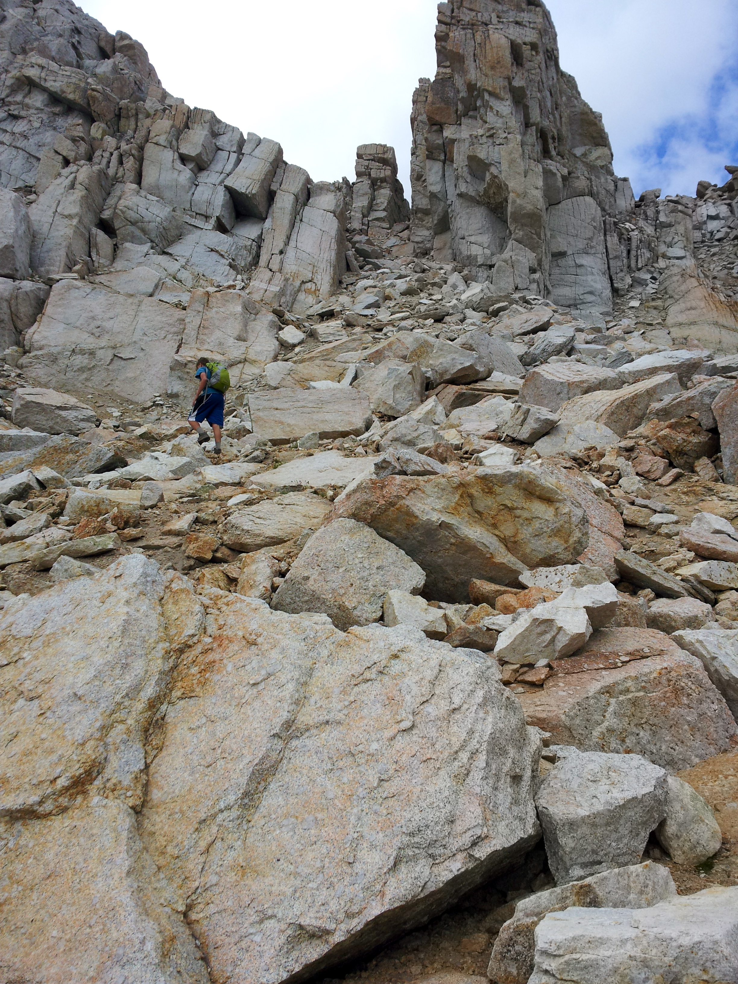
And here he is getting through the chute. I’m told it was very steep:

Once at the top, they assessed the weather and determined it would not be safe to summit with thunder and lightening threatening. This is a shot down the valley from where they’d just come:

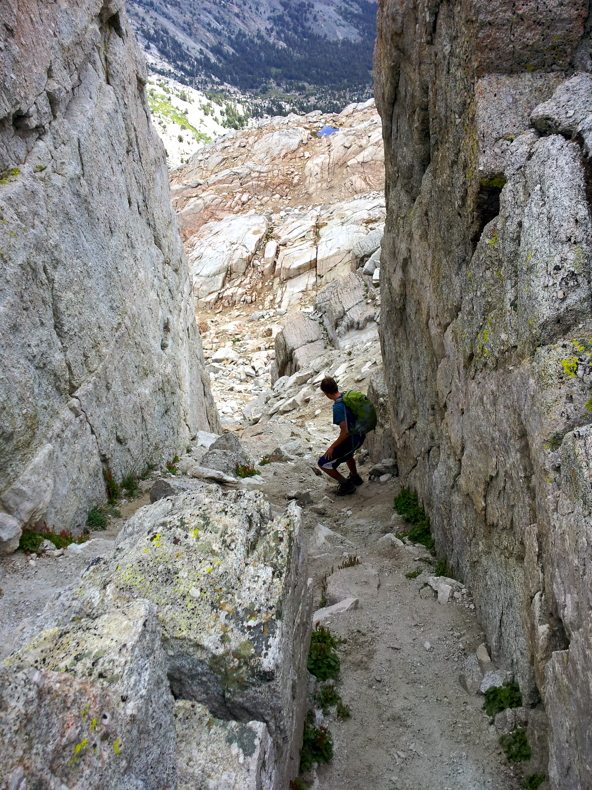
So… they turned back. This is Peter going back down through the slot:
They ended up back down in the flats (relative flats) and had lunch. It was cold and getting stormy:
This was the view in a sunnier direction, but definitely not safe for climbing… good decision to come down.
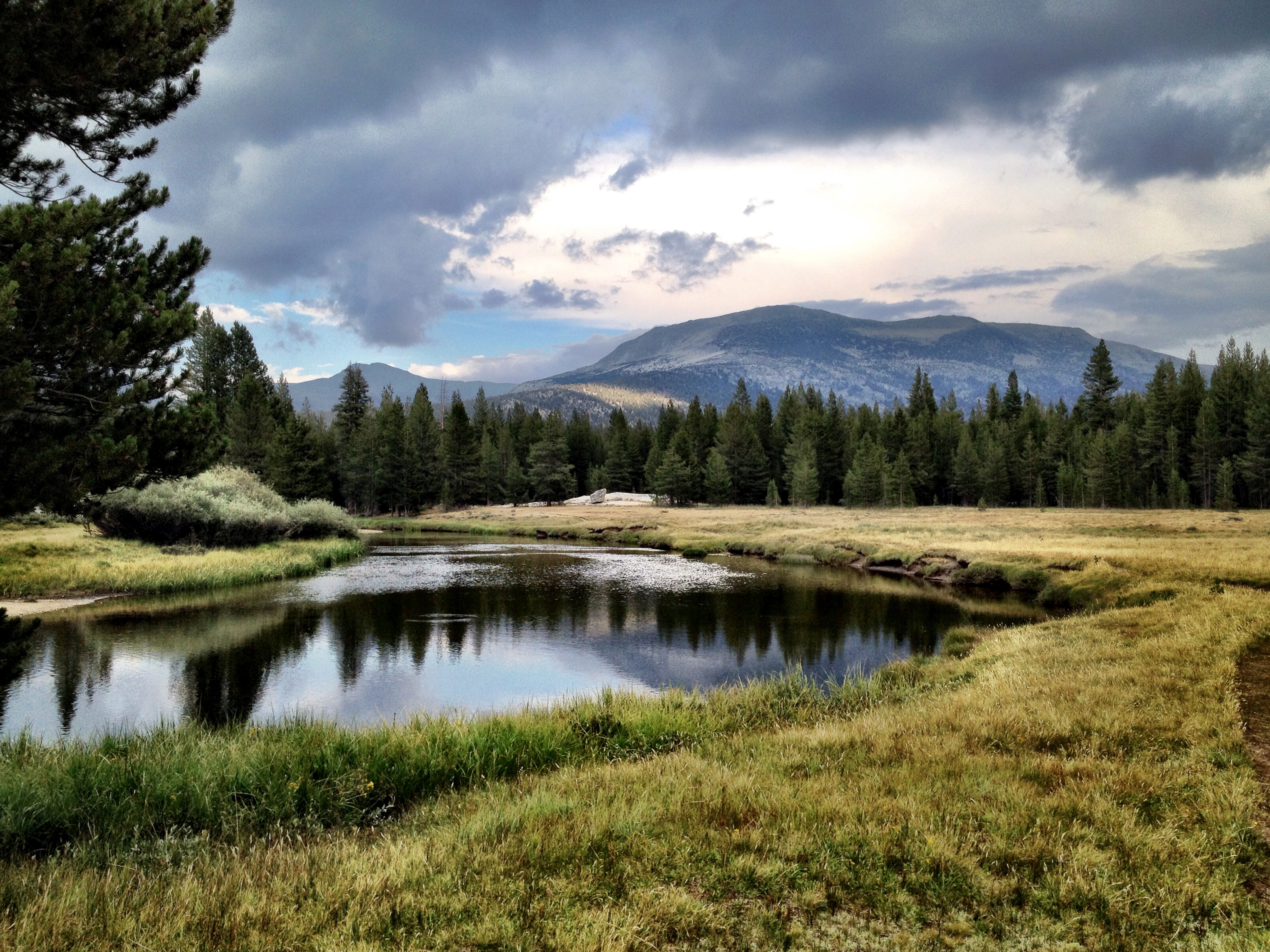
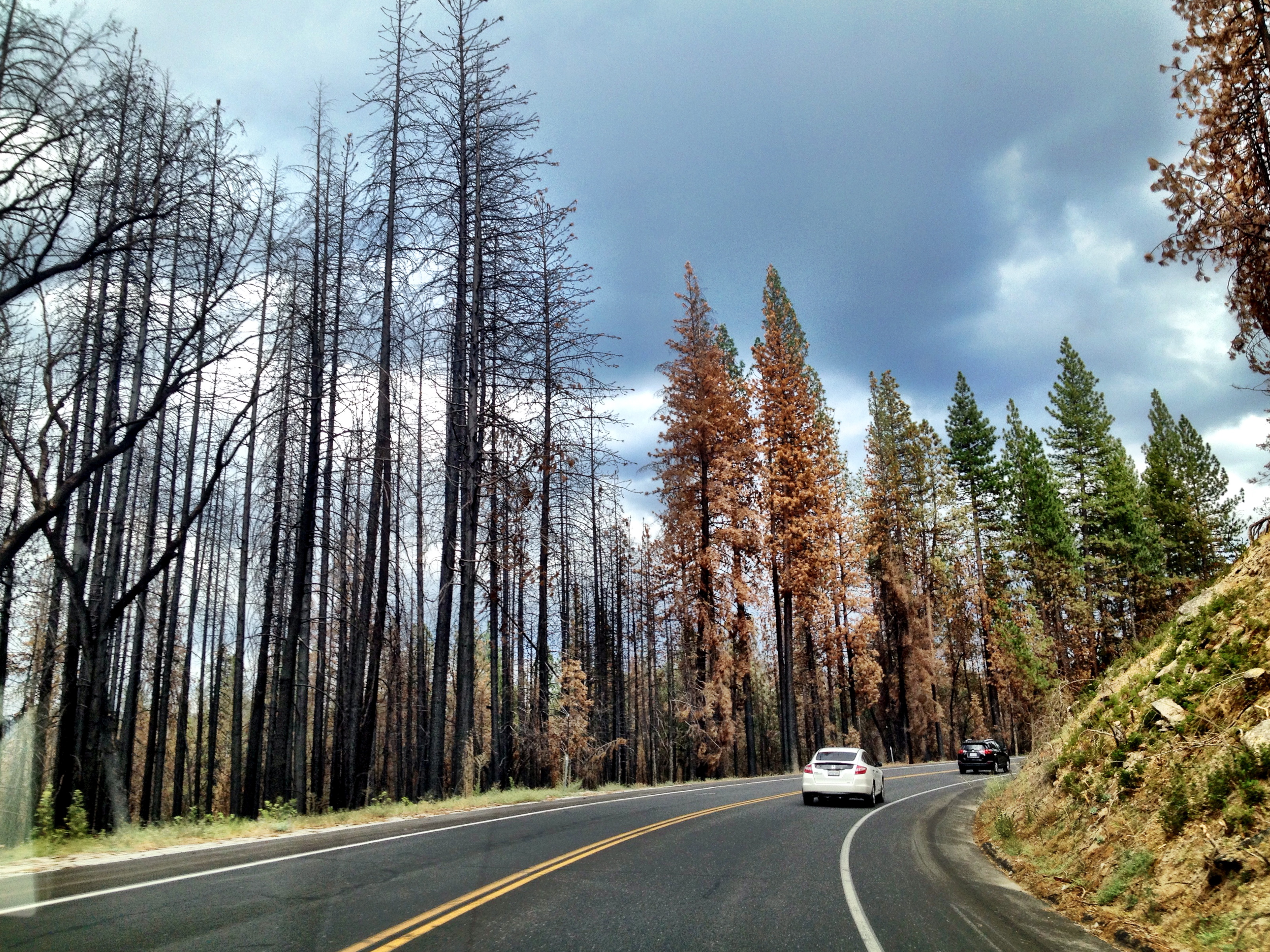
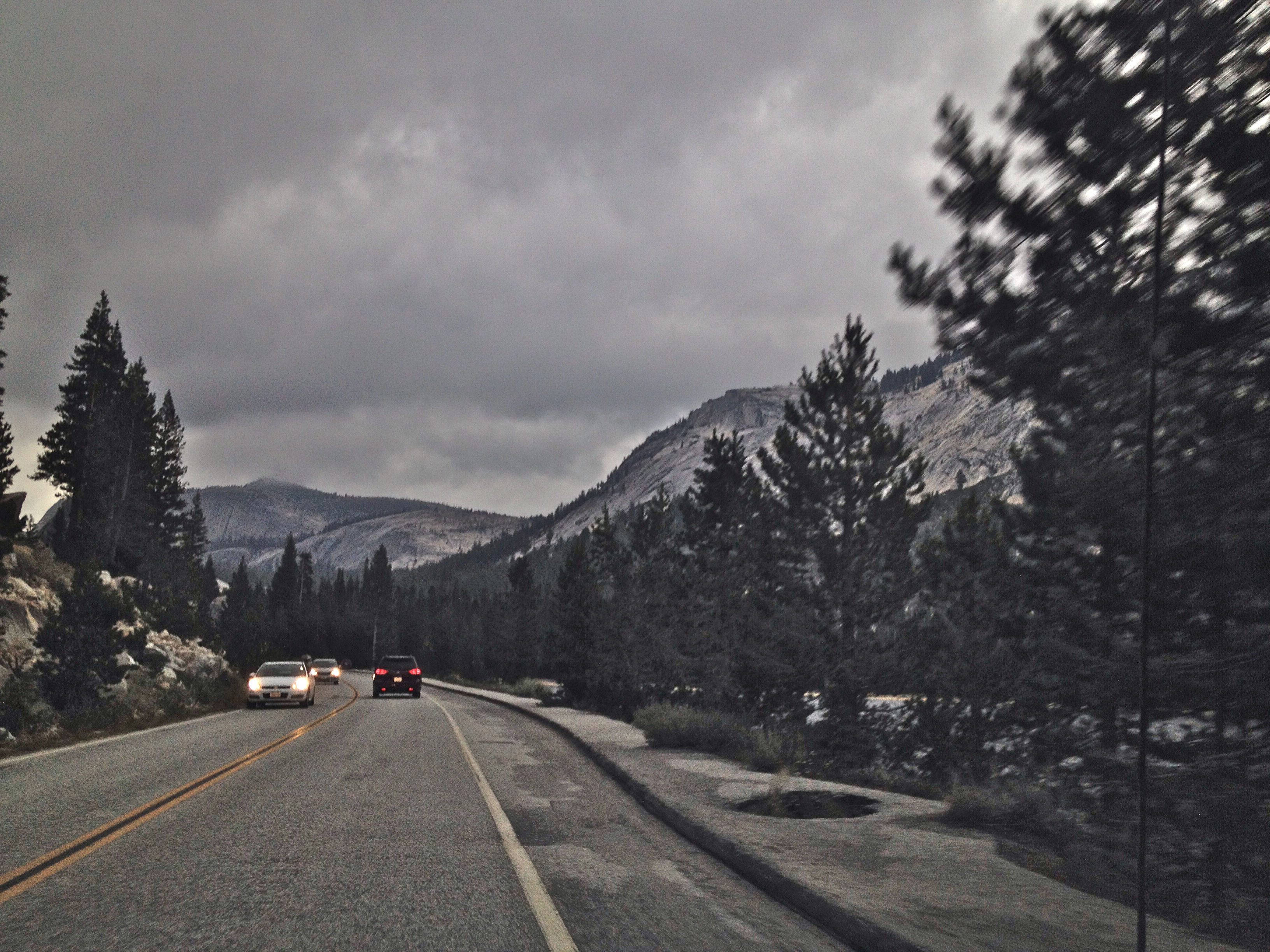
By the time they returned to the car it was pouring. We drove back into the park via the Tioga gate. Here are a couple of shots from the backseat by me, grumpier than ever. I was a terrible sport.
The Dana meadow with Mt. Dana in the background:

And, while stuck in a bit of construction traffic, here’s a dog hanging out the window of a car going in the opposite direction… kinda how I felt… wistful, sad.

The consolation, and there was one, Peter and Jim had a great day, even though they didn’t make the summit. We can go back and try again!
Sunrise, Moonrise
August 10, 2014
Monica, Dror and Ben are leaving today, so we thought we’d send them off with a good half-day hike under their belts and make the drive home to the Bay Area a lot more tolerable. We chose a hike to Sunrise High Sierra Camp. (Bwaaaaaa..)
The hike starts at the west end of Tenaya Lake–same place we start for Cloud’s Rest and the fun cross country we do to get to Tenaya Peak. It starts easily enough and for about a mile and half is mostly gentle and foresty. Then comes that intense set of switchbacks that take you up approximately 1000′ feet in about a mile. Relentless, gnarly, insanely steep, but definitely better going up than it is going down.
At the top, at a giant trail junction, you can go toward Cloud’s Rest (which is another 4.7 miles) or go left to the three Sunrise Lakes (and beyond that, to Sunrise High Sierra Camp). Or you can do this little detour and get a great view of Half Dome (which we did on the return trip).
Here is a shot up at the junction. Hardly looks like we just grunted up five billion switchbacks, does it?
We went left. Here is the first, and in my opinion the prettiest, of the three lakes:

The second one you have to look for.. and I missed it.. it’s a bit off the trail. I saw it on the return trip. This is the third, where we had lunch:

(I’m just now noticing my poles in the picture; they were marking our location for the Matalon-Frames.)
We hung out for about an hour and did a little of this (talking):

And a little of this (target practice):

And then the Matalon-Frames took off to go back home with a tidy 8.4 miles on the day, including a super hard ascent/descent, some stunning views, and lots of sparkling conversation.

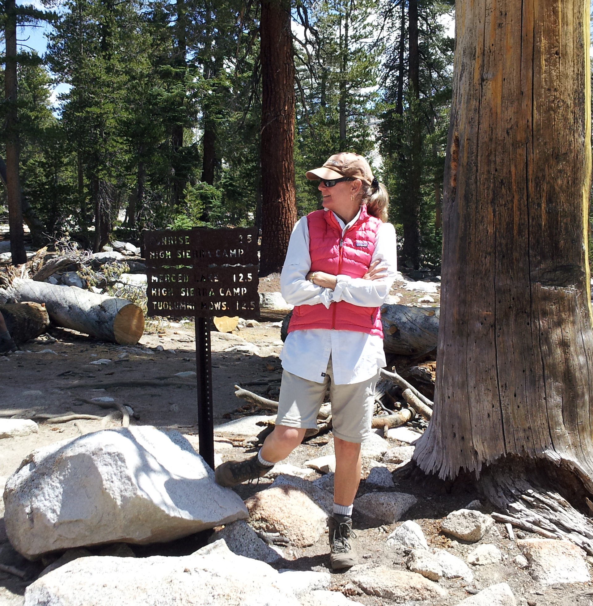
We pressed on, because we wanted to see the Sunrise High Sierra camp, which was only another mile.
We’ve now seen four of the five backcountry High Sierra Camps–May Lake, Glen Aulin, Vogelsang, and Sunrise. We have yet to see Merced. Tuolumne Meadows tent cabins and White Wolf are considered High Sierra Camps, but not part of the famous backcountry loop.
Here is a shot of what the camp looks like. The cabins (only 9) are very spread out, though they have a lot of backpacking sites on the outskirts.
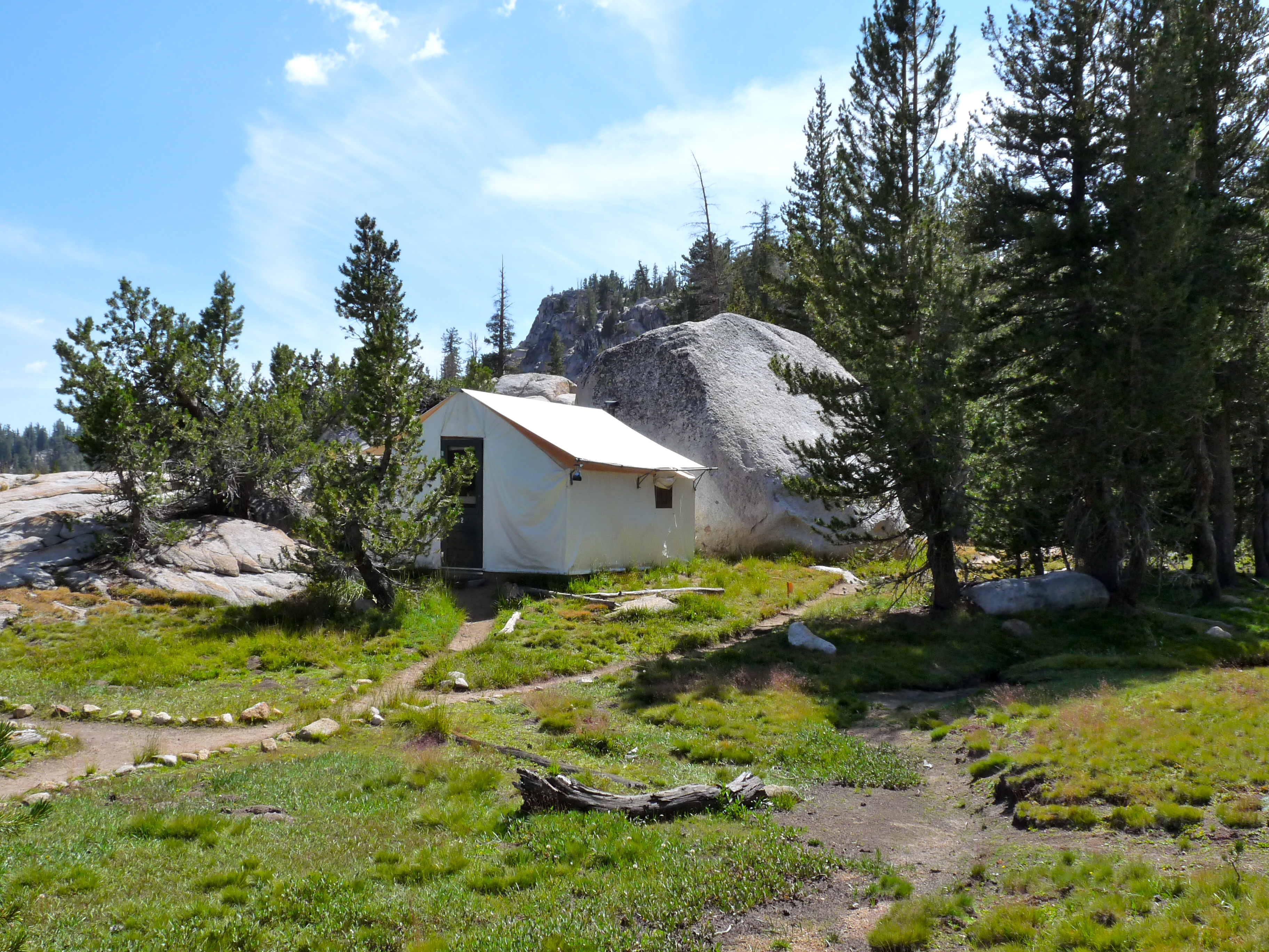
Near the dining tent is this giant boulder, and a nice view out across Long Meadow. I hear the sun comes up over that range to the left, and is spectacular, which gives the camp its name:

The area was new to us. Here are Jim and Peter figuring out what’s what:

Then it was time to head back down (had 5.2 miles to go, it was getting late, and yours truly, after many days of hiking, was starting to hurt, which is a bummer, but it’s definitely going to heal, whatever it is).
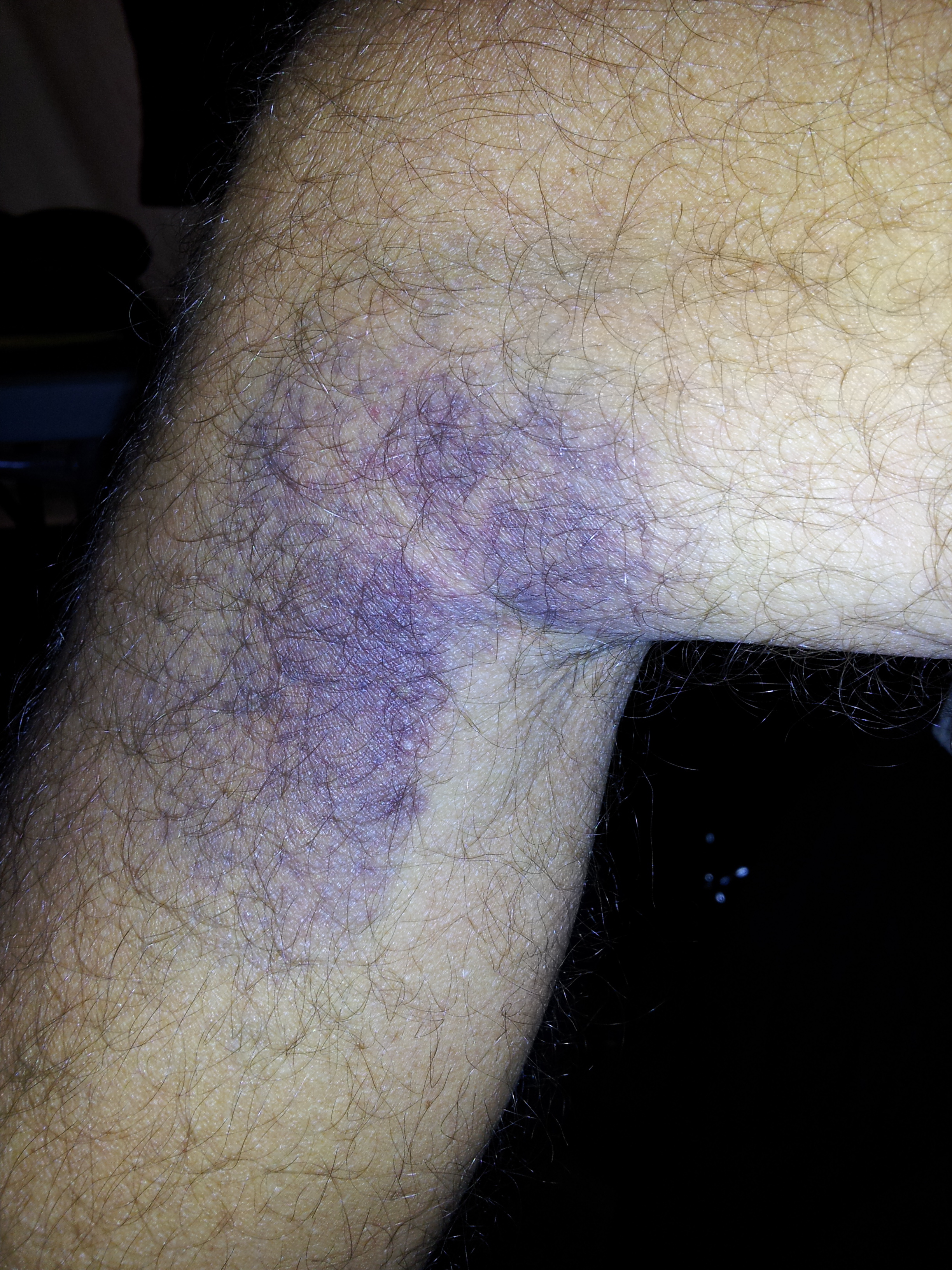
I might mention here that Jim was hiking with his own little problem…a giant bruise he’d gotten a couple days earlier when–playing catch with Peter one late afternoon–a baseball sort of missed his glove and smashed into the inside of his knee. T’was quite painful, as I understand it.
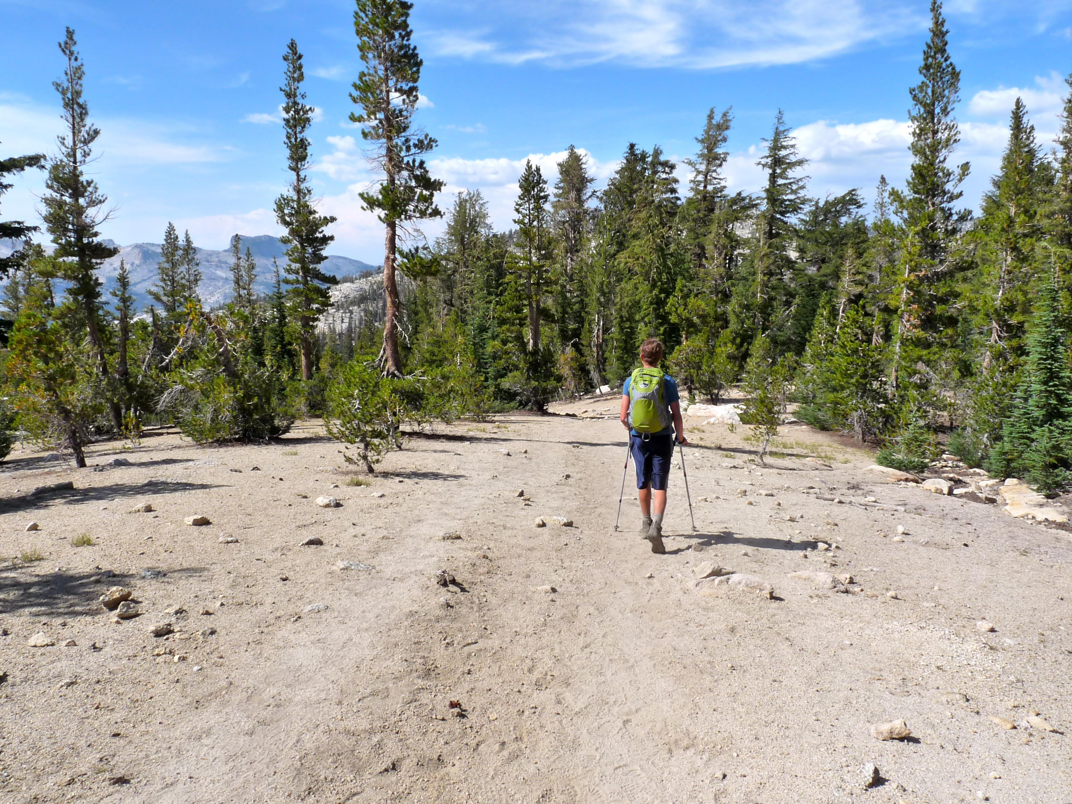
Anyway, injuries and all, we forged on. Jim went ahead to catch the last shuttle (though turns out this was not an issue); Peter and I hiked together. I’m in draggy, sloggy pursuit, but enjoying views of Mt. Hoffmann and other cool things:
When back at the trail junction, before the very ridiculous descent, Peter and I did peel off the trail to check out Half Dome. We pee’d (behind separate boulders)… probably one of life’s best pee spots.
Here is the initial view; you can see Half Dome peeking up on the left:
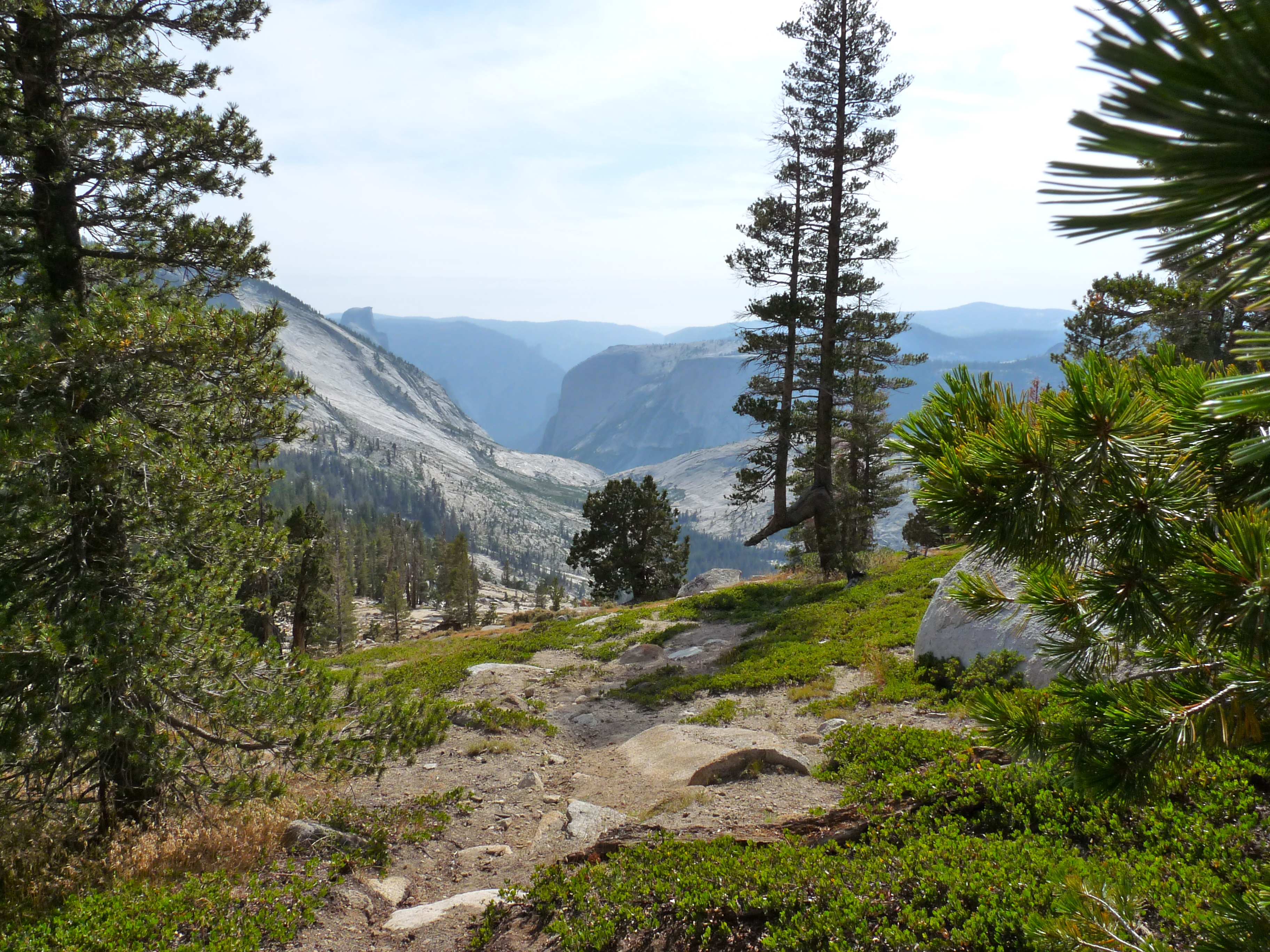
And here is the view a bit around the bend and down the hill all telephoto’d up. Cloud’s Rest (9931′) is a huge mountain just out of view on the left, and has the best view ever of Half Dome (8839′), especially the cabled ascent. You actually look way down on Half Dome from the top of Cloud’s Rest. Definitely one of my favorite hikes of all time.
While a little off topic, this is what the yosemitehikes.com website says about Cloud’s Rest:
Take in one of Yosemite’s most stunning and wide-ranging 360-degree panoramic views, stretching from Hawaii in the west to Nebraska in the east. Or thereabouts. You can definitely see a lot of stuff from here.
The top of Clouds Rest is a narrow ridge with a long, sheer dropoff on the north side (the side you can see from the Tioga Road). The dropoff to the south is less extreme, but it wouldn’t require special talent to wind up just as thoroughly and symmetrically dead by falling off that side. It’s best to visit Clouds Rest sober and during dry weather.
That said, the route over the ridge is more manageable and less dangerous than Half Dome’s cable route. If you’re slow and careful, you shouldn’t feel like you’re a freak gust of wind or a momentary lapse of concentration away from the bottom of Tenaya Canyon. And the very top of the peak opens up again to around fifty feet wide, which will feel like the Great Plains after the underpants-imperiling knife edge you’ve just crossed to get there.

Peter and I listened to songs on his iTunes (and I tried to guess what rating he’d given to each) which took my mind off my aching achilles or more likely hip, maybe both. Made it to the trailhead (a very satisfying 10.4 mile day) and found Jim waiting.
Riding home on the shuttle (love that shuttle), I took this picture of Lembert out the window. Nice time of evening:

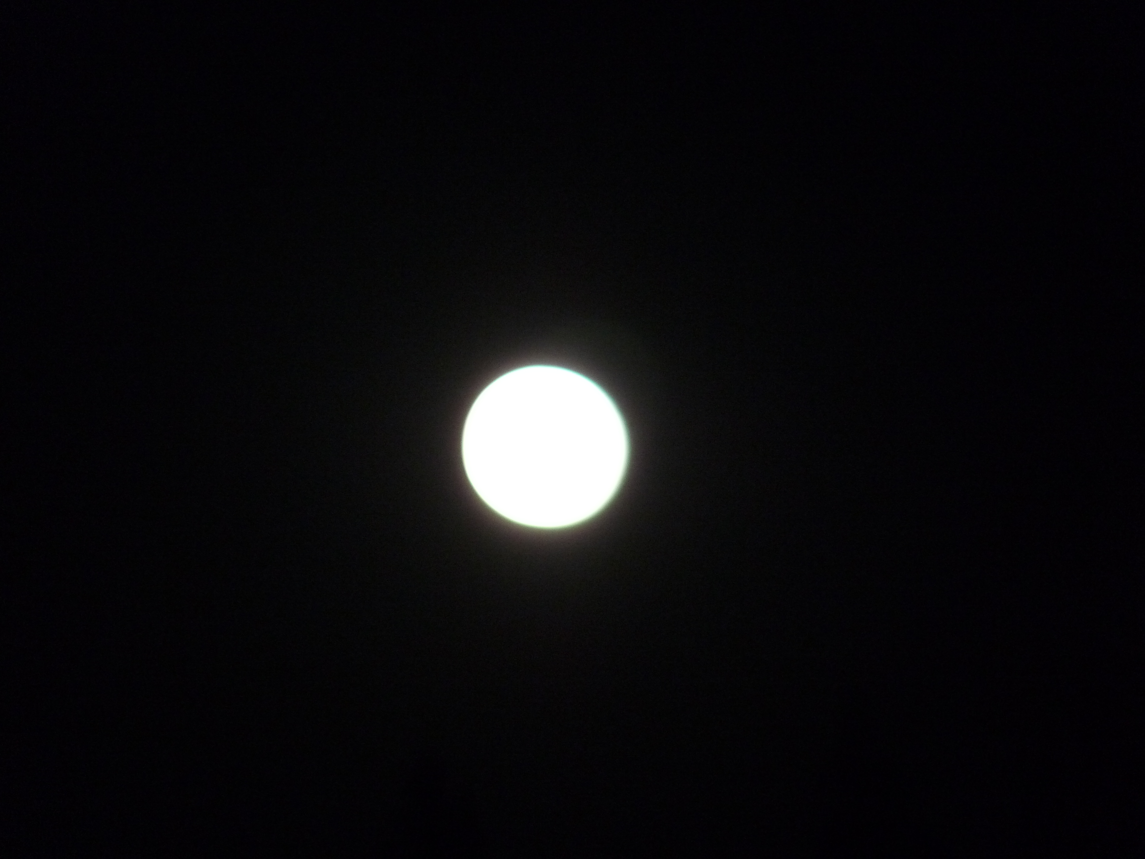
We managed to make it back in time for dinner, barely. Then caught an amazing full moonrise:
Ho hum. Another killer day in Yosemite.
Lyell Fork
August 9, 2014
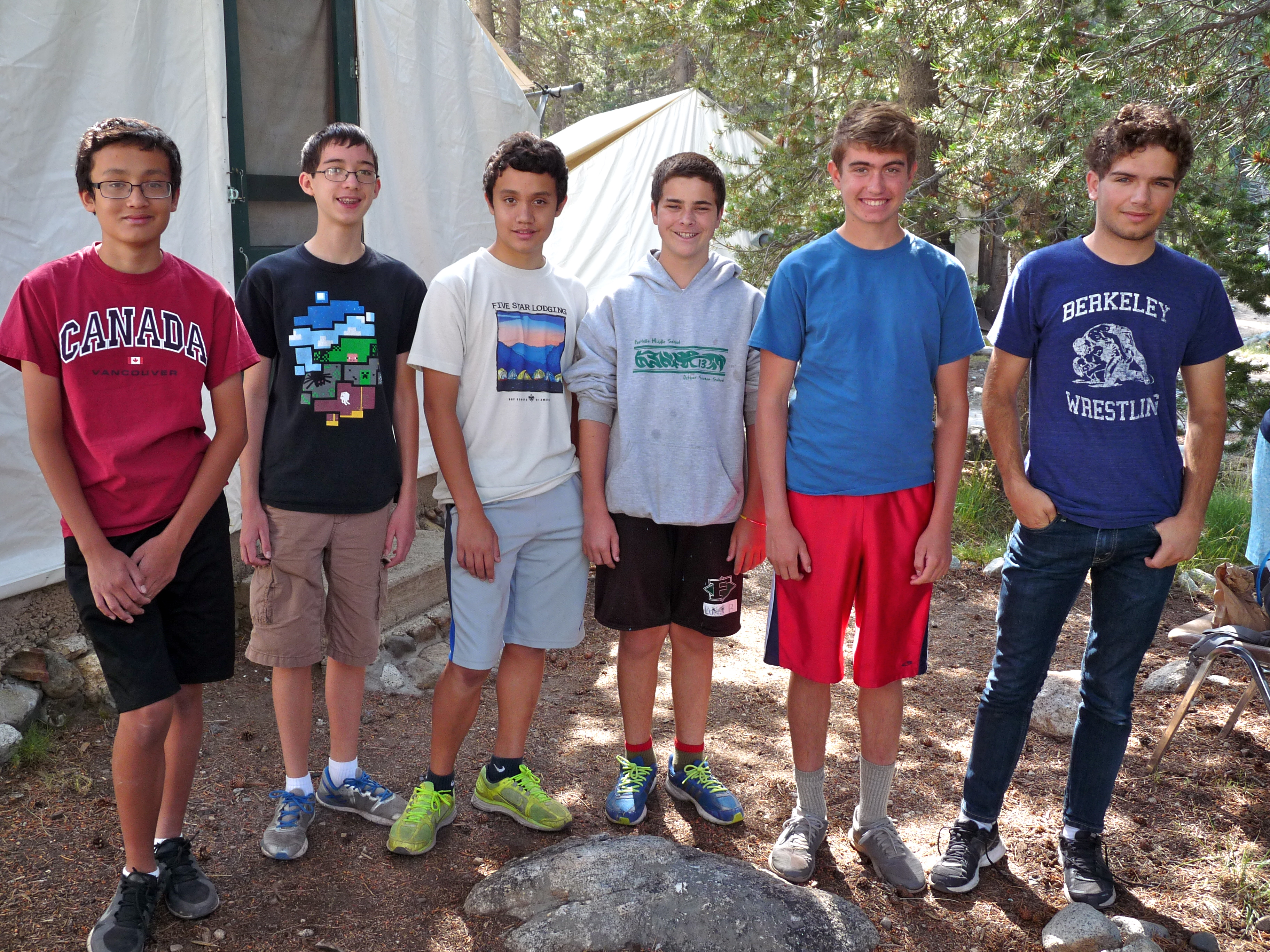
We said goodbye to the John Frame + 2 clan this morning… it’s really fun to see the twins and smile at how far they’ve come in the last ten years or so of trips to Tuolumne Meadows. They are turning into great hikers. Fun to see them with their friends, too.
Matthew (13), Jeffrey (Matthew’s friend, 13), Dean (13), Tyler (Dean’s friend, 13), Peter (16), Ben (19)
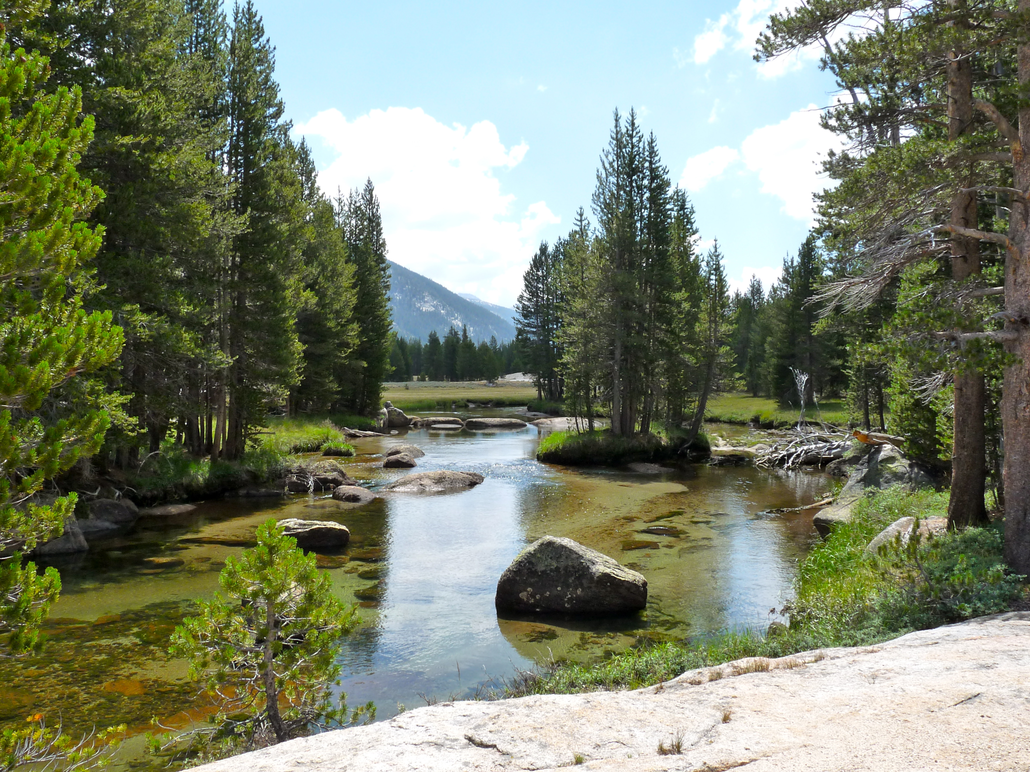
We decided to do a river canyon day, so after breakfast packed up and headed back behind the cabins to the Lyell Fork of the Tuolumne, about 3/4 mile to the bridge. Both the John Muir and Pacific Crest Trails follow this fork and you can go a long way up the canyon, but we’ve never gotten anywhere near the end (Donohue Pass, 12 miles away), but we’ve followed it for a few miles here and there, which is what we did today.
At the bridge where you cross the river (one of several places in this canyon):

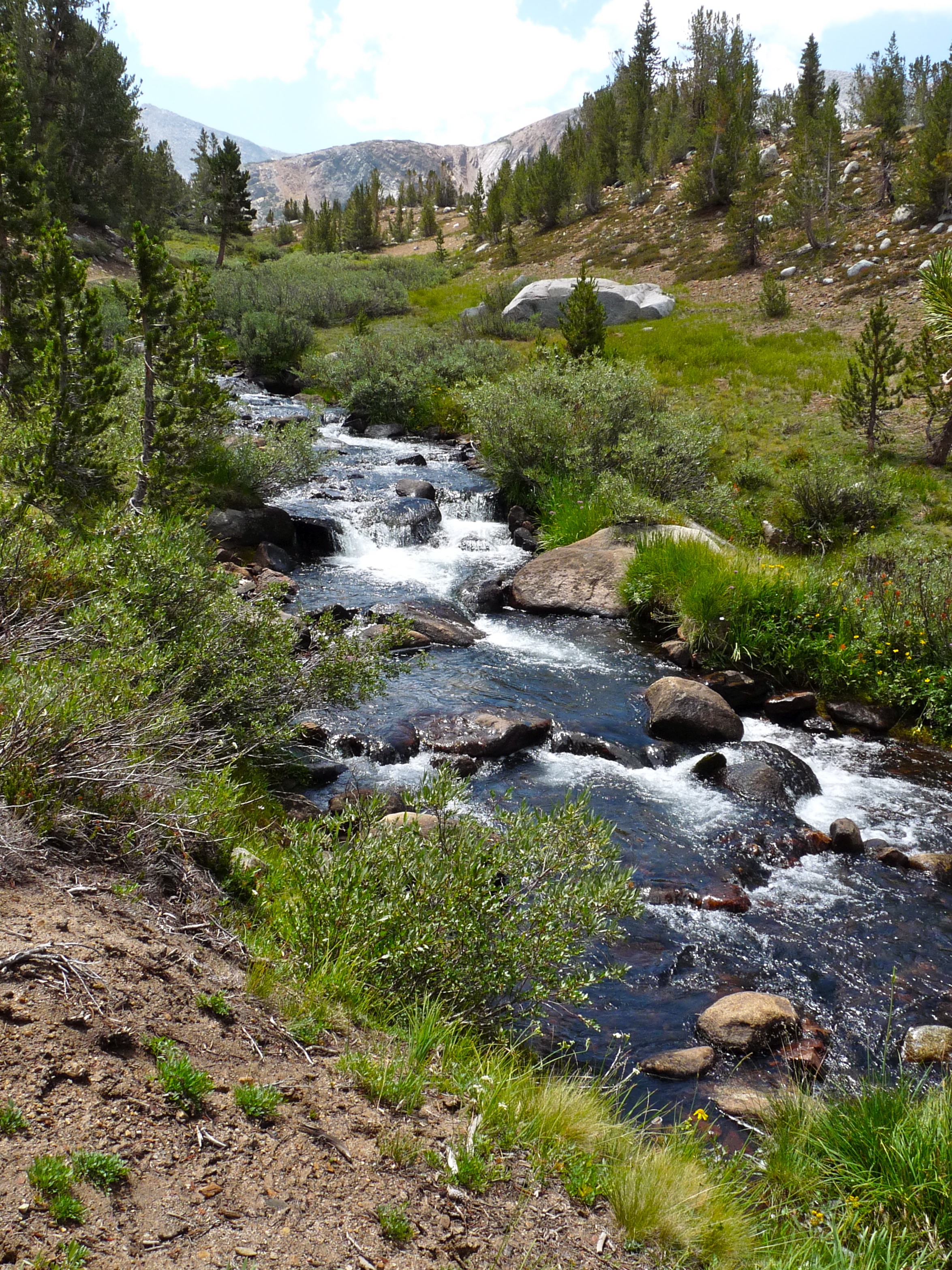
We started up canyon by following the river (where sometimes there is a small fisherman’s trail, but most of the time not) instead of the main trail, so we meandered a LOT for a lot of unnecessary contours, but of course that was fine. Some shots:

We must have crossed the river, somehow, well past the bridge at Rafferty Creek… we’re not sure how, but probably has to do with the drought and low water, and whatever. Many arguments were had about where we were… but by and by we connected to the main trail and just hiked for another couple/three miles.
Most of the canyon looks something like this…

Some parts open to large meadows, sometimes with the river being too far away to even see (due to meadow brush not distance). It’s a truly, truly gorgeous place for just hiking unencumbered.. flat, protected canyon, and miles and miles before you. And again, for some reason, you hardly see anyone. I believe the John Muir Trail has peeled off toward Vogelsang (back at Rafferty Creek) and maybe the PCT comes in over Donohue Pass, but, whatever, we just don’t see a lot of people ever.
We decided to stop for lunch. People did their own thing… these guys did this:

I took off to sit by myself and take pictures and muse:
And Peter and Ben did this:


It was ever thus. They just love this shit. So much fun to watch them.
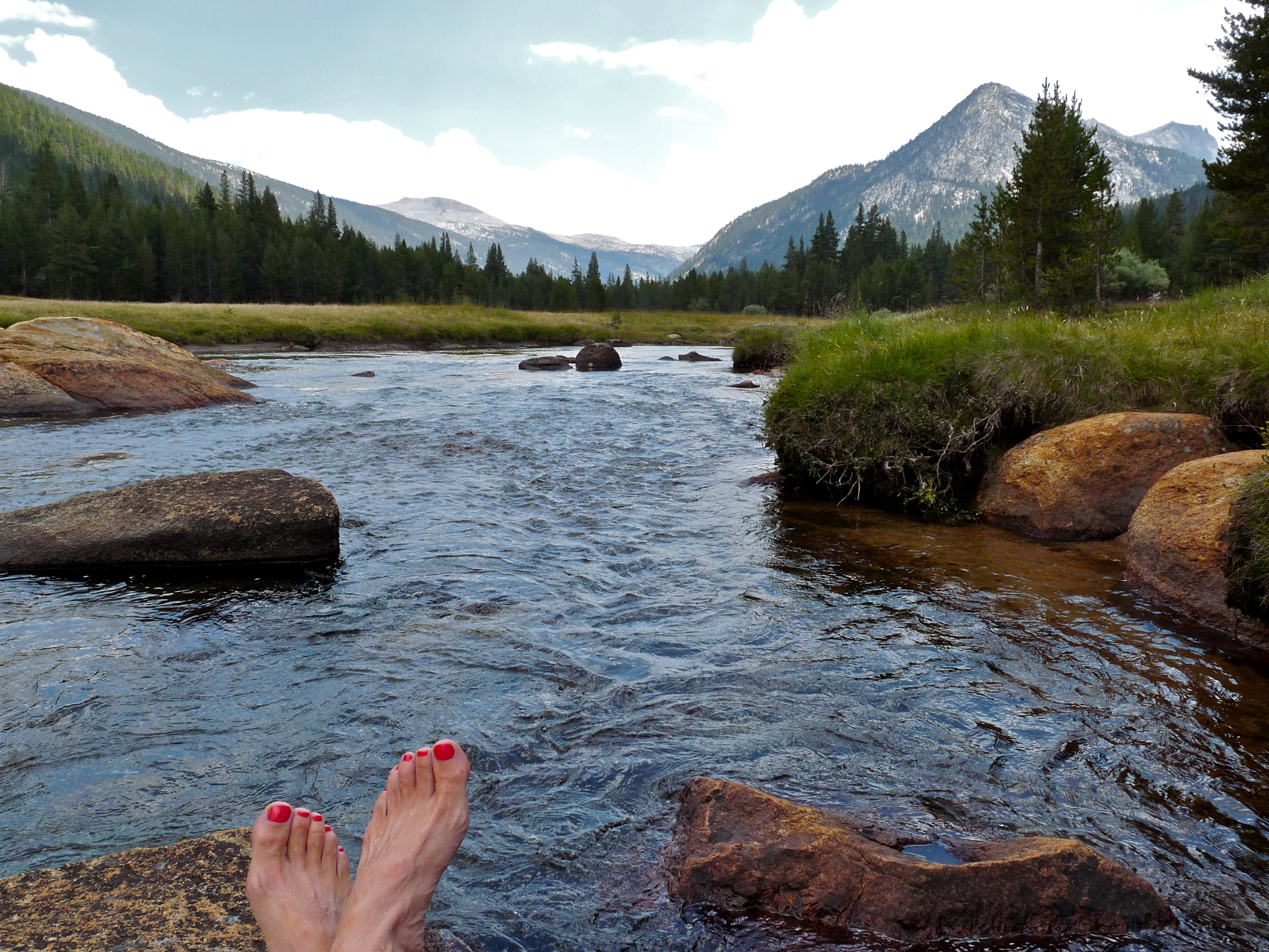
After a while, Peter came and joined me. My journal from the day says (and I totally remember this):
Had one of my most SUBLIME MOM MOMENTS ever, lying by the river in the grass with Peter, talking, looking at the sky, taking pictures, listening to the sound of the mountains.
Here was a picture I took (yawn):

And here’s what Peter did with the same subject. Guy’s got a gift…. or at least figured out how to use the macro setting to much greater effect:
Again, we hustled back in order to miss the afternoon rain, which came just as we got back. Peter took us on his short cut.. a route from the Lyell Fork to the cabins through the forest he’d figured out earlier in the trip. I like that he feels comfortable making his way cross country (knowing there are not a lot of ways to get lost between forks in the Tuolumne River).
I have a note in my journal that says after a shower, I sat in the lodge with a heating pad (on hip flexor), an ice pack (on achilles), a manuscript I was editing (Toni’s third book), a beer, and Peter, who joined me for a while before Monica and Dror came down to hang out. Nice.
Dinner was its usual fascinating assortment of old Sierra Club types (whom I usually love and enjoy talking to). Two in particular this evening: Fran (74) and Gerry (75), two women who’ve been coming to Tuolumne Meadows together for 30 years and who’ve literally climbed everything in Yosemite there is to climb, plus Everest’s back side (not to top), Kilimanjaro, Rainier and so many others. Impressive. They are now very hobbly, but they are still there hiking. Hope that will be Jim and me in about twenty years.
Mt. Huff, Huff, Huff, Huff Hoffmann
August 8, 2014
Located in the dead center of Yosemite National Park, Mt. Hoffmann (10,856′) is a perfect climb–great 360-degree views, super challenging & thus rewarding, spectacular formations at the top, a mix of trail types. Def a fave.
Twelve of us got an early (9:15am) start–early when you’re mobilizing a group that now includes six teenage boys. We drove two vans to the parking lot and trailhead for the May Lake High Sierra Camp–about half-hour west along Tioga Rd, then up a spur road.
From the trailhead, it’s about a mile and a quarter and 500′ up to May Lake, which was so pretty this morning..
May Lake is at 9270′. But our plan is to climb to the summit of Mt. Hoffmann (not visibie from May Lake and behind those two granite formations). It’s only about a mile and three quarters from the lake, but it’s about a 1500′ gain, so it’s steep.
The trail starts on an actual trail, some of it is ducked but most is well carved out. Once up the first pitch there are great views back down to May Lake…

before it meanders back through a more foresty part. Then it heads straight up the side of the mountain, steep and random. There are an infinite number of routes; you just pick your way… all roads lead eventually to the high plateau.
Here’s a funny description I just came upon:
The trail up Mt. Hoffmann is steep and rocky, and some of the steepest parts are covered with decomposed granite, one of the most insidiously slippery substances nature has devised in its campaign to add slapstick to the world. Between this and oxygen’s inexplicable fear of heights, plan on a slow pace going up.
And I must say, he is absolutely right.
On this day, Peter and Ben hustled ahead, Tyler hung with them for a while, then fell back. I picked a route that soon became a very solo route way off to the right, and didn’t see or meet up with anyone until I saw Dean across the hugely expansive gravelly plateau and we walked the last quarter mile together. Jim was up already and by the time we got to Jim, Peter and Ben had set out on the final scramble to the actual summit.
Jim, Dean and I waited a while for the others to arrive, and when they didn’t, Jim went back to find Tyler, which he did, and most of the others, as well.

They arrived at the base of the final ascent and decided that was as far as they wanted to go. Jim and I headed up.
The final boulder part is usually scary for me, but for some reason it wasn’t– I was having a great time with the climbing, pretending I was some sort of serious rock climber. Ha. The four of us–Peter, Ben, Jim and I–ate lunch at the top top, and took in spectacular views. Of course.
There is a fair amount of space up there and you can walk around and even climb various piles of boulders. You can see virtually the whole park. Here is Half Dome and part of Cloud’s Rest:
The only other person we saw up there was a young woman, Mina, who staffs one of the High Sierra camps, there on her day off. She was great.
And we had this guy to deal with. You can see a bit of the antenna’s guy wire and a bit of smoke in the background to the north. There were a lot of fires burning in Yosemite this year, though we were not bothered by smoke by the time we got there.

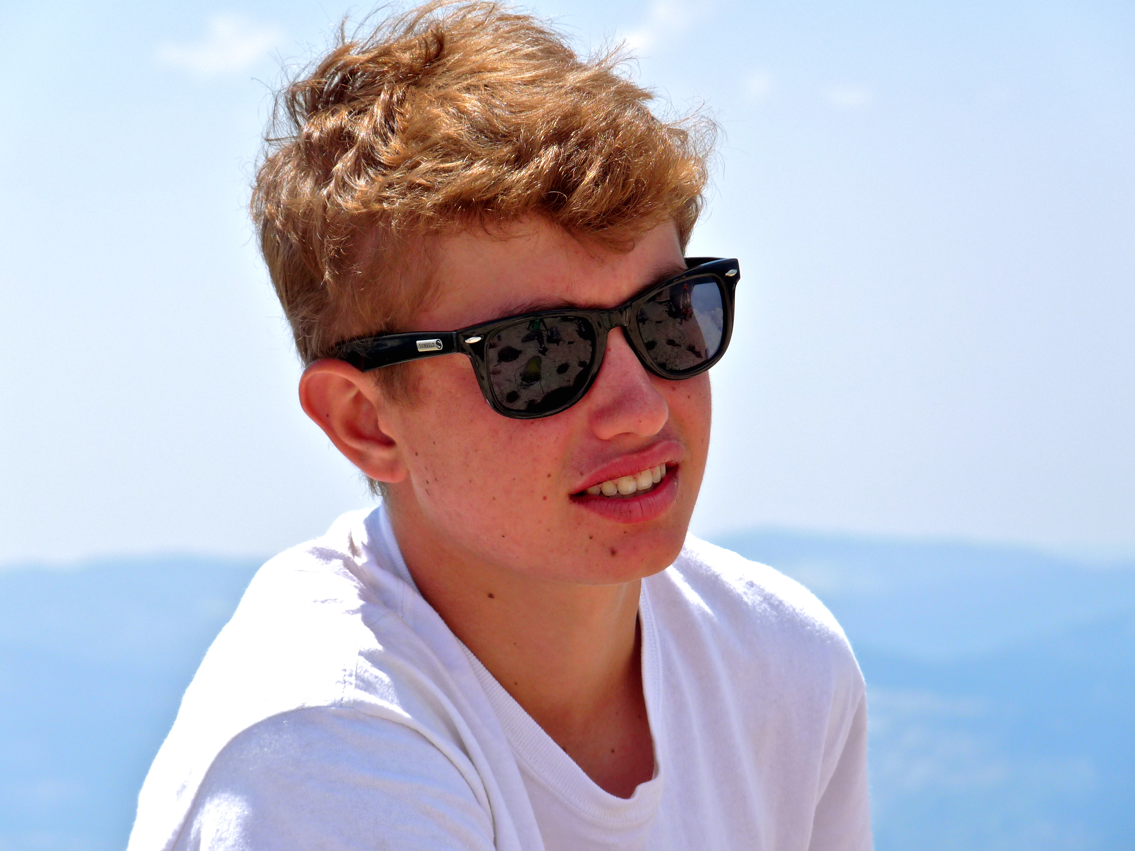
I like this one of Peter, so cool and relaxed, braces freshly off:
Monica and Dror, even though it was their first day of hiking and were not quite acclimatized, decided to join us at the top. Heros!

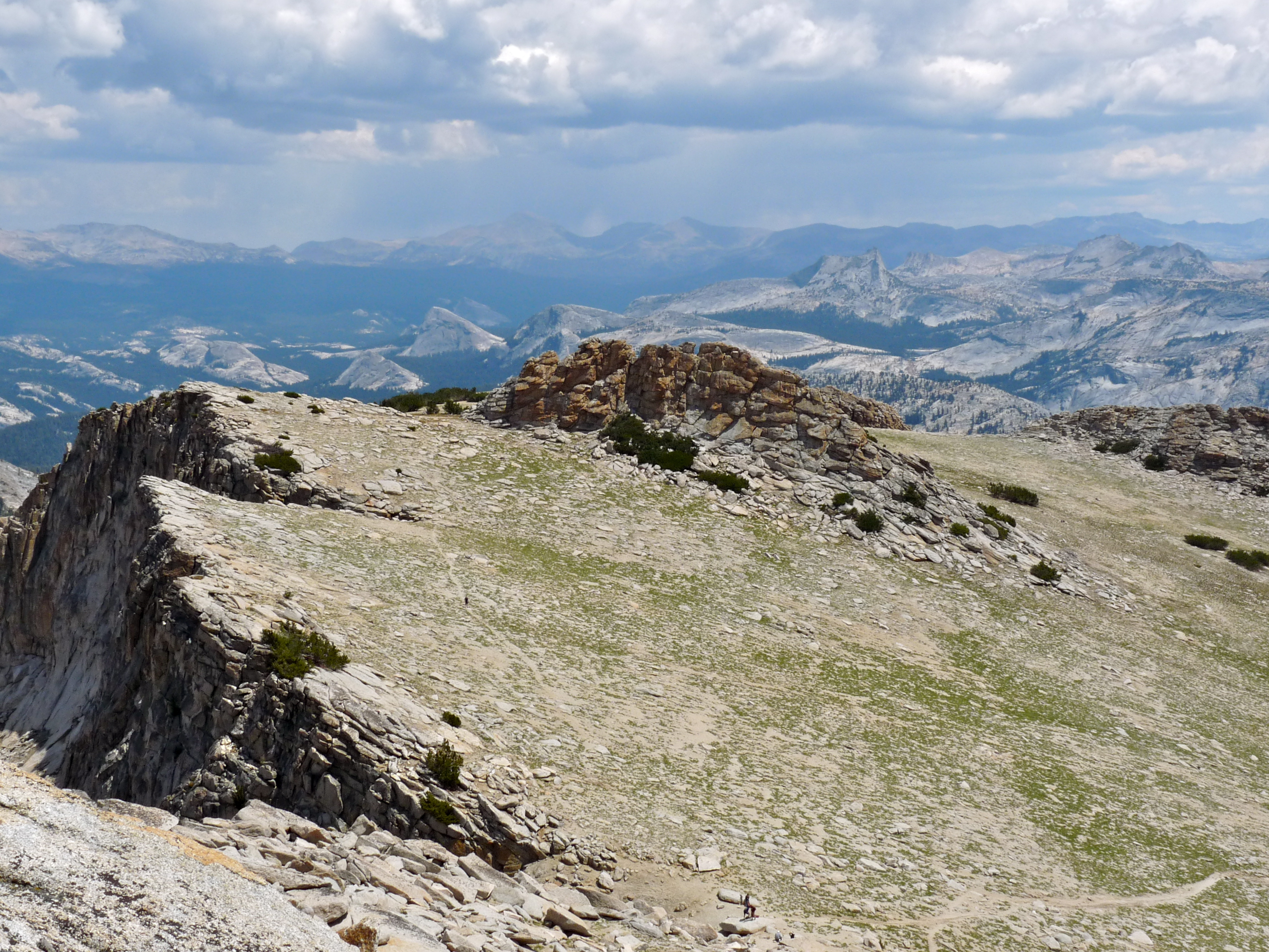
After a while up top, we all headed down, Monica and Dror joined up with the John Frame clan while Peter, Jim and I stayed up there and explored the edges a bit. It’s so huge and dramatic, there was nobody up there… like having this giant park to ourselves. For scale, you can see a human in the lower, center of the picture. That’s where the trail ends if you’re not going to Mt. Hoffmann’s summit. May Lake is 1500′ below the ledge over by that boulder pile. In fact, that boulder pile is probably one of the prominent structures you see from the Lake.
Here is a closer-up shot of the boulder pile, and me for scale:
And the view from the other side of that pile… there’s May Lake. I understand it was named for Charles Hoffmann’s (a member of the 1863-67 Whitney Geological Survey) eventual wife, Lucy Mayotta Browne. Little Yosemite trivia.

Here’s Peter at one of those edges: 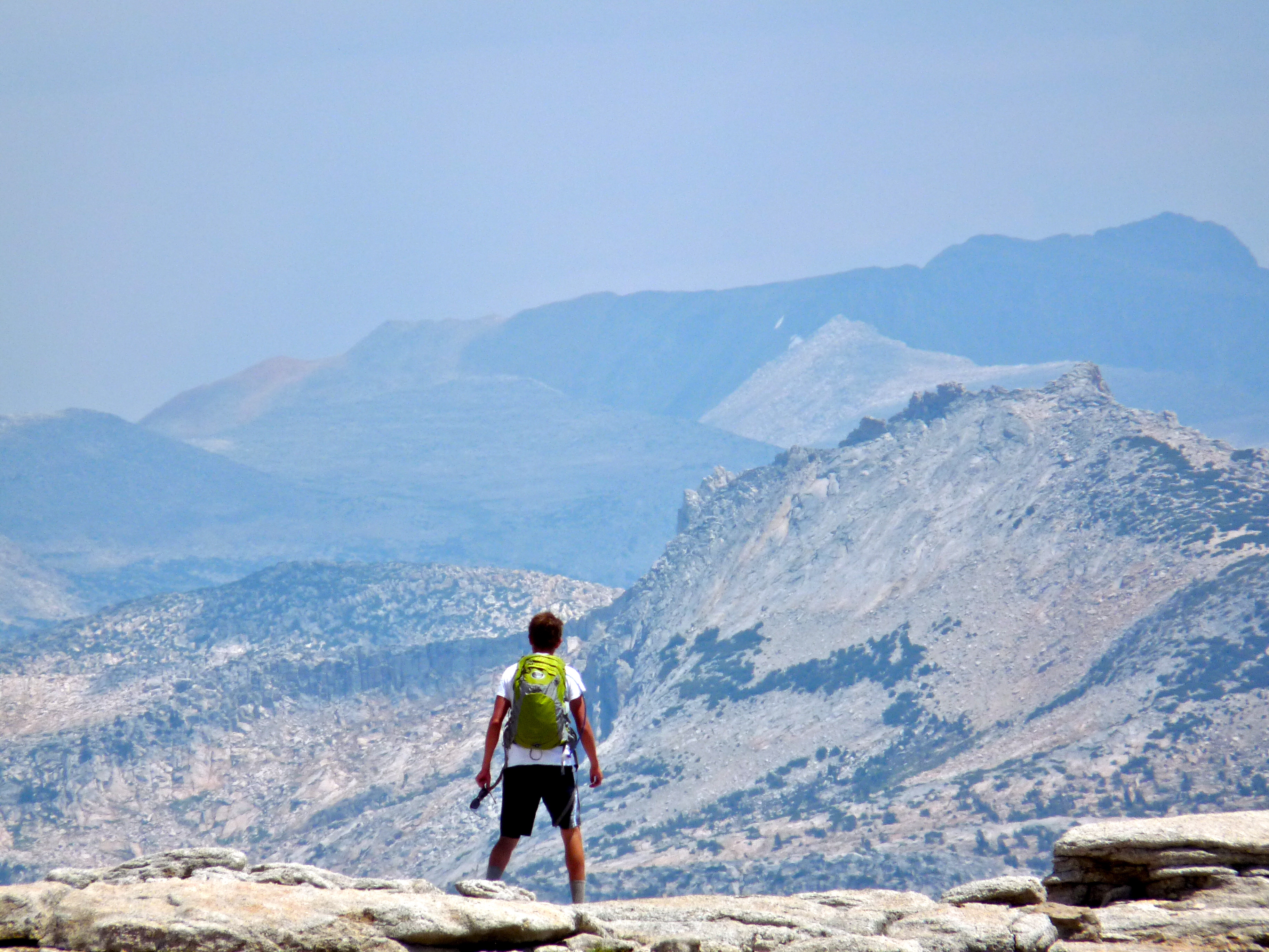
Looked like weather was coming, so we headed down.
We all congregated at May Lake again, hung out a bit, then made our way back to the cabins and dinner.
On the Lighter Side
August 7, 2014
With kids, ya gotta intersperse days that are less hike and more thrill or more chill. We did that with Peter in the early days and I think it paid off; he’s now a certified hiking fiend. For us this meant a few years of alternating hike days with Peter-care days. One of us would stay behind and have a river day with Peter, while the other hiked alone or with someone else in the group (if there was anyone else around), and we’d switch roles the next day. Or sometimes we’d leave Peter behind with his cousins and the two of us would go off on a kidless adventure. I even remember a couple years when Peter was old enough to stay back in the cabin by himself and he picked and chose the hikes he’d go on. Point was, we never forced him and tried to always make his days up there fun with activities of his choosing.
So… with five boys pooped out from the day at Spillway yesterday, today was an easy day with a modest thrill-filled dome scramble, and a stop at the Tuolumne Meadows diner counter for burgers, fries and soft serve–the chill portion of the program, and a predictable hit with early teen crowd.
The trailhead for Lembert Dome (9,949′) is within walking distance of the tent cabins. Once at the trailhead, it’s about a one-mile climb through the forest to the base of the dome, and then a scramble up the granite slope of Lembert. From the cabin (8,775′) to the top of Lembert is about 1,200′. Though short, the hike definitely gets your heart going and the exposure and views keep it thumping.
Here are the boys taking a breather before the final granite ascent, Matthew, Tyler, Dean, Jeffrey, Peter (and John in back):

Here we’ve probably climbed half of the dome, and have this much remaining, the more exposed part:

This gives a clearer idea of the slope and scope:

And this, though on the way down, gives a sense of the drop off and exposure. Jim’s always doubting my assertion (panicked at times) that were one to fall, they could easily roll and roll to their death… or at least get bumped, scraped and bruised a lot before finding a spot in which to stop. He thinks you’d go nowhere. Plus, who falls when footing is so secure? Says he.
This is looking down on eastbound Tioga Road.

This is a view from the top also looking east at that other prominent no-name dome (or, maybe they call it Dog Dome, since if overlooks the trail to Dog Lake?) that one accesses near the base of Lembert Dome, off to the right when the dirt trail comes to an end. Pretty day..

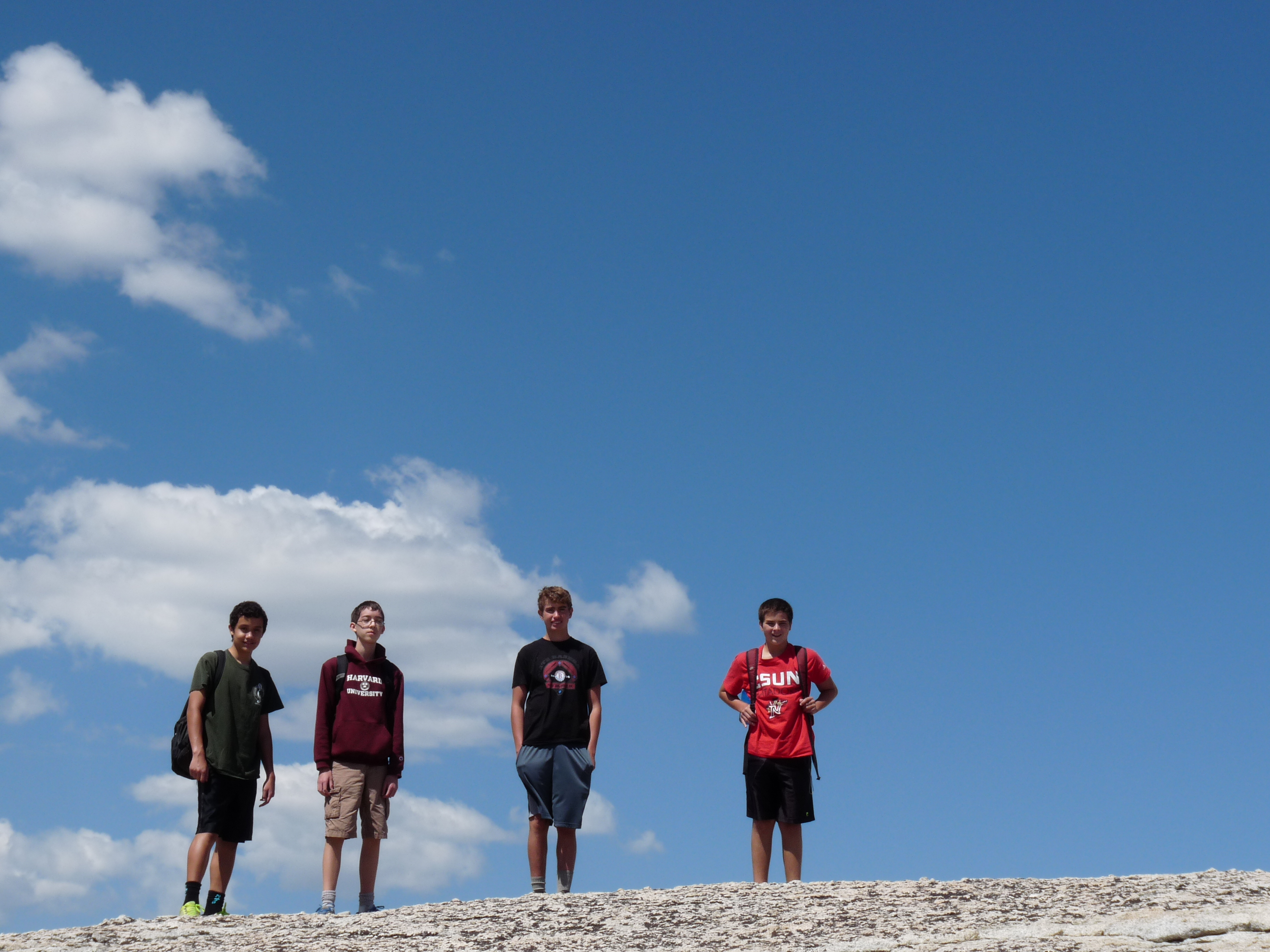
Four of five youngsters at the top:
The three of us taking what is our umteenth family summit-of-Lembert photo. Still, who could resist?

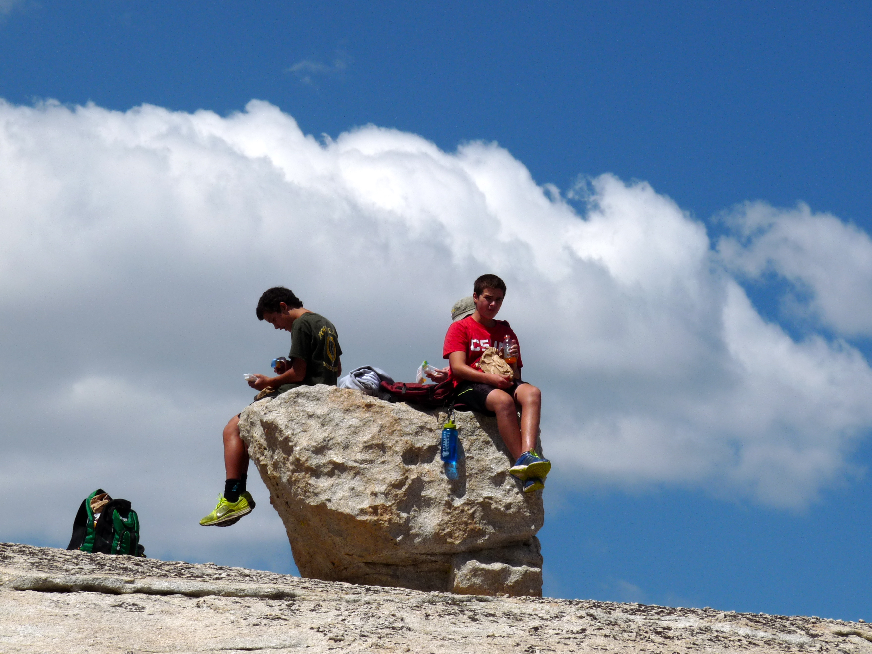
It’s amazingly fun up at the top, with lots of nooks and crannies to explore, lots of ledges on which to sit, lots of edges over which to look, lots of giant, flat-ish plateaus, lots of boulders…
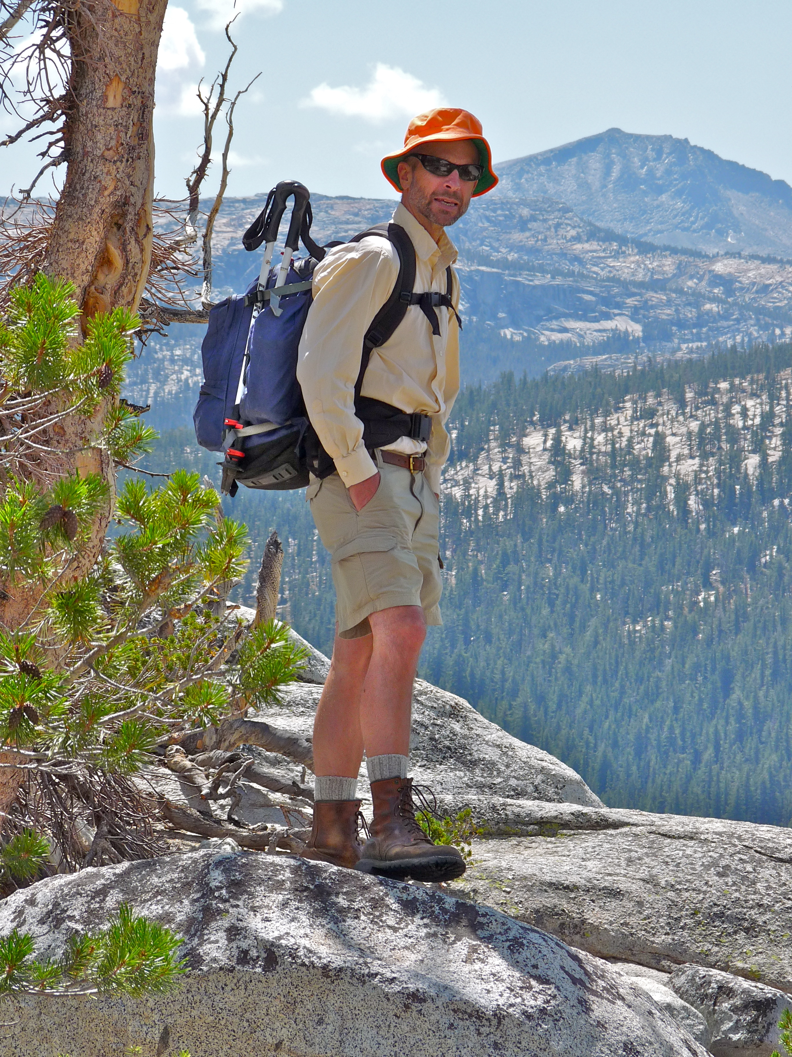
Here’s Jim, and this is looking more or less south. There are even lots of trees up there, very non-viewable from the bottom.
After about an hour or two up there, we descended, and decided to go down around the backside of the dome, getting to a different trailhead and parking lot. Along the way, Peter and I took a .3 mile detour to get a look at Dog Lake. Nobody was around and the lake was still. That’s Dana (13,061′ second highest peak in Yosemite), center.
The nice thing about this other trail is you get nice views of the backside of Lembert (or maybe its true face). You can usually see climbers, which is fun:
And once free of the forest, this is the view you get west toward the meadow.. that’s Cathedral Peak in distance:
After a stop at the diner, we returned to the cabins.
Here’s what’s fun: My childhood friend Betsy and her family also come to Yosemite every year and for the last few, we’ve overlapped our time there. They stay in the housekeeping cabins in the Valley so it’s not easy to hook up. Last year, Jim and I hiked down to the valley from Olmstead Point to meet them–great but hard on the knees, and then we took the YART bus back to Tuolumne for a very long but nice day. This year, Betsy agreed to drive up and meet us for dinner at the lodge. We had a few hours to hang out, so I took her to two favorite river spots within walking distance of the cabins. She was duly impressed, both by the jaw dropping beauty, as well as the lack of people.
First we walked up the Dana Fork a bit:
And did this:
Then went back to the Lyell Fork.
Insanely beautiful. Felt proud of our little slice of heaven.
And I took her to one of our favorite swimming and hang out spots, which was cooperatively dramatic:

She took some pics from the bridge….

… of this…

Then we went to dinner… a couple shots at the end of the day…
By this time, the Matalon-Frames had arrived, so here’s Ben, and his sidekick, a happy Peter:

and John and Maita:

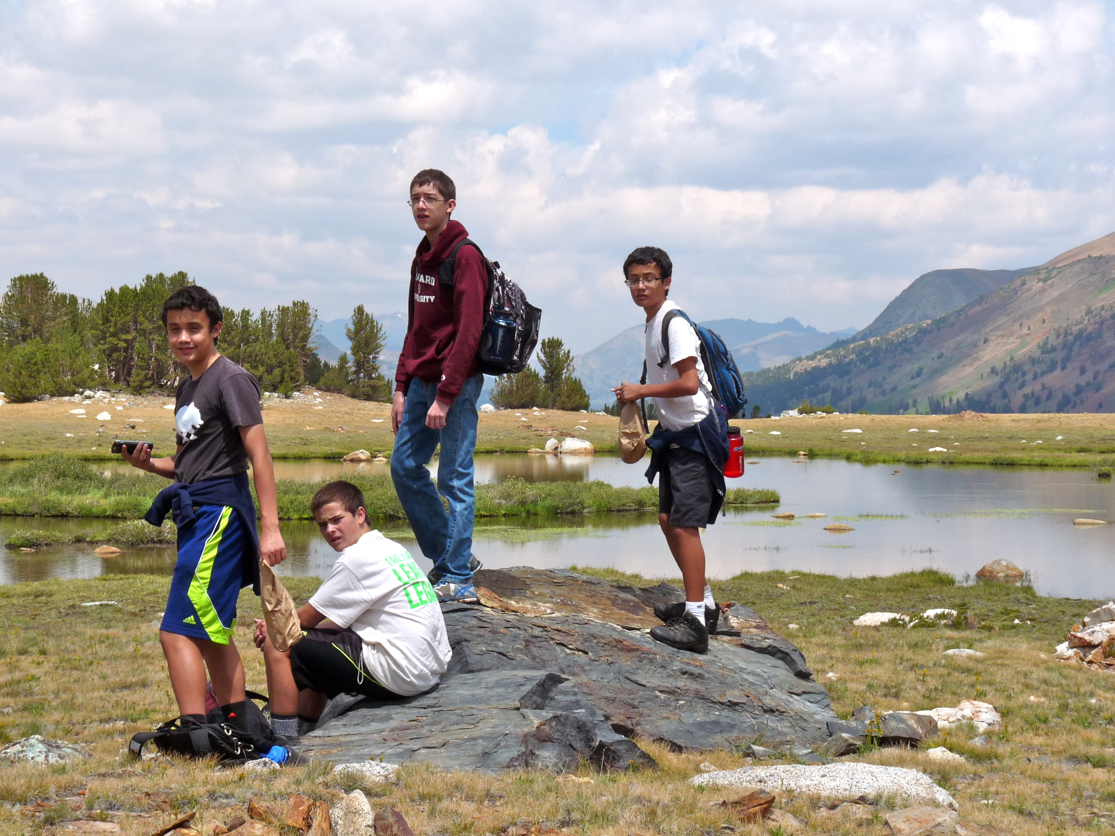
Spillway Day
August 6, 2014
The John Frames arrived last night. In tow were two extra 13-year-olds: Matthew’s friend Jeffrey and Dean’s friend Tyler. We all–nine of us–had dinner together in the lodge and plotted our plans for today’s intro hike (their intro hike, our day two).
We decided it’d be Spillway. Man, I love Spillway. The John Frames had never been up to the Mono/Parker Pass area.
In for a treat.
We got to the Mono Pass Trailhead (9,700′) and hit the trail at 10:15 under sunny skies and cool temps. Off to the right (west), a great view of the Kuna Crest the whole way and its northern-most edge, Mammoth Peak (12,117′):

Yes, as a matter of fact, Jim, Peter and I did climb that… about four years ago, I think.
The meadows at the lower part of this hike are beautiful (you can see a small bit of Parker Pass Creek off to the right) :
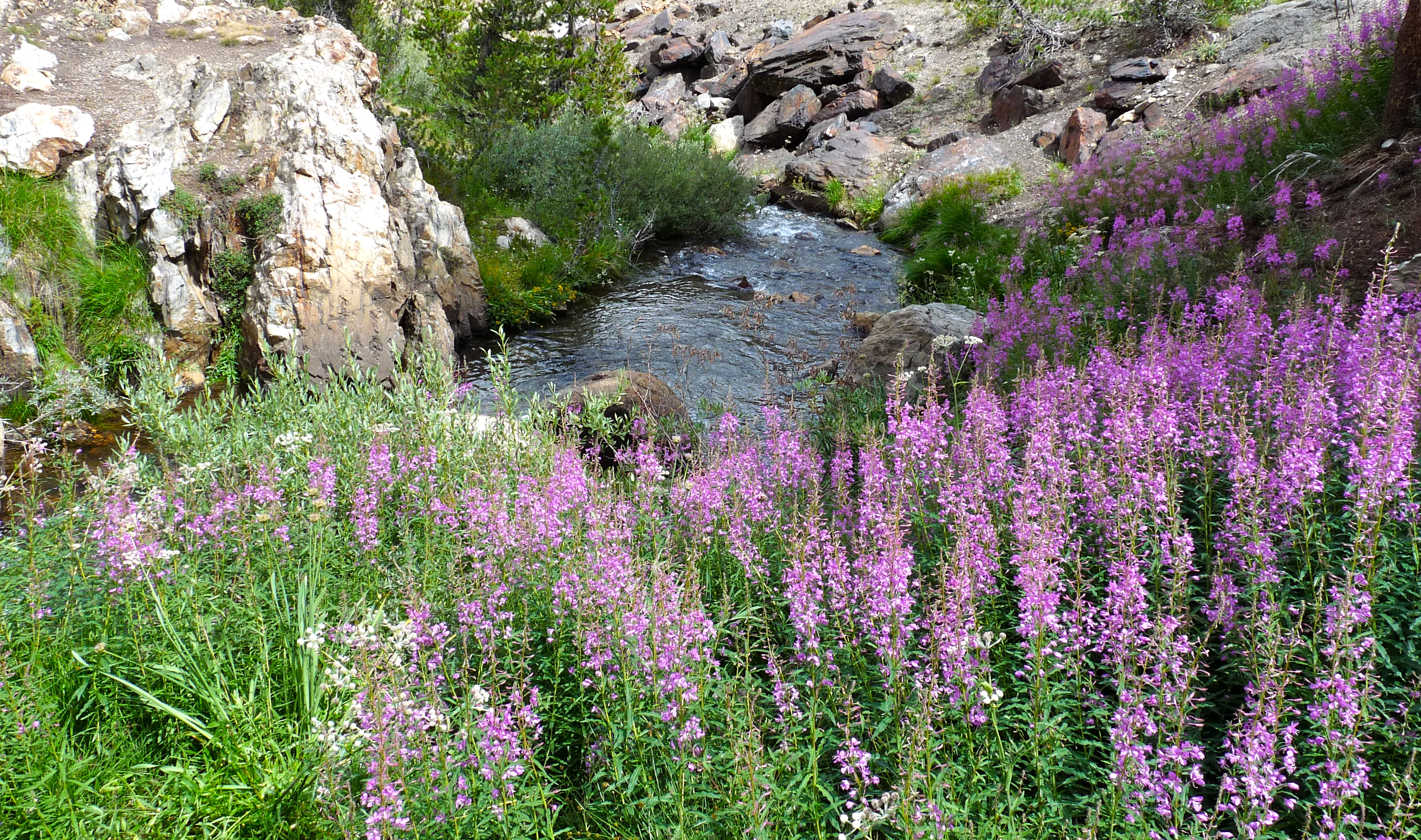
I love this part of the trail where you follow this creek which eventually flows into the Dana Fork of the Tuolumne. The wild flowers along here can be stunning if you hit it just right, and the sound of the falls can be deafening in good water years.
After about four gentle miles, you get up to Spillway Lake (10,450′). The setting is truly magnificent. It’s open and expansive and just looks like a giant, giant grassy, rocky park, surrounded by mountains–the entire Kuna Crest to the west, and Mt. Gibbs (12,764′) and Mt. Lewis (12,296′) to the east (and Mono Lake on the other side of that). You can see Mono Pass and Parker Pass, both incredible destinations (and Yosemite Park boundaries).
This is right near the edge of Spillway, looking north, back from where we’ve come; this water will flow out to the drainage we followed coming up (Parker Pass Creek). Gorgeous day, cool.
Clouds are forming.

Maita, John and their four charges arrived after a little bit (they had a couple of new hikers). We all found rocks to sit on and had lunch.
Jim, Peter and I decided we were going to climb up to a massive shelf at the base of the Kuna Crest and explore a bunch of lakes up there and come back a slightly different route. We parted ways here.
We started by following the drainage of Lake Helen, our nominal destination:

Then headed up out of the basin..
…and arrived at Lake Helen (10,952′), super pretty up there:

The two peaks Peter and Jim climbed last year, part of the Kuna Crest, Kuna (13,002′) and Koip (12,962′) are off to the left.
One of our books says this about the area:
The jewel of this trip is the extended cross-country traverse along the base of Kuna Crest from Mammoth peak to the crest above Helen Lake. This is a rocky upland with marvelous views in every direction–just the thing for those who yearn, at least occasionally, to get off busy trails and enjoy some soothing solitude.
We definitely had the place to ourselves, saw one guy once, but he disappeared at the top. The trail coming into the Spillway area? I’m not sure we saw more than half a dozen people all day. If that.
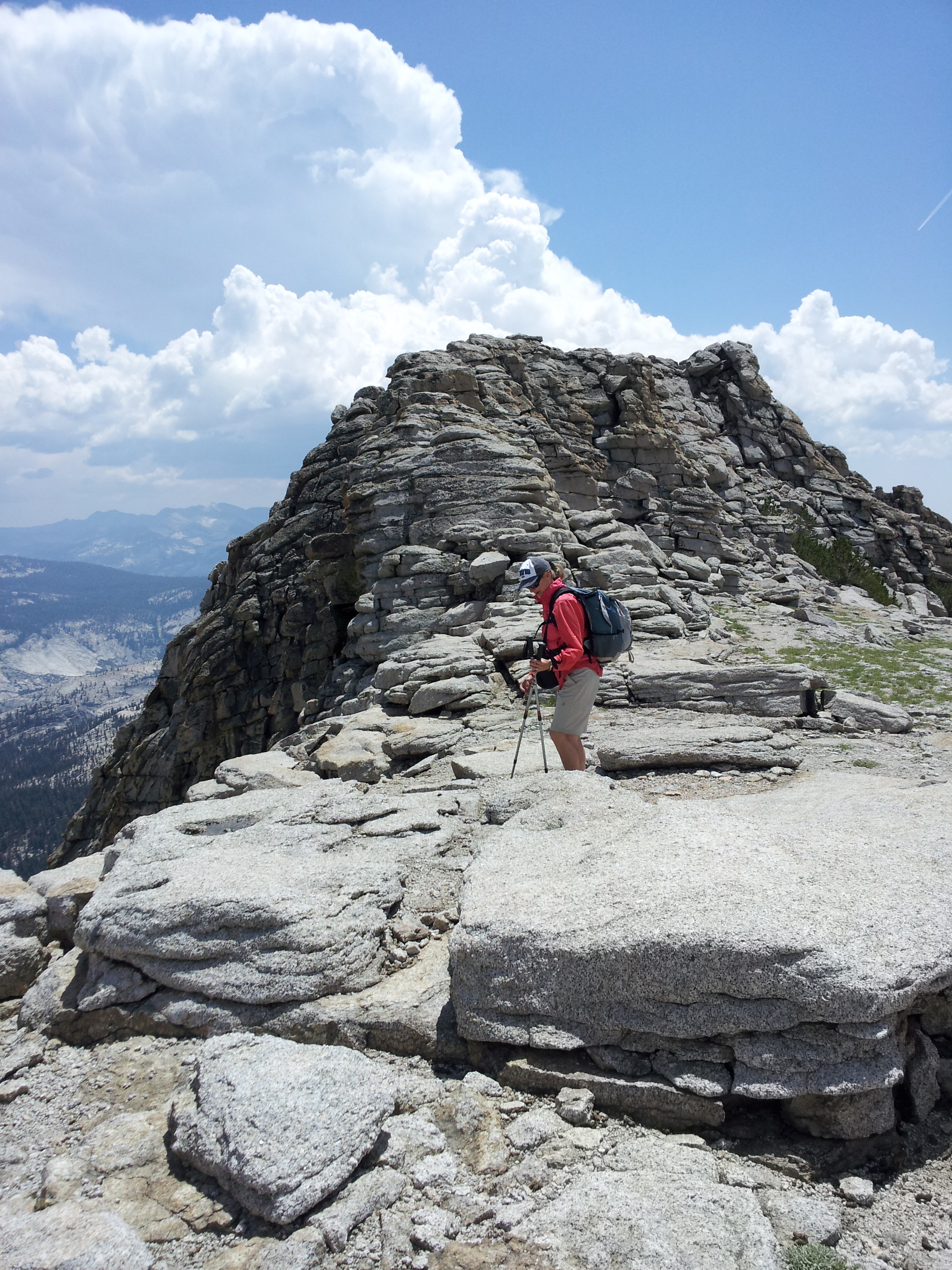
We got to a good view spot and planned our next move. We were trying to decide 1) whether to bail because of imminent weather or go explore a couple more lakes (Bingeman and Kuna and a couple smaller ones, which we’ve been to before, but from the other side), but if we were going to bail, 2) which direction would be best for descending to rejoin the trail back to the trailhead. It looks reasonably nice here, but thunderstorms were in the forecast and thunderheads were definitely forming:

Here’s the view; that’s part of Spillway below, about 500′ down:

We decided to do a bit more exploring. We traversed a couple of largish cirque-y things, and ended up scrambling down one fairly challenging (for me) slope with giant boulders. It was getting storm-dark… I was starting to feel like we’d overstayed our welcome.
And then it started getting really windy and thundering like crazy; the storm was hitting the mountains on the east side of the basin, so we decided to forgo the other lakes and head down.
Which we did at somewhat of a run. Which, if I hadn’t been so freaked at the prospect of getting zapped by lightning, would have been really fun. We were high-tailing it (well, I was) down this sort of soft, moist (but not yet wet) slope with beach-ball-sized rocks and scrubby trees all over making it seem like a giant obstacle course. Fun, but would have been funner if I hadn’t felt like a moving target.
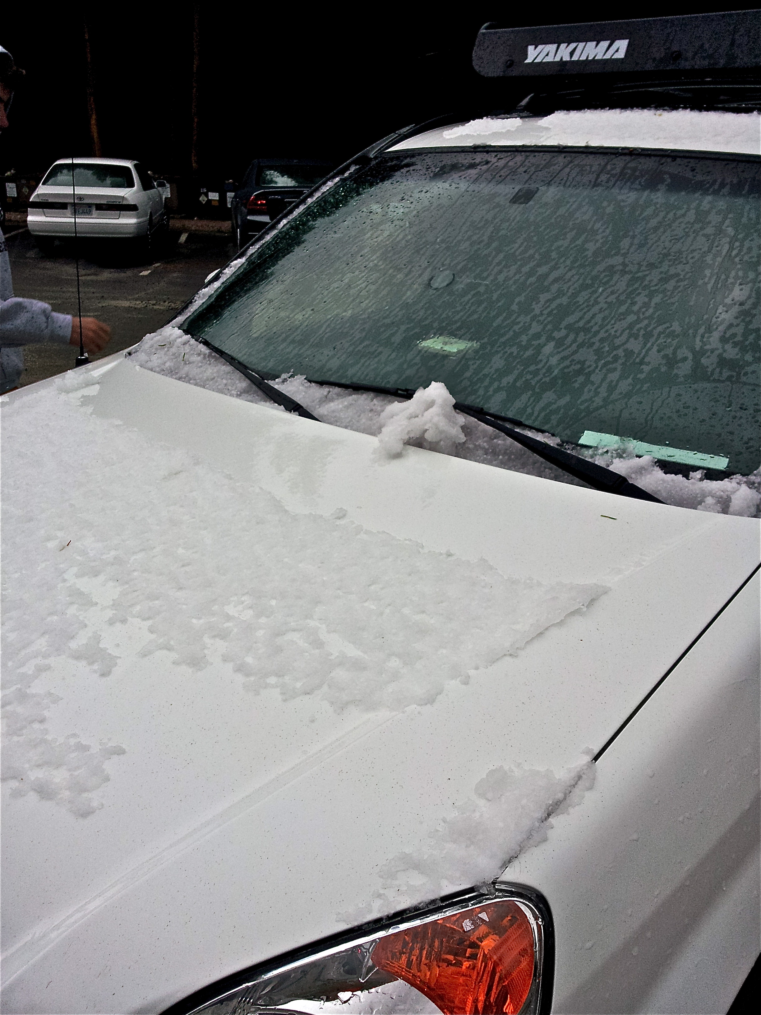
It thundered and thundered, super loud and very dramatic. After about an hour of mad down-scrambling we rejoined the trail, which made things seem a bit safer, and then had about three miles left to go. We avoided rain until exactly the moment we got back to the car.
And then the skies just opened up. Hardest downpour of rain and hail I’ve ever been in. And such the noise! Within minutes the hail piled up on the sides of the road looking like snow drifts, it was also piling up on our windshield, and we had to pull over because visibility was almost zero. Plus, we were laughing hysterically and trying to shoot videos on our phones.
Talk about Spillway.
Here’s our car back at the lodge, after most of the ice had blown off:
The rest of the evening was the usual… hot showers, then hung out in the cabin and snoozed and read until dinner. So tired, but so great.
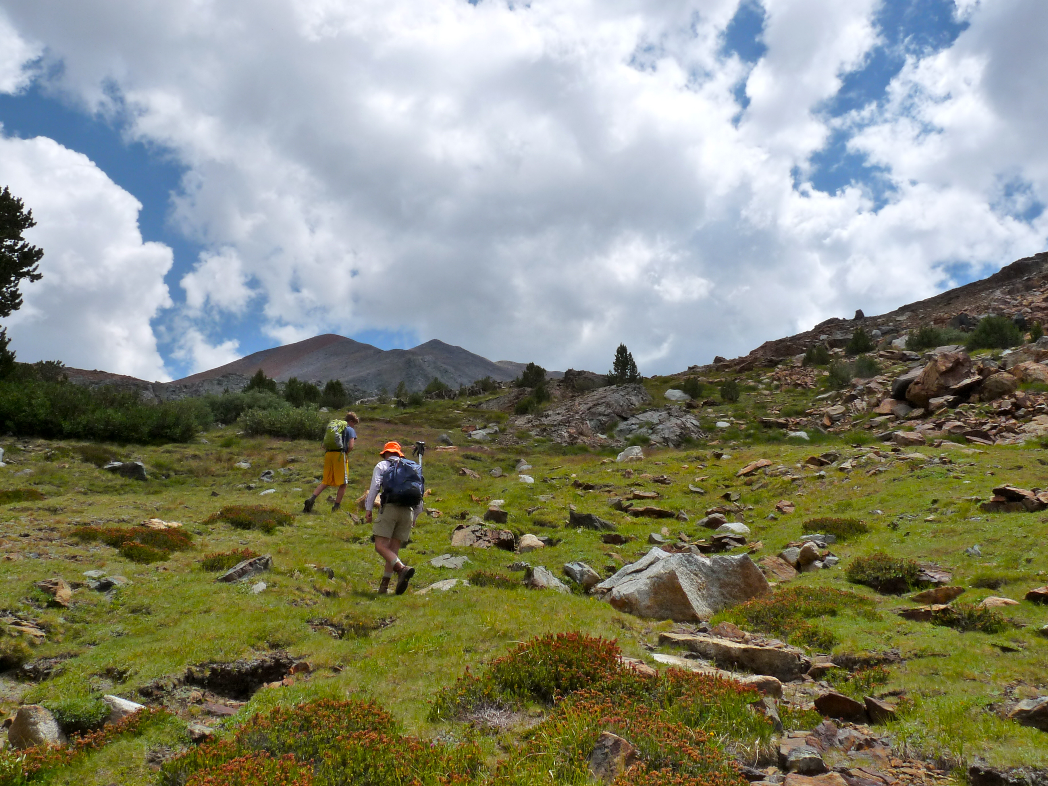
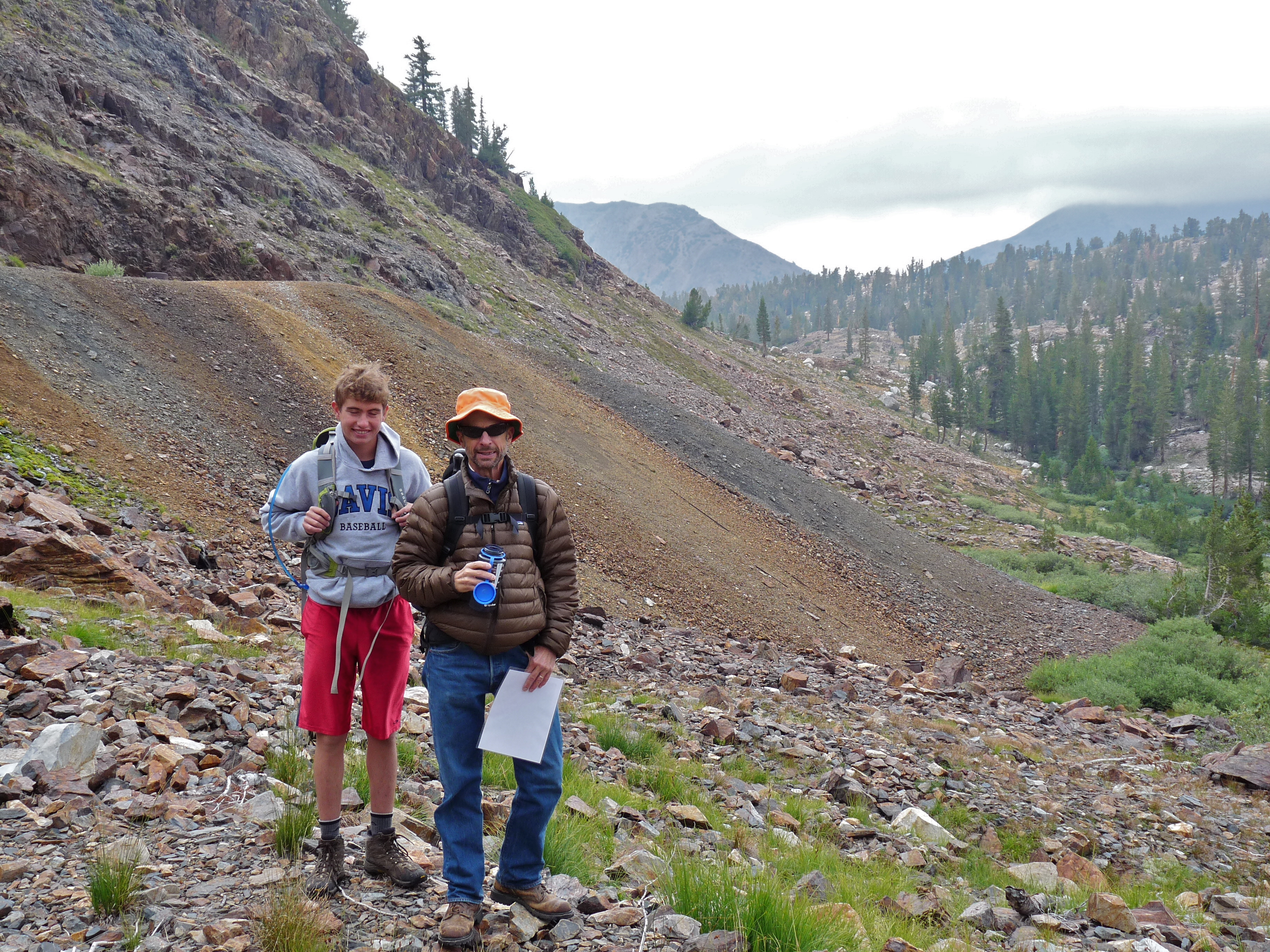
Bennettville Hike
August 5, 2014
First day is always about acclimatization. If we’re smart, we look for a hike that is not terribly strenuous, but still gets us out and about (because we’re here to hike) and also works to increase our red blood cell supply. You know.
Plus, we’re always looking for a hike we’ve not done.
Bennettville was that hike.
Parked across the road from the Tioga Campground just outside the Tioga gate, starting around 9800′. We headed up the hill until we found a small lake, on the other side of which was a trail that lead to an old mine (in use from 1882-1884).
Here you can see some of its tailings:
Here’s the mine, close up… a deep tunnel, some remaining tracks, a blower and some sort of steam engine. I think.
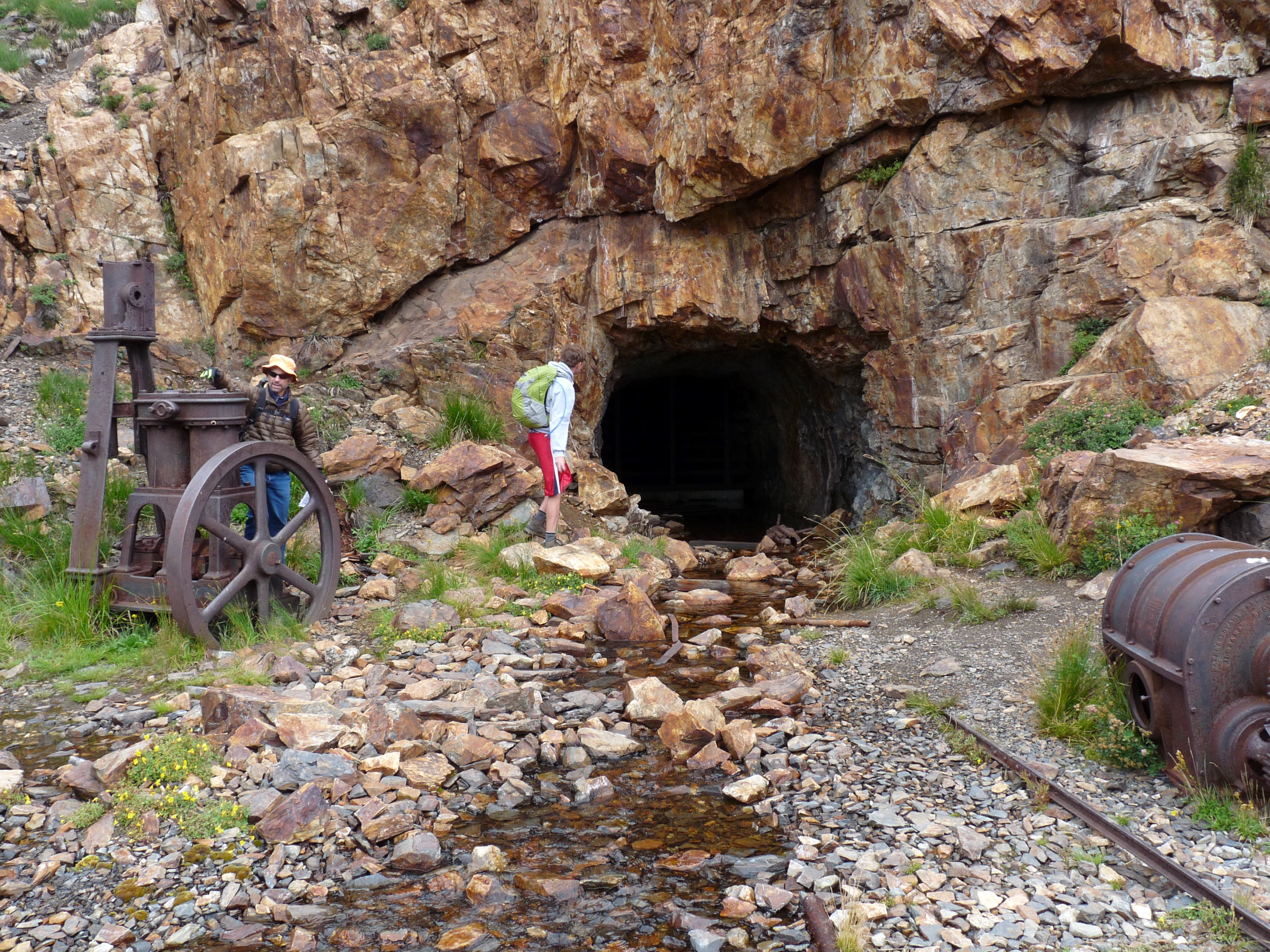
Visible down the hill were a couple remaining buildings from the small mining settlement of Bennettville:

And closer up:
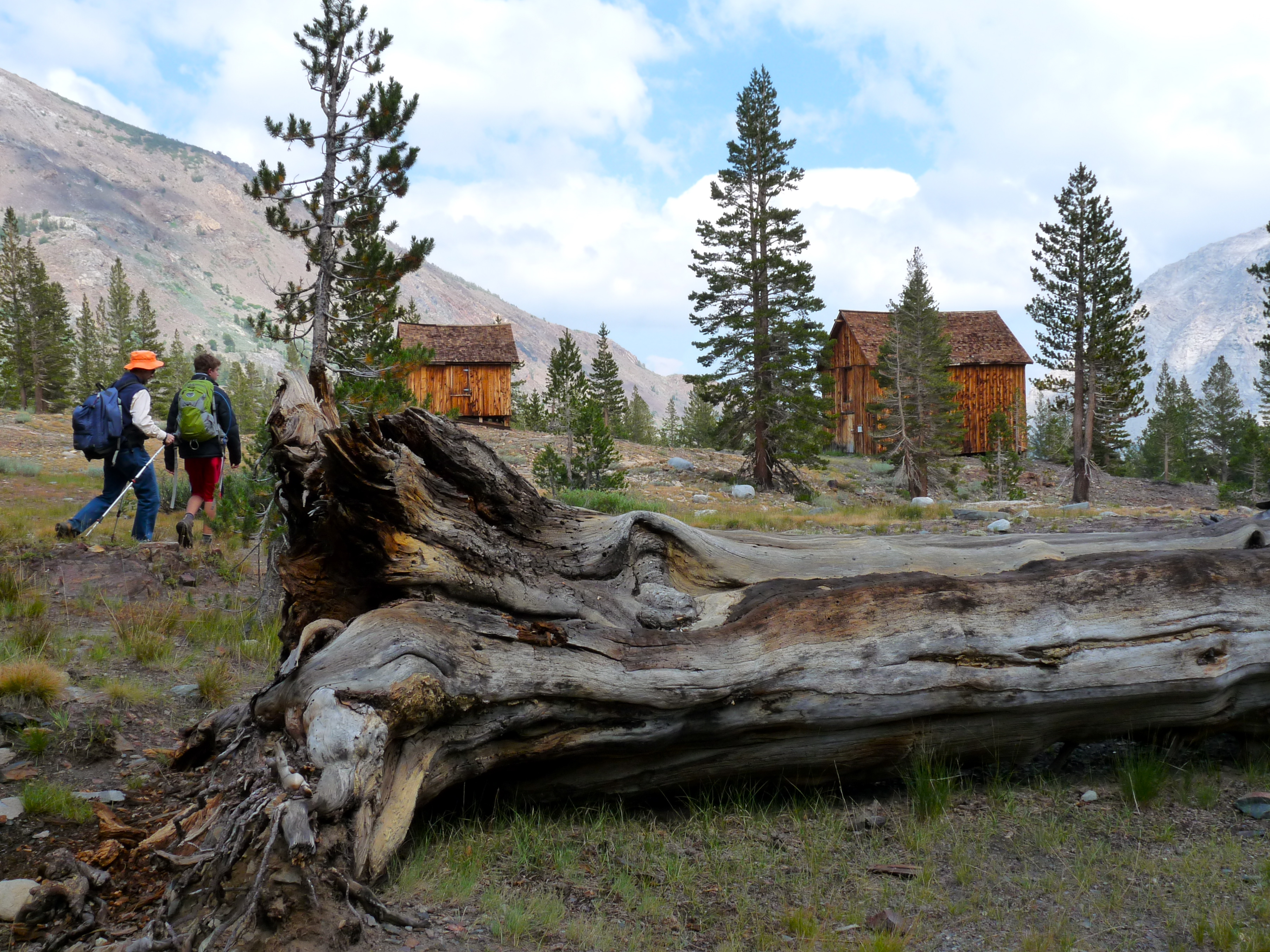
They’ve restored these a little. Below is the bunkhouse. We went inside the smaller of the two buildings (the former assay office).

Here’s an explanation:

So that was all interesting, if you like that kind of thing, but I enjoyed the hiking more.
Some shots…
Jim’s trying to figure out how best to cross this bit of water:

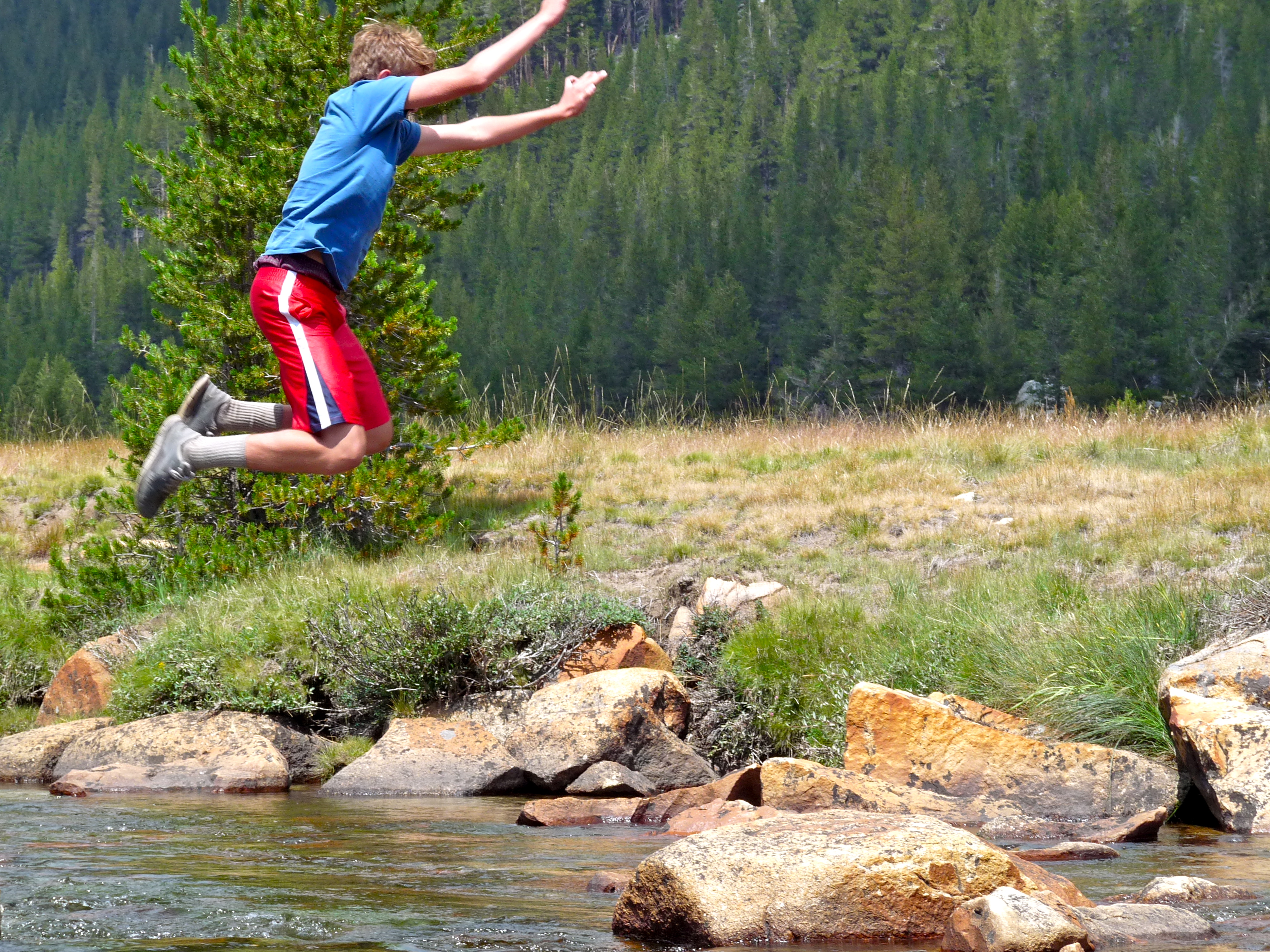
Peter has an idea:

Which worked pretty well!
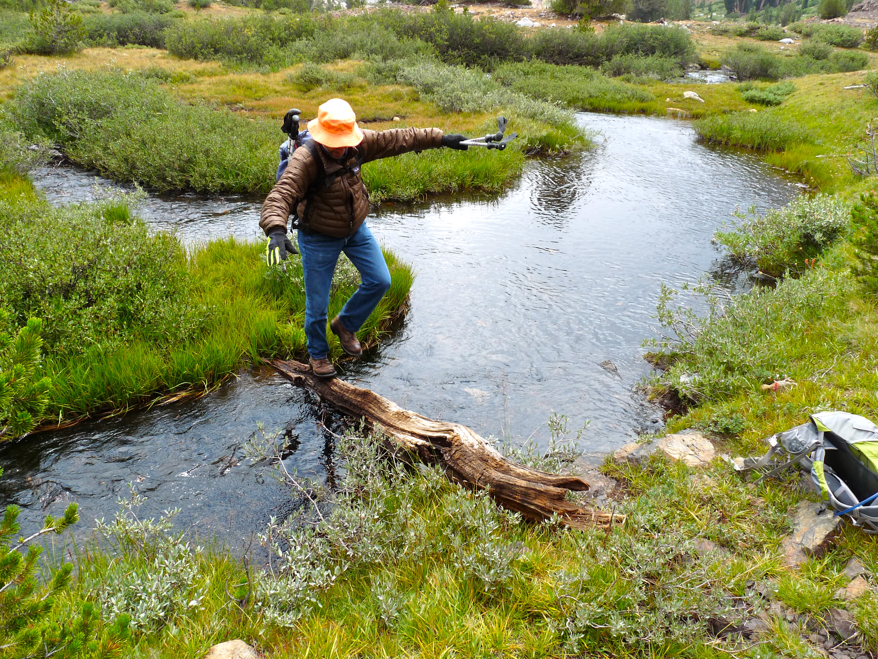
I took one boot off and stepped right into the water, crossing easily… while Peter did this (for him: easy and fun):

We wandered about another mile up the valley past a couple lakes (Shell, and Fantail where we ate lunch)…. and eventually got to Spuller Lake. From there we could sort of see the valley we hiked through two years ago to get to the route up the East side of Mt. Conness, 12,648′ (which Peter and Jim would try again this year).

It was extremely cold! I can’t remember the last time I hiked in Yosemite, in summer, in long pants and down…wishing I’d had gloves!
But it was very pretty!!

And we had this guy with us…

So… definitely not complaining.
Yosemite Commute
August 4, 2014
Okay, annual go-to-Yosemite trip. Oh yay, oh yay!
New thing this year, Peter has his license and got to drive. He actually shared the wheel, but here he is on the uppity-downity part of the commute… that wonderful stretch along Hwy 4 between Stockton and Copperopolis.

Oh how I love this road (especially sitting in the back seat, taking drive-bys, and messing with the settings on my iPhone):
Now on the little connector road between Hwy 4 and Hwy 120 — the O’Byrnes Ferry Road – this is Lake Tulloch:

Then on to Hwy 120, past Groveland and a late lunch at PJ’s, and finally on our way to the park:

First signs of the fire damage… could almost be a fall shot… but it’s definitely not:

At last, entering Yosemite at the northern-most of the two west gates:

More evidence of fire damage:

And smoke still visible:

In nine days in Tuolumne Meadows, we saw little to no smoke… there were a couple times– when at the top of domes or peaks–we saw the smoke from some small fires that broke out for short periods, but nothing from the big ones that shut down portions of the park in the week before our arrival.
We got some rain, however, which was very welcomed! Here’s a shot as we are passing Tenaya Lake just before Tuolumne Meadows. Yay, almost there!
Arrived at about 6:45pm, time enough to unload all our stuff into cabin #5 and make our 7:15 dinner reservation in the lodge.
Happy.
Down the Mountain, Up the Mountain
August 3, 2014
Peter just got back from a 4-day camping trip with some baseball friends today. Tomorrow, we leave again for a 10-day Yosemite trip.
Poor guy. Summer’s rough.

That is Jake’s mom, Kathy on the far right. She, apparently, takes a ton of kids camping every year. Kathy, herself, has seven kids, so by the time you include many of those (this year, I believe four or maybe five of them came) and throw in their friends, well… it’s a big group. And, for the most part, Kathy handles most of the duties. High functioning or nuts. Maybe both.
They went to Lodgepole Campground which, as I understand it, is near the Emigrant Gap area off I-80, not all that far from the summit.
Front row: Jake (Kathy’s son), Solly, Peter, Ray, Kathy
Top row: Friend, friend, friend, Leah (Kathy’s daughter)
Another son (college sophomore) was there with a whole bunch of his friends, plus one of Kathy’s older daughters and her son. After that, I lose count.
Anyway, dirt, lake, logs, rocks, fire, trails, bear, mountain lion (maybe)… I heard about many adventures. Peter said he had a really fun time.
Photo, courtesy of somebody who was there, which I was not.
Framed
August 2, 2014
Oldest line in the family of my in-laws…. Framed… as in, I got Framed.
One can do a lot with a family name like Frame.
Today was a mini Frame reunion. In fact, it was so mini, it was more like just a family gathering. It was hosted by Jim’s Uncle Mike and Aunt Marsue in their crazy garden in the hills of Clayton, for us about an hour away.
Traditionally, the Frames have a reunion every two years which brings together the eleven Frame siblings (those remaining)–all of whom were born in the same house in Lawrence, Kansas starting sometime just before the 1920s–and their families.
However, for some reason, the reunion was not held last year, as scheduled. So, Jim’s aunt decided we should at least gather those in the vicinity. One of the uncles came from outside that vicinity, so it felt like a special gathering.
There were eleven of us today, including three of the original Frame brothers–Jim’s uncles Dean, Kent and Mike.
A good time was had, even if it wasn’t a full-blown reunion.
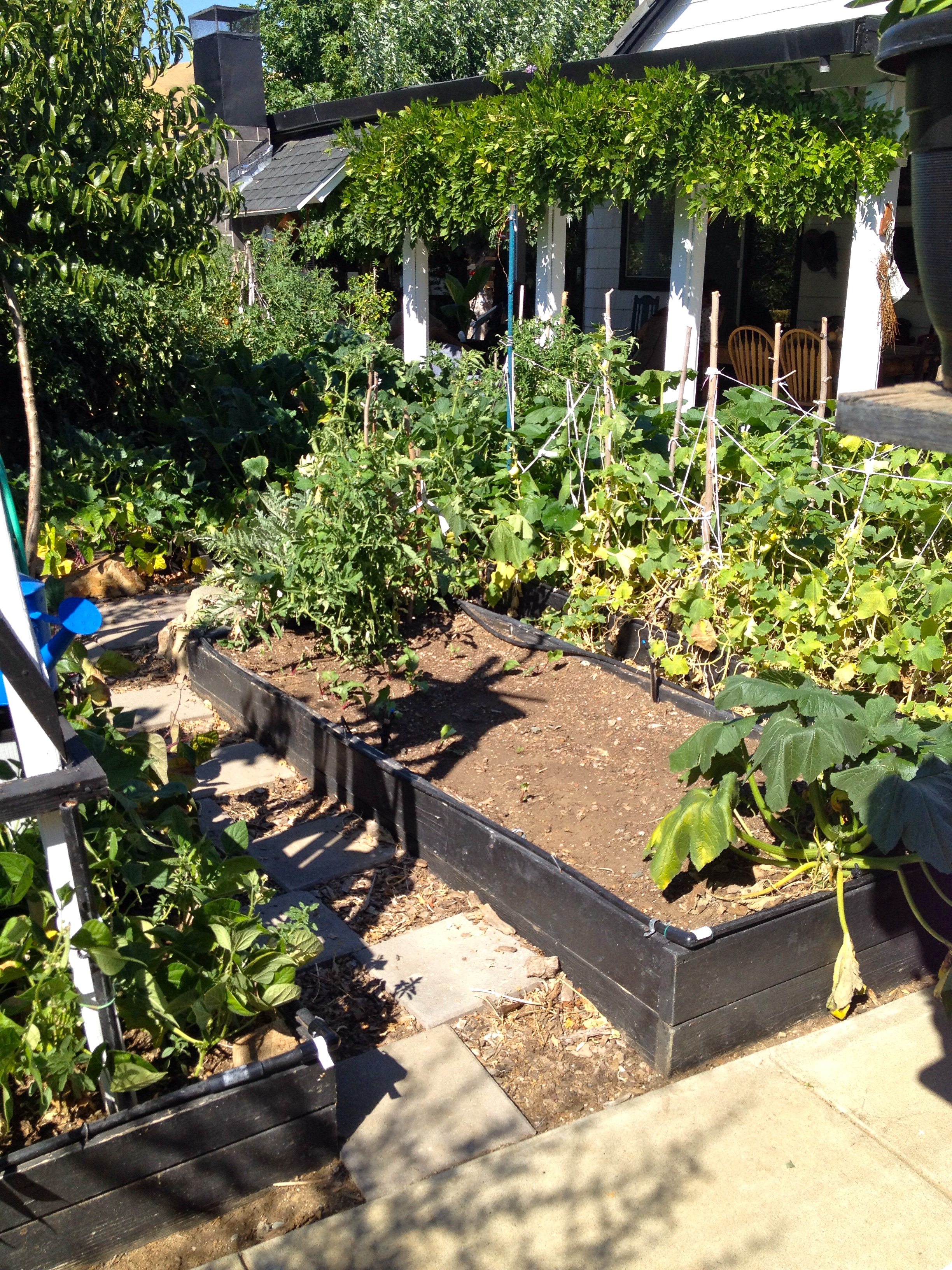
Anyway, Mike is a gardener, designer, builder, artist, handy guy. He’s covered every single square inch of space in their large backyard with raised beds, terraces, trellises, archways, numerous seating areas, swings, art, mirrors, more art, pathways leading up and down the slopes & banks, and cobbled pathways that wind all over the place. It’s quite the ongoing project–the Winchester Mystery House of gardens–and very difficult to photograph. But, here are a couple shots:
He’s got his various crops assigned to their own beds–and lots of them–tomatoes, artichokes, peppers, onions, squash, etc. He’s got trees: citrus, peaches, plums, figs, avocados and someI couldn’t identify. Grape vines, too.
The art’s a hoot… whimsical wood and ceramic sculptures, various rock constructions, bottle art, all kinds of hanging things. This particular tree is covered with favorite quotations printed on colored wood blocks:

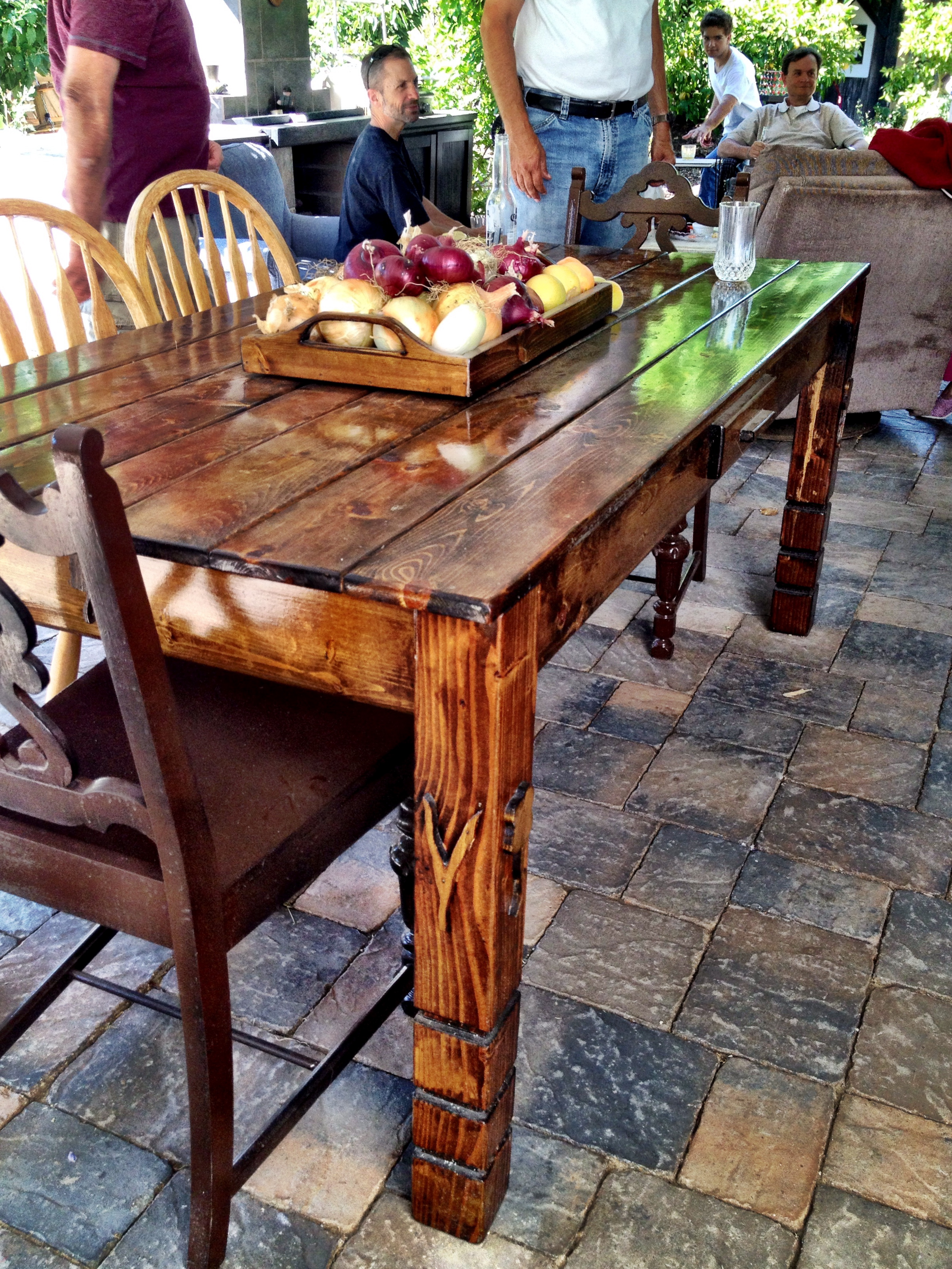
This is the main patio, with a basket of garden bounty on a beautiful wooden table (misters and fans are keeping everything cool):
I took lots of people shots, and of course group shots, but this is my favorite: Peter’s cousin and great buddy, Ben:

