
Flood, River and Ocean
July 31, 2016
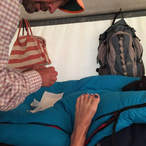
Welp, started the day with a big flood. I can think of a thousand things I’d rather have had happen… but, flood it was.
Old house, aging pipes, overload (Peter’s long showers may work in Davis, but not Palos Verdes)… whatever it was, it resulted in water rising in mom’s bathroom, covering the floor, soaking the rugs, walls and other low-lying items. A big messy mess.
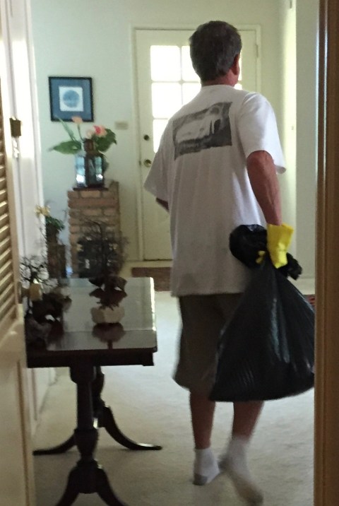
Chris did the lion’s share of the cleaning.. here he is, rubber glove-clad, hauling out a load of wet matter:
Very unlike me–iPhone documentarian that I am–I missed all the best flood photos. Probably better that way.
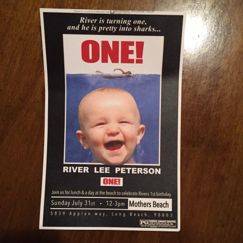
Mom and I decided to stay to deal with plumbers (who, actually, never came, this being Sunday and all), and once everything was cleaned up, Chris and Peter headed out for the party:
They had a lot of fun.
Mom and I spent the afternoon playing gin rummy. As usual, she won most of the games.
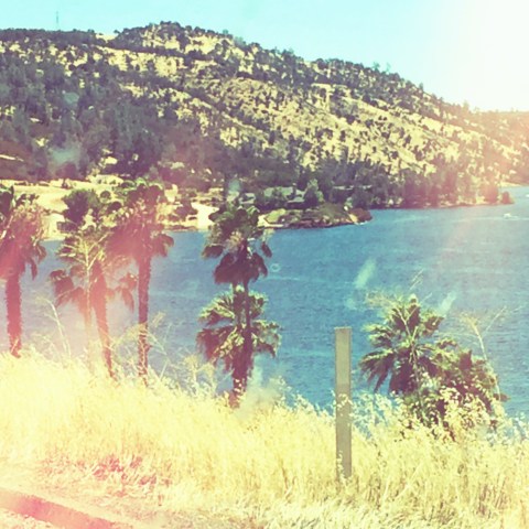
Peter and Chris returned. Mom didn’t feel her Sunday best, but we figured Grey Goose, double espresso, rich meal, late night, the drama of the morning’s flood… she’d be okay. Peter and I took off for points south–La Jolla, here we come!
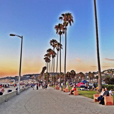
Happy to be strolling along the strand in La Jolla shores… one of us pretending he’d never seen the other goofball before in his life…

This is actually what he’s looking at… the scene at La Jolla shores…
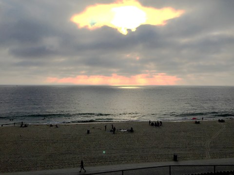
As we seem to do, we’d arrived just in time for sunset…

The beach was packed with people, pit fires, activity….
Decided to eat at the La Jolla Shores Restaurant (and Hotel). We actually had a great dinner, and most certainly got a great table. Our view, as the sun disappeared beneath the horizon…

…and then…

After dinner, we walked around the shores area. Peter was feeling comfortable, as we’d been there for Grandpa’s 90th… a year ago January… and he remembered a lot.
Lots of twinkly lights, restaurants, bars…

We stayed at the Sheraton, up the hill and adjacent to the university. Good place.
Tomorrow: UCSD, Torrey Pines, La Jolla Village, and the cove.
Road Trip
July 30, 2016
Got back to Davis from Yosemite on a Friday night… left for Southern California on a Saturday morning.
We had all kinds of reasons for this quick trip:
Top of my list: wanting to squeeze in some special together time with Peter before he flies the coop. Also, having missed the June UCSD orientation, Peter was feeling like he needed to get a feel for the campus before he moves down there for good. It’s also River’s first birthday party weekend… so a triply good time for a road trip. Bonus buys: see Grandma, play Torrey Pines.
No time to waste.
Even a day spent on I-5 is time well spent when you’re with your college bound kiddo. Hit the South Bay, exited the 405 at Rosecrans and headed west. Made it by sunset…
Ahh….
Checked in at the comfy Inn at 2915. Mom seemed great. Chris, mom, P and I had a nice (if noisy) dinner at Admiral Risty (wow, it’d been a long time)…. ran into some people we knew, had cocktails (mom loves her Grey Goose), excellent fresh fish… capped our late night dinner with double espressos and dessert….facts that may or may not be relevant, but there they are.
Good start to what would become a memorable couple of days.
See Ya Next Year, Tuolumne
July 29, 2016
Go home day.
Some parting shots.
Sitting in lodge, waiting for breakfast. The “lodge” is nothing fancy–concrete floor, canvas walls and ceiling, wooden frames, furniture that must endure the winter locked up in some metal crate. It’s a high camp experience…
Still, they have windows… and I love them:
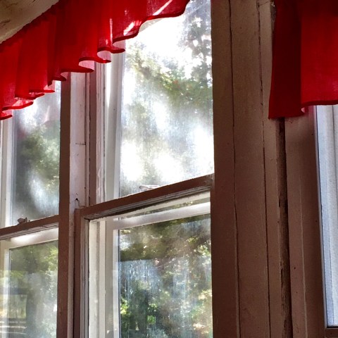
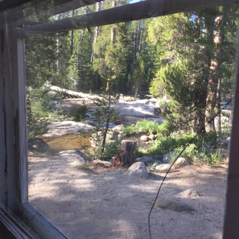
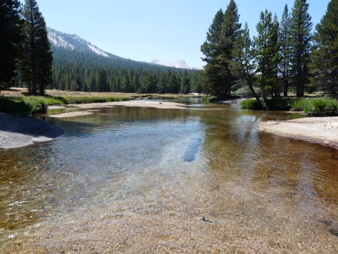
Here’s our view, from the corner table, looking out at the Dana Fork…
Peter’s hot chocolate…

My favorite combo this year: toasted english muffin, served with a side of peanut butter, bananas and crispy bacon. Some assembly required:

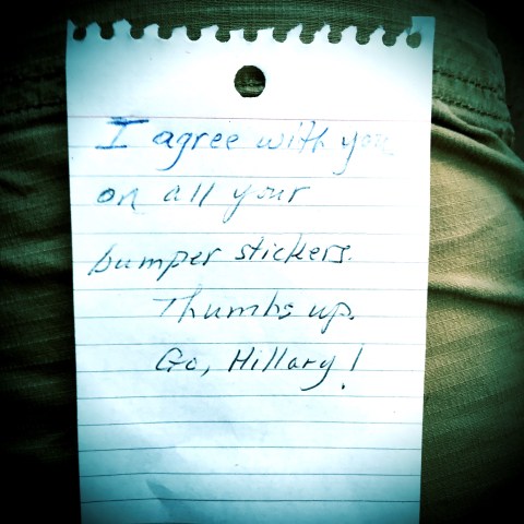
Here’s a note we found tucked under our windshield one morning. Made my day!
And that’s the thing about Tuolumne… many birds of a feather drawn to a vacation of hiking. Lots of boomers with aging knees (and hips), who appreciate the comforts, if minimal, of tent cabins, because carrying heavy packs into the backcountry and having to do all your own cooking just seems… unnecessary… when you can have a bed, hot shower, and the aforementioned peanut butter, banana and bacon sandwiches. I always love being in the company of people who prioritize hiking and climbing, love the mountains, care about the environment, value science and, for the most part, lean left. It’s the Tuolumne way.
So, let’s see, what else… here’s another couple shots of Lembert I like:

Here’s our annual shot from the stoop. Of note, we were given the option, when we checked in, of selecting Cabin #2–one of the highly sought after 1, 2, 3 cabins situated adjacent to the Dana Fork and removed from the hustle-bustle of the rest of the compound (such as it is). We seriously considered it, but then settled on Cabin 6 because of its proximity to the bathroom. Are we old or what?
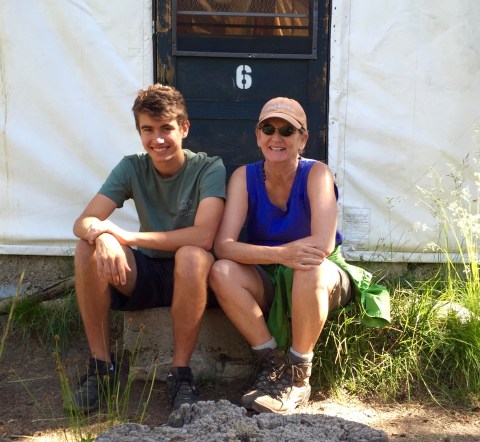
He’s cute, isn’t he? I’m just ridiculously happy to be sitting next to him, and so in heaven having had an entire week to spend, just the three of us, in our favorite place on earth, doing what we love the most. Holy cow. Doesn’t get any better than this. All misty as the week comes to an end.
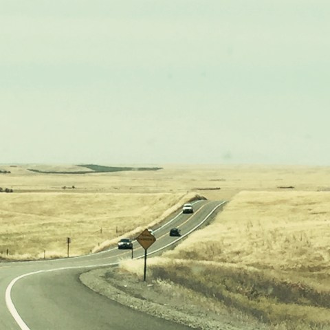
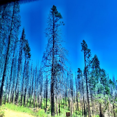
Here’re a couple shots from the drive home…
Fire aftermath:

And, because I can never get enough road shots:

A Peak Experience
July 28, 2016
I’ve probably used that clever title before. Please forgive.
Our collective objective today was to climb Tuolumne Peak. I knew Peter and Jim would have no issues, and I had hopes for me… so we started out with optimism.
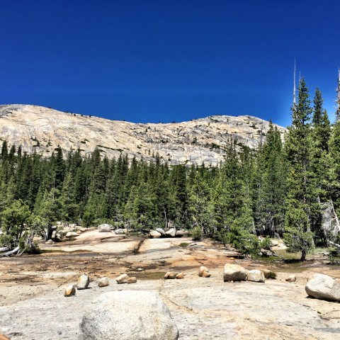
Drove up to the May Lake turn off, three miles beyond Olmsted. There’s a parking lot a couple miles in along a dirt road, which serves as an easy and accessible trailhead for the May Lake High Sierra Camp. Have used this trailhead numerous times, and love this short little 1.2 miles into the lake.
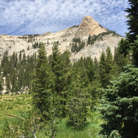
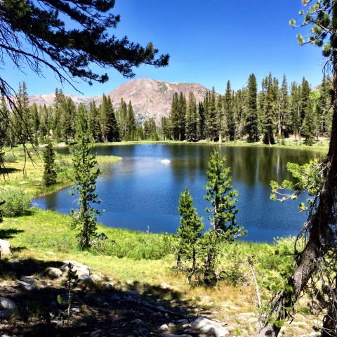
And wow, nothing beats May Lake for beauty. Mt. Hoffman is off to the left, out of view…

… and Tuolumne Peak, our destination, is to the right:

At the recommendation of Nester, an interesting fellow who’s been a host/waiter at Tuolumne Meadows lodge for the last five years (and who comes from Long Beach, as it turns out), we sought out Brian, a long time staffer at May Lake, to inquire about the best route up Tuolumne Peak. He recommended something entirely different than we’d planned, a route that would save us maybe five or six miles. Good tip!
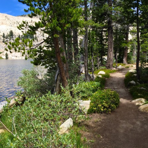
We set out. the trail along the lake is so pretty:
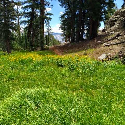
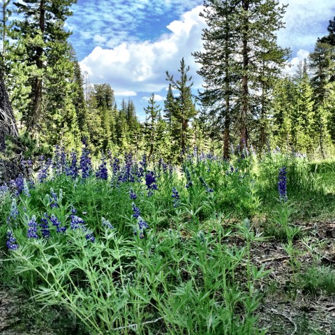
After about a half mile, came across this lovely meadow, thick in yellow wildflowers..
Then, this one…
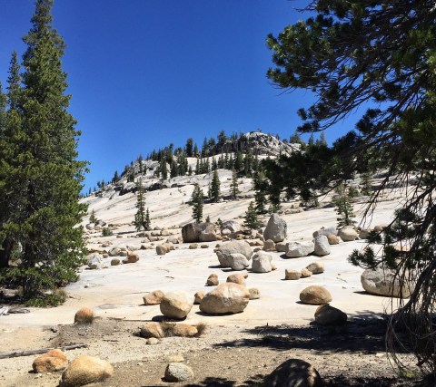
Bore off the main trail at this point, and meandered northward.. more good views, this one of the peak (though not sure which is the real one in there):
We went another half mile or so and I realized, 1) my hip wasn’t going to make it, and 2) I didn’t want to have to retrace too much of the off-trail stuff by myself, so turned around.
Bummer.
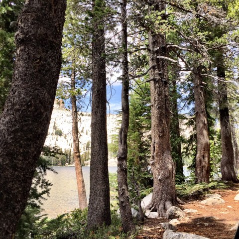
I returned to May Lake and found a good spot under a tree (or twenty):
And did this:

For the next three or four hours.
Ate lunch, hung around with this guy:

And this guy:

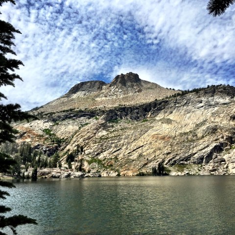
And zoned out on views of Mt. Hoffman (which is behind those two prominent points):
Peter and Jim returned after a great, great trip to the top [Jim’s pictures coming]. Said they found the route, most of it was actually an unmaintained, but clear, trail, and it was done of the best views of the whole of Yosemite.
Headed down to the car, and back.
This being our last day, I decided to take a short walk up the Dana Fork.. mostly just a sentimental jaunt.
The thunderheads were building, something we didn’t see much of at all this trip..
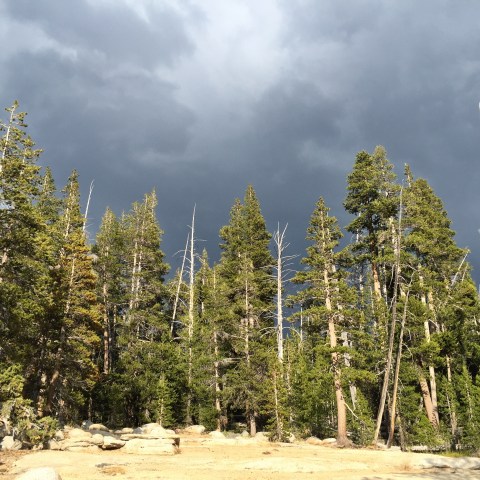
A nice view downstream:
Sat for a spell…

Sad, of course, that it’s our last day.
Hidden Lake
July 27, 2016
We were looking for an easy day–as Tuolumne Peak is in our sights for tomorrow–but also wanted something we’d not done before… hard to find those uncharted destinations, within the day’s hike perimeter of Tuolumne Meadows tent cabins.
Jim suggested a little off trail hunt for Hidden Lake.
Which we did.
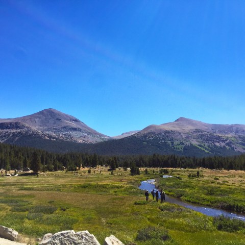
Started at Olmsted, which we sure don’t do often–not much goes out of there, and what does is down. Ambled along the trail that leads to Yosemite Valley (the valley’s about an 8-11 mile hike or so from Tuolumne.. which is funny because it takes about an hour and a half to get there via car). This trail zigs around beneath the Olmsted turnout; you’re within earshot of the dozens of cars parked at the vista point parking lot above you. Feels like too much humanity when you’re trying to have a wilderness experience, but soon enough, after about a half mile, we bore off trail and out of earshot of the road.
We spent a bunch of time bushwhacking around, then up the side of a big hill, and along a particular contour, confident the lake was more or less at our level, but further beyond/around. Jim scouted, found the lake, and we proceeded.
Here was our first view:
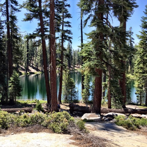
Nice, huh? Not a granite-bound lake, like so many, but also not mosquito infested. And we were utterly alone. It was only about a mile from Olmsted, as the crow flies, but with no trail, it doesn’t appear to attract folks.
Spent about an hour by the lake… Peter did this:

Jim and I did this:

And then we decided to try a different out. We headed to the top of the granite slope behind us, instead of retracing our bushwhacked steps:

At the top of that rise, we found we were in four-bars-of-service land! So we did a little of this:


For about another hour. Caught up with the world…that was fun.
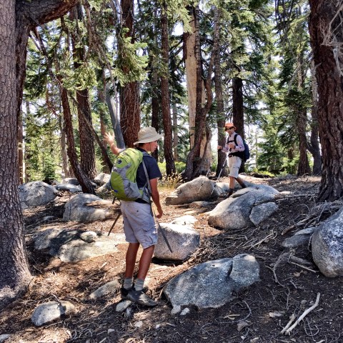
Continued our amble through a forested area that looked like this… this is Peter practicing his golf swing:
Then, we’re almost to the top of the ridge:
Got to the top and got this view… Tenaya Canyon is to right, not visible in this picture, and straight ahead in the distance, the domes and peaks of Tuolumne Meadows, with Tenaya Lake in view. You can even see Olmsted point down and in the foreground. We will head there after spending time taking in the fantastic views.
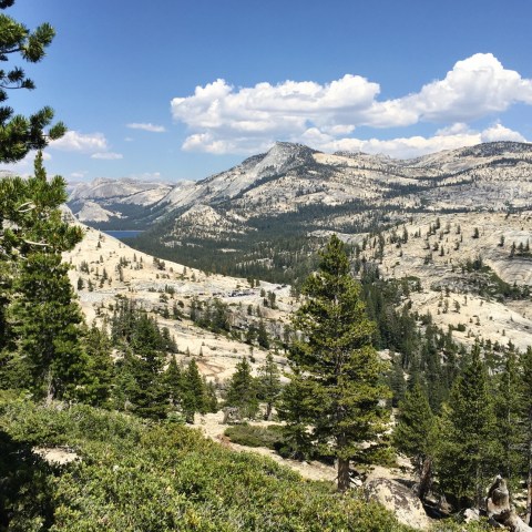
Here’s a bit to the left:

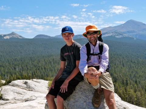
Peter and me. The photo shows the terrain made for some good boulder scrambling:
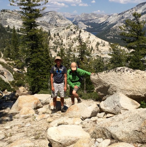
The trip down from there was easy and fun. In future, we’ll pick our way up this ridge, rather than mess with the bushwhacking round back. Loved the area. Made for a sweet hike.
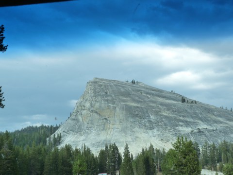
Drove back through the meadow… got this shot of Lembert… Tuolumne Meadows’ iconic structure that borders the east end:
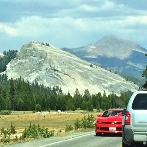
We didn’t even climb it this year!
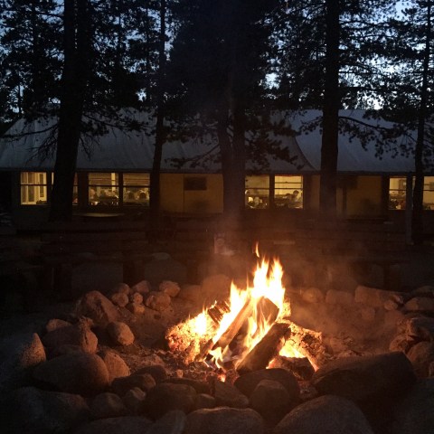
Returned early enough to have lots of time for gin rummy… that has been our pattern: breakfast, hike, gin rummy, newspaper (after all, the Democratic National Convention is underway!) and beer, chips, sodas, etc. Then shower, read a bit, dinner, maybe campfire, maybe more gin rummy… and do it all again the next day.

North Dome
July 26, 2016
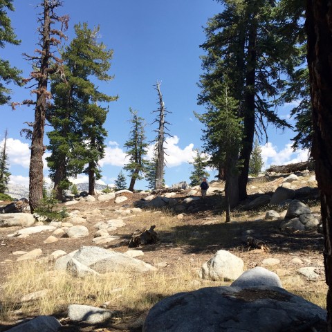
Today, decided on an oldie but goodie hike; it’d been two or three years since we’d been out on North Dome.
North Dome trailhead, which takes off from Porcupine Creek, is about seventeen miles from Tuolumne Meadows Lodge, so today was a get-in-car-and-drive day. The no-longer-free shuttles (don’t get me started), go only as far as Olmsted Point–twelve miles from the lodge.
Oh, now I’m started…. the no-longer-free shuttles….here’s the scoop:
With longtime Yosemite concessionaire Delaware North out and Aramark in, there are just untold dramas playing out. There’s the high profile trademark kerfuffle that’s resulted in the name changing of landmark institutions (for example, the historic and beloved Ahwahnee Hotel is now the Majestic... and other such silly things), and there are the dozens of other smaller, lower profile changes that are noticeable to people like us who return year after year and have well-established routines and practices that are now sort of.. different.
Like, for instance, the shuttle busses that were once free and are now not. Worst decision ever. The result of charging $12 (per person) for the 15-minute ride from the lodge to Olmsted Point, for example, is that nobody’s going to ride the shuttle. We’d always appreciated the ability to just grab day packs, climb on a shuttle and get dropped off at a trailhead. Or to flag down a bus if we emerged at some random place along the road after some off trail adventure. Easy peasy. Free. Convenient. And so relaxing. I mean, who wants to drive? But $36 for the three of us, plus the added hassle of now having to carry money/credit cards, plus the time it takes for everyone climbing on board to deal with these transactions… for crying out loud.
Worst of all, the result of people forgoing the now expensive and far-less convenient busses is bumper-to-bumper LA-style congestion all through the twelve-mile Tuolumne Meadows area, and super impacted parking at trailheads. It’s beyond ridiculous. Their goal has always been to minimize traffic impact in the park, for a zillion excellent reasons. The result of this boneheaded move is more cars, more traffic jams, likely more accidents and empty shuttle busses. Word among the lodge staff is they’ll reverse this decision. Hoping for that by next year.
~~
Not only am I dealing with an arthritis-challenged hip, but last Saturday’s first-day acclimation hike up Murphy Creek, for some reason, left me with a whole slew of crazy end-of-toe blisters. Now, these are boots I’ve owned since the spring of 2011, boots I wore all over the Himalayas, and for years up and down the mountains of the Sierra (and wherever else I may have hiked). My boots. My totally worn in, trail-tested, perfectly fitted boots. Last year, I wore these well-worn boots on day one of our summer hiking season and, out of the blue, ended up with a major case of toe jam which lead to the loss of a several nails…a week before we were leaving for three weeks in Europe, I might add, where walking the streets of major European cities and hiking in the mountains of Norway and Switzerland were very much a part of the plan. So I was pretty let down by my boots last year. I promptly forgot about that, however, until I found myself hobbling down the Murphy Creek trail two days ago with that same annoying toe jam. Which turned into all these annoying blisters.
Really baffled by this, but there it is.
Jim was kind enough to administer first aid this morning:
I was grateful, but a horrible subject… as the procedure included a needle. Won’t go into detail.
~~
Back to the North Dome hike: it’s a great one.. a mile-ish down to numerous forks of the small Porcupine Creek; another mile and a half, or so, out to a junction, where one can catch a trail down to the valley, as well as other notable remote spots; and then up and up another mile, maybe, to a nice ridge and another trail that takes you to Indian Rock. This ridge forms the western edge (I think western) of Tenaya Canyon, on the eastern side of which is gorgeous Cloud’s Rest and the spectacular Half Dome. You’ll never get a better view of Half Dome. The canyon’s granite wall is just simply breathtaking, a word invented for this view.
Once out of the trees and onto the dome, I set up on a rock under a tree, amid all the towering granite (my happy place), and Jim and Peter continued to the very end of the ridge and the official rounded mound of granite known as North Dome. This is maybe another half mile of granite scrambling and is really fun. I hated not to go, but I’ve been out there numerous times. I missed the chance to peer over the edge down into the main Yosemite valley itself, but I knew my hip wouldn’t handle it well. (On the blister front, they still hurt like hell, but were small zones of pain, limited to discreet, tiny circles. The hip…. that’s another category of hurt with sharp, gasp-worthy shooting pains and sometimes radiating tendrils of pain that aren’t quite as endurable.)
So…happy enough to sit.
The only problem was I’d left both the camera and my iPhone in the car. No pics! I did remember the binocs, so amused myself looking at amazing details in nature near and far.
And again, will have to post some of Jim’s pictures later. Come back.
Tip Toe Through the Wild Flowers
July 25, 2016
Today was a big day for the bag-peaking Frame boys. [Pictures will be posted as soon as Jim and I do the transfer from his phone to my computer; come back to see those.]
They set out to climb another prominent, high profile peak: Mt. Gibbs. It’s prominent because it’s right along the road as people first come to the Yosemite high country, through the Tioga Gate. You look right at it as you pass into the park on the eastern side, and is part of that amazing mountain-scape that includes Mt. Dana (second highest peak in Yosemite, 13, 061), Gibbs (12,772), and the peaks of the Kuna Crest: Kuna (the third highest peak in Yosemite, 13,008), Koip (12,968), and Mammoth (12,117). Gibbs was the only one they hadn’t yet climbed.
(For the record, I’ve climbed Dana and Mammoth. I was incapacitated last year when they did K and K, and this year as they bagged Gibbs. Boo. It’s killing me here, it’s kind of heartbreaking. And.. maybe I don’t have it in me anymore to climb these kinds of peaks, especially the trail-less ones with lots of exposure … who’s to say, we’ll just have to see next year when I’ve got a new hip joint on board.)
Here is what Gibbs looks like (Dana on left, Gibbs on right):
I took this photo in a pull out along 120. Bear in mind, I’m standing in a meadow that’s well over 9,000′! Those two peaks rise over 3,000 feet over the floor of that meadow. Significant elevation gain, significant elevation. These are big boys.
While Dana has a trail for most of the ascent, Gibbs does not. Peter and Jim started on the Mono Pass trailhead (way off to the right of this photo), bore left off the trail at the first moraine, bushwhacked through the brush and trees until they got out to the ridge (visible on left side of mountain) and headed up. I dropped them off at the trailhead at about 10:00 and picked them up at about 3:30. They had a great, great day… shaky legs at the end (Jim) notwithstanding!
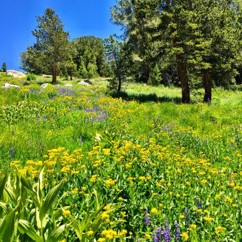
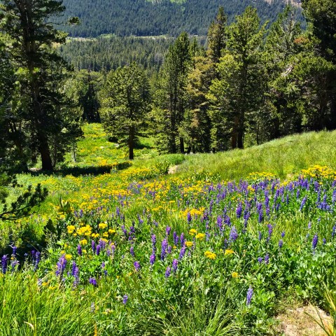
While they were scrambling around and up Mt. Gibbs, I was 1) trying to score a tee time at Torrey Pines golf course next week for Peter and me, with mixed success, and 2) hiking partway up neighboring Mt. Dana (very part way) to luxuriate in the beauty of the so-called hanging gardens.
Here is the view, looking southwest from the Mt. Dana trailhead, right next to the Tioga Gate, on Hwy 120:

Here is a small lake along the way, looking east, before the trail starts to climb steeply up the side of the mountain:
And then, as you begin to climb, come the flowers:
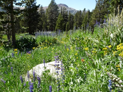
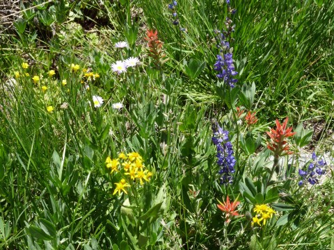


Looking up (I ate my lunch a bit higher and to the right of this photo):
And looking down (you can see 120 far below):
It’s just so damn pretty.
The Details in the Devil
July 24, 2016
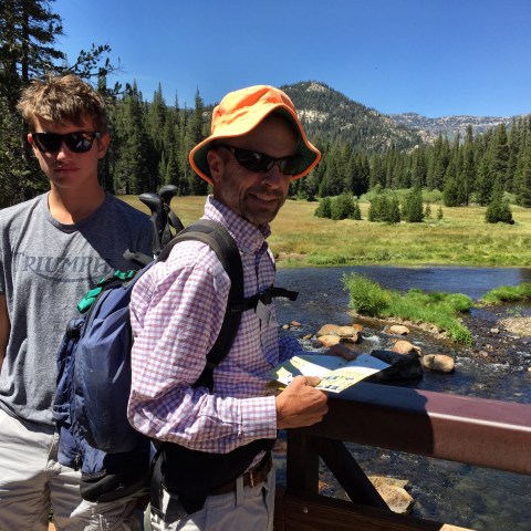
Decided to head over the mountain to the east side today. After breakfast with…[fill in] we took off for a mellow day of lazy exploration.
We stopped at the famous Mobil station for gas and some miscellaneous supplies. Then headed to June Lake for a looksee:

I don’t think any of us had ever been around this 15-mile loop. It was pretty:

There were a few lakes to see, a pack station, some modest RV-type resorts, and toward the end of the loop (the southern end), was the town of June Lake, and the lake itself. Also pretty:

(Shot in moving car, through windshield glass, avoiding Jim and the steering wheel.)
We next headed south to Mammoth. But missed. Here’s the view from a roadside pee stop, as we drove south and then north again on 395:

(I am partial to this nostalgia filter.)
We did a quick restaurant search and [one of us] ended up buying lunch from here [while the other two ended up next door]:
I had this, an “avocado bowl” (with sauteed kale, beets, feta, pickled onions, roasted peppers, carrots, balsamic reduction and brown rice, hold the edamame):

Peter wanted something a little less raw, and went with tacos from the diner next door. Jim ordered french toast from there, as well, and we all sat on the diner’s patio with a lovely mountain view.
Mmmmmmm.
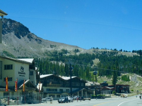
We thought it’d be cool to visit Devils Post Pile.. a national monument that, again, none of us had seen. Good choice!
We were turned away at the gate, as they don’t permit private cars down the steep, narrow road, but bought tickets for a shuttle bus, which departs from the Mammoth Ski Resort, which was a better way to go anyway.
Here’s what Mammoth looks like during the summer…gondolas and lifts in operation everwhere, and full parking lots!
Here’s the view from the shuttle (that canyon off to the left is very deep)…

(Sitting on a luggage rack…)
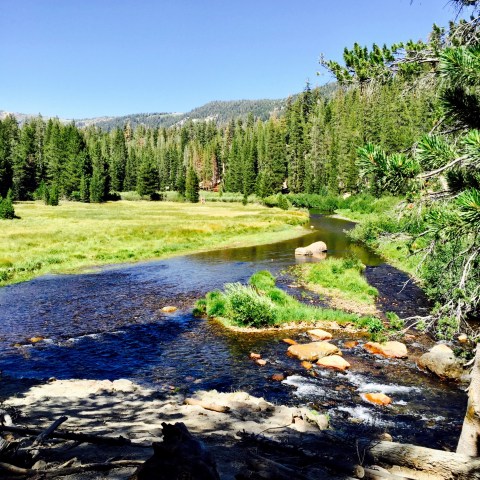
When the shuttle drops you off at the DPP Ranger Station (elev. 7560), you have a half-mile walk to the title geological attraction. It’s a beautiful little hike:
The creek in this meadow eventually leads to the San Joaquin River:

Here is an explanation of the activity that leads to the formation of basaltic columns:

They say the Devils Postpile formation is one of the finest examples of visible basaltic columns in the world… and here it is:

Pieces have broken off and tumbled down the slope. Here is a close up of a piece of column:
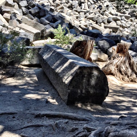
Hexagonally shaped.
Here’s what it looks like as you walk around the far end… Peter poses for scale:
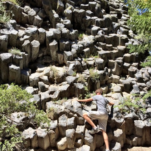
And whoa… here’s the top:

Kind of incredible. The detail is fabulous. (Like my blog title?)
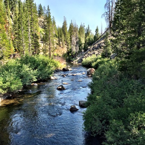
After an hour of poking around the pile, we crossed a nice bridge over the creek…
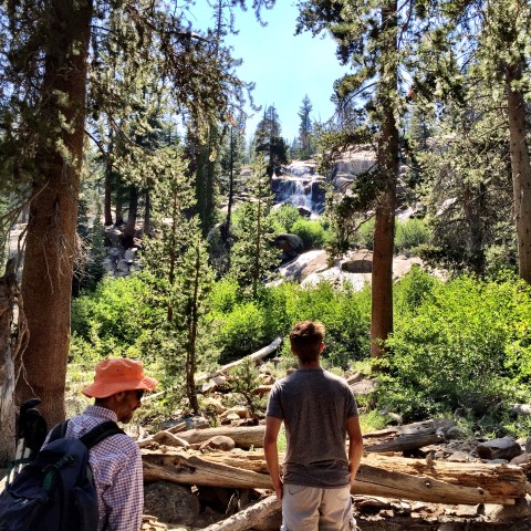
…and hiked about a mile and a half back to Minaret Falls. The trail links up with the Pacific Crest and John Muir trails. Who knew…

Here’re the falls:
After this, we headed back to the shuttle, back to car, back up to Tuolumne Meadows and made it in time for our 7:15 reservation. Dinner was with some folks from….[fill in]
Acclimation Day
July 23, 2016
Here are a few shots from the drive to Yosemite yesterday and our first evening.
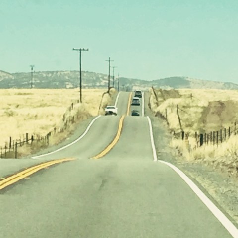
I’m a freak for road shots…so here are a few I liked of the trip in. I’d buy this if it were a painting:
A few cows:

That Lake Tulloch place…which always seems so random, out in the middle of ag, cows, and the golden rolling hills of California (as Kate Wolf used to sing of so silkily):
A logging truck making its way down the New Priest Grade..

And the effects of last year’s fires. Nice to see the undergrowth is coming back already…

We arrived and moved into cabin 6… pretty much our favorite for about 7-8 years and counting. Here is the view from the stoop:

And a shot sitting beside the fire. Nice to also see the view into the dining room…
Rose this morning to a brilliant, clear blue sky and mild temps. Looks like a good weather week in store.
Breakfast was with a guy named Fred Strauss, and his family. Fred’s 96 and has been coming to Yosemite annually since he was six, and Tuolumne Meadows as soon as the cabins were built (will have to check that date). Needless to say, he was a wealth of stories. He is a retired civil engineer–very sharp and engaged.. and a real delight. I was surprised that we’d not met him in our seventeen years! He grew up in San Jose (on 15th Street) and I later found out that he’d not only gone to San Jose State, but when I asked if he knew Professor Peterson, he said, “Chemistry. Of course, I had him for chemistry” and then told me a story about grandpa calling him a smart aleck in class one day when Fred tried to challenge him in a lecture.
Meeting people and hearing their stories is one of the best parts about staying in and returning to the tent cabins each year.
~~
Jim picked a new spot for an acclimation hike. We started at the Murphy Creek trailhead, right on the main road. The Murphy Creek trail is one of the ways to get to Glen Aulin High Sierra camp. It’s also how most people get back into the Ten Lakes area (putting that on our list for a maybe backpack trip sometime), or is the long way to May Lake HSC. We hiked in about three miles… which felt great.
Here’s a shot to the west (I think):
And here’s one to the east (other side of the trail, in any case):
I love this terrain.
This was a test hike for me, and I was pretty tentative… very uncertain how my hip would handle it. But.. the cortisone shot a few weeks ago, plus high doses of ibuprofen seemed to work okay. I decided to play it safe though, and turn around at this point.. six miles total, though, with some decent elevation gain. Not too shabs!
Jim and Peter continued on. Their plan was to bear off trail toward Polly Dome in search of a cluster of lakes–not even sure they’ve got names.
I returned to the cabin and waited for a text from them letting me know they were somewhere (we didn’t know exactly where they’d come out) so I could come pick them up. This plan failed as there is extremely limited service in most of the meadow and surrounds. After finding the lakes they were looking for and Polly Dome, they meandered through the forest until they got to a place well up the road, but had to walk another three miles before they could get a bar of 1x. They called from Pothole Dome and I picked them up there.
I ended up joining the Strauss clan for happy hour at their tent, which was next door to ours, which turned out to be pretty fun and interesting. Dinner was with some folks from Texas.
Weather, hike, hip, folks… all good. A great first day.
Trump Sure Dumped
July 22, 2016
I watched the republican nominee deliver his acceptance speech last night. The no longer presumptive Trump dumped quite a load.
Longest speech in decades by a convention nominee. Clocked in at an hour and fifteen minutes.
I actually watched it all. That was more Trump in one hour than I’d seen in the last year. Um, wow.
He played his crowd like a fiddle. Set out to scare the bejibbies out of them. His people sure seemed to buy it, we’ll see if the country does.
I doodled and scribbled notes as he went along (what else are you going to do during a speech like that?). Things that I wrote on a piece of scratch paper…
What United States? This is the kingdom of Donald. He’s going to fix everything, he’s going to make the deals, he’s not going to bother with alliances; he’ll take care of everything on his own.
The arrogance is breathtaking.
America first. Screw the rest, those pesky global partners . We are going to rule the world.
Sounds like Putin building his empire.
Knucklehead.
He’s going to have a coronary. [He was pacing a lot, sweating and red.]
He views this as a conquest. Dictator Trump wants to rule the world.
Which jives, right? This is all about him. And about him saving us.
He seemed to come off the prompter toward the end.. more adlibbing with a lot more repetition of sentences for effect, and then out came the “believe me” punctuation. Over and over. “Believe me, believe me.”
Nails on a chalkboard.
So, there it is, the Law and Order candidate who, alone, will FIX EVERYTHING. On day one. He said the country will wake up the day after his swearing in and be safer.
He is going to fix our police force and make them strong again. Our criminal justice system will work. He won’t let in any scary people.
What else?
Oh, the wall.
Just like his kids said he would. “My father will fix everything.”
He painted a picture of the country as on the verge of collapse, with violence and unrest rampant. Especially the killing of cops, those who should, but can’t, protect us, um, because of the immigrants. Too many of them are killing cops and raping women.
He made up all kinds of stats about all the killing, plus he had amazing stories about how Hillary took us from a safe and stable world, to a Middle East that is warring and now after us, via ISIS.
Breathe, breathe.
I guess scare tactics are effective in elections. Our “collapsed and weak” country, and a “dangerous world full of enemies who want to destroy us,” both play right into his role as fixer and father and ruler of the world. This plan will certainly work to rally his folks. I don’t know if a majority will buy it.
But wow.
A friend just posted this quote as a reminder of how these things work, time tested:
“If you tell a lie big enough and keep repeating it, people will eventually come to believe it.
The lie can be maintained only for such time as the State can shield the people from the political, economic and/or military consequences of the lie. It thus becomes vitally important for the State to use all of its powers to repress dissent, for the truth is the mortal enemy of the lie, and thus by extension, the truth is the greatest enemy of the State.”
Joseph Goebbels – German politician and Reich Minister of Propaganda in Nazi Germany from 1933 to 1945.
~~
I’d like to hang around and talk more about all this, lord knows, but we leave for Yosemite in a couple hours. Will miss the whole DNC. Bummer.
But Tuolumne Meadows. Respite!! Cool mountain air, clear skies, the crunch of pine needles beneath our boots. Granite, granite everywhere. And that smell. Time with my guys, hiking, reading, gin rummy, lots of sleep. No trump. I. CAN. NOT. WAIT.
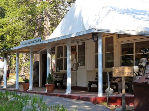
There is our beloved lodge (whose new name–thanks to hard feelings all around and sticky legal wickets as there was a change of hand with the park concessions contracts–alludes me):
There’s our goofy little cabin:

There’s the spot behind the cabins, along the Lyell Fork:
And there will be hikes!

With my guys:
The above, all from 2013.
