Going Solo
August 2, 2016
We decided that I would stay on in Palos Verdes and Peter would drive our car back to Davis. Last night, we went to LAX to get me a rental car.
This would be Peter’s first-ever solo road trip. Jim and I wanted him to have the experience of managing a trans-California trip (is it still “trans” when one travels from south to north?). There are issues of navigation, traffic and rush hour, gas management, alertness. He felt more than ready.
He also wanted to get an early start… because he wanted to make a tee time in the afternoon.
The life.
We got up around 4:00. He followed me down to the Malaga Cove Plaza where I could access an ATM…. gave him some money… and off he went.
He ended up with a few navigational challenges, but arrived in Davis before noon with a successful solo road trip under his belt.
Yay P.
~~
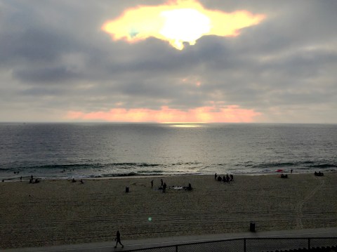
As for me, today was going to be a lot of this:

The hospital zone.
Ventilator; IVs for fluids, antibiotics, sedation; pick lines; Foley catheters. Got refamiliar with the monitors, ICU terminology, the color coding of hospital coats (navy for nurses, green for respiratory, brown for phlebotomists), the location of the gajillions of hand sanitizers. There’s a rhythm to the whole affair, and pretty soon you’re right in there with the best of them: you walk into the room after lunch, give a quick glance at the monitors, read the board for any updates, and inquire about her most recent muca-mist procedure (did anything come up?). You know the lead nurse, the nurse nurse, the nurse’s assistant. You know the guy who delivers meals, the PT who’s on for the day. You know when the doctor is likely to make her/his rounds and the tests she/he is likely to report on.
It’s all about getting mom better and home.
Where Adventures Begin
August 1, 2016
We got news from Palos Verdes at 4:00am that 9-1-1 was called and mom was being taken in to emergency for evaluation. It was a very good thing that Chris had decided to stay the night.
Under the circumstances, we decided to forgo our round at Torrey Pines… playing a round of golf didn’t feel right. We decided, however, that since we were there, we’d spend the day exploring campus and see a little more of La Jolla. Instead of staying another day, though, we planned to return to PV. We knew mom was stable and in safe hands. We expected that she’d be admitted and we would visit her this evening.
Started the day at Torrey Pines.. not playing golf, but having breakfast. We sat under the trellis behind the first hole, watching people tee off. That is the Pacific Ocean in the distance beyond. The 18th hole is just out of the photo to the left.
A lovely setting.

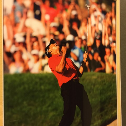
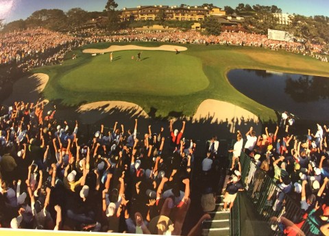
The Torrey Pines Lodge is quite handsome and elegant… and all about golf. Torrey Pines was the site of Tiger’s 2008 US Open victory…
We were looking at the 18th green while eating breakfast. The restaurant part of the Lodge is the brown building on the left side of the photo (a photo that hangs in the hallway on the way to the bathroom).
Peter was, still is, in a golf-obsessed haze. He hoping to play a lot of golf here.
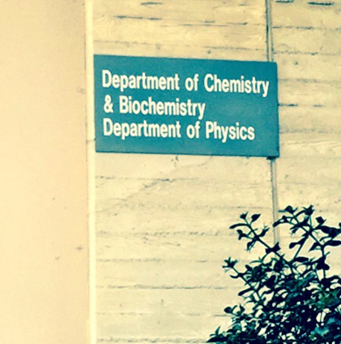
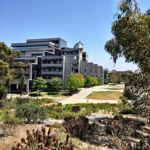
After breakfast, we hit the campus. We were most interested in seeing Revelle…
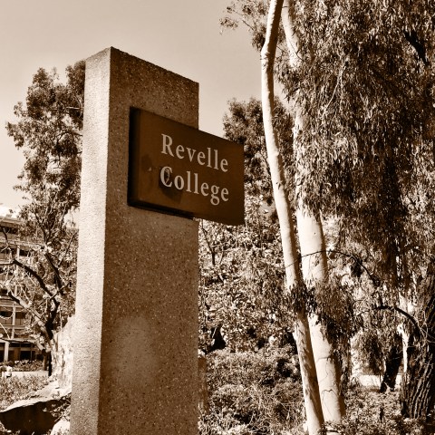
Of note. Forty two years ago, I was accepted at UCSD (who wasn’t?), Revelle College. I chose Revelle, one of four colleges at the time, because it was the math/science college (now, we’d call it STEM). I entered UCSD as a math major (don’t laugh), but before classes even began, I had major-remorse and switched to Muir (what outdoorsy gal wouldn’t?). I held onto my math major for a little while, switching to econ when I aced my first ever economics class, then finally settled on undeclared in my third year. I know, funny time to lose one’s way.
Well, more to that story, but, point is, I, too, was a Revelle admit. How this tugged at all my nostalgia/poignant buttons while we lost ourselves in the concrete/eucalyptus vastness.
Peter was most interested in seeking out places like this…
We also checked out Revelle’s dorm community…

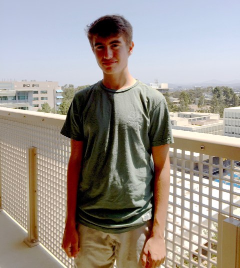
Taking this photo, high atop the Revelle campus, made me choke up. In this, I see a kid who’s ready to go to college, really pleased that he’s going to UCSD, and yet a little guarded, a little tentative. All the time we were walking around, he seemed open and eager, at moments even bold, and then at times he seemed like he was careful not to be too eager, like he was protecting himself from any disappointment. I could tell he wanted everything to be just right; he didn’t want to walk around any corners and be disappointed. I’m sure his mind was going a million miles a minute, imagining himself there in a couple months. I know he’s excited and I know it was a big deal to be here.
It was all I could do to keep all my weepy emotions in check (I did) and not hug him every five minutes (I managed not to).
I also want him to love every little thing. I want him to have the time of his life.
Deep breath.
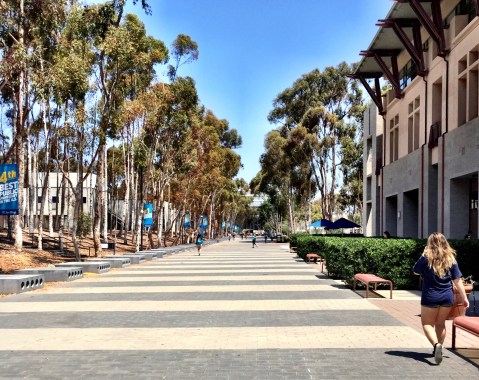
After walking all over the Revelle campus, we meandered down toward Warren, the library, some other new parts of campus that weren’t there when I was… some pics:
This is a large student center of some sort, with the library dead ahead. It’s a very attractive, expansive plaza, nestled among towering trees. A very cool feature is the tribute to each and every graduating class–those concrete benches on the left–dating back to … I’m not sure… the sixties, I think.
I didn’t graduate from UCSD, so I took a picture of the year I entered school there:

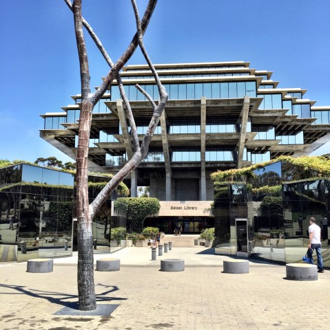
And, of course, the architecturally renowned Geisel Library. I did, in fact, spend due time sitting in a study carrel, jutting out over the forest:
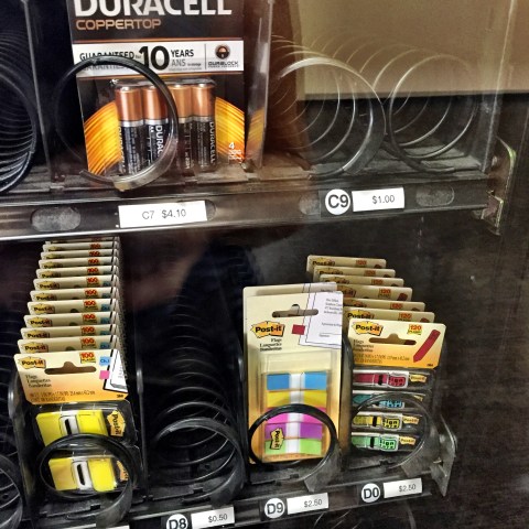
I went in to find a bathroom and found this vending machine… new to me!
And here’s this engineering building with the house on top again (I must have shared a similar photo in about January 2015):
After a few hours walking around campus, we decided to check out a little of downtown La Jolla (the Village)… the beaches were crowded, even on a Monday, though not in this particular spot.
This is along Coast Blvd, a place we could finally pull over:
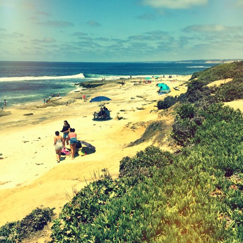
We couldn’t find parking anywhere near the cove, so didn’t get out, but it, and everything else along the coastal route, was spectacular (and spectacularly crowded). On a Monday.
Then we headed back up toward campus, wanting to check out the Glider Port. Very worthwhile! Hundreds of cars parked in a huge dirt lot, and trails along the cliffs where you could watch these guys:

If you looked in the other direction, you’d see a few Torrey Pines golf course holes. And the Salk Institute was down that road, too.
Stopped at a red light, I caught this view and thought it prophetic:
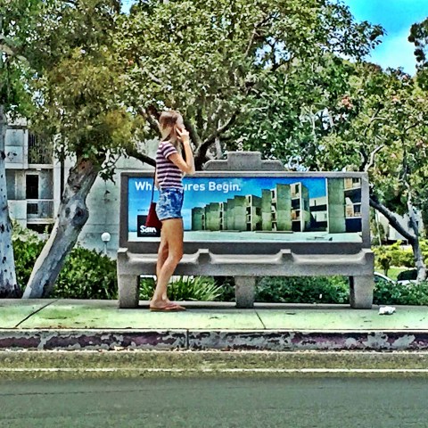
The sign on the bench reads, “Where Adventures Begin.”
Indeed.
Obtuse
August 1, 2016
We headed back up the coast, arriving at Torrance Memorial by about 5:30. Mom was checked into Room 3136 in ICU.
Turns out, she’d contracted a bug (we later learned staph), which lead to pneumonia, which lead to respiratory failure, which lead to lung collapse…. and in order to sustain breathing needed a ventilator.
All serious stuff. She was in very able hands, however. Very grateful for Chris, very grateful for Torrance Memorial.
She was heavily sedated, due to being intubated, and seemed completely asleep. In fact, she was aware, able to communicate in a limited way, and glad we were there. She listened to stories about the day, and responded by squeezing her hand or moving her eyebrows.
Matt had come up with the idea of putting a pen in her hand and having her communicate by spelling out words. He shared some of her written comments. They revealed a knowing about her situation, including questions about what was going to happen. It was profound.
I liked the idea of communicating in this manner, as it gave her a part in the conversation. The dialogue shifted to lighter topics, and even social commentary. She filled sheets and sheets. Fascinating where the mind goes.
Matt tried using his iPad, which didn’t work as well because we couldn’t move the writing surface quickly enough to capture individual letters… but it was a good effort!
I liked when she accused a nurse of being dismissive, and when she determined the whole experience to be obtuse.

She won’t remember any of this, due to the verced, but it was worthwhile conversation nonetheless.
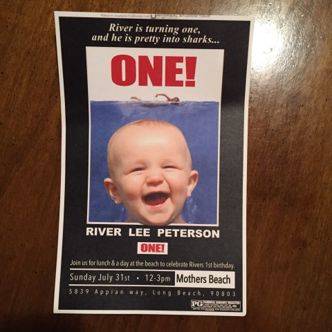
Flood, River and Ocean
July 31, 2016
Welp, started the day with a big flood. I can think of a thousand things I’d rather have had happen… but, flood it was.
Old house, aging pipes, overload (Peter’s long showers may work in Davis, but not Palos Verdes)… whatever it was, it resulted in water rising in mom’s bathroom, covering the floor, soaking the rugs, walls and other low-lying items. A big messy mess.
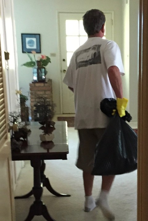
Chris did the lion’s share of the cleaning.. here he is, rubber glove-clad, hauling out a load of wet matter:
Very unlike me–iPhone documentarian that I am–I missed all the best flood photos. Probably better that way.
Mom and I decided to stay to deal with plumbers (who, actually, never came, this being Sunday and all), and once everything was cleaned up, Chris and Peter headed out for the party:
They had a lot of fun.
Mom and I spent the afternoon playing gin rummy. As usual, she won most of the games.
Peter and Chris returned. Mom didn’t feel her Sunday best, but we figured Grey Goose, double espresso, rich meal, late night, the drama of the morning’s flood… she’d be okay. Peter and I took off for points south–La Jolla, here we come!
Happy to be strolling along the strand in La Jolla shores… one of us pretending he’d never seen the other goofball before in his life…

This is actually what he’s looking at… the scene at La Jolla shores…
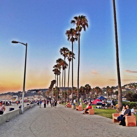
As we seem to do, we’d arrived just in time for sunset…

The beach was packed with people, pit fires, activity….
Decided to eat at the La Jolla Shores Restaurant (and Hotel). We actually had a great dinner, and most certainly got a great table. Our view, as the sun disappeared beneath the horizon…

…and then…

After dinner, we walked around the shores area. Peter was feeling comfortable, as we’d been there for Grandpa’s 90th… a year ago January… and he remembered a lot.
Lots of twinkly lights, restaurants, bars…

We stayed at the Sheraton, up the hill and adjacent to the university. Good place.
Tomorrow: UCSD, Torrey Pines, La Jolla Village, and the cove.
Road Trip
July 30, 2016
Got back to Davis from Yosemite on a Friday night… left for Southern California on a Saturday morning.
We had all kinds of reasons for this quick trip:
Top of my list: wanting to squeeze in some special together time with Peter before he flies the coop. Also, having missed the June UCSD orientation, Peter was feeling like he needed to get a feel for the campus before he moves down there for good. It’s also River’s first birthday party weekend… so a triply good time for a road trip. Bonus buys: see Grandma, play Torrey Pines.
No time to waste.
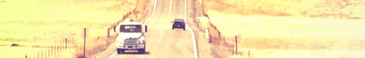
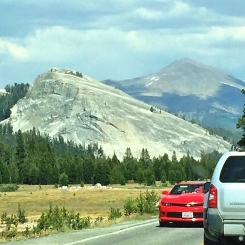
Even a day spent on I-5 is time well spent when you’re with your college bound kiddo. Hit the South Bay, exited the 405 at Rosecrans and headed west. Made it by sunset…
Ahh….
Checked in at the comfy Inn at 2915. Mom seemed great. Chris, mom, P and I had a nice (if noisy) dinner at Admiral Risty (wow, it’d been a long time)…. ran into some people we knew, had cocktails (mom loves her Grey Goose), excellent fresh fish… capped our late night dinner with double espressos and dessert….facts that may or may not be relevant, but there they are.
Good start to what would become a memorable couple of days.
See Ya Next Year, Tuolumne
July 29, 2016
Go home day.
Some parting shots.
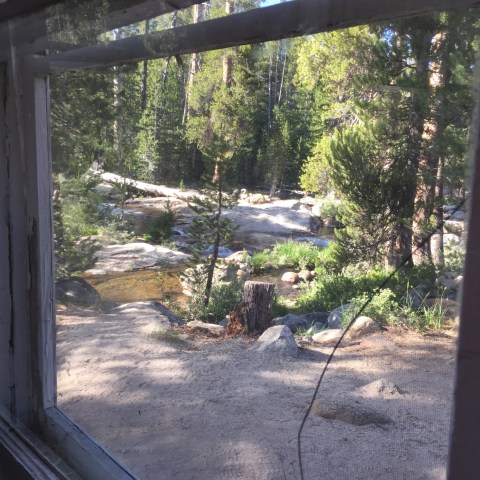
Sitting in lodge, waiting for breakfast. The “lodge” is nothing fancy–concrete floor, canvas walls and ceiling, wooden frames, furniture that must endure the winter locked up in some metal crate. It’s a high camp experience…
Still, they have windows… and I love them:
Here’s our view, from the corner table, looking out at the Dana Fork…
Peter’s hot chocolate…

My favorite combo this year: toasted english muffin, served with a side of peanut butter, bananas and crispy bacon. Some assembly required:

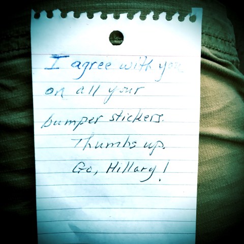
Here’s a note we found tucked under our windshield one morning. Made my day!
And that’s the thing about Tuolumne… many birds of a feather drawn to a vacation of hiking. Lots of boomers with aging knees (and hips), who appreciate the comforts, if minimal, of tent cabins, because carrying heavy packs into the backcountry and having to do all your own cooking just seems… unnecessary… when you can have a bed, hot shower, and the aforementioned peanut butter, banana and bacon sandwiches. I always love being in the company of people who prioritize hiking and climbing, love the mountains, care about the environment, value science and, for the most part, lean left. It’s the Tuolumne way.
So, let’s see, what else… here’s another couple shots of Lembert I like:
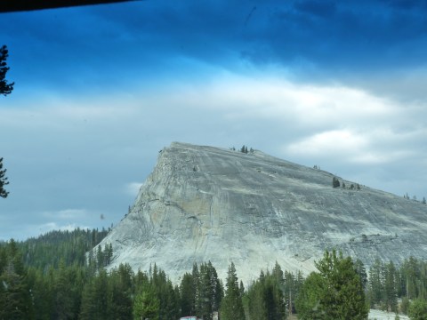

Here’s our annual shot from the stoop. Of note, we were given the option, when we checked in, of selecting Cabin #2–one of the highly sought after 1, 2, 3 cabins situated adjacent to the Dana Fork and removed from the hustle-bustle of the rest of the compound (such as it is). We seriously considered it, but then settled on Cabin 6 because of its proximity to the bathroom. Are we old or what?
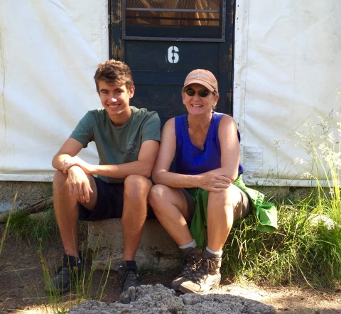
He’s cute, isn’t he? I’m just ridiculously happy to be sitting next to him, and so in heaven having had an entire week to spend, just the three of us, in our favorite place on earth, doing what we love the most. Holy cow. Doesn’t get any better than this. All misty as the week comes to an end.
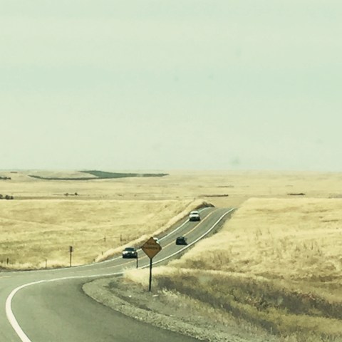
Here’re a couple shots from the drive home…
Fire aftermath:

And, because I can never get enough road shots:

A Peak Experience
July 28, 2016
I’ve probably used that clever title before. Please forgive.
Our collective objective today was to climb Tuolumne Peak. I knew Peter and Jim would have no issues, and I had hopes for me… so we started out with optimism.
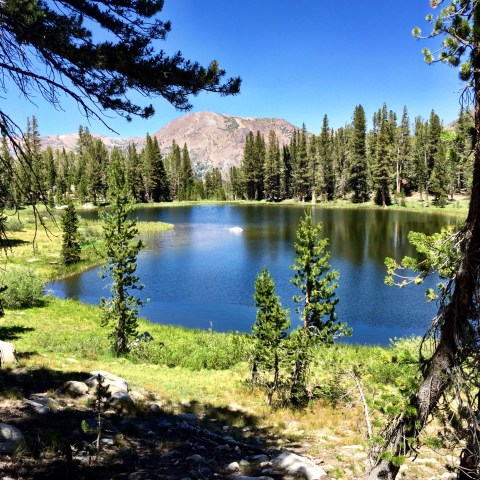
Drove up to the May Lake turn off, three miles beyond Olmsted. There’s a parking lot a couple miles in along a dirt road, which serves as an easy and accessible trailhead for the May Lake High Sierra Camp. Have used this trailhead numerous times, and love this short little 1.2 miles into the lake.
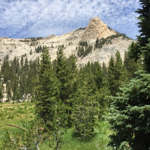
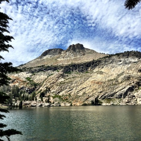
And wow, nothing beats May Lake for beauty. Mt. Hoffman is off to the left, out of view…

… and Tuolumne Peak, our destination, is to the right:

At the recommendation of Nester, an interesting fellow who’s been a host/waiter at Tuolumne Meadows lodge for the last five years (and who comes from Long Beach, as it turns out), we sought out Brian, a long time staffer at May Lake, to inquire about the best route up Tuolumne Peak. He recommended something entirely different than we’d planned, a route that would save us maybe five or six miles. Good tip!
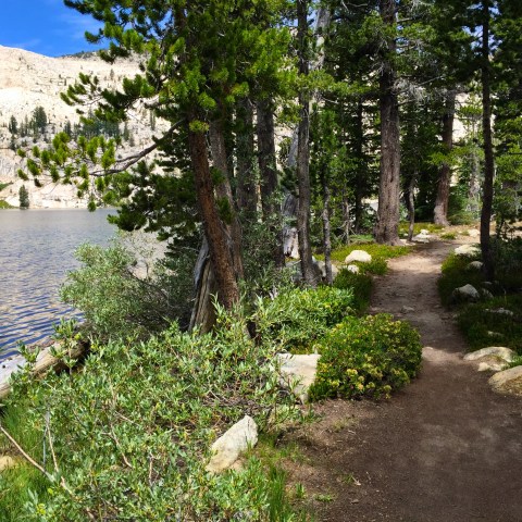
We set out. the trail along the lake is so pretty:
After about a half mile, came across this lovely meadow, thick in yellow wildflowers..
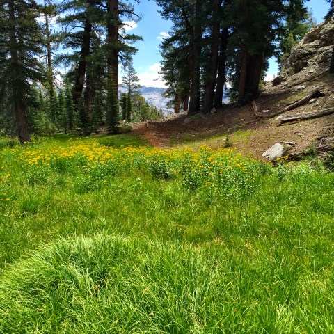
Then, this one…
Bore off the main trail at this point, and meandered northward.. more good views, this one of the peak (though not sure which is the real one in there):
We went another half mile or so and I realized, 1) my hip wasn’t going to make it, and 2) I didn’t want to have to retrace too much of the off-trail stuff by myself, so turned around.
Bummer.
I returned to May Lake and found a good spot under a tree (or twenty):
And did this:

For the next three or four hours.
Ate lunch, hung around with this guy:

And this guy:

And zoned out on views of Mt. Hoffman (which is behind those two prominent points):
Peter and Jim returned after a great, great trip to the top [Jim’s pictures coming]. Said they found the route, most of it was actually an unmaintained, but clear, trail, and it was done of the best views of the whole of Yosemite.
Headed down to the car, and back.
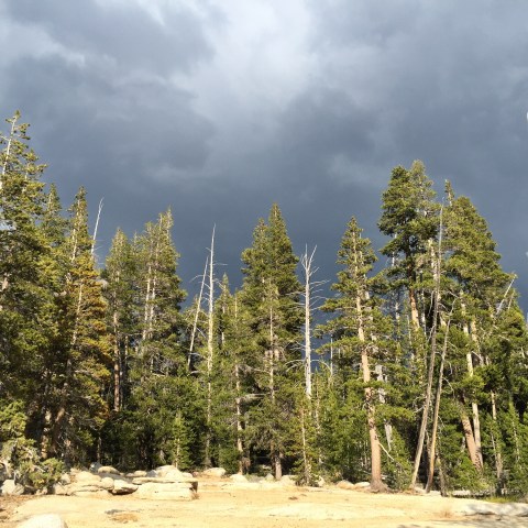
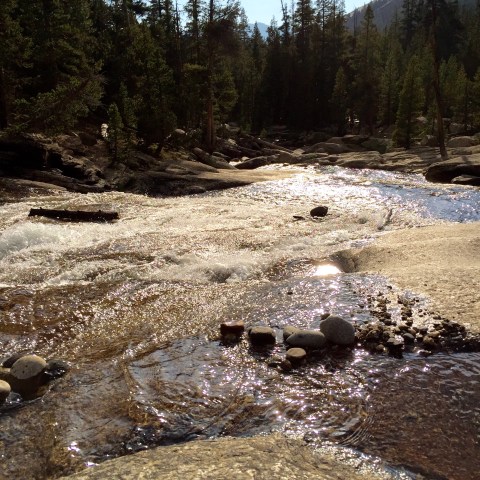
This being our last day, I decided to take a short walk up the Dana Fork.. mostly just a sentimental jaunt.
The thunderheads were building, something we didn’t see much of at all this trip..
A nice view downstream:
Sat for a spell…

Sad, of course, that it’s our last day.
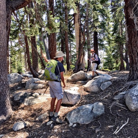
Hidden Lake
July 27, 2016
We were looking for an easy day–as Tuolumne Peak is in our sights for tomorrow–but also wanted something we’d not done before… hard to find those uncharted destinations, within the day’s hike perimeter of Tuolumne Meadows tent cabins.
Jim suggested a little off trail hunt for Hidden Lake.
Which we did.
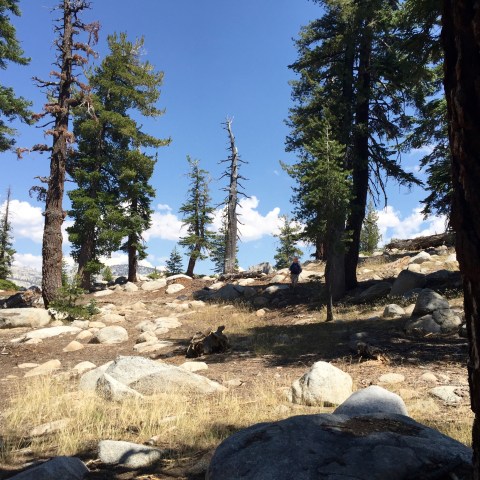
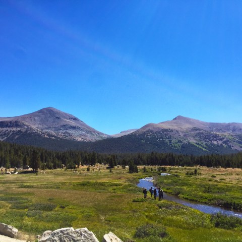
Started at Olmsted, which we sure don’t do often–not much goes out of there, and what does is down. Ambled along the trail that leads to Yosemite Valley (the valley’s about an 8-11 mile hike or so from Tuolumne.. which is funny because it takes about an hour and a half to get there via car). This trail zigs around beneath the Olmsted turnout; you’re within earshot of the dozens of cars parked at the vista point parking lot above you. Feels like too much humanity when you’re trying to have a wilderness experience, but soon enough, after about a half mile, we bore off trail and out of earshot of the road.
We spent a bunch of time bushwhacking around, then up the side of a big hill, and along a particular contour, confident the lake was more or less at our level, but further beyond/around. Jim scouted, found the lake, and we proceeded.
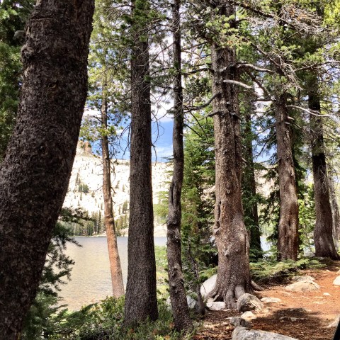
Here was our first view:
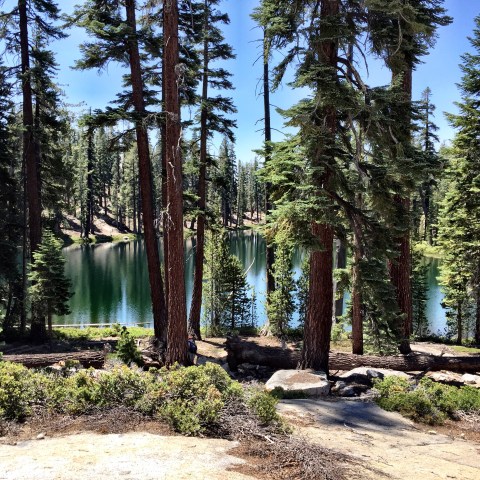
Nice, huh? Not a granite-bound lake, like so many, but also not mosquito infested. And we were utterly alone. It was only about a mile from Olmsted, as the crow flies, but with no trail, it doesn’t appear to attract folks.
Spent about an hour by the lake… Peter did this:

Jim and I did this:

And then we decided to try a different out. We headed to the top of the granite slope behind us, instead of retracing our bushwhacked steps:

At the top of that rise, we found we were in four-bars-of-service land! So we did a little of this:


For about another hour. Caught up with the world…that was fun.
Continued our amble through a forested area that looked like this… this is Peter practicing his golf swing:
Then, we’re almost to the top of the ridge:
Got to the top and got this view… Tenaya Canyon is to right, not visible in this picture, and straight ahead in the distance, the domes and peaks of Tuolumne Meadows, with Tenaya Lake in view. You can even see Olmsted point down and in the foreground. We will head there after spending time taking in the fantastic views.
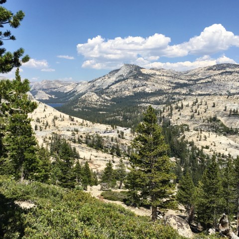
Here’s a bit to the left:

Peter and me. The photo shows the terrain made for some good boulder scrambling:
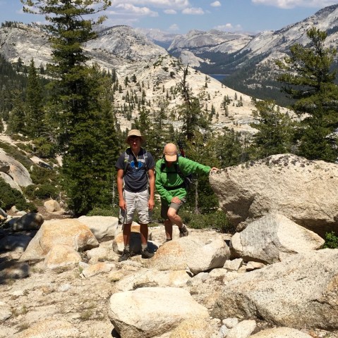
The trip down from there was easy and fun. In future, we’ll pick our way up this ridge, rather than mess with the bushwhacking round back. Loved the area. Made for a sweet hike.
Drove back through the meadow… got this shot of Lembert… Tuolumne Meadows’ iconic structure that borders the east end:
We didn’t even climb it this year!
Returned early enough to have lots of time for gin rummy… that has been our pattern: breakfast, hike, gin rummy, newspaper (after all, the Democratic National Convention is underway!) and beer, chips, sodas, etc. Then shower, read a bit, dinner, maybe campfire, maybe more gin rummy… and do it all again the next day.

North Dome
July 26, 2016
Today, decided on an oldie but goodie hike; it’d been two or three years since we’d been out on North Dome.
North Dome trailhead, which takes off from Porcupine Creek, is about seventeen miles from Tuolumne Meadows Lodge, so today was a get-in-car-and-drive day. The no-longer-free shuttles (don’t get me started), go only as far as Olmsted Point–twelve miles from the lodge.
Oh, now I’m started…. the no-longer-free shuttles….here’s the scoop:
With longtime Yosemite concessionaire Delaware North out and Aramark in, there are just untold dramas playing out. There’s the high profile trademark kerfuffle that’s resulted in the name changing of landmark institutions (for example, the historic and beloved Ahwahnee Hotel is now the Majestic... and other such silly things), and there are the dozens of other smaller, lower profile changes that are noticeable to people like us who return year after year and have well-established routines and practices that are now sort of.. different.
Like, for instance, the shuttle busses that were once free and are now not. Worst decision ever. The result of charging $12 (per person) for the 15-minute ride from the lodge to Olmsted Point, for example, is that nobody’s going to ride the shuttle. We’d always appreciated the ability to just grab day packs, climb on a shuttle and get dropped off at a trailhead. Or to flag down a bus if we emerged at some random place along the road after some off trail adventure. Easy peasy. Free. Convenient. And so relaxing. I mean, who wants to drive? But $36 for the three of us, plus the added hassle of now having to carry money/credit cards, plus the time it takes for everyone climbing on board to deal with these transactions… for crying out loud.
Worst of all, the result of people forgoing the now expensive and far-less convenient busses is bumper-to-bumper LA-style congestion all through the twelve-mile Tuolumne Meadows area, and super impacted parking at trailheads. It’s beyond ridiculous. Their goal has always been to minimize traffic impact in the park, for a zillion excellent reasons. The result of this boneheaded move is more cars, more traffic jams, likely more accidents and empty shuttle busses. Word among the lodge staff is they’ll reverse this decision. Hoping for that by next year.
~~
Not only am I dealing with an arthritis-challenged hip, but last Saturday’s first-day acclimation hike up Murphy Creek, for some reason, left me with a whole slew of crazy end-of-toe blisters. Now, these are boots I’ve owned since the spring of 2011, boots I wore all over the Himalayas, and for years up and down the mountains of the Sierra (and wherever else I may have hiked). My boots. My totally worn in, trail-tested, perfectly fitted boots. Last year, I wore these well-worn boots on day one of our summer hiking season and, out of the blue, ended up with a major case of toe jam which lead to the loss of a several nails…a week before we were leaving for three weeks in Europe, I might add, where walking the streets of major European cities and hiking in the mountains of Norway and Switzerland were very much a part of the plan. So I was pretty let down by my boots last year. I promptly forgot about that, however, until I found myself hobbling down the Murphy Creek trail two days ago with that same annoying toe jam. Which turned into all these annoying blisters.
Really baffled by this, but there it is.
Jim was kind enough to administer first aid this morning:
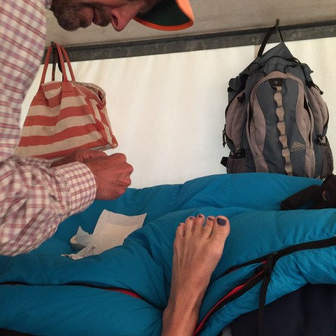
I was grateful, but a horrible subject… as the procedure included a needle. Won’t go into detail.
~~
Back to the North Dome hike: it’s a great one.. a mile-ish down to numerous forks of the small Porcupine Creek; another mile and a half, or so, out to a junction, where one can catch a trail down to the valley, as well as other notable remote spots; and then up and up another mile, maybe, to a nice ridge and another trail that takes you to Indian Rock. This ridge forms the western edge (I think western) of Tenaya Canyon, on the eastern side of which is gorgeous Cloud’s Rest and the spectacular Half Dome. You’ll never get a better view of Half Dome. The canyon’s granite wall is just simply breathtaking, a word invented for this view.
Once out of the trees and onto the dome, I set up on a rock under a tree, amid all the towering granite (my happy place), and Jim and Peter continued to the very end of the ridge and the official rounded mound of granite known as North Dome. This is maybe another half mile of granite scrambling and is really fun. I hated not to go, but I’ve been out there numerous times. I missed the chance to peer over the edge down into the main Yosemite valley itself, but I knew my hip wouldn’t handle it well. (On the blister front, they still hurt like hell, but were small zones of pain, limited to discreet, tiny circles. The hip…. that’s another category of hurt with sharp, gasp-worthy shooting pains and sometimes radiating tendrils of pain that aren’t quite as endurable.)
So…happy enough to sit.
The only problem was I’d left both the camera and my iPhone in the car. No pics! I did remember the binocs, so amused myself looking at amazing details in nature near and far.
And again, will have to post some of Jim’s pictures later. Come back.
Tip Toe Through the Wild Flowers
July 25, 2016
Today was a big day for the bag-peaking Frame boys. [Pictures will be posted as soon as Jim and I do the transfer from his phone to my computer; come back to see those.]
They set out to climb another prominent, high profile peak: Mt. Gibbs. It’s prominent because it’s right along the road as people first come to the Yosemite high country, through the Tioga Gate. You look right at it as you pass into the park on the eastern side, and is part of that amazing mountain-scape that includes Mt. Dana (second highest peak in Yosemite, 13, 061), Gibbs (12,772), and the peaks of the Kuna Crest: Kuna (the third highest peak in Yosemite, 13,008), Koip (12,968), and Mammoth (12,117). Gibbs was the only one they hadn’t yet climbed.
(For the record, I’ve climbed Dana and Mammoth. I was incapacitated last year when they did K and K, and this year as they bagged Gibbs. Boo. It’s killing me here, it’s kind of heartbreaking. And.. maybe I don’t have it in me anymore to climb these kinds of peaks, especially the trail-less ones with lots of exposure … who’s to say, we’ll just have to see next year when I’ve got a new hip joint on board.)
Here is what Gibbs looks like (Dana on left, Gibbs on right):
I took this photo in a pull out along 120. Bear in mind, I’m standing in a meadow that’s well over 9,000′! Those two peaks rise over 3,000 feet over the floor of that meadow. Significant elevation gain, significant elevation. These are big boys.
While Dana has a trail for most of the ascent, Gibbs does not. Peter and Jim started on the Mono Pass trailhead (way off to the right of this photo), bore left off the trail at the first moraine, bushwhacked through the brush and trees until they got out to the ridge (visible on left side of mountain) and headed up. I dropped them off at the trailhead at about 10:00 and picked them up at about 3:30. They had a great, great day… shaky legs at the end (Jim) notwithstanding!
While they were scrambling around and up Mt. Gibbs, I was 1) trying to score a tee time at Torrey Pines golf course next week for Peter and me, with mixed success, and 2) hiking partway up neighboring Mt. Dana (very part way) to luxuriate in the beauty of the so-called hanging gardens.
Here is the view, looking southwest from the Mt. Dana trailhead, right next to the Tioga Gate, on Hwy 120:

Here is a small lake along the way, looking east, before the trail starts to climb steeply up the side of the mountain:
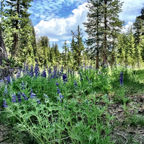
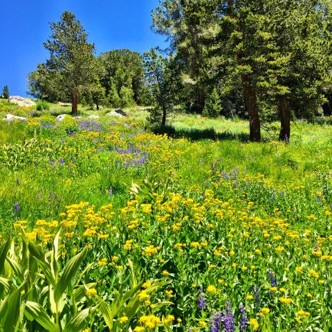
And then, as you begin to climb, come the flowers:
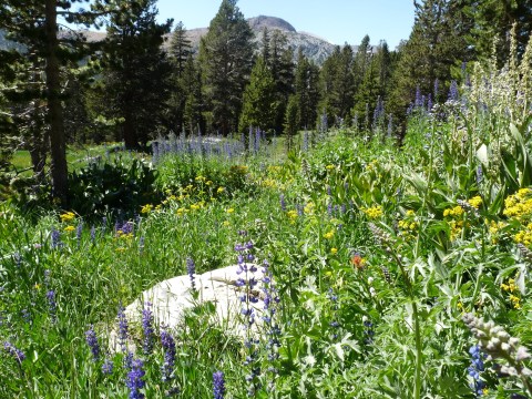
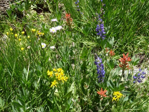


Looking up (I ate my lunch a bit higher and to the right of this photo):
And looking down (you can see 120 far below):
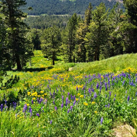
It’s just so damn pretty.
