
Gokyo to Thaknak
April 12, 2011
Trip Day #14, Trek Day #8
On our way from Gokyo to Thaknak today. Sometimes Thaknak is called Tagnag, sometimes Dragnag, all of which has to do with language translation. Makes research and route finding a little challenging. Though, in our case, we were in the able hands of our guides, so not an issue.
Slept in a bit after our big climb yesterday and looked forward to an easy day today. Tea came at 7:30, we went to breakfast at 8:30 and had a planned departure of 9:30. Today’s hike was to be short–about 2.7 miles–and would take a leisurely 2 1/2 hours. We had only to climb out of Gokyo village to a ridge, pick a route through the Ngozumpa Glacier to the mountain on the other side, traverse along the edge of that mountain, then meander into Thaknak. We were looking forward to a short hiking day with a long afternoon of rest in preparation for three huge days of major hiking and elevation gain to come.
So. Breakfast was my favorite–a fried egg on toast and tea. I put peanut butter on the other piece of toast. Across the table, Karen’s having a bowl of oatmeal and Laura’s having a scrambled egg.

Here’s the view out the window, looking north. That’s Cho Oyu dead ahead (6th largest mountain in world at 26,864′). We talked to many people who’d climbed it. Yaks are kept in the yard below. Gokyo Ri, the 17,585′ peak that kicked our butts the day before, is mostly out of sight just to the left. It’s well below freezing out there but it’s a mostly sunny morning:

Here’s a nice shot Karen took as we climbed a muddy, steep hill and reached the top of the ridge. I have to say, my legs were really tired from the day before. I also hiked most of the day with a headache. I was usually able to knock my headaches out with two tylenol and two ibuprofens, my usual headache remedy, but for some reason, I didn’t take that this day. Bummer. In any case, even at 15,700 feet, no real altitude issues.

Hiking through the remnants of the Ngozumpa Glacier was interesting, not at all what I’d expected. It was sandy, rocky, gravelly, a lot of ups and downs. We followed cairns throughout, and the rough semblance of a trail. But the trail has moved over the years as the glacier’s receded.
Here it is on the map. We started on the west side in Gokyo, adjacent to the Dudh Pokhari (third lake), and traveled southeast to Dragnag (it’s called on this map). You can see the marked trail (black dotted line), and the route we were able to take because the ice was gone (red line that I added).

Here are some views of the glacier crossing:
Here’s Leslie at top of ridge before dropping down:

Here we are on one edge of it, looking across. You can make out people on the small hill in the foreground.

Here we are somewhere in the middle, Laura in foreground. Leslie took this:

And here’s another of Leslie’s shots: Rick out in front, Laura following. Very rocky. Literally, the “trail” has shifted seasonally as the ice has melted. Though now that the glacier boundary is so far north, these trails across from Gokyo to Thaknak will probably settle in.

Here’s a shot Rick took of Leslie, me and a random sherpa porter–no idea what party he’s with –carefully picking our way down a steep hillside. The one really nice thing about the Gokyo lakes region side trip (with its harrowing pass crossing), besides the spectacular scenery, was the absence of crowds. So few other parties for so many days. Very nice.

There were patches of frozen water.. not glacial ice (I don’t think), just water and some snow layers that had frozen. And you can see the granite layer on top. To give you a sense of scale, were I to stand on that frozen pond, I might be able to reach up and touch the tip of one of those icicles hanging there. Maybe that is glacial ice…

Anyway. We walked pretty slowly through all of this and finally got to the other side, the base of a huge, steep mountain wall that formed the glacier’s eastern boundary.
Here’s a snip from my journal:
“I got the most scared on the trip so far as we traversed beneath a giant rocky slope where there’d been a lot of rock fall. Any rock rolling down that mountain would be potentially deadly.. the boulders were huge and sitting so precariously on the loose scree slope. I had that in my mind the entire time.”
Here’s a picture of that portion of the hike, shot by Leslie. If you click on the photo, you can make out the trail and a person or two on it at the base. I don’t think anyone else had this notion of an avalanche.

But we did make it out of that little canyon-ette, unflattened by giant, rolling boulders. Yay. Here’s a shot Karen took:

In any case, we were soon ambling into the settlement of Thaknak, around noon. This is Leslie’s shot. You can see a rock-roofed house in the foreground, a green-roofed building in the distance and a trail that cuts up a canyon far ahead. We’ll take that trail the next day up to the pass:

Here is our teahouse, the brand new Khumbila Hotel:

Some blankets drying outside (not sure how anything dries in that cold):
![]()
This place was very clean, if spare. Here’s our room. I shared this night with Leslie.

Some parts were still under construction. Here’s Leslie, down the hall from our room. You have to imagine that all the construction materials came in on the backs of porters and yaks. And all the work happens in very, very cold weather.

We got settled in and had lunch–dal bhat (in bowl, which is a lentil soup), basmati rice and a cabbage, carrot and onion thing–and just hung out.

Here is a view out the window… wandering yaks and a small stream:

The Khumbila Hotel was very quiet with only us and two or three other very small groups. Here’re some guys sitting across the room doing basically the same thing we were:

I did this:

And wrote this:
… Going to gather at 4:00 to drink tea and play cards, then dinner, then sleep, as we’re getting up early (3:30am!) to make an early assault on the pass. There is much nervousness about the crossing. It’s cold and snowing now. The cute Israeli who just came over from the other side said two people died on the pass two days ago. They closed it due to bad weather then but it seems it’s open now and we are going. So plenty of anxiety. Cold, altitude, snow, ice, slippery, many miles, long day, much elevation gain, soreness, weakness. Scared.
But I need not approach tomorrow in scared mode! I need to believe we are in good hands, that Hom is conservative, that if it’s not wise to continue we will either go back or not even attempt it. I know a lot of people cross the pass daily. Still. I’m hoping for better weather. The path up is ominous, steep, relentless (a word I’m using a lot these days), but that part doesn’t worry me. Part of me really wants to do this, to challenge myself, to accomplish it. Part of me is a mom of a young boy and I don’t want to take the risk. I don’t really think it’s that risky, but still, even writing this is making me cry. I’ve cried many times thinking of Peter. Sharing pictures of Peter and Jim with others makes me cry. Kind of emotional..but going to stop now. Must be tired…
Tomorrow, the Cho La Pass.
Gokyo Ri!
April 11, 2011
Trip Day #13, Trek Day #7
Two things defined this day:
First, it was to be an 1870′ climb to the top of Gokyo Ri. The summit of Gokyo Ri (17,585′) is reputed to provide one of–if not, THE–best panoramas in the Himalayan range. If we were lucky enough to get good weather, we would feast our eyes upon the granddaddies of the Himalaya: Everest (29,029′), Lhotse (27,940′), Makalu (27,838′), Cho Oyu (26,864′)–the 1st, 4th, 5th and 6th highest mountains in the world!
Secondly, staying another day in the Gokyo environs would provide an additional day of high altitude acclimatization, and ensure our bodies were prepared for crossing the Cho La Pass (17,782′) two days later, and getting to Everest Base Camp (17,598′) three days later. The nearly 1900′ one-day ascent of Gokyo Ri was more than is generally recommended, but we wouldn’t be too long at that elevation before descending. And again, one of our objectives in acclimatizing was to hike high, sleep low whenever possible.
Pradip and Homnath brought hot tea to our rooms at 4:45am, earlier than usual, but we wanted a pre-dawn, pre-breakfast start. Laura and I thought we were moving right along, but found we were the last to mobilize. Worse, as I was hurrying down the hall, I realized I couldn’t see a thing, as I’d forgotten to put my contacts in so I needed to go back, which was going to further delay our departure.
Then more difficulties: my practice–because of dry, bleedy cuticles–was to lotion my hands to maximum goopiness before putting my gloves on, which I’d done this morning. This made putting contacts on extra challenging; it’s not like it’s easy to find a place to wash one’s hands. Additionally, my contacts had frozen into un-round shapes overnight so they were difficult to place on my eyeballs. And I had to do this in a cold, dimly lit room without a mirror while in a hurry. Needless to say, this took awhile, which made me even later. Nobody was amused. It was now 5:45, we’d lost our pre-dawn departure. We walked in silence for the first little while… which was either anger toward me or general nervousness, I wasn’t sure.
But moods changed quickly as we realized we had a perfectly cloudless sky above–fantastic news after patchy cloudiness and snowy weather the days before. If we could get to the top within the next couple of hours, we were sure to get spectacular views. We were eager and relieved. We walked delicately across the frozen end of the lake, then began a brutal ascent.
I was in the mood to walk fast, persona non grata that I was, and took off after Rick, who bolted up the mountain like a goat (he would later say it was the best hiking day of his life). It took him an hour and a half to get to the top, me two hours, and the others followed after that. It was very steep and super slow climbing, one foot in front of the other, stopping only occasionally to drink, stretch, catch my breath, and take pictures.. like this one as the sun finally rose over the ridge.

If you look carefully, you can see the village of Gokyo beside Dodh Pokhari (the lake). The small squares and rectangles are buildings. Our teahouse is the one farthest up the hill from the lake. That massive, bumpy plateau above Gokyo is the gravelly remain of a glacier–the receding Ngozumpa Glacier–said to be one of the largest in the world.. or was. The impacts of climate change are very evident. Our trek the next day would be across this glacier, the route of which shifts as the glacier melts.
The above picture was taken about 30 minutes into the climb. The sun felt gloriously warm (it wasn’t), and it melted a lot of ice, making the climb feel safer.
Here’s what it looked like looking upwards as we picked our way up the slope, note clear, clear sky:

And turning around to look down, this was the view (note ice and snow still on slope):

We made it to the top!
Here I am, exhilarated, looking relaxed, but oh so pooped! That’s Cho Oyu (6th highest mountain in world) behind me. Tibet on the other side of that.

Here’re Leslie and me. Leslie was feeling some altitude effects, but soldiered through:

Here are Laura, Karen and Rick:

And a great shot of Homnath:

And a few minutes later, Laura doing what we all felt like doing: napping in the sun.

We ended up staying on top of Gokyo Ri for two hours taking it all in and allowing our bodies to adjust to the 17,585′ elevation (three thousand feet higher than I’d ever been). Here are some views… first, Rick’s great shot of EVEREST! Right there!

And here’s Leslie’s of Everest (with shroud of cloud) a little further back, including some of the surrounding mountains:

Here’s a range of mountain tops through prayer flags:

There was a little buddha altar in the middle of some prayer flags.. so peaceful and comforting to see:

Here’s a nice one I shot at the top, prayer flags flying. You can make Rick out, standing atop another part of the peak; I joined him over there right after I took this picture. Below you can see some of both the receded glacier (left) and active glacier (right, top). This glacier feeds the raging Dodh Kosi river that we followed for most of the trek:

This shot gives you a good sense of the texture of a receded glacier:

Here’s a shot Rick took looking back down at the Dodh Pokhari lake (frozen white blob), the village of Gokyo (triangular piece adjacent to lake in lower left), the Ngozumpa Glacier (bumpy plateau on left), and our route through the glacier the next day (no, you can’t really see the trail).

Karen shot a closer view of the settlement. Again, our teahouse is the large blue house highest on the hill:

We had to take a group shot (Rick, me, Hom, Laura, Pradip, Leslie and Karen) just before descending:

Going down was a lot harder on my legs, an hour and fifteen minutes of relentless down. Was very glad to reach the bottom. I was just exhausted when I reached our lodge. Rick snapped this shot as I came up the final rise. So flattering, thanks Rick:

However, after lunch I felt a lot better. Mostly, it’s the bone chilling cold and elevation that get you. The climb is tough, but made tougher by the thin air. I was also coming down with a cold, one that lasted about three days. Laura had a nice sudafed-Vitamin C-tylenol powder, which came in handy!
Here’s Karen, pooped, photo also taken by Rick:

And one I shot of our guides Hom and Pradip. Not as pooped, but definitely enjoying a quiet afternoon:

We played Oh Hell, a really fun card game, did more time in the cyber cafe, and drank tea and hot chocolate until dinner:

This lodge is well known for its pizzas, so some had that. I had dahl bat, hot tea. Bed by 9:00!
Machermo to Gokyo
April 10, 2011
Trip Day #12, Trek Day #6
Woke up in Machermo (14,649′) after a great night’s sleep. It had snowed a little and it was cold, but the morning was relaxed and straight forward. Laura and I had shared a room the night before and had woken up easily, had our 6:30 cup of hot tea, packed our bags and were at breakfast by 7:30. We were all on the road by 8:30 for what was to be a fairly simple hike to Gokyo (15,715′).
I took a nice group shot early in the day: Rick, Leslie, Hom, Pradip, Karen and Laura.
Mmmm, toasty warm.

The hike today was only about 3.7 miles with a climb of 1100′. We are leaving the foothills and entering the desolute tundra of the high mountains. Here’s what it looked like looking up canyon. You can see the trail on the left and the Dodh Kosi river, the same one we’ve followed all along, way below. Again, this is the runoff from the Ngozumpa Glacier that sources from Cho Oyu, some 12 miles to the north. Cho Oyu (26,864′ is the 6th highest mountain in the world) is visible all day and for the next few. You can’t see it in my shot, due to clouds. We are headed up to that gap, then will bear right to enter the Gokyo Lakes region.

Here is a very nice shot by a photographer, Mike Mellinger, whose work really captures the beauty of the area (goes to show what a REALLY nice camera can do). It’s the very same view up the Dodh Kosi river canyon. In his, you can see Cho Oyu in the background.
Looking down the valley, from where we’d come, looked like this. It provided a nice view of Kantanga, 21,932′, a prominent part of our vista since day one.

Along the way, we passed the tiny settlement of Pangka, then climbed steeply up; here are a couple shots of the trail, taken by Rick. In the first, you can see, from left to right: Pradip, Laura, Karen, me and Leslie. Hom must be somewhere out front, just out of view. It’s rocky.

These stone steps are steep and the drop precipitous, but not scary. Pictured are Laura up front, Leslie then me.

We then crossed a stream that feeds the Dodh Kosi on a short iron bridge covered with kata and prayer flags and entered the lateral moraine of the Ngozumpa Glacier. We were now in the Gokyo lakes region, where six lakes are wedged between a very steep mountain wall and the crumbling mounds and sandy, gravely remains of the receded glacier. The lakes are spread over many miles; we’ll pass two and stay at the third. Had we more time, perhaps another day, we’d have continued north to explore the other three. Sorry we didn’t have time for this. Shortly after crossing the bridge, we came upon the first lake:

Longponga Tsho was small and unremarkable, but it had a family of Brahminy ducks that were interesting looking.. Rick, above, crouching down, shot this one:

This lake was also surrounded by hundreds of cairns of various sizes.. here’s one that Rick shot:

Then we came to the second lake, Taboche Tsho, which looked like this, and was totally frozen:

And we took a group picture.. it was mighty cold, but hey, we’re at 15,500′!!

By noon, we’d reached the third lake, Dudh Pokhari (15,715′):

And came upon this sight and Rick couldn’t resist. There are far, far fewer people on the trail and in the villages. The Gokyo loop is well off the beaten path. Fewer trekkers, for sure, but also much quieter village life (like, barely any). It’s not a major road, saw no pack animals (we did see some yaks around Gokyo, but not in service), no farming, shopping or trade. We’ll rejoin that activity later in the trek, when we reconnect to the main trail a day after crossing the Cho La Pass (assuming we are able to do that, given weather..).
Anyway.. came upon these women, practicing a little yoga besides the lake:

Karen joined them and they did a group warrior pose:

In the Gokyo settlement, along the lake, there were probably 6-10 teahouses. Ours was the one at the top of the hill: Gokyo Resort.
As usual, as soon as we arrived, Hom went in, announced our arrival and came out with keys and our next instructions. We found our rooms, unpacked a little, and headed to the dining room for lunch. Then showers (story below), and some internet access. Finally, Rick taught us a new card game, “Oh Hell,” which we played for the rest of the afternoon while drinking hot tea and eating popcorn. Here’s Reggy, the teacher from Germany whom we’d met for the first time in Dole and saw again in Machermo, who joined us for cards. (So fun.)

So.. the resort…
Rick shot this view from his room (ours was next door and had the same view). Very stunning:

Here’s the front of the place. Rick’s window is bottom, far left, Laura’s and my room in the middle, and Karen’s and Leslie’s room on right. Great rooms.

Looks all charming and Alpsian, doesn’t it? In many ways, it was. Bearing in mind, we’re now at at 15,739′ and all building materials come in on the backs of sherpas and pack animals. Given the season is short… it’s amazing there’s anything there at all.
Our rooms looked like this… note curtains, blankets, carpet.. very cozy:

Here’s what the shower looked like:

Hot water comes from the kitchen (out of view to the right) and is poured into the blue bucket (by someone standing on a ladder). The water fills a pipe that runs down a short flight of stairs to a shower stall, just out of view here, where the water comes out (hot) in a little more than a trickle. But it’s very nice because it’s a shower (the last we’d had was three days before). The stall is more or less enclosed, but is open air. Snow blew in while I showered. The whole operation is steps away from the dining room, so discretely undressing, showering and dressing again was a little challenging. Still: glorious.
As I mentioned, they had internet access:

Here’s Laura and another couple trekkers sending email and/or Facebooking. We paid rupees by the minute, but it was very reasonable and worth it.

Also on site were a book store and candy shop. Really.

The proprietor was someone who’d been there a very long time (maybe since it opened in 1991) and took pride in his operation, as did each and every proprietor we met.

At one point, one of us had purchased a Toblerone candy bar that had gone white and chalky and, after some initial resistance, he made good on it. Life’s hard up there and you sort of never know when your next delivery of candy’s coming in on the yak, and you certainly can’t count on its freshness. I really have no idea how he manages to run his place at all under those conditions, how he is able to offer such variety on the menu, how he even has the infrastructure and supplies to care for dozens of trekkers a night.
I was constantly at odds with the notion that I was a guest with guest needs. While trekkers are, for the most part, experienced international travelers, we are also hikers and environmentalists and chose to come to the remote mountain regions of a third world country to experience not just the highest peaks on the planet, but an ancient mountain culture that’s never seen a car, or even a bike.
My human instincts made me uncomfortable being waited on. While I appreciated every amenity and every kindness, I just wanted to be a gentle visitor who was there to observe a culture, help as needed, return the gestures, and contribute to their lives.
I felt uncomfortable being waited on by people who worked so hard with so little. I do understand that once the English came to India and once Himalayan exploration became a thing, and especially once Hillary conquered Everest, that mountain climbing and trekking would transform the Sherpa culture and tourism would spur the growth of a service economy, turn subsistence farmers into business entrepreneurs, and provide new sources of income and wealth… and that that’s actually a welcomed thing that improves their quality of life. I’m not completely naive about this, but part of me is saddened by the invasion of first world visitors and the westernizing of the Sherpa culture in order to adapt to our needs.
Anyway….
Most on our minds that day was the weather.. and what that meant for crossing Cho La Pass in two days. If the pass were closed, we’d be forced to rethink our route, our itinerary, and potentially forgo Everest Base Camp. I was already feeling like our trip thus far had been more than rewarding and anything else we might see or do was icing on the cake, but the cold and the snow and the wind made everything feel dramatic and foreboding. The sheer altitude, as well, made things feel surreal. We were so high. Such new territory… how would our bodies react? It was all exciting, but there was also anxiety about what would happen next.
Dole to Machermo
April 9, 2011
Trip Day #11, Trek Day #5
Woke up in Dole. First evidence that it was a very cold night: frozen windows in our room. The ice is on the inside.

Still, and I’ll never forget this, cold and frosty as it was, Leslie pulled out her flute and played music as we packed up our duffle bags. It made things feel warm and happy. I just loved that.
I went out to look around and found snow! Lots of it. (Well, a lot for this California girl.) The sun had not yet appeared from behind the mountains so it was shady, but it was clear and the mountains were sharp and dramatic against the paleness of the early morning sky.

Things to note in this picture: 1) Crocs are my footwear of choice around the tea houses, especially good for wearing to and from the bathrooms at night (bathrooms.. I’ll call them that, but they were just small rooms with holes in the ground). The thought bubble above my head says, “I remember buying these Crocs in Talum, a small beach village on the Yucatan peninsula in Mexico. It was so warm there…” 2) You can see a rogue down feather stuck to my fleece pant leg because these are what I slept in and the feather must have come from my sleeping bag, and 3) the aforementioned snow; about 2 inches fell during the night.
This day was going to be a relatively short day, in order to limit our rate of ascent. I cannot find a nice hike profile graphic on the web, so I’ll just say that we went from Dole (13,484′) to Machermo (14,649′)… it was a short distance (about 2.5 miles), but 1,200 feet of elevation gain, most of it early on, which felt significant enough.
Notably, this day we climbed to my highest-ever elevation. My previous high was Mt. Whitney (14,500′) which Jim, Peter and I climbed last summer, the highest point in the United States (minus Mt. McKinley in Alaska). I was excited about this. And, of course, thinking a lot about elevation issues.
The trek began with a fairly tricky descent out of Dole on a slippery, snow-covered slope. I’ll just say, some of us have less experience in snow than others, and for us, it was slow going! Here’s a flat, snow-covered portion of the trail, before the steepness begins. You can tell I’m moving gingerly.

Once out of that, we began a steep climb, about 800′, up an increasingly barren hillside, covered in tundra grasses and dotted with scrub junipers. The sun came out and it got warmer.
As we climbed, we got a great view of Dole behind us, covered in snow:

In this one, it looks like Dole could just slip right off the mountain. This view is south, back in the direction from which we’ve come.

We continued our traverse north up through the valley, hugging the mountain along the western slope. We could see Thamserku (21,675′) and Kantaga (21,932′) off to the right and behind, and Cho Oyu (26,864′) the world’s sixth highest peak, ahead and to the north. Again, the Dodh Kosi river is far below and we can make out a trail on the eastern slope that goes from Gokyo to Phortse.
After about an hour and a half, we rested briefly outside this lodge in the small settlement of Lhabarma.

Then we hiked up a gentle slope for another hour or so. It got muddy, so we ambled up the slope to get on dry ground. After a while, we got to Luza, tucked into a side valley, and hung out a while eating peanuts and peanut M&Ms, drinking a bunch of water, etc. Here’s Laura on the ridge above, just before we descended into Luza. It’s clouding up, and is freezing, but no precipitation.

And Luza. These tea house names are all overstatements. The settings and views are spectacular, but the accommodations are very primative. Not a criticism at all… I never expected to even stay in buildings. Still, the names are funny.

It was a short trek from Luza to Machermo, up a few hundred feet over tundra covered slopes. This is pretty nice walking; the ground’s soft, but firm, nice after all the rock and stone steps and such.

We then arrived in Machermo, the last major settlement before Gokyo. Machermo is tucked into a wide, flat-bottomed valley below the terminal moraine of the Ngozumpa Glacier. We would spend a few days in and around the Ngozumpa Glacier, which is the largest in the Himalaya and comes off the slopes of Cho Oyu, about 12 miles north.
We had lunch and settled into our rooms. That’s Hom standing in the hallway outside the room Laura and I shared here:

The trek today was only about 3 hours, so after lunch, Hom took a few of us out for a scramble up the slopes above Machermo. Karen had been sick all day (altitude), so opted out of the walk. We climbed another couple hundred feet (climb high, sleep low), but I wouldn’t call it an enjoyable hike. It was windy, very cold, started to snow a little, and it was extremely treacherous footing. It was total hell on my achilles tendons (which have been very messed up for months), as we were twisting and jamming all over the place. Later we realized we’d been tromping over all kinds of delicate plant life and felt kind of bad about that.
We came down in time to attend a 3:00pm lecture on AMS (Acute Mountain Sickness) at the medical facility–the International Porter Protection Group rescue post–staffed by international (and young!) medics.


Machermo is situated in what they call, “Death Valley.” It’s called that because should someone get a bad case of AMS here, they cannot descend fast enough in a short enough time to reverse the effects. So they’ve built a medical facility here to treat trekkers and porters as needed. The center also offers daily lectures to educate people about the dangers of AMS. There is a heliport on site for evacuations for life threatening AMS cases.
The hour long lecture was attended by about 30 trekkers and guides staying in the five or so tea houses in Machermo, and was presented by an earnest and young doctor from England, with supervising doctors looking on and occasionally prompting her. It was fascinating and timely. A bucket load of info. We donated to their program and in return they gave each of us a pulse ox test to measure the efficiency of our oxygenation. The range within the larger group was incredible (anywhere from 75% to low 90s) and that spoke to each person’s own physiology and adaptation. It’s entirely genetic and not a sign at all of somebody’s level of fitness.
Gave us much to think about. To diamox, or not to diamox. My high pulse ox (so high it raised eyebrows among the medical staff) was a good indication, though not a guarantee, that I would not suffer serious AMS, but I had a low grade headache and I wondered if that might go away if I started diamox. But I was still otherwise asymptomatic, so I didn’t. Yet. The only real downside of taking diamox is that it’s a diuretic so when you’re on it, you have to 1) drink massive volumes of water to keep from getting dehydrated, and 2) have to pee all the time. This seemed to me enough of a disincentive that I wanted to avoid it if at all possible. If any of the other symptoms of AMS were present (nausea, loss of appetite, inability to sleep, GI issues, dizzyness), then I’d definitely start, but the mild headache seemed manageable.
After the lecture, we returned to our tea house and had tea and cookies around the stove–Hom, Pradip, Reggy (the teacher from Frieberg on sabbatical) and us–which eventually, again, morphed into dinner. So fun.
At one point that evening, I ran into Allie (recall, Allie Pepper, the 35-year-old Aussie woman attempting an Everest climb sans O2) in the hallway, both on our way to the bathroom. We got to talking and one of the things that came up was how to properly use a Nepalese toilet. I thought I knew (I mean, it’s just a hole in the ground, right?), but was open to hearing what she had to say, so we went together to the bathroom nearest our rooms and she showed me how it’s supposed to work. Not complicated: there is typically a bucket in the corner, full of water, with a pitcher that usually hangs by its handle over the side. After doing one’s business in the hole (often just a hole, but sometimes it’s actually a porcelain insert with flat, grooved foot rests on the sides and a smooth, sloped shoot between), one is to “flush” contents using the pitcher filled with water from the bucket. Aaand… I didn’t really know this. So now I did. Which was helpful. Thanks, Allie!
Anyway, hung out in the dining room for a while after dinner, then it was bedtime–guessing it was around 8:00 or 9:00pm. Yawn. By this time, the bathroom on our side of the tea house had become unusable for some reason. This meant we had to cross the courtyard (in the snow that had started getting heavier) to use the truly disgusting facilities on the other side of the teahouse. The floor inside that stall was covered in pee (most of it frozen into an uneven, yellow, shiny, slick death trap type thing), mud, and discarded TP, and it was hard to keep pant legs from getting mixed up in all of that while in a crouch. It was also hard to keep from slipping on the frozen water and pee, so I decided this was a good time to test drive my P-EZ, a gadget I’d purchased online before the trip and which had seemed to work pretty well at home–in my warm, well-lit, evenly-surfaced bathroom. In the Himalayas, in the dark, on an icy, slippery, undulating floor, my P-EZ utterly failed me. The effort turned out to be the low point of the trip thus far. I’ll leave it at that.
Still, bathroom experience aside, I got a great night’s sleep at 14,600′. Everything was awesome.
Namche to Dole
April 8, 2011
Trip Day #10, Trek Day #4
Friday, and we’re leaving Namche Bazaar after two days of acclimatization. Saying goodbye to a very competent and gracious proprietor who runs a wonderful and comfortable inn. She was amazing. Feel grateful that in eight days we’ll be back, but not before we’ve had a ton of adventures.
At this point, I certainly have no idea what those adventures are going to be, but I know (or hope, anyway) that we’ll climb another 7,000 feet (give or take) before it’s all said and done, and we’ll do and see some amazing things.
Altitude is always on our minds. We know it will get increasingly cold and the accommodations increasingly primitive. We know, having chosen an alternative route to Everest Base Camp, that we’ll leave the crowds behind… at least for a while. We know that weather may affect our route and potentially shut down the pass, and if that happens, who knows. I know we’re in good hands and I’m along for whatever the journey turns into. I did think that very thought and was pleased I could let go of any sense of pre-determined goals.
There are SO MANY things that could bear on the “success” of this trek. Many are out of our control.. like the weather. Or an injury or illness. Best to just enjoy every moment and not worry about the what ifs. It’s all part of the adventure, no matter what eventually transpires.
Hmm… maybe I’m a natural-born Buddhist?
Still we had to stay smart and vigilant…. be mindful of altitude, manage our sore muscles, deal as best we could with fatigue, hydrate and eat properly to keep ourselves performing maximally, and have proper clothing for whatever the weather. There were minor little things to keep in mind, too, like having TP on hand whatever you might need it, or medications you might need during the day or night, having light if/when it got dark, dealing with contact lenses. Much minutia!
It was no wonder it took an hour to pack in the morning– to fill pockets with stuff you needed access to, or strap things onto your pack. Ziplocks and stuff sacks for every imaginable thing. It was an organizer’s wet dream, or maybe worst nightmare.
The Diva of Detail was Karen. She had equipment, gear, fixes, remedies, solutions, and gizmos for every eventuality. As long as she was around, we knew we were okay.
Thankfully, a lot of this got much easier the longer we’d been on the trail, but it was also true that we were dealing with new situations with each passing day (going higher, getting colder, growing wearier..)
I got to a point where I didn’t want to think about any of that stuff. I just wanted to be present to the mountains, and alone with my quiet mountain thoughts. It seemed to this point it was all about our systems and logistics and conditions and planning. I just wanted to be. I wanted this experience to be about communing with the highest mountains in the world, under dramatic conditions, far away from my daily life, physically challenged, immersed in a beautiful and foreign culture!
And it was. Plus, we had Karen.
Anyway, here’s the trekking profile for the day: We’re going to climb 400 feet out of Namche (this was a LOT easier today than it was yesterday), walk nearly level for a couple miles (wow!), climb steeply for another couple miles, lose the 1200′ we’d just gained over the next mile (now that’s a bummer!), then climb steadily for another couple miles, ending the day seven miles farther and 2000′ feet higher.

For me, this turned out to be a very, very nice trekking day. The magic of day #4. Here are some shots:
First thing in the morning, we were going to say so long to our buds from Australia (Emily, Rie and David, front row to my left). They’re heading off to climb Island Peak, then on to Everest Base Camp. We are not sure we’ll see them again so we took a group shot.

Immediately following this group photo, I looked to my right, and snapped this one. It amused me–cyber cafe, high speed satellite.. and the ubiquitous yak. A little new-and-old juxtaposition thing.

Same thing to the left–highly modern, high-tech outdoor gear on sale, while cows march down the cobbled, dirt path in front. No herder to be seen.. just renegade cows.

As we walked through the streets of Namche on our early morning departure, a few people were gathered for tea and breakfast on the balcony of the Everest Bakery. A very huge view and dramatic setting. Namche’s location on a sloped plateau, utter dwarfed by monster mountains all around, is just impossibly, jaw-droppingly scenic. But I’ve probably mentioned that already.

After about thirty minutes, we’d left the streets of Namche, traversed around a big hill and finally had a view of the trail ahead. This is what the flat part looked like; we’d be traversing around this mountain for a couple miles. It is very exposed, but wide enough not to be scary. It was a very steep canyon, however; the Dodh Kosi river is at the bottom, about 3000′ below..

It was also insanely crowded. Not in all spots, but enough. I was not prepared for this many people. As it turns out, while March-May are great trekking months in the Himalayas (and the season when most ascend Everest), the top trekking season is October-November, when the crowds really spike. I just can’t imagine what that Fall experience is like (besides warmer, maybe, with swollen rivers and waterfalls from the summer monsoons).

After a couple hours, we got to a crossroads. The vast, vast majority of people will bear off on a trail that heads northeast to Tengboche. We’ll head almost due north toward Gokyo on a 6-day alternate loop. I can’t overstate how grateful I was that we did this. On our way down, we’d rejoin the main trail, and would, ourselves travel through Tengboche (fantastic place). For most who hike to Everest Base Camp, they’ll hike in and out on the same trail.

Along the way, some fantastic trail building! Trails and bridges built into the steep sides of rugged mountains.. with stunning vistas and dramatic drops. Gorgeous views of Everest, Ama Dablam, and others.

It’s steep.

We then arrived at Mong La for lunch. This is a shot looking back south to where we’d just hiked. Loved this trail.

This is the restaurant where we stopped for lunch.

And I guess Rick took a picture of the loo. Which, I thought was good to show here. Rocks to stand on, hole in the ground, a bit of bark. Looks like some guys weren’t paying much attention to the target.

This is the Mong La stupa.

Mong La is beautifully situated with views that take your breath away. I didn’t get a very good overview of it, so am borrowing this photo I found on the web (thanks to yetizone.com):

While waiting for lunch, I watched this little guy.. a sherpa in training. His mom was the cook in our tea house.


In fact, his mom is the women in the stripped shirt. This is their busy kitchen. We’re the only customers; those are our plates set out on the table to the left. Hom (polka dotted hat) is helping with some of the prep… he often did that.

This is Rick’s picture of the dining room.. the usual bench seating around the perimeter. Killer views out the windows. We sat inside because it was so windy and cold outside… though clear and beautiful!!

Here’s Karen, eating fried noodles with vegetables and egg. Happy Karen.

And Laura, taking her usual nap. Happy Laura.

Ready to hike again after lunch. We are going to drop steeply down to a town called Phortse Tenga. There are definitely fewer trekkers along the trail, but still plenty of pack yaks. The trail is relatively narrow and there is a very steep drop off. The thing to note in this picture is the sprawling Sherpa village of Phortse on the opposite side of the canyon. This is not to be confused with Phortse Tenga, which is on our side (the west side) of the canyon, and which we’re on our way to. Phortse picturesquely sits on a flat-topped ridge overlooking the confluence of the Imja Khola and Dudh Kosi rivers. We didn’t go there, but if we’d been snowed out on the pass a few days later, we’d have had to come back, and likely would have returned on the east side of the canyon through Phortse.

Here’s a closer shot of Phortse. You can see more of the terraced potato fields and homes and some of the trails leading to/from. It is a truly awesome setting. The corners of the world where people live…

Our drop after lunch in Mong La is steep, over 1000′ in about a mile, and that brings us to Phortse Tenga. That took us about half an hour. We stopped briefly, then started the final ascent (2 miles, 1200′ or so) to Dole. There are rhododendrons scattered throughout this forest and later in the season, they will be in full bloom. This is also the forest where musk deer and pheasants are regularly spotted. Saw no musk deer, but I saw a couple of pheasants. I did love the moss hanging from the trees and the flaky red bark.

Typically, when the trail steepens, they’ll build stone steps. This keeps the trail from eroding and makes it more easily passable for pack animals. Since all transport and travel between villages happens over these trails, it’s critical that they remain useable.

It’s very cold and the waterfalls are still almost completely frozen.

On our way up to Dole, we met a woman named Allie Pepper. Allie is a 35-year old Australian woman, a mountain guide who’s climbed many of the world’s highest peaks, who was planning her first ascent of Everest. She was planning to do it alone (one sherpa/guide), and without oxygen. When we saw her, she was on her way up for 5 weeks of training, climbing and acclimatizing and was planning her Everest ascent around mid-May. We learned later that she did, in fact, succeed, at least at getting to the top. It’s a fascinating story that you can read about on her blog here.
This is Allie (a picture borrowed from her website):

She offered to take our picture, and then took off; she was headed to Machermo, our destination the day after Dole. We look sort of cheesy here.

We got to our tea house in Dole after about 2 hours of a grueling climb. It was about 3:00 maybe.

Hom had to haggle a little to secure rooms for all of us, I’m not sure why; the place was nearly empty. The rooms were nice and very basic: two beds, a window ledge big enough to hold toiletries and such, hooks on the wall to hang clothes, and a light bulb overhead. There was a toilet down an outside corridor, just past the yak head on the wall. I roomed with Leslie this night.

We ended up hanging out in the dining room for hours, mostly because we were tired and it was the only warm place to be. There was one Russian guy and one German woman, Reggy, not together. Reggy is someone we’d get to know well and spend a lot of time with (so remember that name..) At around 4:00 the proprietor, a sort of crazy woman, lit the fire, which was fueled with yak dung (see basket-full below). We all sat around the fire and talked, including our porters and guides. It was really low key, lovely and fun. We ate cookies and drank tea, our usual afternoon activity.

Tea time morphed into dinner time. I had garlic soup and momos (those veggie dumplings), others had sherpa stew or dal bhat. And tea. Drinking like crazy, so knew I’d be up a lot at night.. didn’t look forward to that.
This was where Laura said to me for the first time (of many): “Suck it up, princess.” (Which I actually got a kick out of..)
I’m so not a princess and I’m definitely not complaining. In fact, feeling confident and loving every second of the trip so far. I’m sore, my legs feel weak at times and it’s a lot harder than I thought it’d be. But I’m feeling now like it’s going to be very doable. Very much settling into the rhythm, and digging it.
Around Namche Bazaar
April 7, 2011
Trip Day #9, Trek Day #3
Woke to the sounds of village life echoing off the buildings: barking dogs, the hammering of new construction, herders moving their yaks along. The sun was dramatic behind snow covered Thamserku (21,675′) that towered over us and the air was cold as we came out from beneath our electric blankets to open the door for our morning tea delivery.

My head was still pounding when I woke up. I’d been hesitant to treat the headache the night before with my usual concoction of motrin and tylenol since I’d taken a half dose of Diamox (the medication used to treat Acute Mountain Sickness, or AMS) and didn’t know about its reaction with the others. Karen, ever resourceful, emailed our nurse friend Betsy, but had not yet heard back. But by morning, I was so tired of hurting so much, I went ahead and took the double dose of headache stuff, and, whattaya know, the headache went away quickly. This was a great sign that I wasn’t, in fact, having altitude issues. Yay!
Day #3 was going to be all about acclimatization. That meant we were going to remain in Namche Bazaar for one more night in order to let our bodies adjust to the altitude. Acclimatization is a Very Big Deal in high altitude trekking. AMS can be life threatening if not recognized and treated, so we were on altitude sickness watch pretty much all the time.
Acclimatization and AMS are both fascinating. Some really good basic information is available here.
In a nutshell, the key to avoiding AMS is to let your body adjust to altitude at an appropriate rate. You need time to generate extra red blood cells (they carry oxygen), to compensate for the diminished concentration of oxygen at higher elevations. You keep your ascents to a certain number of feet per day, stay super hydrated and watch for signs. First sign is a headache and is itself not a threat. But, a headache plus one or more additional symptoms gets worrisome (nausea, lack of appetite, vomiting, stomach ache, fatigue, dizziness, insomnia, shortness of breath… and a few more). Again, the incidence of my intense headache, coupled with nausea was a bad sign (Hom thought it was certainly altitude, but I suspected cigarettes because that’s how I frequently react to cigarettes), but with a rapid ascent to 11,200′ you just never know.
Suffice to say, it was always on our minds.
We saw a LOT of people struggle with altitude and heard a number of stories about people being sent home. We saw the helicopters flying up and down the valleys daily, transporting the more serious cases off the mountain.

There are several small medical facilities located along the main trails, and each of them offers lectures on AMS and its more deadly variations–high altitude pulmonary edema and high altitude cerebral edema (HAPE and HACE).

Trekkers are strongly encouraged to attend a lecture at least once at one of these facilities. We attended a lecture on day 5 when in the tiny settlement of Machermo (14,649′). More on that later.
Anyway, our second day in Namche was all about red blood cell production. A good rule of thumb is to hike high, sleep low. Meaning, spend your day hiking at high elevations, then come back to a relatively lower elevation to sleep (this is when your body goes to work producing those rbcs). So, we did that.
After breakfast, we took off. And headed up. I can’t tell you how tired I was. It was very steep (started to dislike those stone steps) and my legs felt very weak. I just didn’t get it… I was very surprised. Never have I been that tired hiking.
First stop was the Sagarmatha National Park Visitor Center.

It sits at the top of a hill (of course) that gave us our first official view of Mount Everest (29,029′) and these surrounding rock star mountains: Nuptse (20th highest in world, 25,801′), Lhotse (4th highest 27,940′), Ama Dablam (24,493′), Thamserku (21,675′)… and lots of supporting players.
Below is Everest — the distant-most rounded peak with cloud formations (ever present) trailing off its right side.

I actually teared up upon seeing Everest. Couldn’t stop thinking of Peter. Kept saying to myself, “you’re going to love this, Peter, when you get here.” We’d get much closer for better views as the trip went on, but this was the most exciting vista, since it was the official first on the trek.
Here’s the very prominent and easy-to-spot Ama Dablam. It’s sort of like the Matterhorn of the Himalayas because it is so recognizable; it is the subject of many a painting!

After taking in the view, we spent about an hour in the visitors center and Sherpa Culture Museum looking at displays on Himalayan flora and fauna and the sherpa culture of the Khumbu region.
This is a good time to show you the entire trek route, since, in Namche, we are at a crossroads. At the bottom, you see Lukla, where the airport is, and where the trek starts for the vast majority of trekkers in this region. Hiking north we spent the first night in Phakding, and then our two nights in Namche. From here we’ll bear left and go through (and stay one night each in) the villages of Dole and Machermo before reaching Gokyo, where we’ll stay another two nights in order to acclimatize to that elevation. From there, we’ll cross the famed Ngozumpa glacier to the east (receded where we cross) and stay overnight in a settlement that doesn’t show on this map, Thaknak, sometimes called Dragnag. The next day, we’ll cross the Cho La Pass and spend that night in Lobuche. Then we’ll trek north again to Gorek Shep, where we’ll stay for a night (and from where we’ll hike to Everest Base Camp, not shown on the map, but just north of Gorek Shep). Then, it’s back down. We’ll stay in Pangboche, pass through Tengboche, and stay once again in Namche. Our last day is a long one, from Namche all the way to Lukla, where we’ll stay overnight before flying back to Kathmandu. Thirteen nights and somewhere between 75-90 miles.

Here’s some good info about the Sagarmatha National Park:


And a couple other neat things:

First ascenders of Everest: Sir Edmond Hillary and Tenzing Norgay.

After all this, we headed out for a big climb up the mountain. It was actually a surprisingly steep climb. In all, we’d climb another 1500′ this day before returning to Namche to sleep (climb high, sleep low). Slow going, but steady.
We went first to the Everest View Hotel. It was built by a Japanese company in 1968 and is said to be the highest hotel in the entire world with panorama views from all rooms. When it was first opened, they’d pipe oxygen into each room, though found this was not a good strategy and discontinued the practice. We’d read, while in Kathmandu, that the newly married British royal couple was planning to honeymoon here a few weeks after our visit, but that didn’t seem to materialize. Those funny royals. We, of course, did not stay there, but did have tea on the balcony.

Here’s the hotel (not my picture), and below that, a shot of us sipping our tea on a gorgeous, if cold, day (also not my picture; this one taken by Rick).


We did have fantastic views. Yep: EVEREST! And below that, one of Ama Dablam.. nothing like a zoom lens, huh?


After this light and lovely repast, we headed down to the very picturesque village of Khumjung for lunch. Here’s a view along the way.. probably looking at the sacred peak Khumbila 18,901′.

Khumjung is the largest village in the Khumbu region. The houses are “large and ostentatious,” says Lonely Planet. Below is an overview of the village (taken by Rick) as we dropped down the mountain from where the hotel was.

Here’s what it looks like as you’re walking through the village. Property is separated by stone walls. Animals roam.

First we had lunch on the top floor of a nice restaurant. Garlic soup and hash browns with cheese. I’m not the only one who’s pooped; this is Laura, who catches cat naps whenever possible:

Then we visited the Khumjung Gompa to see a Yeti skull. Yetis are mythical, hairy, human-like animals. Countries all over the world seem to have legends about these mythical figures. We call him the abominable snowman. Nepalese and Tibetan people call him a yeti. There is a lot of interesting reading about yetis here.
We had to find the guy who had the key, and after a while he turned up and let us in to the monastery that houses the skull.

Here’s another of Rick’s shots of Khumjung, this one looks down on the famous Hillary School (foreground), established in 1961 by Hillary. Today it provides elementary education for more than 350 children from surrounding villages. Those kids down on that field are playing cricket (that’s my shot of them from field level).


There’s a big statue of Sir Edmond Hillary outside the school. It’s very nice. He gave a tremendous amount of money and support to this area after he climbed Everest. He is very much a local hero.

We climbed a big hill out of Khumjung, then before we started a massive and steep descent, we passed this stupa and a wall of mani stones. Here’s Hom standing along the trail. It was so glorious, the views so breathtaking.

Here’s a close up of a mani stone, on which is written, om mani padme hum.

On the way down, we passed a small airport, Shyangboche, considered the highest domestic airport (more like a grass landing strip and a wind sock) in the world. Huh. About 1500′ feet later, and super sore knees, we arrived again in Namche. It was a stunning approach:

And that was that day.
When we got back to our hotel, the hot water didn’t work, so took cold showers (not so nice), then met for tea and cookies at the Namche Bakery (pretty good!). I spent some time on the internet, then we went out shopping for gear. More gear! With lots of help from Karen, I ended up buying a down coat (really a down “sweater”), a soft shell (for wind and warmth), some down booties (to wear in my sleeping bag at the higher and colder elevations), and some huge gloves with a water proof shell. We also stocked up on iodine tablets to purify our water (since our steri-pen turned out to be dysfunctional), and neutralizers to make the water taste less horrible after sterilizing. Good shopping spree, lots of bargaining. The items could be knock offs, could be real. Hard to say. They were very cheap.. and totally did the trick.
Dinner of Namche soup (a thick vegetable soup, not unlike the sherpa stew we’d order later on the trek) and fried rice. So hungry. Ate like crazy people. Then slept really well. Probably went to sleep around 8:00.
Phakding to Namche Bazaar
April 6, 2011
Trip Day #8, Trek Day #2
Already by day two, the rhythms and routines of the trip were established. Hom and Pradip were taking good care of us (and training us well). We’d made our tea selection the night before and at 6:30am, they brought it to our room on a tray. Have I mentioned how civilized and appreciated this was? Plus, a slug of piping hot, burn-your-mouth tea definitely took the edge off the frigid air.
We then had an hour to figure out what we were going to wear, what we were going to take in our backpacks, and what we were going to stuff back into our duffles for the porters to carry. We were to put our packed duffles outside our doors for the porters; they would meet us, with our bags, in Namche Bazaar later in the afternoon.
So cool.
Then, breakfast at 7:30, also pre-ordered the night before. I’d usually have oatmeal with lots of sugar and maybe a fried egg. Then, more tea, with lots of sugar (not usually my style). Upon reflection, I think I should have eaten a lot more protein. More eggs, maybe meat (when safe), peanut butter on the toast, protein bars along the trail… I think that may have gone a long way toward keeping leg muscles from getting as weary as they did. If you’re a person reading this and contemplating a long trek yourself, I’d recommend doing some research on diet, energy, muscle fatigue. I wish I’d been more savvy in this regard. It all worked out fine, but I think with a little thought about diet ahead of time, I would have felt much stronger.
We were on the road by 8 or 8:15. The torrential rains from the night before were gone. Funny mountain weather. We lined up on the deck outside our teahouse for a sunny pic (we would not do this everyday, don’t worry): Laura, Karen, Leslie, me, Rick. The things to notice here are: trees, clear skies, relatively light clothing. It might be in the high 30s or even low 40s here.

We’re also smiling because we haven’t gotten to the climb part yet. We gained about 2700′ that day over about 6.5 miles, not too bad, but with a very steep final stretch. For those who are given to measuring these sorts of things, it was like 1200’/mile steep. Ouch. Here’s how Lonely Planet describes the last couple miles:
“Grit your teeth and climb to a drooping suspension bridge at a dizzying height above the Dodh Kosi. There is a powerful sense that this is where the mountains really begin. From here to Namche Bazaar, it’s a torturous zigzagging ascent through dense pine forests and the climb will take you to an elevation where you may feel the first symptoms of altitude sickness.”
Here’s the profile for the day’s hike:

But, the day starts mellowly, as you can see, above, with mostly gradual ascents. The handful of very steep parts in the early going are relatively short, (though they don’t seem that short when you’re climbing them).
The walk through Phakding in the early morning was really charming.. shop owners sweeping, women washing clothes, pack animals getting loaded up, kids running around, the heavenly smell of incense, and I thought marijuana, but probably not. You could hear chanting through the open windows and doorways, and a variety of music. For some reason, reggae seems to be very popular in Nepal. Here’s a shot Rick took as we were leaving Phakding:

The hike continued through pastoral grazing land and farmland…


…through villages and past homes (and their residents) along the Dodh Kosi (which, in Nepalese, means milk river, by the way)..


Another of Rick’s shots:

…through lovely lower elevation country side (approx 9000′, a respectable Sierra elevation!) with magnolias, rododendrons and other trees in bloom…


…and over many a suspension bridge (about five this day). Here are some suspension bridge shots..
Things to notice about the bridges: 1) those in sacred locales have kata scarves and prayer flags tied to them, placed there for good karma; 2) modern bridges are made of steel and have massive cables to support them at either side of the canyons and/or rivers they cross; the older ones are made of wood, the remains of which can sometimes still be found near the new bridges; 3) they have cross bars about every 4 feet to keep people and animals from slipping too far; 4) they are really steep!, especially the long ones; walking back up after the low point can be a significant effort; 5) they are sometimes REALLY high above the water, making for very dramatic views; 6) pack animals handle them without issue, but it’s best not to try and pass an animal train… for obvious reasons; 7) they wobble and undulate and sway like crazy; 8) they are very fun to cross .


More bridge shots later.
Along the way we had a pit stop in a very attractive village called Benkar (on the way back, we’d have lunch here next to a modest waterfall) and got a clear and fantastic view of Thamserku (21,675′), one of the more premiere mountains in the region

We passed officially into the Sagarmatha National Park just beyond the village of Monjo.

We stopped here so that Hom could officially register our group and while he did that, we visited a tiny visitors center that included a huge model of the park and some other exhibits describing the region and its flora and fauna.
Sagarmatha National Park was founded in 1976 and was listed as a UNESCO World Heritage Site in 1979 (a program that recognizes and protects about 1000 sites (to date) around the world for their cultural or natural importance to humanity). It’s the highest national park in the world. Seventy percent of the park is above tree line (over 16,000′), rugged and steep, with terrain cut by rivers and glaciers. Three percent is forested, and the rest is grazing.
There are some rare species, including snow leopard, musk deer, Himalayan black bear and red panda, but we saw none. We did see some kind of pheasants and a bunch of birds that seemed unusual, but there were no birders in our group, so that was all lost on us.
Before our final ascent, we had lunch along the river, I think it was in a small village called Jorsalle. Typical lunch menu:

Following lunch, we ambled along the river for a while (just gorgeous!) then got to the famed Hillary suspension bridge, named, like so many things in this region, after Edmund Hillary. Here are some shots:

We were behind a mule train, so waited for them to get across. Those mules will have no trouble managing the very steep steps you see to the left of the bridge, below.

The wind blows hard in the river canyon (actually, this is the confluence of two rivers):

Here are a couple shots on the other side. The first is descending those steep steps.. right behind the mules. That’s the river far below.

This shot is looking back up at the bridge as we start down the steps.

But we now have to climb out of this river canyon to get to Namche which is on top of a mountain. It was two intense hours, steep and relentless. It was some of the most intense climbing of the trek, believe it or not, even though at a relatively low elevation. There were a lot of people and pack animals, too. Just about every trek in this region will pass this way, en route to Namche Bazaar, where park headquarters is (pictures later). I pulled up the rear for this stretch, not sure why. Karen was very spry and moved quickly up this hill. Awesome. Everyone else moved steadily. Me, too, albeit slowly, but that gave me some time with Pradip, our back end guy, who patiently kept my pace and sang. The singing was a lovely bonus.
Got to the Namche Bazaar gate and signed in (not sure what official business that was, but it was official).

Here were our first views of Namche Bazaar:

The town is built in the shape of an amphitheater and situated in a very steep bowl. We still had a lot of climbing to do to get to our hotel. While I didn’t get this shot until the next day, it’s worth looking at here to get a sense of the setting for Namche. It sits at 11,300′, high atop a mountain, a very steep climb out of two river valleys. But mountains also surround it. It’s breathtakingly beautiful.
When we crossed the Dodh Kosi river, on the Hillary suspension bridge, it was in the canyon at the bottom of all these mountains, far down and well below the view you see here. That dark green forested area that wraps around the hill is what we climbed up through to get to Namche.

Here are another couple of views of Namche from above (also taken the next day):

Inside Namche, it looks like this… a warren of narrow, cobbled streets, built on impossibly steep slopes. Animals, villagers, and lots of outdoor supply stores. It has a very international feel, due to trekkers from all over the world.


We finally got to our hotel, the Hotel Namche. A wonderful place. Entered through a hall that opens to a cozy dining room. To get to our rooms, we had to exit the main building, go down a set of stairs, turn left, and enter an adjacent four story building.

Here’s the dining room and lobby:

Here’s Karen’s and my fancy room (with its own bathroom, with western toilet no less, and hot shower!). The beds have electric blankets and huge, heavy comforters. We were so excited to be staying here for two nights.

Here’s the view from our place:

So, we got in, took hot showers, walked around a bit, did Internet, met for cookies and tea.
Then, for me, one of the most uncomfortable episodes of the trip happened. Way back at the Namche gate, I’d gotten a big whif of someone’s cigarette that gave me an instant headache.. it was manageable at first, but then intensified, and by dinner I was too nauseous to eat and went to bed in total pounding pain and angst over whether it was altitude sickness or just a cigarette headache and what I was going to do about it. I’d easily handled 14,500′ (Mt. Whitney, the summer before) so didn’t think 11,200′ was a problem, but I was a bit freaked out and wondered if I needed to take Diamox, which I really, really didn’t want to do. I compromised and took half a dose, and hoped I’d be better in the morning. I’ll talk more about altitude sickness in an upcoming post.
So that was the end of day two. Totally pooped, went to bed with a headache, but thrilled by what we’d experienced so far, thinking it was already way, way, way worth the price of admission.
The Trek Begins: Kathmandu to Lukla to Phakding
April 5, 2011
Trip Day #7, Trek Day #1
Not sure what time any of us got to bed the night before, as it was a frenzy of packing duffel bags, weighing duffel bags, repacking duffel bags, reweighing duffel bags, you know. (Goal was to keep them under 20kg.. respecting limits established by people who look out for porter welfare.) We’d interspersed the packing chore with things like learning how to use the Steri-Pen (a water filtering system we’d later abandon in favor of iodine tablets), or strategizing hydration systems (water bottles, Camelback or both), or conversations about uphill versus downhill socks. Majorly important things! So, it’d been a late night.
This day started off pretty sweetly. We’d gotten an extra early wake up call (5:15) and ordered room service tea. That was so civilized. The mood was calm, a lot calmer than the night before.
The Shanker Hotel lobby was another story altogether. There was a swarm of trekkers–since this hotel seems to be used by many trekking companies–everyone up at an ungodly hour, full of anticipation, with their stomachs in knots. People seemed to be packing and repacking their bags right there in the lobby, gear everywhere. Was hectic. The scene reminded me in many ways of Lone Pine, California where all the hotels are filled with hikers, up well before dawn, planning ascents of Whitney. It also had the same international feel. Mostly, though, great anticipation.
For my part, I was concerned that my training (only one month, in the flats, in weather too rainy to get out much) was insufficient for the altitude and mountainous terrain. I was also concerned about a pair of injured achilles tendons and hoped one wouldn’t blow at some point. There were the usual other uncertainties about potable water, edible food, suitable clothing, adequate gear, compatibility with fellow trekkers, fear of exposure…
But still… I could mostly put all that aside, since whatever would be would be, and felt pretty relaxed and well prepared. And was in a GREAT mood. The trek part was finally here. Everything had been SO fun and easy up to this point.. I was starting to get this feeling the high would last the whole trip.
We grabbed our to-go breakfasts and climbed into the van. (Note the duffels on top.)

Here are Karen and Leslie. Goofily happy. You can also see in this picture Emily and Rie in front, and David with his head down in back, all from Australia. We’d meet these guys a few times on the trail over the course of the next couple weeks and at the end we’d learn about their series of very unfortunate events: one would suffer bad arthritis in her knees and barely be able to walk, one would be hauled off the mountain on a donkey due to altitude sickness, and one would spend 5 days laid up with serious GI issues. Two would not accomplish their goal of climbing Island Peak. I believe David persevered and made it the whole way, not sure who made it to Base Camp. I’m not entirely sure they came out of the trip friends. But at this point, all we have is optimism and eagerness; nobody really knows what is to come…

So… this is the commute in early morning traffic on our way to the airport. I love this shot. Your basic, average Tuesday morning in Kathmandu.

We then spent an hour or so in the very chaotic domestic terminal at Tribhuvan International and another hour sitting in a bus on the tarmac, waiting for clearance to land at the airport in Lukla. The weather has to be just right or flights are canceled (we are all grateful for this). Some people wait days to get out of Kathmandu, which can seriously mess with your trekking itinerary (or they wait several days in Lukla, unable to get back to Kathmandu). Later, we would run into lots of people on the trek whose flights had been canceled due to unsafe flying conditions. Interestingly, this can result in surges of trekkers on the trail and challenges at the tea houses. Tea houses may go a day or two with no customers, followed by a rush they can barely accommodate.
Anyway, we got lucky with the weather and would fly!
Lukla’s Tenzing-Hillary Airport was built in 1964 by Edmond Hillary (and the runway was only paved in 2004). Before the airport was carved out of grazing pasture, Lukla wasn’t even a village (even by Nepali standards). Lukla, by the way, means place of many goats and sheep.
The landing strip is considered one of more dangerous in the world. There is a huge mountain on one end, a 3000 foot drop on the other, and it’s at 9318 feet, so you don’t exactly have full power. The runway is 575 yards long (seemed way shorter) and has an 18% gradient. It’s very impressive. (Check out the photo of the strip and a plane taking off on the April 18 blog.)
In the meantime, check out this video for a look at the approach and the runway. Really. I’ll wait.
(Was that amazing?)
I’m glad I hadn’t seen this video before the trip. As it turned out, however, the flight was fun; I feel a lot more comfortable in small planes. This one was a 20-seater, with a pair of pilots and a flight attendant. They passed out cotton balls for our ears and excellent little candies. The four of us knew to get a seat on the left for the best views. We flew over terraced farms in the Himalayan foothills and caught our first glimpse of Mount Everest (roundish top, diagonal formations, windblown snow). Extremely thrilling.

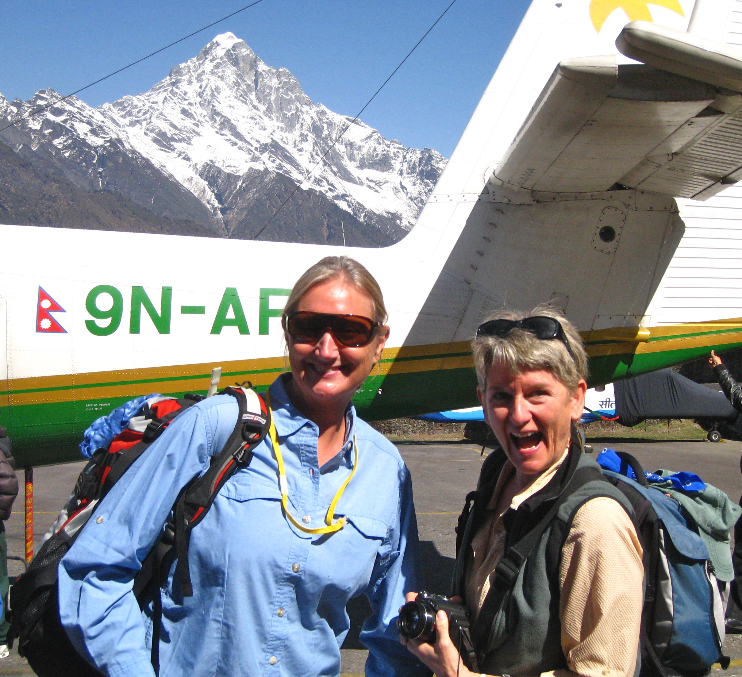
We landed with great certainty (nothing like a small plane!). This is our plane (Tara Air), and Leslie looking relieved.

And Laura and me, also looking thrilled to be on terra firma in the high Himalaya!
Two weeks later, on our departure from Lukla, we’d spend a few hours watching countless planes come and go, and we’d see how truly routine it all is. Planes would land, turn right into the parking and loading zone, 20 trekkers would get off, and airport workers would quickly empty the cargo bin of duffels. Then, 20 trekkers would pile onto the plane, new duffels would quickly get loaded, and the plane would proceed to the runway (50 yards away). They wouldn’t even shut off the motor. Sometimes someone would deliver cups of tea to the pilots.
I found this nice picture of Lukla, which is better than any of mine:

I did take this one, below, just steps out of the airport building…it’s Rick, a couple of store fronts and, of course, some chickens. It’s very charming.

First order of business upon leaving the Lukla airport, was to have a cup of tea and formally meet our assistant guide and porters.
They had all greeted us at the baggage counter, promptly gathered up our bags and vanished up some crowded, steep, stone steps. We caught up to them at the North Face Resort, a short walk from the airport.
(As with so many of the inns and tea houses, the names were sort of an overstatement. The accommodations were a lot more than I expected on this trek, but they were still very modest, and at the higher elevations very primitive. I’ll address all that later.)
At the North Face Resort, Hom, our head guide (37 years old) introduced us to Pradip, our assistant guide (23) and our three porters, Pemba (17), Asaman (27) and Rincha (52). We ordered some tea (ginger for me, which would become a regular choice in a rotation that would also include lemon, banana, mint and masala teas) and had somewhat of a conversation. Both our guides spoke good English, the porters much less.
Here are Homnath and Pradip.


After tea, it was time to load up. The porters would carry our 5 duffels, their own belongings, and our guides’ stuff for the full thirteen days of the trek. They’d also carry some extra provisions (cookies, for example, in a large, heavy metal box) and medical supplies.

Typical of many of the trekking porters we saw along the way, they carried 2 duffels each, for a total of about 75-90 pounds, and bind them together fairly crudely with some rope. They attached a thick strip of fabric to the load which they then wrapped around their forehead. The weight of the load was born largely by their head and neck (no straps at all around their hips), with some of the weight distributed and balanced along their back (they always walk slightly bent over).
Here are Asaman and Rincha, and below, Pemba.


And here’s one more, taken later in the trip:

A few comments about our porters:
Throughout the trip, Pemba, Asaman and Rincha would show up outside our doors first thing in the morning, collect our duffels and head out. We wouldn’t see them again until we arrived at that day’s destination, several hours after they’d arrived (at least). Not only did they carry these amazingly heavy loads over very rugged terrain wearing inadequate footwear and marginally suitable clothing… they did it very, very fast!
Meanwhile, we’d carefully and obsessively adjust the numerous straps and buckles on our small daypacks in order to perfectly balance and distribute the 15 lbs of water, snacks and extra clothes that we’d carry. We’d also wear high tech synthetic clothing designed for every possible weather condition, adjusting as needed to subtle weather changes along the way. And, of course, we wore the finest and latest in high-tech footwear. We were such the trekker geeks (nearly all trekkers are). It’s sensible, of course, but couldn’t help feeling wimpy.. and not a little self-conscious.
I just can’t tell you. What porters were called upon to do was both impressive and disturbing. We were entirely grateful for our porters.. AND had to fight off the impulse to challenge the conditions under which they worked (for meager pay).
On the one hand, carrying loads up and down the mountain is a fundamental part of life in the Himalaya. There are no roads. There are no cars. Everything that a person needs has to be carried up the mountain. With few exceptions (food that’s grown up there, animals that breed up there, and some native raw materials), everything we saw, anywhere along the way, had been carried in on the backs of humans or animals. The trails are crowded with men, women, children and pack animals hauling stuff up and down the mountains. Constantly. Everywhere. Everyone is quite accustomed to it and their bodies have (presumably) adapted (to some degree anyway). Our porters are carrying on, as they have for generations.
On the other hand, it seems a fine line between fair exchange and exploitation. There are, we’re told, great efforts being made to institute protections for Sherpas and porters–load limits, decent wages, medical care, and I don’t know what all. Grateful trekkers by and large tip well at the end of their trips, which is small compensation, but something. In the last 50 years, as trekking in this formerly untraveled region has exploded, consciousness about the human and environmental impacts has increased, but there’s a long way to go.
I thought about it a lot (because you’re constantly observing it and have a lot of time to think), not just about the porters, but about all the impacts that tens of thousands of foreigners annually (and growing) must have on the daily lives of these mountain communities and people. The invasion of a once remote and quiet culture was hard to reconcile… even if the invaders are largely culturally sensitive hiker types.
It always felt invasive. The introduction of modern life was often clumsy and tacky. It always felt like a clash.. a culture clash, an economic clash, a material clash, a religious clash.. etc.


Anyway, lots more to say on the subject… but moving on for now to the actual trek…
After finishing our tea, we took off through the village of Lukla, passing stores, cafes, teahouses and lots of village life. The streets were crowded with people and animals.
This is a dzopkyo.

They can be saddled up (like the young man is doing here) or used to haul great loads (the ultimate, all-purpose beast of burden). Dzopkyos are actually a hybrid between yaks and cows, but it gets a bit more complicated, as males are often called Dzos while females are technically called Dzomos. Not knowing how to pronounce any of that, I just called them yaks.
Yaks are, actually, hairier and are the more predominant pack animal at the higher elevations (over about 14,000). Below is a yak. Everything you’d ever want to know about yaks is here. They were very cool and shared the trail well with trekkers.
They also left a LOT of poop on the trail.

All treks in this region officially begin as you pass through this gate on the edge of town. We started our trek at about 10:45. It was sunny and fairly warm… I’m guessing in the high 40s or low 50s. (That would certainly not last..)
(I actually took this picture on the return trip, which is why it’s cloudy).

This is a map of where we are going to be trekking for the next few of days (better seen if you click on it).

Essentially, we’re hiking up the Dodh Kosi river canyon. You can see Lukla in the bottom right corner. We’ll have lunch in Cheplung and stay our first night in Phakding. We’ll cross the river numerous times on suspension bridges (wait’ll you see those) high above the water on our way to Namche Bazaar, where we’ll spend two nights.
But back to day one… it’s a short hike, only 4 1/2 miles, with a net drop in elevation, from 9318′(Lukla) to 8563′ (Phakding). Easy peasy. Here’s a profile:

Here’s what it looks like along the way.
Farmland:

Blooming Rhododendrons:

Villages:

And lots of Buddhist religious structures:

Leslie is spinning a prayer wheel (always clockwise), there are carved mani stones to the right (with Om Mani Padme Hum written in sanskrit on them), and prayer flags are blowing. Below, I’m standing in front of a stupa, and you can also see a couple prayer flag posts. In all cases, it is traditional to pass on the left of sacred structures, keeping it to your right (I read that this imitates the path of the sun, but I’m not sure).

Also of note in this picture are the four loads sitting on the wall. The porters are lying on the ground resting, just out of camera range. In their baskets are probably cases of beer (I see Tuborg brand) or laundry soap. The baskets are extremely typical; everyone carries them (except us). You can also see the straps that go around the porters’ foreheads, and the thick, squat walking sticks they all carry (and sit on from time to time).
Here is the first view of Kusum Kangaru (20,889′), which was just beautiful and would be in view for many days on this trek. We had our first trail lunch looking up at this, in a teahouse in Cheplung.

At lunch, we all tended to order the same thing to simplify and expedite the process. This day, it was a big plate of fried rice with egg, vegetables and cheese. And tea. Always tea. Here is a picture Karen took of Laura, Leslie, me and Rick.

After lunch, we continued on, sharing the narrow, often steep trail with dzos, locals, porters, and other trekkers. The red rooftop below gives a sense of how steep the trail is. The pack animals (dzos, yaks and donkeys) never seem to have trouble managing steep stairs.

The things that impressed me most on day one of our trek were the number of people (locals, trekkers, porters), the villages and village life I didn’t expect to encounter, the number of pack animals, and the garbage. I just had no sense of any of this prior to arriving. After day three, we’d leave most of the crowds behind (very nice!) but I just had no idea we’d find ourselves in the middle of communities of mountain people.
Regarding the garbage… while it wasn’t a lot, it was definitely there. It certainly wasn’t left by trekkers, who, by and large, have a pretty strong environmental ethic.
The reality is, trekkers and climbers are a relatively new addition to the Khumbu region. It’s really only been since 1953, when Mt. Everest was first climbed by Edmond Hillary and Tenzing Norgay, that visitors have started pouring into this area. I think there are increasing efforts underway to introduce all kinds of environmental regulations, largely at the initiation of foreign visitors and global environmental and mountaineering organizations. It very much seems like an area in huge transition.
Anyway..
We got to the smallish village of Phakding in the late afternoon. That is our teahouse, straight ahead, the Beer Garden Hotel (blue, four story building). The level with the red siding is the dining room, which had a great view of Phakding, the valley and terraced farms, the river far below and the mountains far, far above!

Here’s the inside of the dining room:

This is very typical of what we’d find in every teahouse: a large room with windows and bench seating around the perimeter, a stove in the middle (barely visible here), and trekkers & guides everywhere. They’d fuel the stove with yak dung (no smell from the dung, but it’d smell intensely of kerosene), usually firing it up in the late afternoon. It’d be warm in the dining room with lots of lively conversation and card games. We’d often hang out in there after the day’s hike (as it was the only warm place) drinking tea and talking to people from all over the world. It was pretty damn fun.
Phakding was one of the larger villages we stayed in, so we took the opportunity to explore a little. That afternoon, we went to a bakery for cinnamon rolls, and to a little shop that had internet access. The higher elevation places, especially those along the trail we eventually veered off on (well off the main Everest Base Camp trail), did not have those kinds of amenities.
These are the steps up to our room. It was pretty charming with lovely little gardens. This is doable at this elevation. Teahouses would get increasingly primitive the higher we went.

And this is our fancy dancy room. Having a bathroom and all that space was unique.

We always had electricity, but never heat. This is what I wore to bed: fleece pants, socks, fleece turtleneck, expedition weight thermal top, and a down vest. I probably also wore a fleece cap and mittens (but I failed to note that in my journal…so not sure). I brought a silk liner that I placed inside the down bag they provided. We’d put the blankets that you see on the bed over us for extra insulation. It got colder in the higher elevations and I’d add a pile vest, a down sweater, thermal bottoms, down booties and a fleece buff around my neck.
So, yeah… cold.
It also ended up raining really hard this night. We all lay in anxious anticipation of what that meant for the coming days… snow at the higher elevations? Would they close Cho La Pass? Would we need to change our route? Forgo Everest Base Camp? Were we going to spend our next few days soaked and cold? The prospect of any or all of that was daunting.
Even so, we went to bed at 8:00 and slept super well and toastily.
Deeper into Kathmandu
April 4, 2011
Trip Day #6
The note in my journal says, “What an interesting day. Can it all be like this, please?”
Always a good sign.
So, today, we traveled deeper into Kathmandu. The nice people at HGT offer, as part of their trek package, a full day of sight seeing. Come for the trek, leave with a few key sights under your belt. This is a cool thing, and we were more than happy to play city tourists for a day.
We five, plus two from South Africa and three Aussies (whom we’d get to know pretty well over the next two weeks, as we’d criss-cross the Himalayas), took off in a van with a driver and a guide. This is our guide:

Here’s a funny:
I asked our guide if it was ok to sit in the front seat (always eager to find the seat most car-sick proof), and he said ok. So, as departure time neared, I walked around to the front passenger seat and climbed in. I had to maneuver, with some difficulty, into position, and, as usual, finding the seat belt was a bit tricky, but I did it. Then I tried to settle in, but it felt so cramped, and, well, whatever; I just dealt with it. Then I noted that the passenger side had a steering wheel (must have been pretty preoccupied to have missed that very obvious detail, but I must have had carsick avoidance on my mind). I thought the steering wheel was odd, but in the fleeting moment I considered this fact, I figured it was like those driver education vehicles, where the passenger also serves as a backup driver, in case… you know. Or whatever; probably just a Nepal tour bus thing. Then I saw a bunch of guys outside laughing, and I realized, Ohhh…. I’ve climbed into the driver’s seat… because, duh, they drive on the opposite side of the road here… and… yeah. Felt very silly, suddenly. So… just got out, smiled at all the laughing guys, and got back in on the other side. Awkward.
First place we went: Swayambhunath, a bit west of the Thamel district in downtown. It is an ancient religious complex at the top of a hill and offers amazing views of Kathmandu (though it was a hazy day). It is probably the most sacred among Buddhist pilgrimage sites. It is also known as the Monkey Temple as there are holy monkeys, they say, living in many parts of the temple.
Monkeys are everywhere.

The complex consists of a stupa, and a variety of shrines and temples. The site has two access points: a long stairway, with 365 steps, leading directly to the main platform of the temple, and a car road around the hill. At the top of the steps, you see a big vajra (thunder-bolt scepter) and behind that is the vast, round, white dome of the stupa, at the top of which are two giant Buddha eyes.
Prayer wheels surround the stupa and people walk clockwise around it spinning the wheels. Spinning the wheel is supposed to help to accumulate wisdom and merit (good karma) and to purify negativities (bad karma).

There are a lot of vendors and sales people wishing to sell you singing bowls, jewelry, prayer flags and Buddha paraphernalia. There were lots of candles burning and it smelled great because of all the incense.

Also, in the background, repeating over and over, a beautiful choral chant we’d become very familiar with: Om Mani Padme Hum.

Above are the six syllables in sanskrit. They translate as follows: Om: generosity, Ma: ethics, Ni: patience, Pad: diligence, Me: renunciation, Hum: wisdom.
We’d hear this chant at temples and monasteries. People often chanted while spinning wheels. On the trek, we’d see the words carved on stones, which served as blessings on mountain tops, in towns, along the trail, on memorials, and around stupas.
We visited Durbar Square next, a bit south of Thamel. Durbar Square is made up of a few loosely linked squares and is considered the traditional heart of Kathmandu’s old town and represents an amazing legacy of traditional architecture. Dozens of gorgeous buildings.. I had no idea the significance or history.. we were here only a short time.
But, there is a *lot* of activity in this area and lots of temples. The plaza with all the pigeons and cows seems to attract a lot of attention.

Among many other things (open air markets, shops, restaurants, hotels), the Royal Palace is here, though the King does not live here anymore.
Also in this area is the Kumari Bahal–a three story red brick building with intricately carved windows–home to Kumari, the town’s selected “living goddess.” In Nepal, the Kumari is famous. She is selected when she is very young and remains the goddess until her first period. After this, she returns to mortal status and a new Kumari is chosen. We saw her–she came to a window to wave at us–I think she was about 6. I have no pictures because they were not allowed.
We loaded up the van and headed next to Bodhnath, on the northeastern outskirts of Kathmandu. Bodhnath is considered one of the holiest Buddhist sites in the city. It has one of the largest spherical stupas in Nepal which dominates the skyline and is also one of the largest in the world (note those eyes!). Prayer flags hang everywhere, and around the perimeter of the stupa are prayer wheels, so people walk around and around.

Our focus here seemed to be on shopping. Our guide took us to a number of places where we learned about (and/or purchased) singing bowls, cashmere/pashmina fabrics and scarves, and Thankas.
I’m not much of a shopper, but I appreciated the chance to learn a little about some of Nepal’s art and cultural life. We helped the local economy, I’m sure our guide got some pretty good commissions… so, you know: win, win. It was a lively, bustling place (and like everywhere, smelled great). Stores surround the circular plaza, completely bulging with stuff.. paradise for the shoppers.

Here is a Thanka painting school where we spent a lot of time and sat in on a lecture and demonstration of this ancient process.

Thankas consist of a picture panel which is painted on textile or embroidered, over which is laid a cover, usually silk. It is sometimes called a scroll-painting. Images of deities and/or the life of Buddha are depicted, which describe historical events, or are a retelling of myths. They often become a teaching tool. Perhaps most importantly, this form of religious art is used as a meditation tool to help bring one further down the path to enlightenment. I found them very interesting… and.. bought one.

We had a great lunch in Bodhnath before taking off for our final stop….
Out on the western side of downtown, near the Tribhuvan International Airport, along the banks of the sacred (if dirty, polluted, and full of garbage) Bagmati River, is one of Nepal’s most important Hindu temples and cremation sites: Pashupatinath. Here, in the middle of town, in full view of passers by, they perform open air cremations, with humanity and traffic in chaotic bustle all around. It’s hard to make out in this picture, but you can see the ghats–concrete platforms which are used for the cremations–along the river banks. The formal public viewing (and where we sat) is across the river on the right, on concrete risers, not quite viewable in this picture.

Funerals of ordinary Nepalis take place daily on the ghats. Bodies are wrapped in shrouds and placed on wooden pyres. We saw corpses in various stages of the process (I think it takes about 2-3 hours to fully burn). We saw the beginning of one ceremony, where family members walked around the body, tossed flowers, burned incense, etc., after which straw was placed upon the body and the whole thing was set on fire.

We saw the end of another process where, once fully burned, the final remains (and clothes, shoes and the structure itself) were tossed and/or swept into the river.

I’d somehow missed our guide’s explanation of where we were going, so it took awhile for me to fully grasp what was happening. It was at first disturbing, but then I found it fascinating. In our culture, death is such a private event; few of us get close to the experience of it, so it’s mysterious and remains sort of forbidden. But here, in this setting, it was very public and, while I’m certain people grieve the loss of their loved ones, death seemed clearly a part of people’s everyday reality of life. I was grateful for the experience of it. Much to think about.
The entire tour today offered a lot; the sights were fascinating, beautiful, extra-experiential and macabre. There is a lot more to learn about Nepali life and culture, Hindu and Buddhist practices, but there was much today to ignite the senses and make curious travelers out of us all.
Kathmandu: Orientation and Welcome Dinner
April 3, 2011
Trip Day #5
Waking up in Kathmandu? Yeah, pretty neat.
We ventured to the hotel’s large dining room for their breakfast buffet and actually liked it a whole lot more than the dinner buffet the night before. Nothing much to say about it, except it was convenient and it did the trick. We had a busy day ahead.
First, we were meeting up with Hari. Forty years ago, Bill had found a way for Hari, only 12 years old at the time, to move from his home in the country to a place in Kathmandu and closer to a good school. This was Hari’s opportunity for a better education. In return, Hari, at 12, served as Bill’s cook. Bill was also instrumental in setting Hari on a lifelong career path in sustainable farming and community development. Hari now lives in central Kathmandu with his family (wife, kids, grandkids) and also has a farm about a five-hour drive away. He joined us for coffee while we ate breakfast. He was a lot of fun to talk to and gave us a lot of insights about Nepalese life, his life, and his experiences with Bill over the years. We made plans to visit again upon our return. Nice to suddenly have local friends to make plans with! Yay.
The big event of this day was our orientation. We were scheduled to meet Homnath at 11:00 to walk to the Himalayan Glacier Trekking office in Thamel and spend a few hours reviewing details about the trek, paying balances, taking care of insurance, picking up extra gear, etc.
But the other Big Thing, which was also happening at 11:00, was meeting the fifth member of our trekking cadre–the guy who’d independently booked a trip with HGT and, by luck of the draw, got added to our group… a group of four women. The proverbial 5th wheel. We were anxious to meet this guy. I mean, if we’re going to spend the next 2 weeks hiking together, eating all our meals together, and who knows what other adventures or misadventures we’d encounter together.. well… we’d better like him, and vice versa, or it could be uncomfortable.
So, all that happened. First we met Rick Whitney, who turned out to be a nice guy, very easy going, a fit and experienced hiker, well-traveled (and, we’d learn later, had great snacks, knew fun card games, was very accommodating, was a good sport, an unabashed dancer, and had a tri-pod). So, wow, good fit. Though we put him on Man Probation right away, anyway.
Then, Hom led us on a fun little sprint from the Shanker Hotel to the district of Thamel, where the streets are dense with people and persistent vendors and items for sale, and we had to stay alert to 1) keep Hom within our sights, and 2) avoid being flattened or crushed by some form of moving object. The population of Kathmandu is 1 million, and it feels like they’re all on whichever block you happen to be on.
Thamel is a tourist ghetto, fun and convenient, and is packed with shops, cafes, cheap hotels, restaurants, hookah bars, people, and vehicles of every stripe.
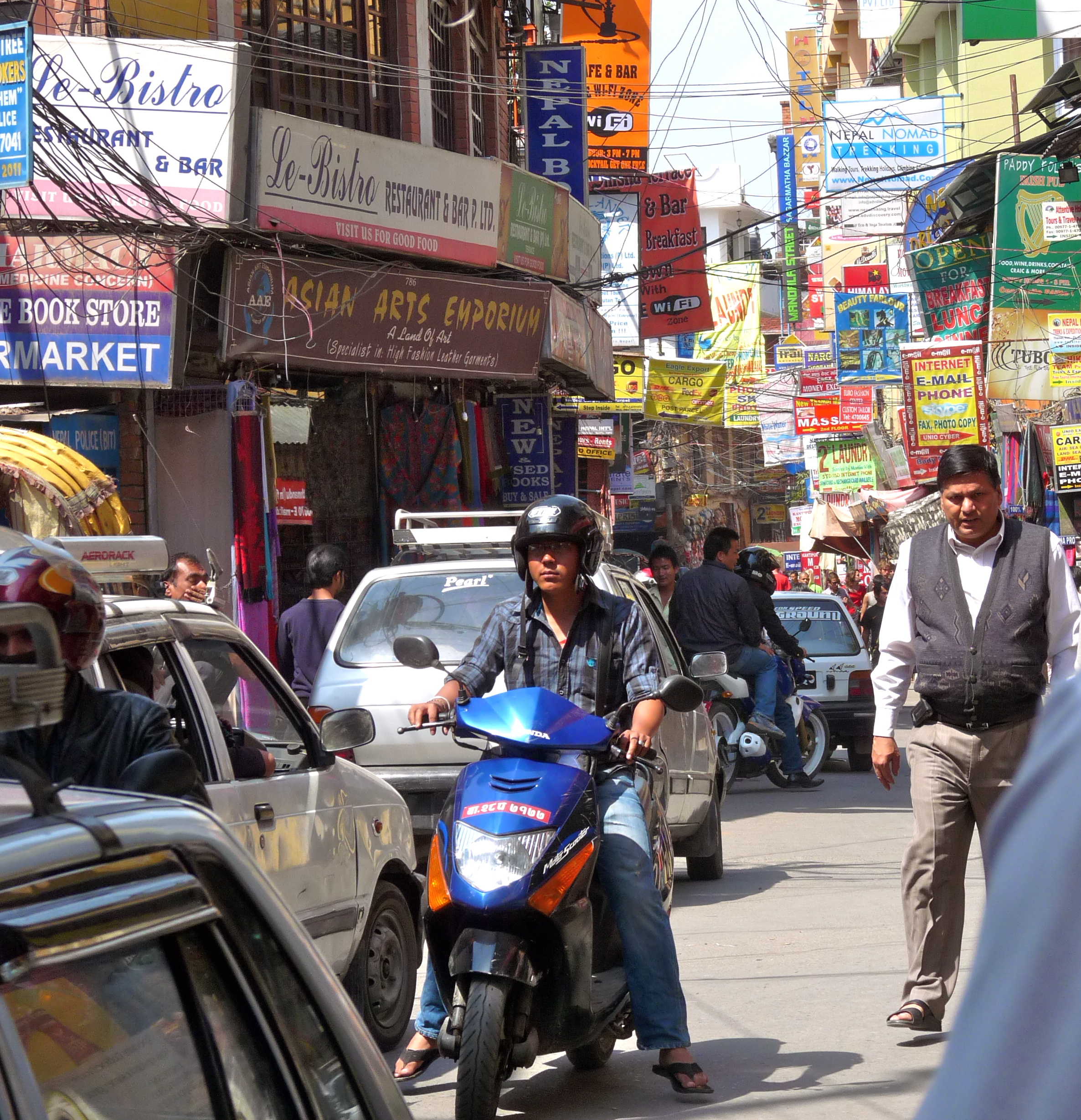
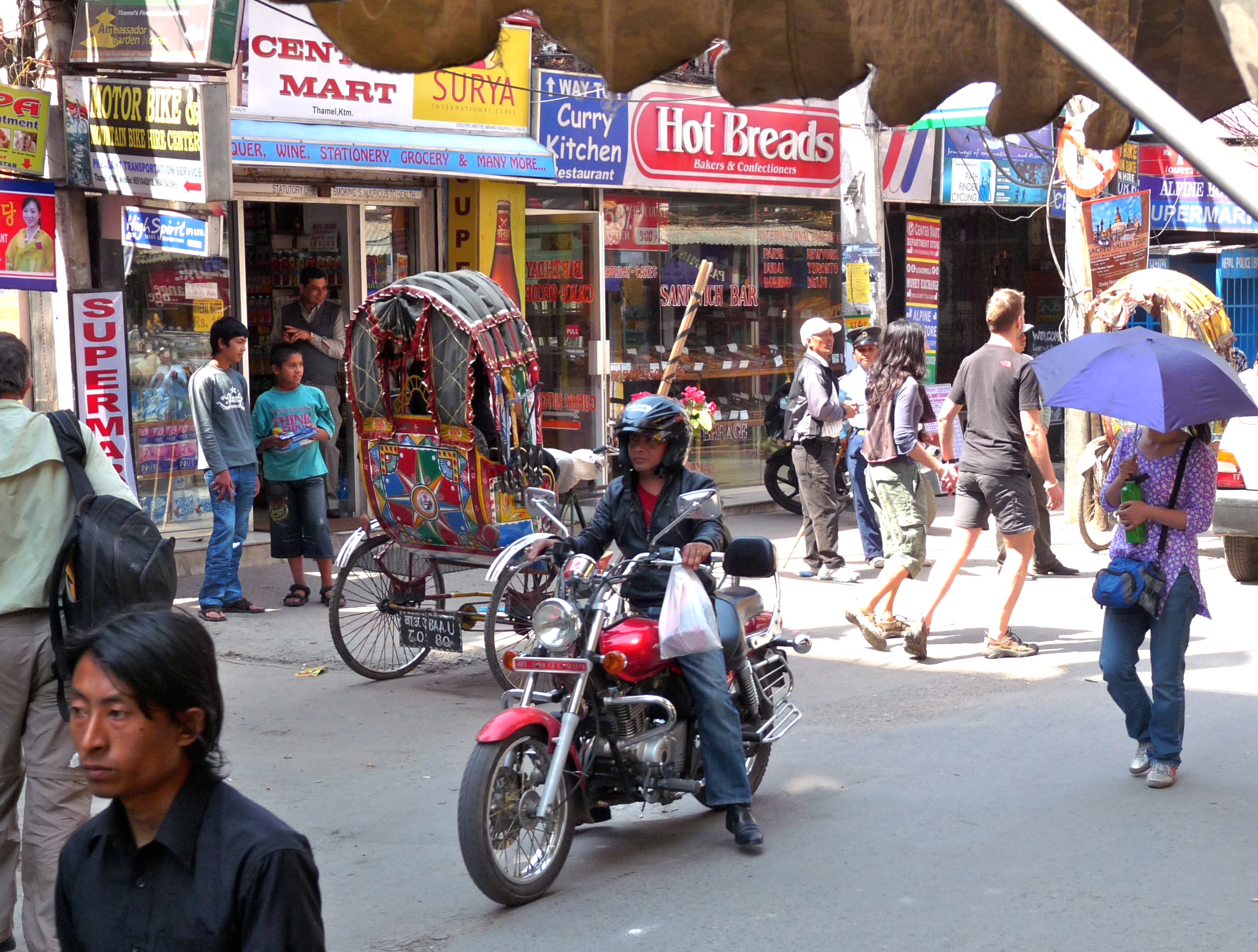
Here’s a third world tangle of cables:
The HGT office is on the 3rd floor of a building in the heart of Thamel–trekker mecca, gear store overload. We were greeted by one of HGT’s co-owners (Narayan Regmi, pictured with Leslie, below), who was gracious and welcoming and conducted a thorough overview of the trip (painstakingly thorough). He processed remaining paperwork, answered innumerable questions, gave us free stuff (duffel bags, trail maps, shirts with corporate logos) and finally sent us on our way.

Next stop: get gear. Hom took us to see this woman (see pic) who equipped us with sleeping bags, walking sticks and the biggest down coats I’ve ever seen, carried, or worn. No worries about cold weather. We could have brought our own stuff from home, but it was easier and less hassle to get it there, since it was included in the price.

Heading out of Thamel, it was impossible to not shop or to avoid vendors. Laura and Leslie both bought flutes. Later, on the trek, we would be grateful for their purchases. Leslie played hers often, offering a haunting and lovely start to many of our early mornings.

Pooped and shopped out, we returned to our hotel and settled ourselves in the garden. We ordered momos (steamed dumplings, sort of like potstickers, made with chiles, garlic, ginger, onion and sometimes meat, served with a spicy tomato relish) and the most fabulous spiced peanut dish. This time we drank masala tea (spiced tea with milk), but later, we discovered these go better with beer.

The day ended with the HGT “welcome dinner” event. Our group joined many other tourists at a restaurant that specialized in traditional Nepalese cuisine and offered a series of national and regional music and dance performances. This was exactly as you would expect it to be–touristy and non-intimate–but it was a great introduction to the culture and we had a lot of fun. We ate basmati rice and various curried meats (chicken, boar), Nepali style french fries, spinach & other veggies, some intense hot alcohol drink, a lemony yogurt dish for dessert and some Everest beer. It was all really good.

One of our fellow table mates was Jan Smith, a 66 year old woman from Australia who we learned was planning her second attempt at climbing Everest. She started trekking at the age of 60 and had already summited Cho Oyu (6th highest mountain in the world, also in the Everest region). After failing last year (she got as far as camp 3 before they told her she was not ready), she changed her training and felt she was going to be successful this year. It turns out, we were all flying to Lukla in two days (though on different flights) and starting our respective treks on the same day. We would meet up with her several times on the trail (and note she was an extremely fast walker and super fit). She also must be fairly wealthy, as Everest ascents are not cheap.

We learned, upon our return home, that Jan did not, in fact, make it to the top, largely for weather reasons. I read that this would be her last attempt.
