Happy Buddha Birthday
April 30, 2011

Guess which objet d’ art I brought back from Kathmandu? That Jim is a lucky, lucky guy to have a birthday so close to my exotic little trip to the middle-far east, no?
The UAE and Trip’s End
April 21, 2011
Trip day #23
Okay, kids, gonna be a big day! It’s going to start with an early breakfast in Abu Dhabi followed by a road trip to, and a whirlwind tour of, Dubai. Time also will be spent deep in the depths of desert dunes, and along the way we’ll eat, swim, and cavort with camels. Before the clock strikes midnight, one of us (me) will board a plane to Germany where a connection will be made to a plane bound for the United States. No time to waste; let’s go!
We started with the road trip to Dubai… almost 90 minutes northeast along the Persian Gulf coast. This is a commute Laura did for her entire first year here, before settling in Abu Dhabi.
. 
Here’s a little info about the UAE:
The UAE is a federation of seven emirates (equivalent to principalities). Each emirate is governed by a hereditary emir who jointly form the Federal Supreme Council which is the highest legislative and executive body in the country. One of the emirs is selected as the President of the United Arab Emirates. The constituent emirates are Abu Dhabi,Ajman, Dubai, Fujairah, Ras al-Khaimah, Sharjah, and Umm al-Quwain. The capital is Abu Dhabi, which is one of the two centers of commercial and cultural activities, together with Dubai.[6] Islam is the official religion of the UAE, and Arabic is the official language.[7]
The UAE got its independence from England in just 1971 (they’d been under British rule for almost a hundred years). This is a very modern country, with a lot of money flowing because of oil and natural gas exports. Today the population is about nine million people, approximately 10% of whom are native. The rest are foreign laborers and expats. If you’re native, the government takes care of you. They give you money, land, a home, and you don’t have to work.
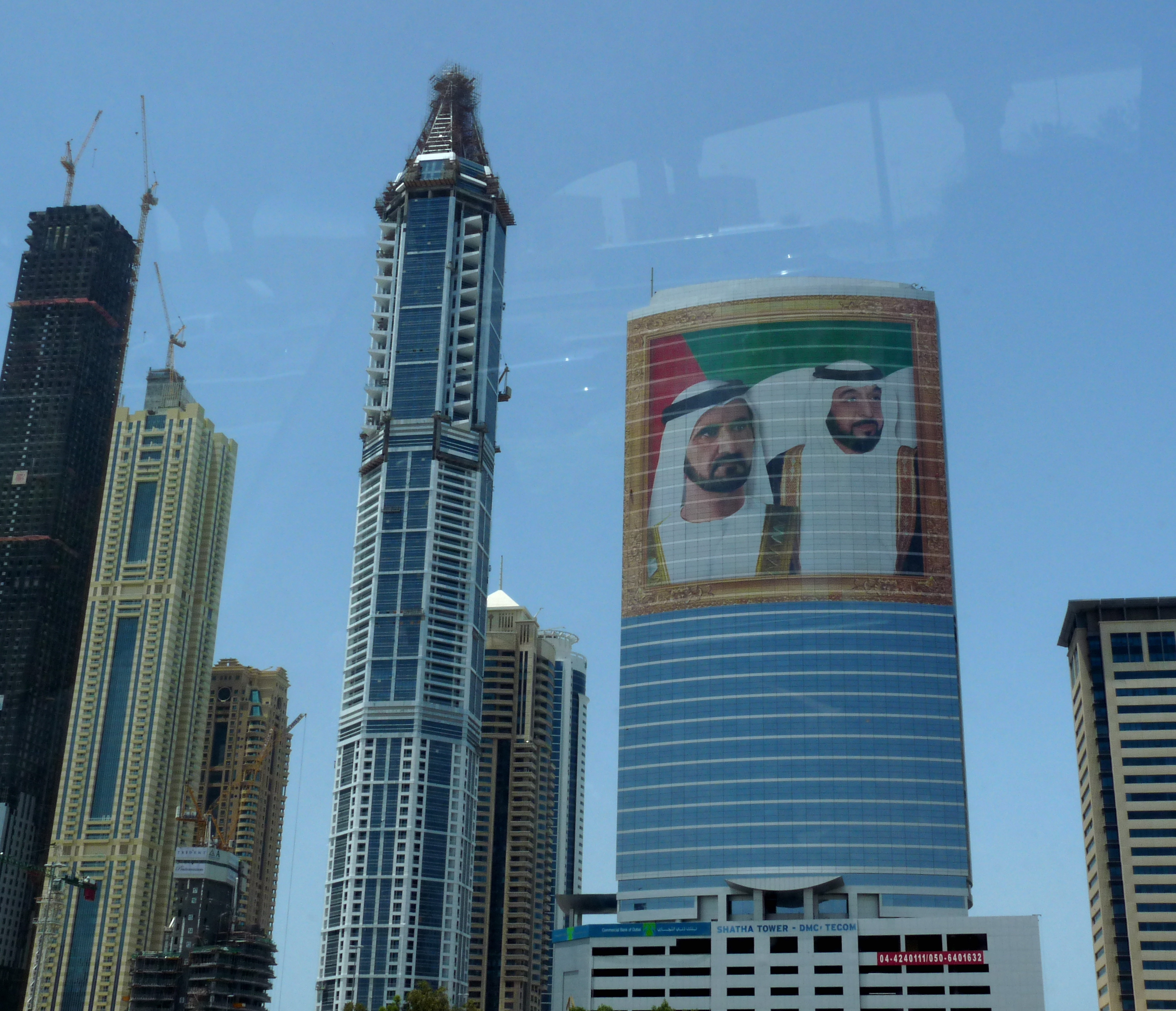
This is a shot out the window of the back seat. Pictured on the building, I believe, are the emirs of Abu Dhabi and Dubai emirates, who also serve as the president and vice president of the UAE. These guys come to power by virtue of family connections. Everyone in their cabinet is a family member. Everything is named after them. The current president of UAE, is a guy named Kalilfa, after whom the tallest building in the world (in Dubai) is named.. the Burj Kalifa (burj means tower). We’re on our way there.
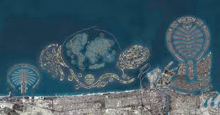
On the road between Abu Dhabi and Dubai, we saw a number of islands (all of Abu Dhabi is an island, by the way). These man-made islands are in the shapes of palm trees, world maps and other abstract designs, and are amazing. I hear they are sinking, but that doesn’t seem to have stopped the government from continuing to build them, and on them erect very high-end resort-style hotels and mansion-filled housing developments. Here’s an aerial view I grabbed from the web. Close-ups of the beach front estates are worth a look… sheer decadence.
We also saw Ferrari World, and an entirely-indoor ski resort. We didn’t go inside, but it’s a popular place with man-made snow, a chair lift and a 1/4 mile run. On one side of the freeway (which is one of the hugest freeways I’ve ever seen.. and I’m from LA), we saw camels in the deserty distance, and, on the other side, UAE headquarters for Microsoft, 3M, Hewlett-Packard, Cannon, Oracle, and many others. Lotta dirham there (their currency).
Once in Dubai, the first order of business was to navigate an immense downtown parking garage. They had lights above all the parking stalls to indicate vacant (green) or occupied (red) and a digital readout at the entrance to tell you exactly how many spaces were available. Parking was free. Wandered over to the Burj Kalifa. Here it is from the outside:
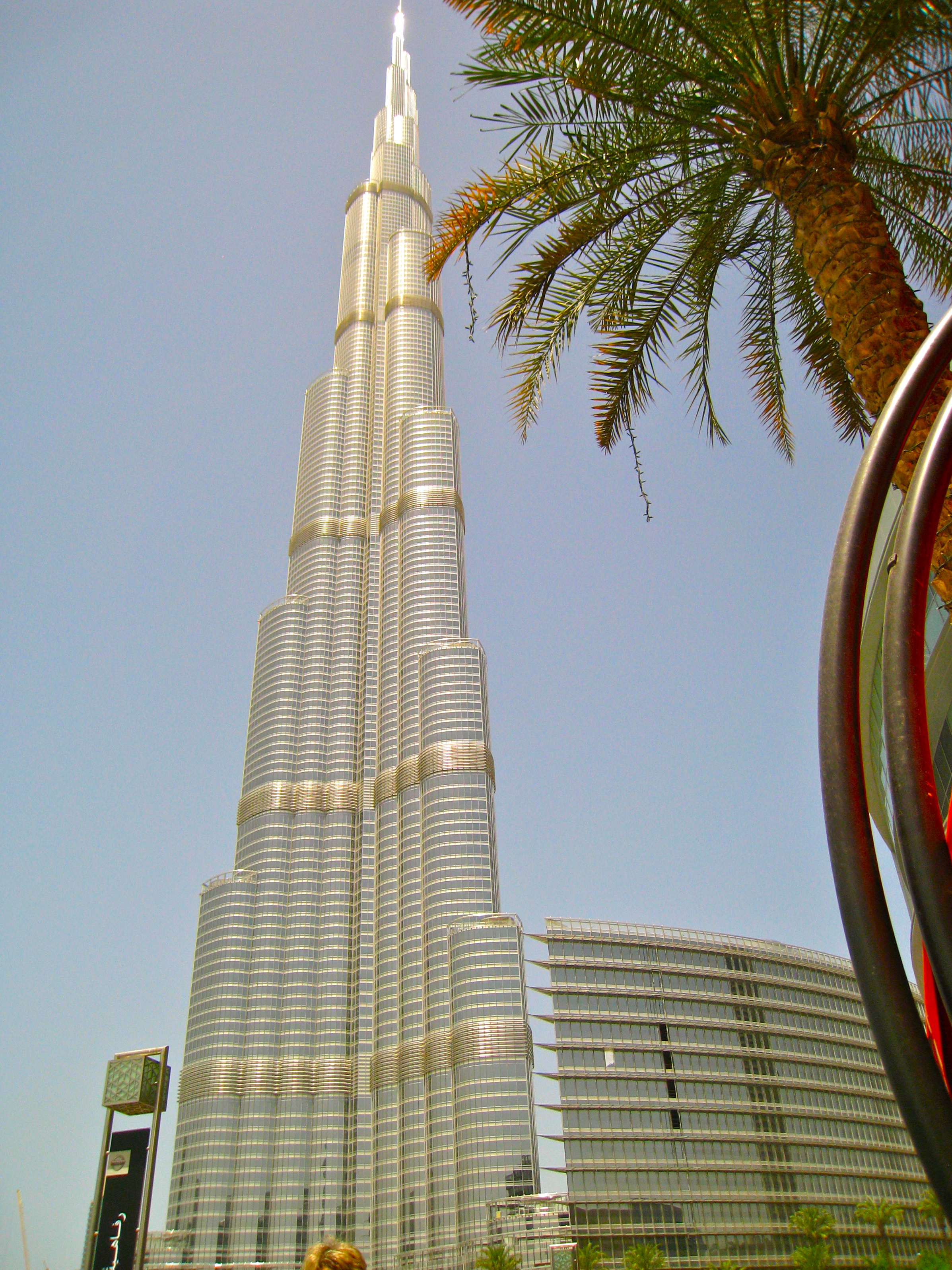
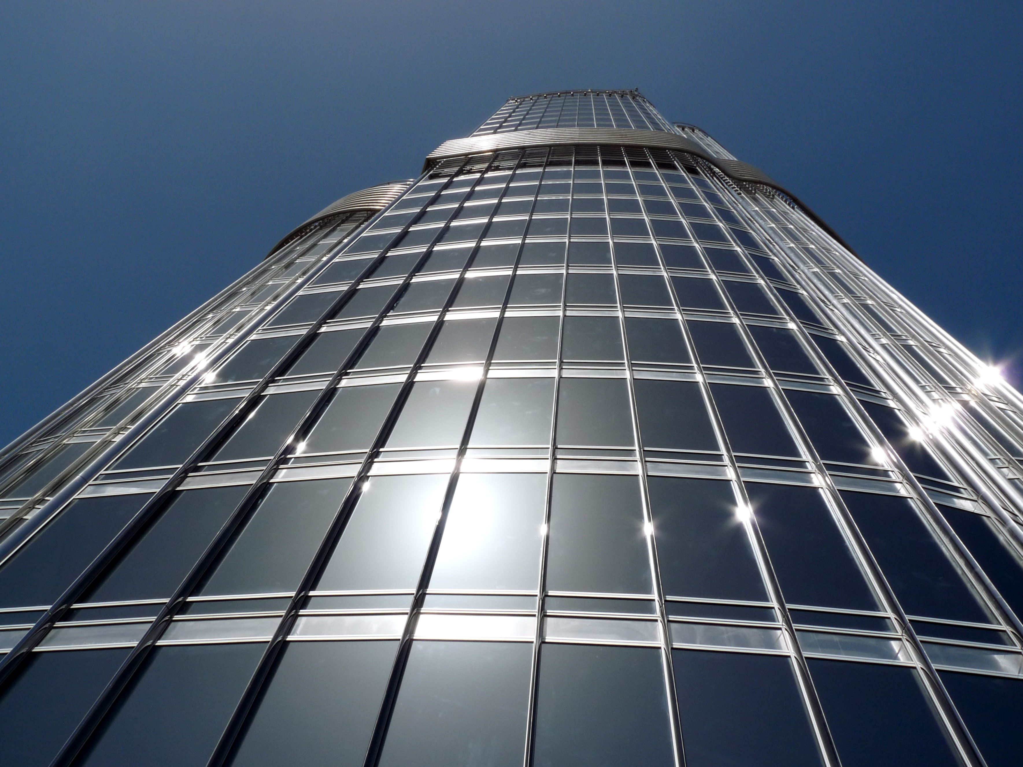
It is a very classy, elegant building with beautiful displays and exhibits about its construction.
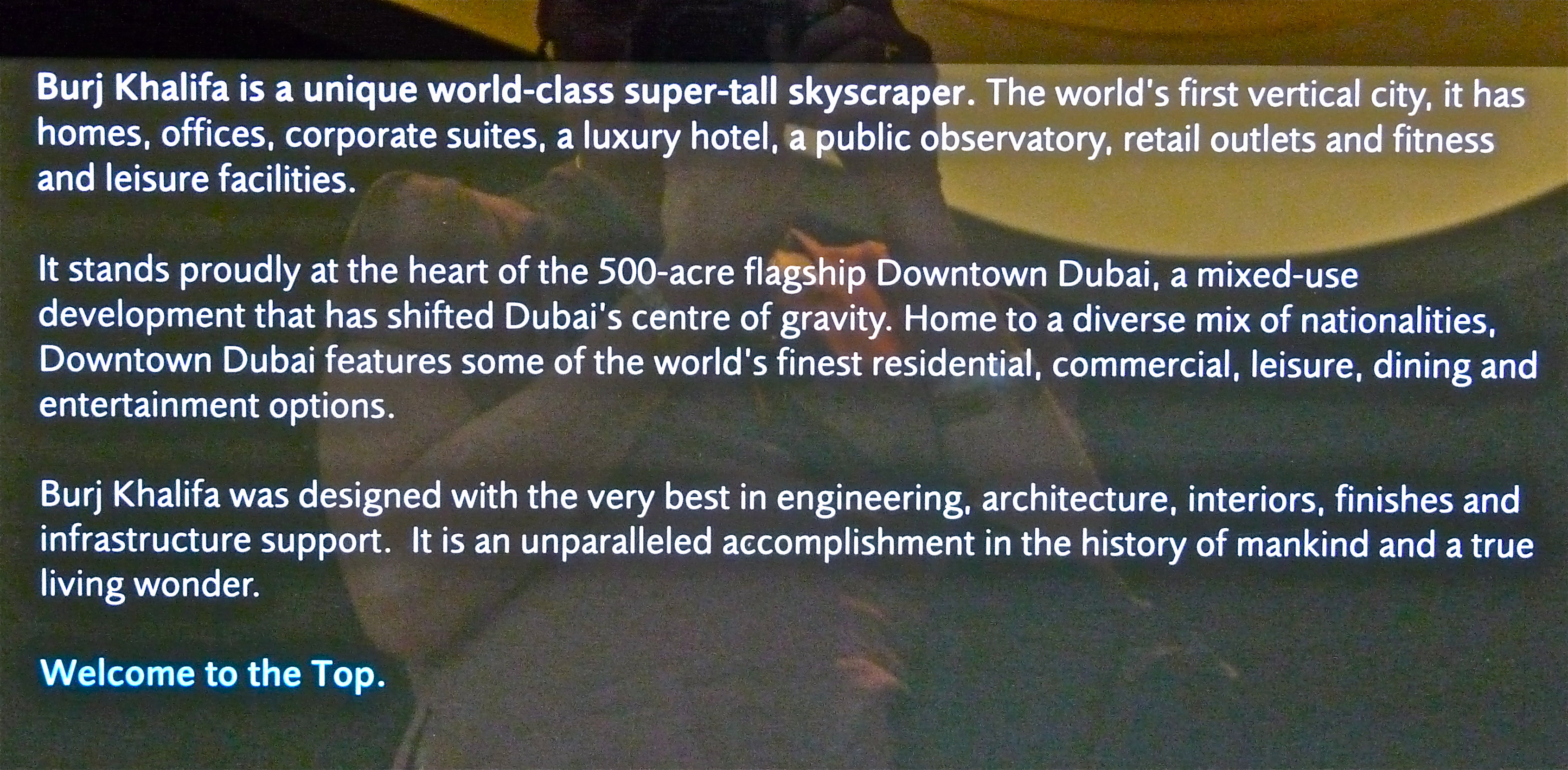
The Burj Kalifa opened in January 2010 and is the tallest building in the world–200 stories. The observation tower is on the 124th floor, which was high enough. I was a little nervous at the top and ready to come down after about 30 minutes…
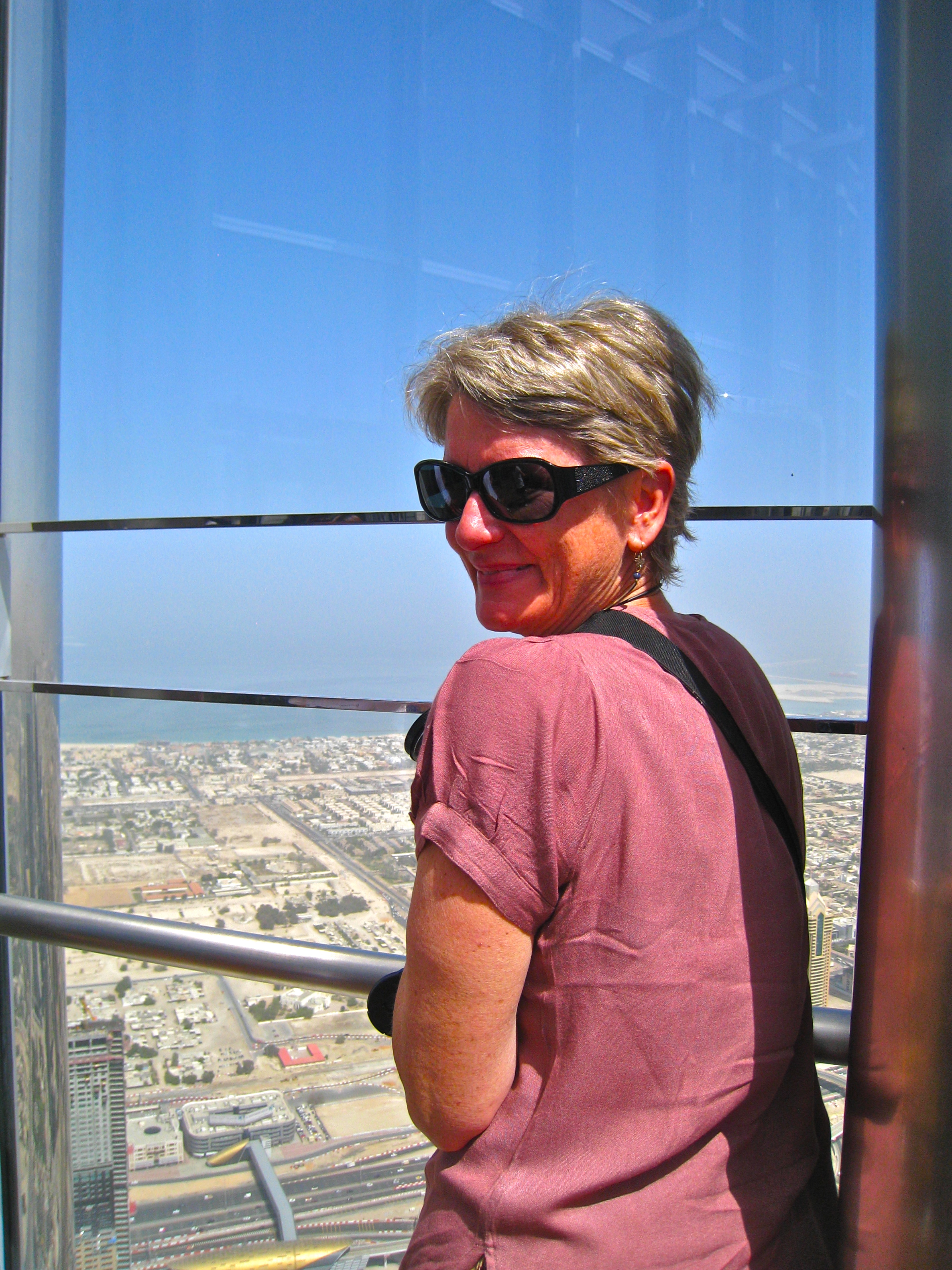
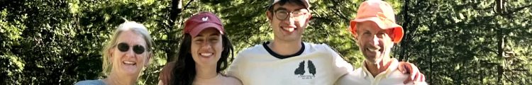
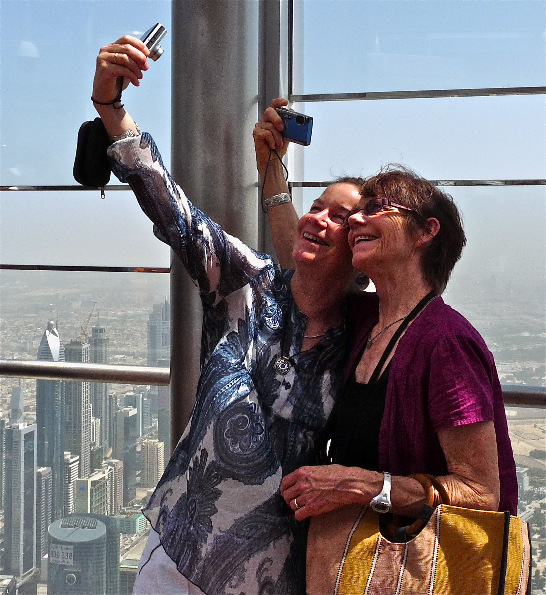
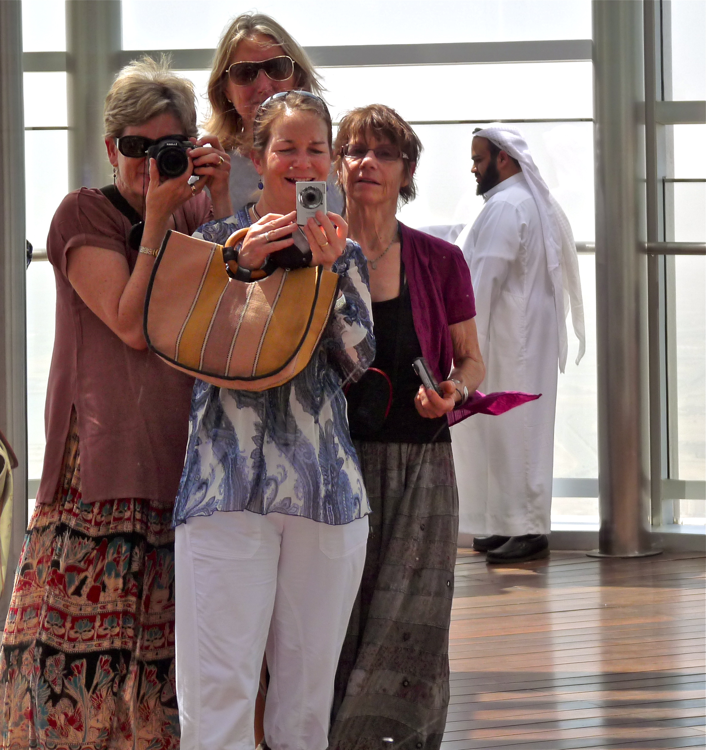
but we had fun up there taking pictures of each other (the Hesse sisters)..
..and taking in the stunning views:
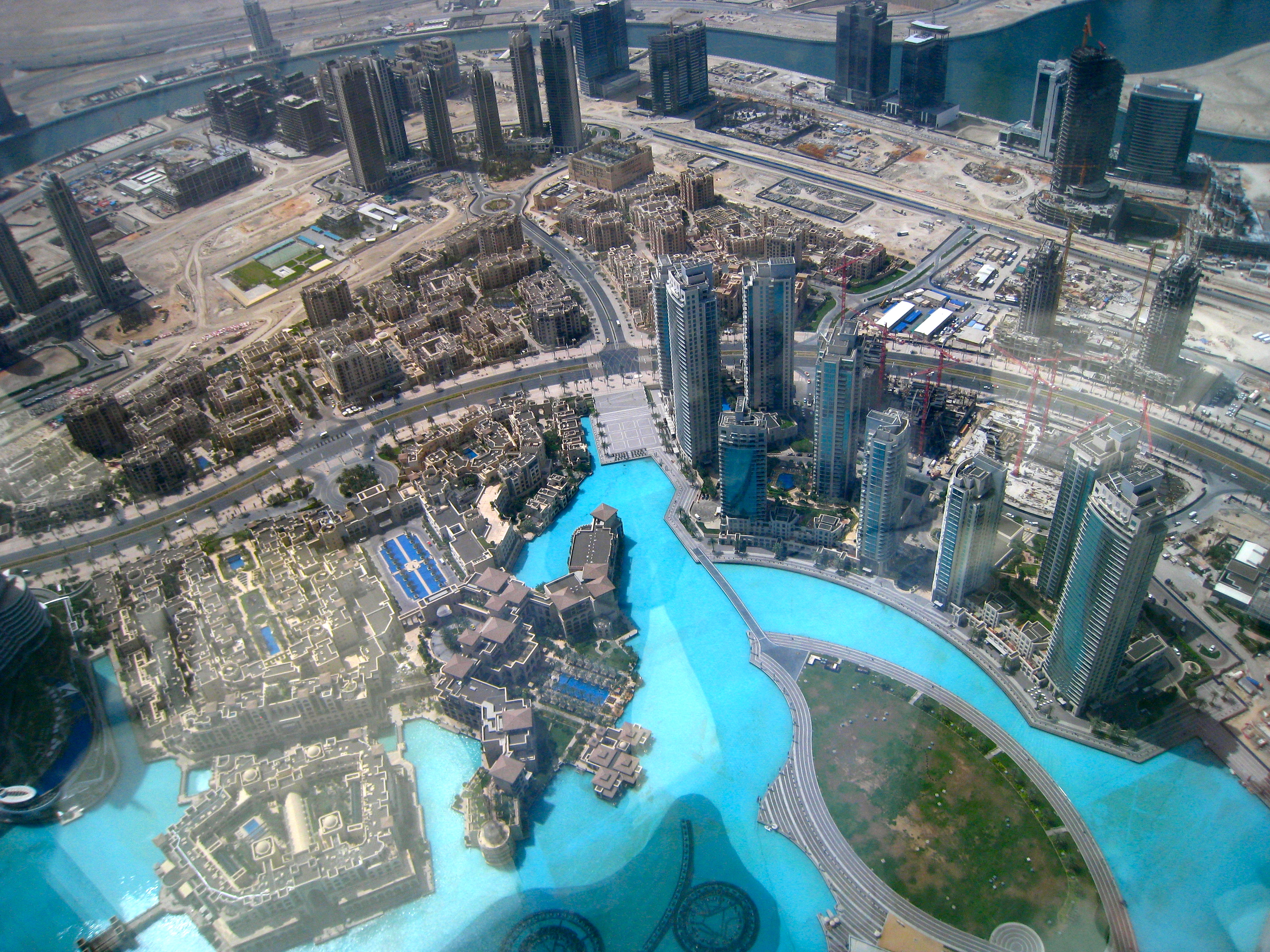
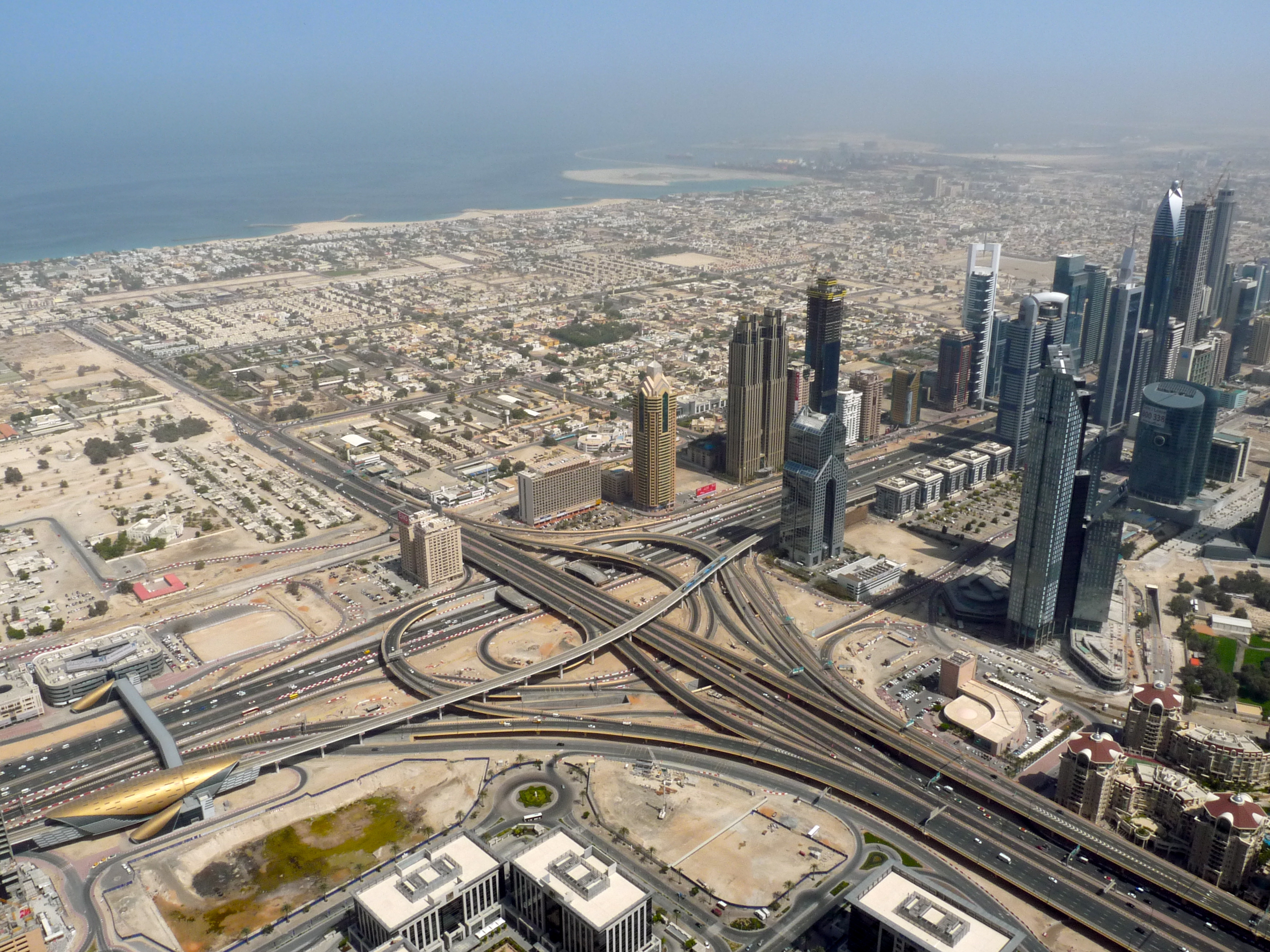
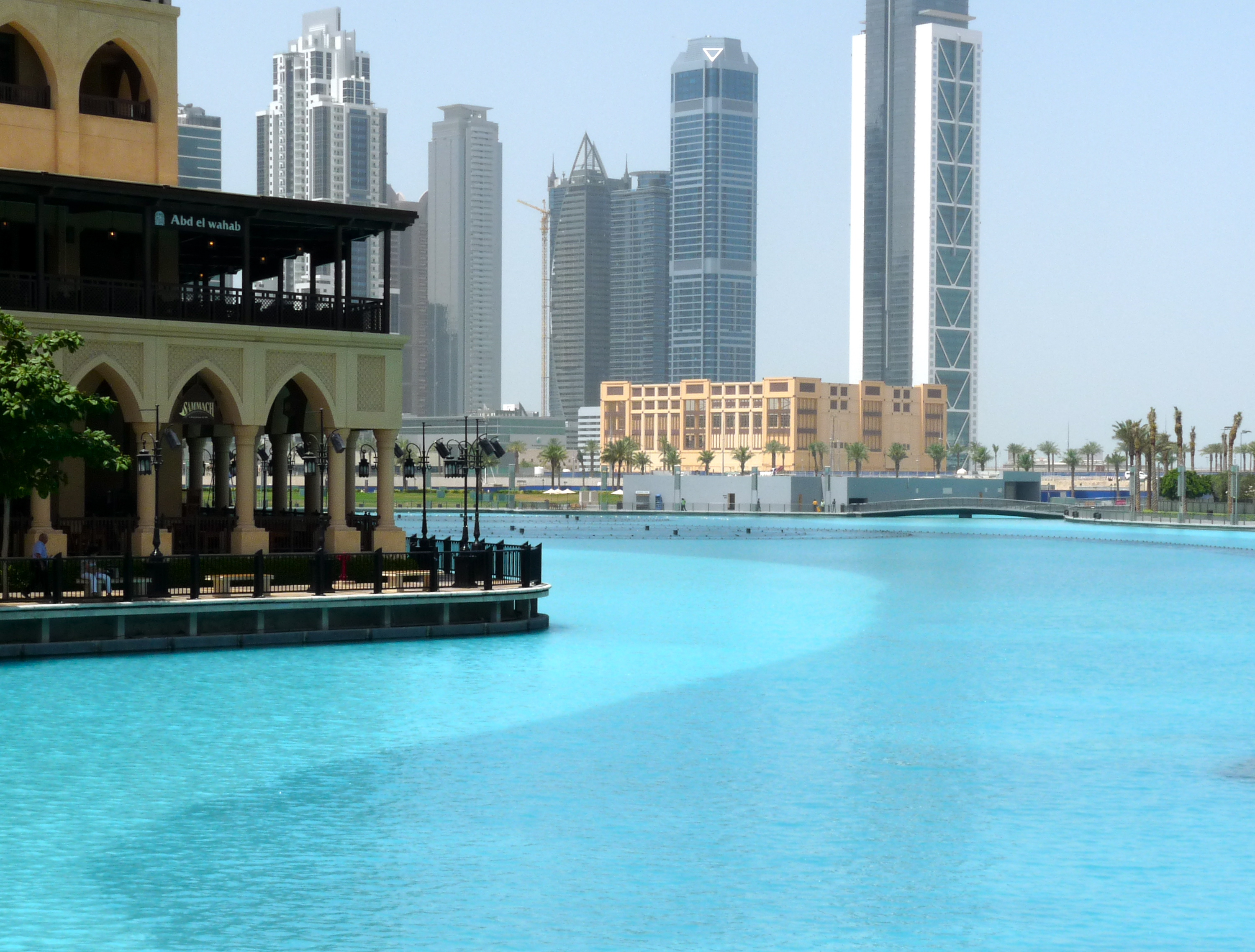
Here are a few shots of the area around the Burj Kalifa and downtown Dubai:
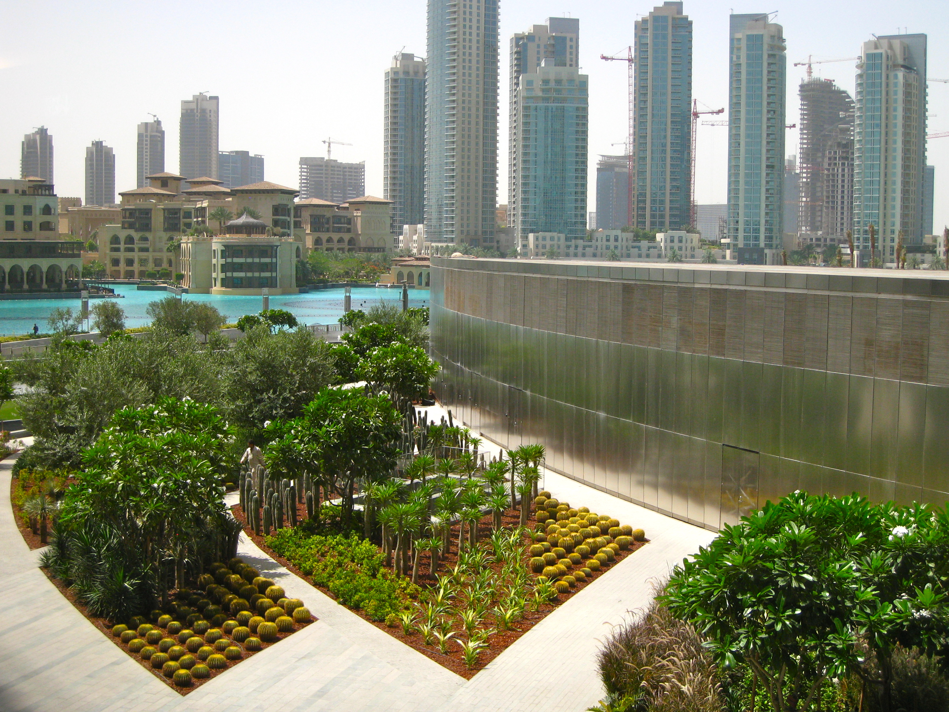
I hear the synchronized fountain display here is mind boggling:
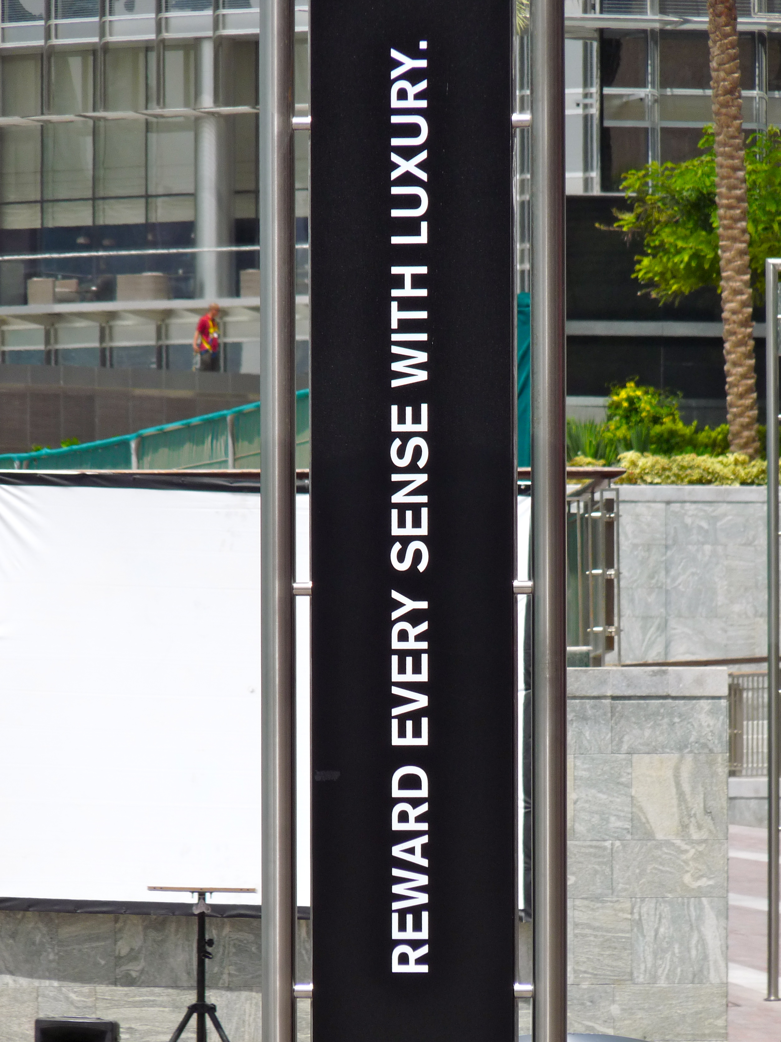
And, yeah… the theme of Dubai…
Here’s a Starbucks:
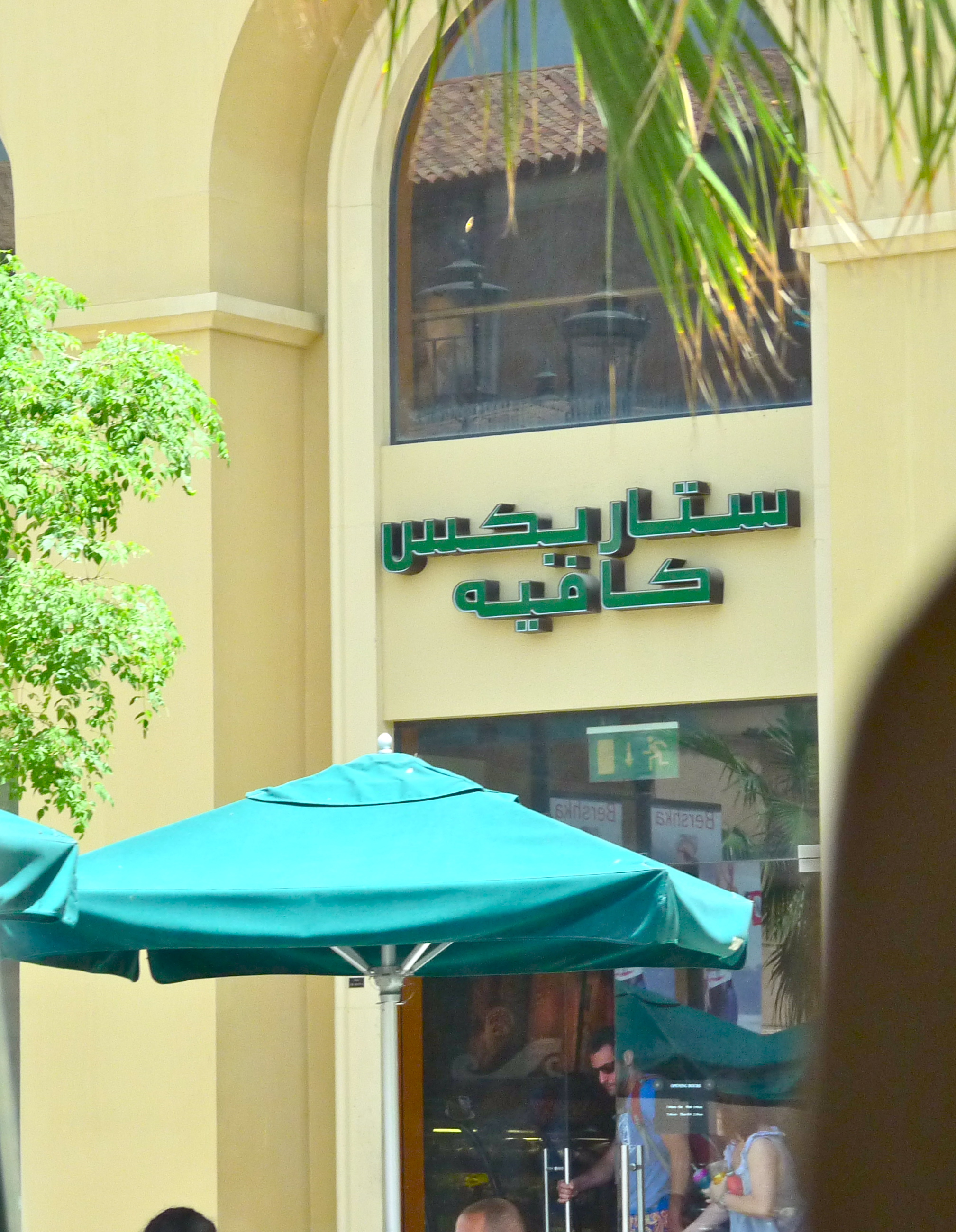
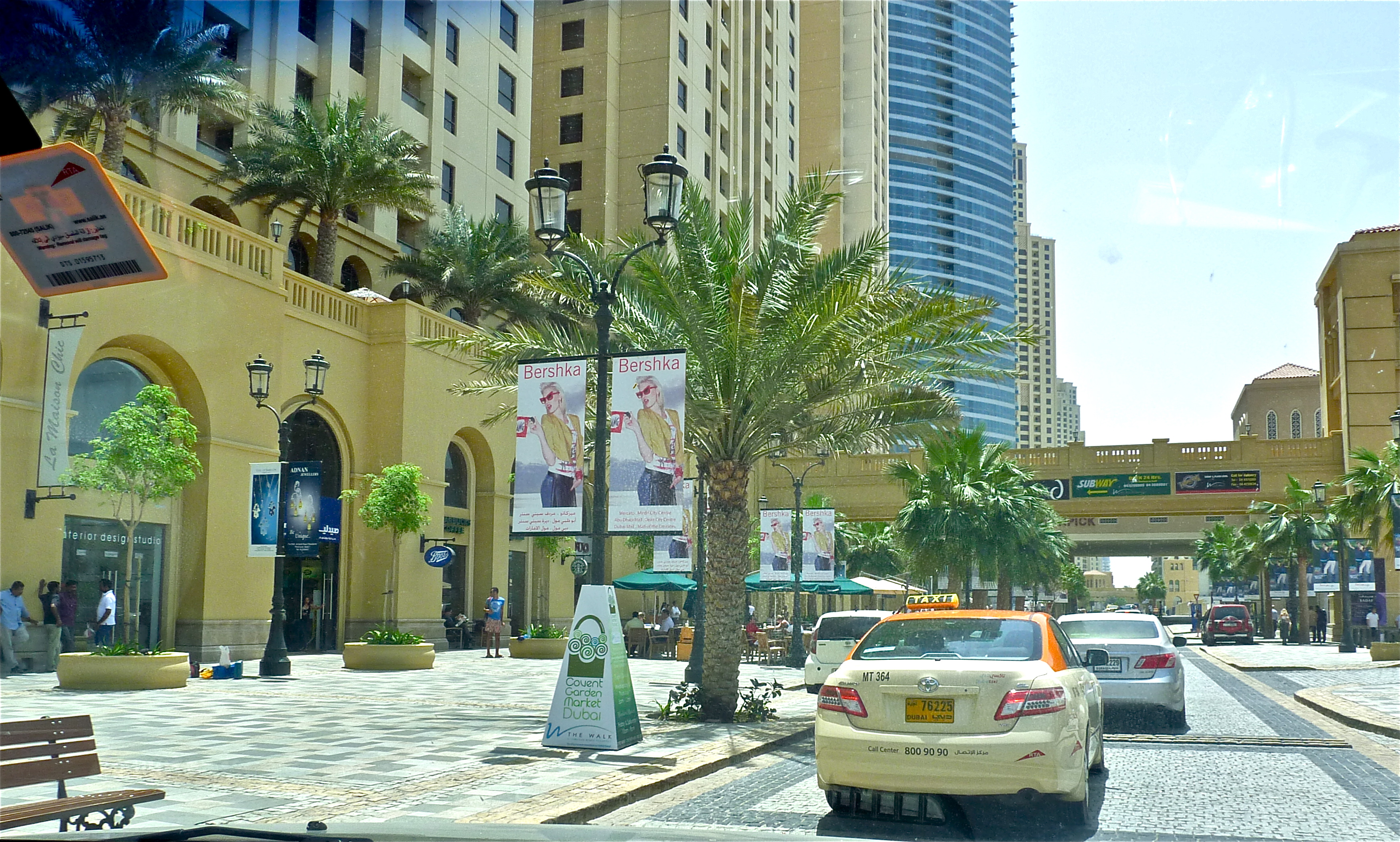
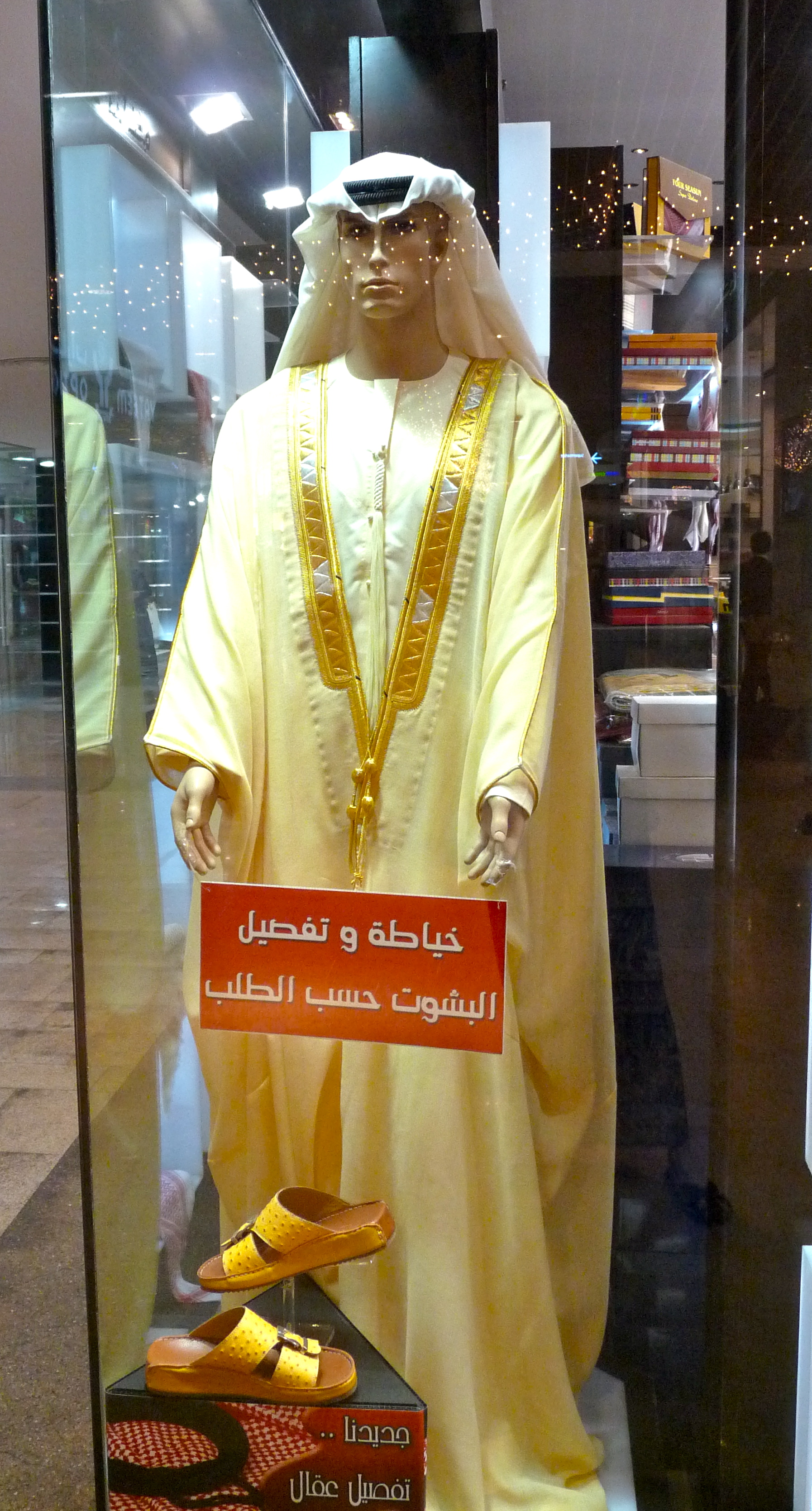
The temperatures were probably around 100. During the summer, they regularly get into the 120s. It’s a dry heat (ha!), but people still spend most of their time in malls, cinemas and in/around pools. The malls are, as you would expect, extremely cool (literally) and sophisticated, chic, modern and monied. The one we walked around had an enormous aquarium; others have internal waterways, and other over-the-top amenities and features. One, I hear, has an entire replica of Jurassic Park. All the usual mall suspects were there–Pottery Barn, Gap, Cinnabon–you could have been anywhere… but for the mannequins modeling the latest in arab attire:
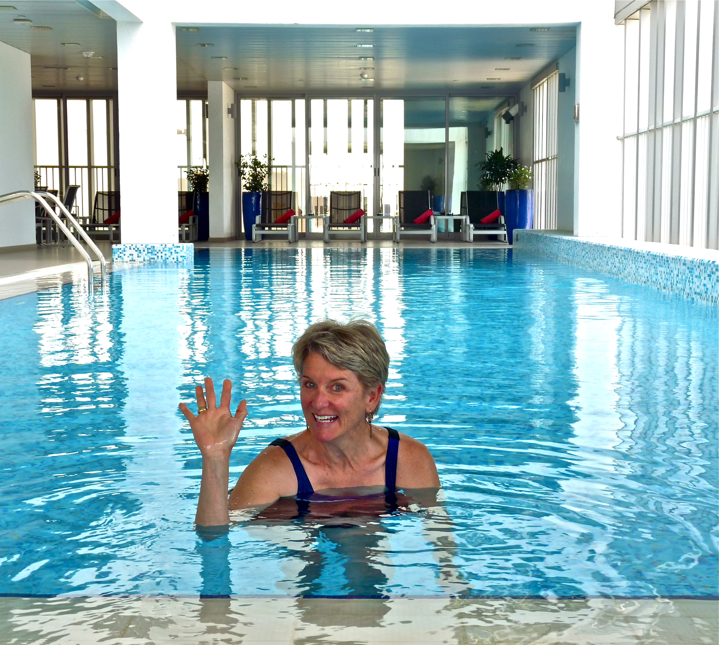
So, we got to see Dubai, and I’m glad we did, if only for a few hours. Then we headed back to Abu Dhabi for a quick snack and swim at Laura’s place
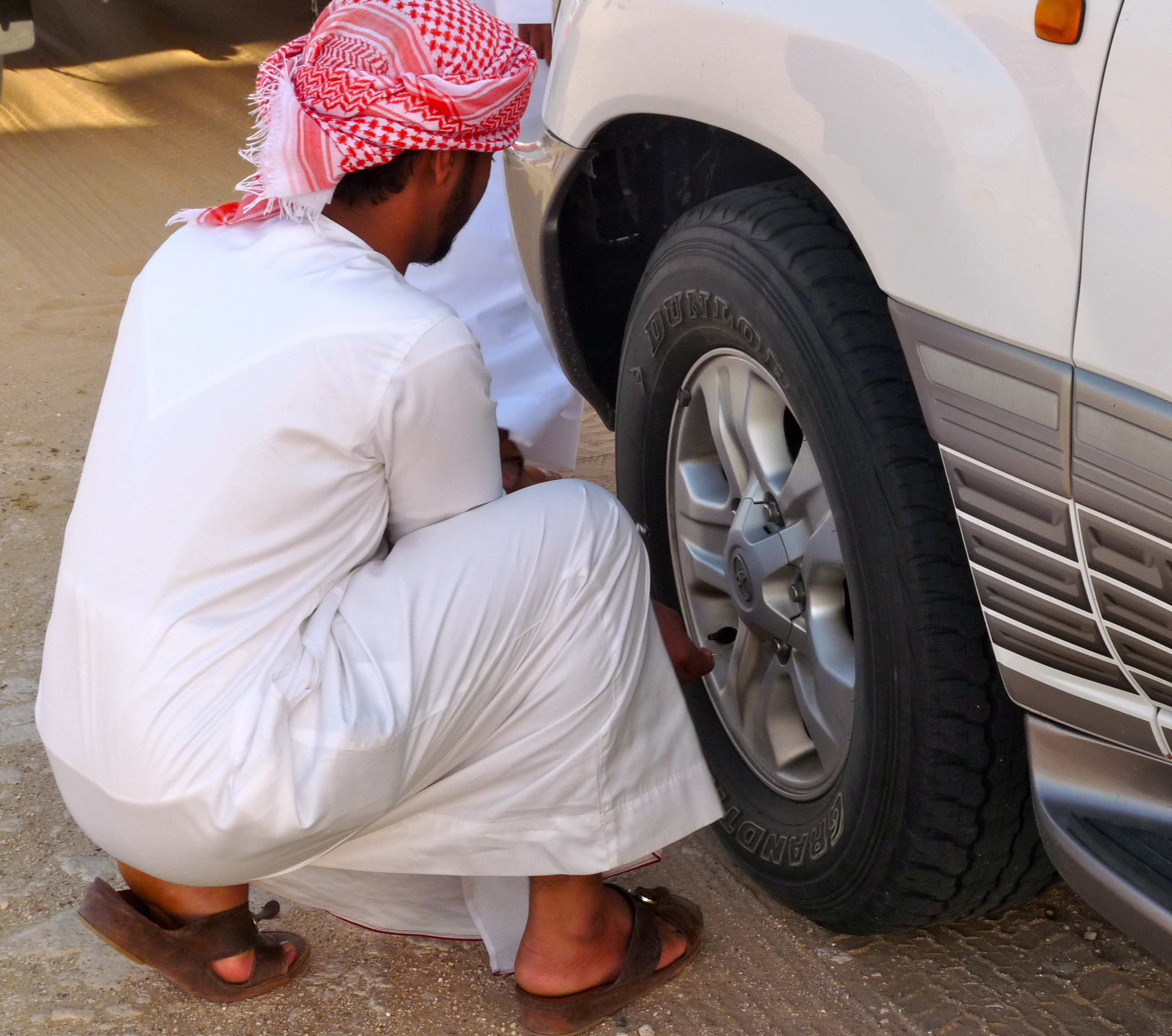
We then met our guide/driver at the Meridian, another nearby high-rise, luxury hotel, and off we went on a wild desert tour, very popular with tourists. We got gas, exchanged a few dollars for dirhams, and then drove to a meeting spot where we joined 6-8 other tour groups, also in Land Cruisers. First activity on the list was dune bashing.
In preparation for this, our guide let out most of the air in our tires:
And then this happened:
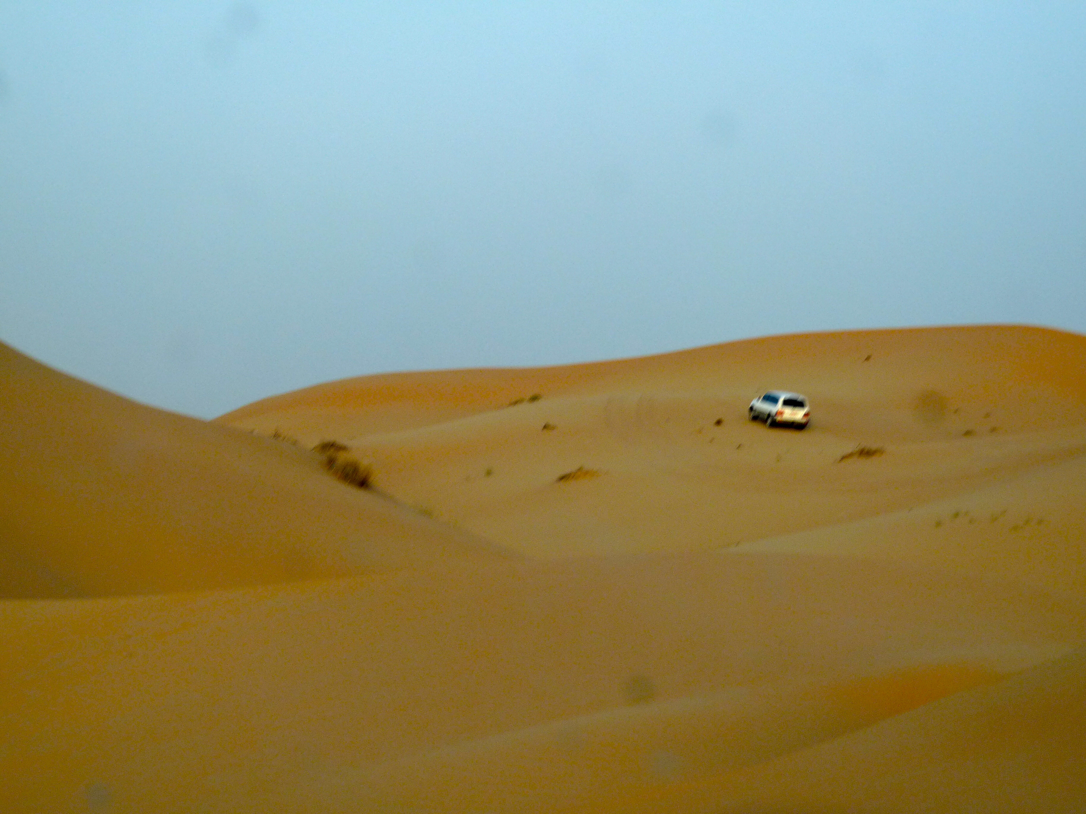
Up, down, sideways, we zoomed around making a lot of noise, spewing sand in all directions for about twenty non-stop minutes. For me, that was about nineteen minutes too long. I focused all my concentration on not puking and tried to avoid thinking about tipping over and rolling down the dune. Luckily, maybe, I was in the front; here’s my view:
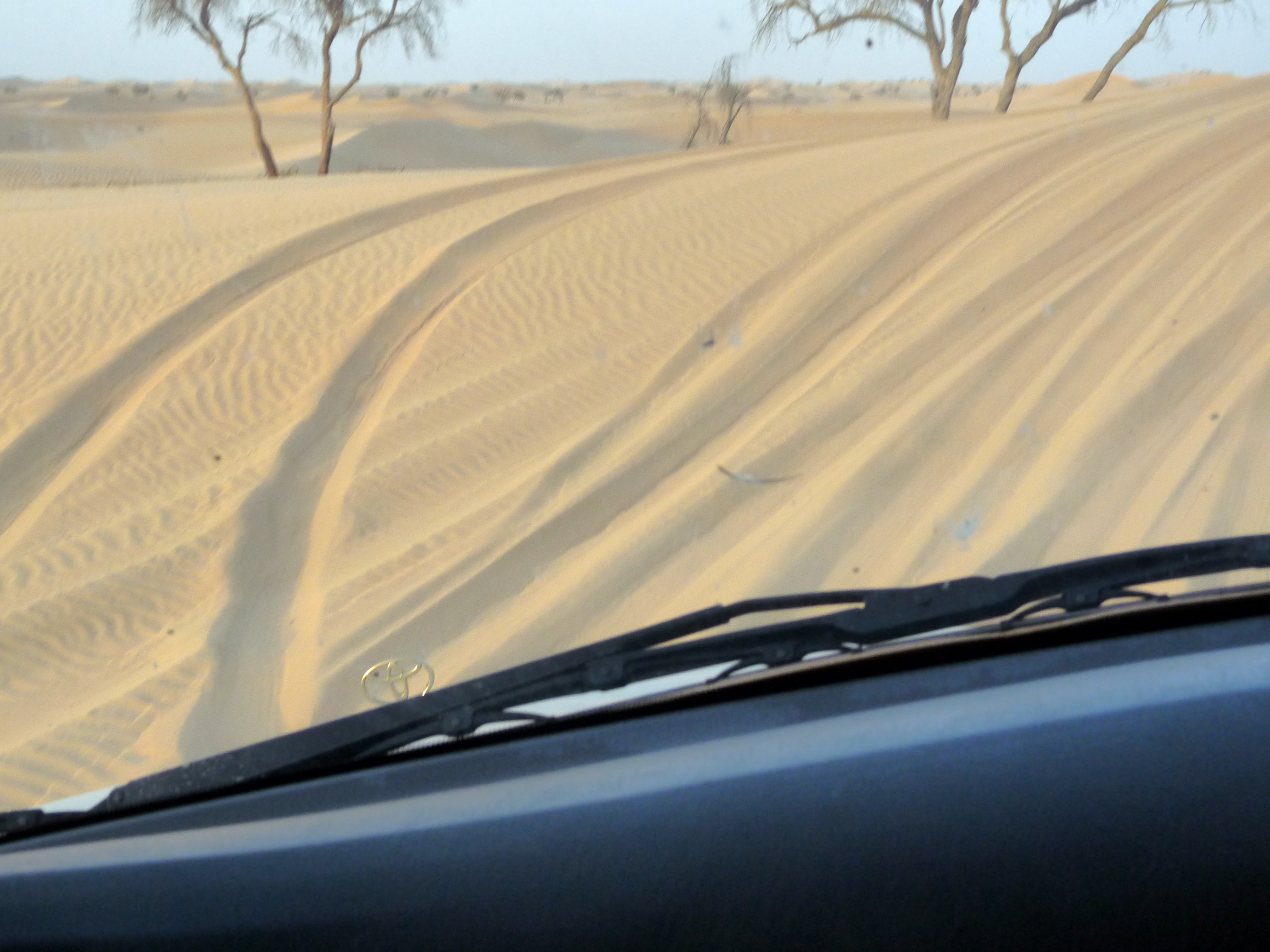
VROOOOOMMMMMM!
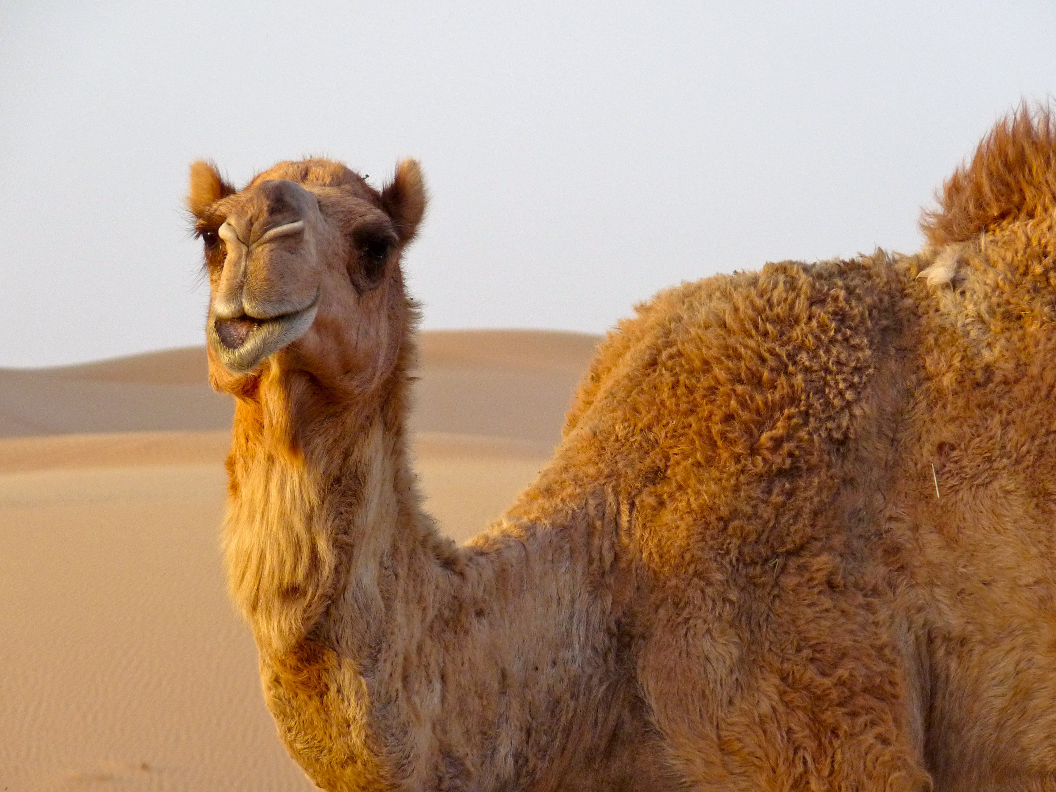
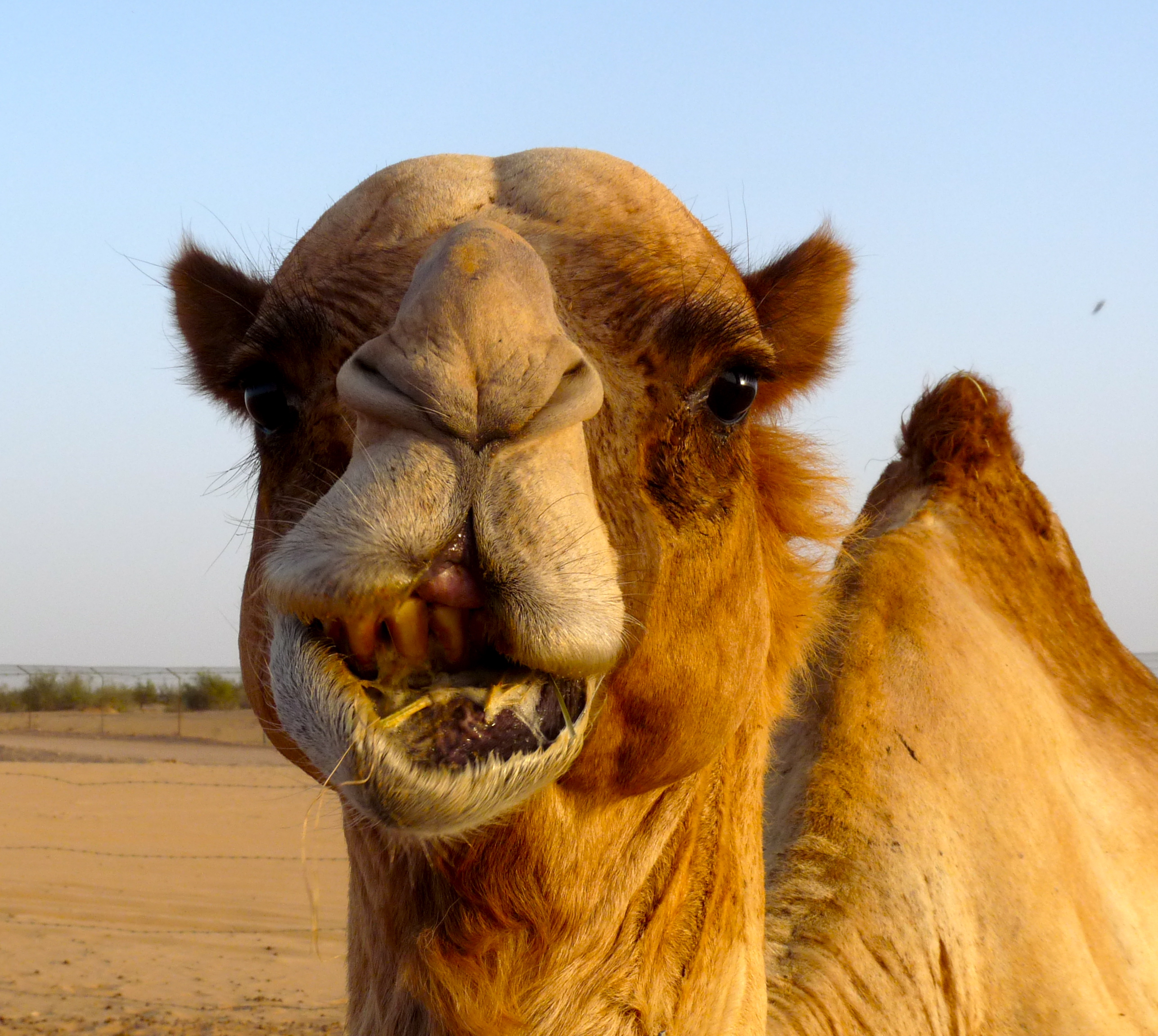
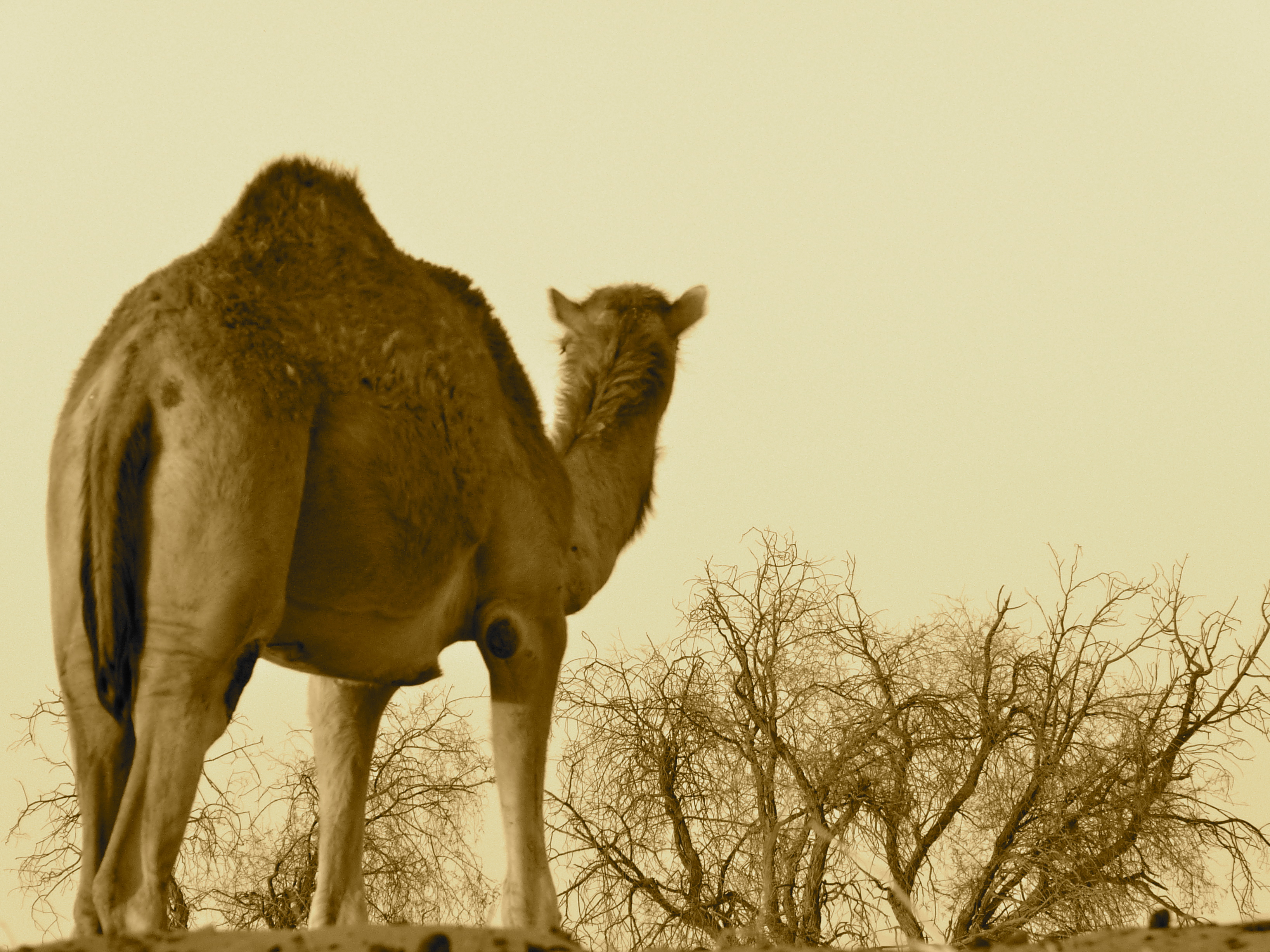
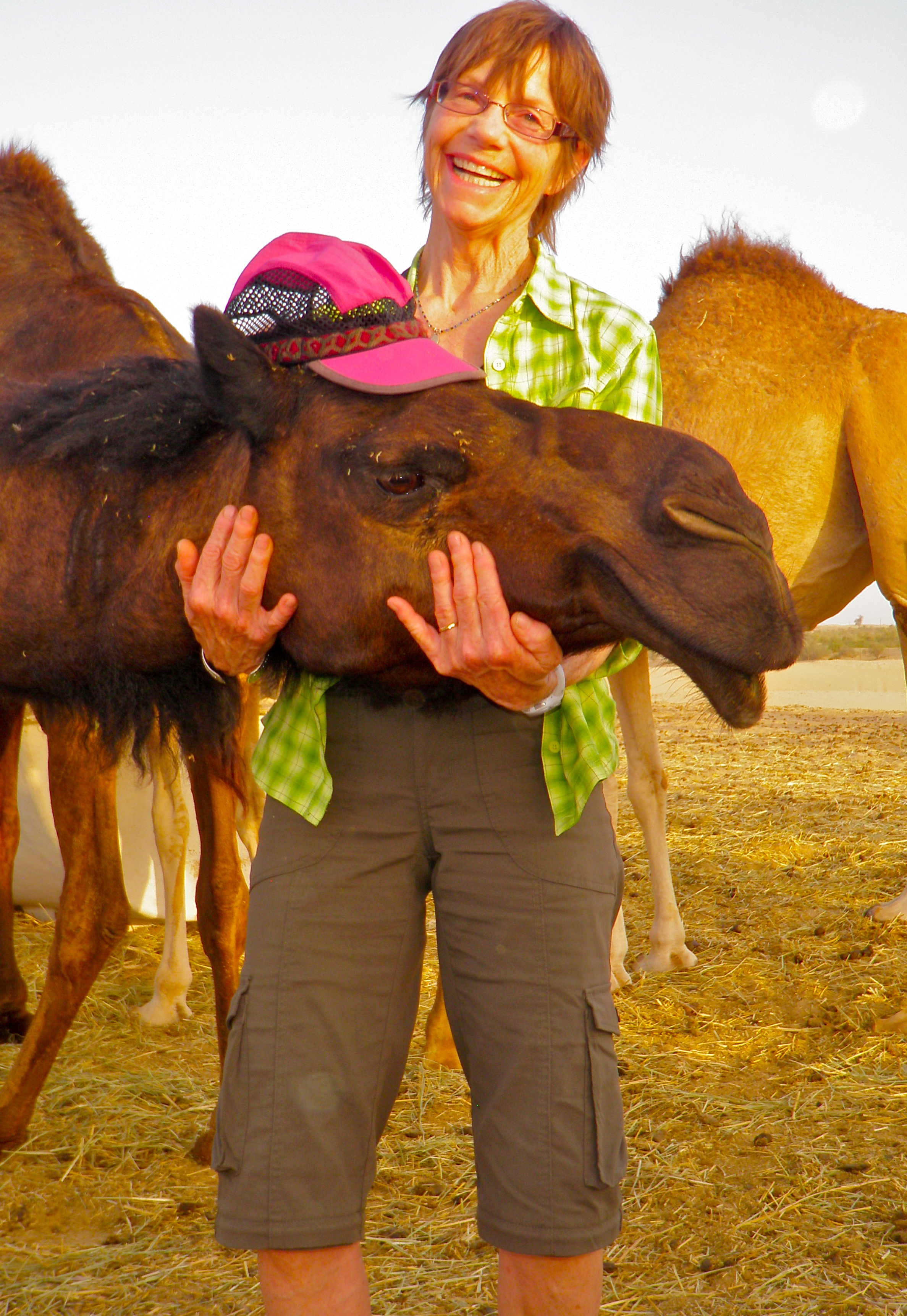
Next stop was a visit to a herd of feeding female camels. Setting was beautiful.. literally out in the middle of endless, light-brown sand dunes, an occasional tree, and dozens and dozens of light-brown camels just standing there, making faces, some eating. What did we do? Took pictures, of course.
Karen decided to share her hat with a friend:
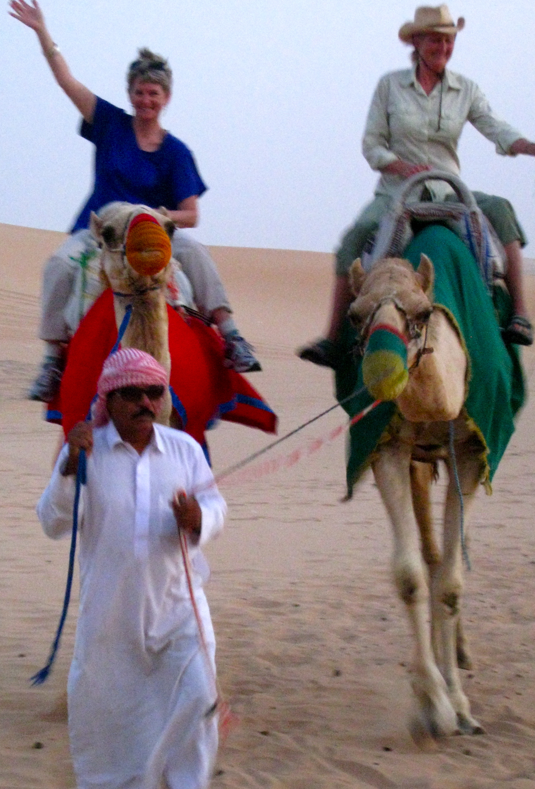
We loaded back into our land cruisers, bashed a few more dunes (ugh), then were dropped off at what seemed like an impossibly remote encampment of tents and more camels. Here, we were treated to a surprisingly wonderful buffet of middle eastern cuisine (nothing makes me happier), were entertained by a variety of dancers, and could partake of hookahs, sand boarding, and camel rides. We did the latter. Below a pair of awkward tourists:
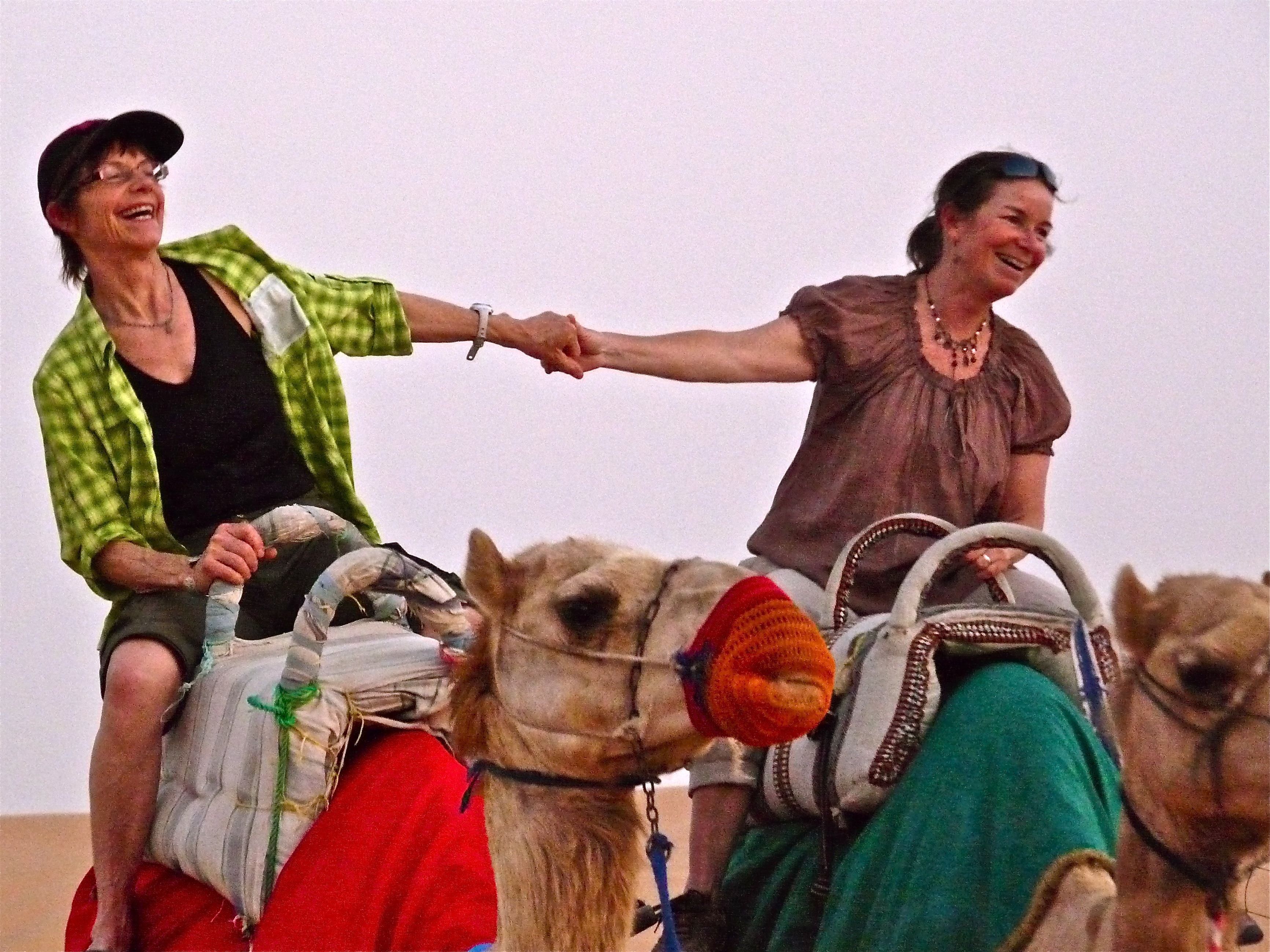
And the ever-photogenic Hesse sisters:
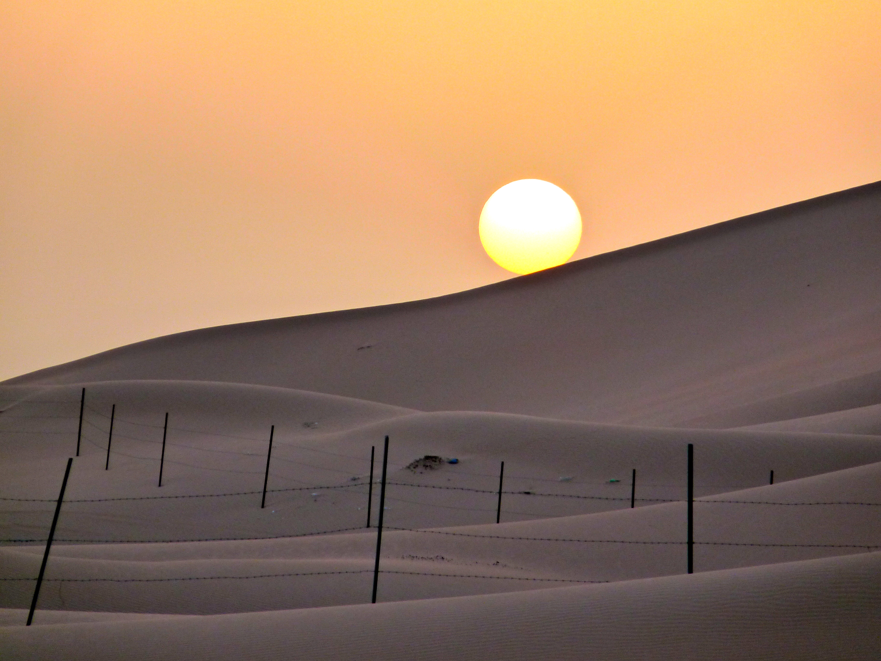
The sun–a truly gigantic, spectacular fire-ball behind a sheen of desert dust–went down, disappearing behind the dunes, which, for me, was really the highlight of our desert experience… it was duly exotic to be among the monstrous dunes watching the sun set in the middle of the middle east.
Tour organizer logistics and a lost car key (not ours) delayed our departure, which began to fray nerves as I had a midnight flight to catch and we were losing our cushion of time. Laura leaned on the horn of our not-going-anywhere Land Cruiser more than a few times as we sat, anxious. The increasingly erratic behavior of our driver prompted another great Laura line, “We don’t need any more of your drama!” But, by and by, we made it back to Laura’s place with a whole thirty minutes spare, time to shower and pack. Barely. Laura arranged a taxi and after a flurry of quick goodbyes and hugs, I was off. Just like that.
It was a bit of a shock to suddenly be driving alone through Abu Dhabi, late at night, tired, in the back of a quiet taxi, after an incredibly wild-ride of a day, after an incredibly mind-blowing trip. My over-full brain was just focused on getting in and through the Abu Dhabi airport, getting to and through Frankfort, and getting to and out of San Francisco. It would take months to catch up to the experience and process all we saw, did and accomplished.
From the Himalayas to the desert dunes, it was an amazing trip.
Leaving Nepal
April 20, 2011
Trip Day #22
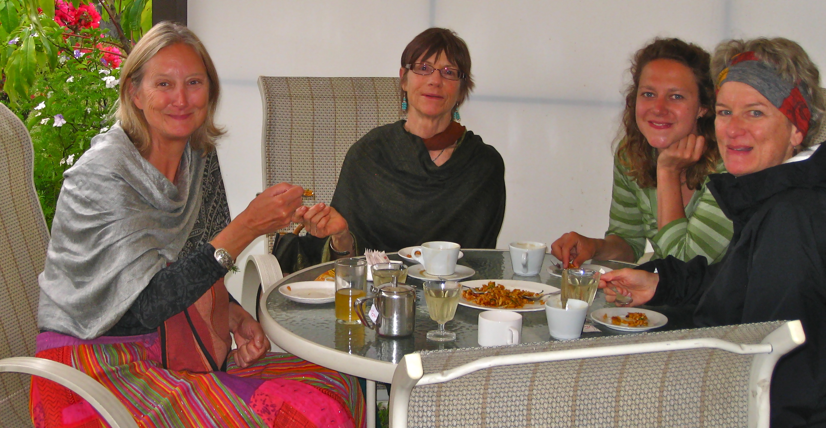
A low-key travel day ahead. Woke early, took a normal person shower, used normal person hair care products and appliances, donned a skirt and sandals, and sashayed into the dining room (not really) to consume the standard fare of an international hotel buffet breakfast. With bottomless masala tea, if you please. I was already aching to return to the challenge of a subsistent lifestyle in the frigid, remote Himalayan high country.
Ate some custom-made omelets and caught up with Emily and Rie, yet again, who filled us in on their flying mishaps out of Lukla the day before.
Returned to the internet cafe down the road for a final round of catching up and Facebook postings, then headed down that same boulevard–which turned out to have a lot of wonderful shops–for some final shopping and gift acquisition. Spent most of my time in a three-story folk crafts store where proceeds benefit a number of women’s organizations in the region. Wonderful place. Got lots of stuff there.
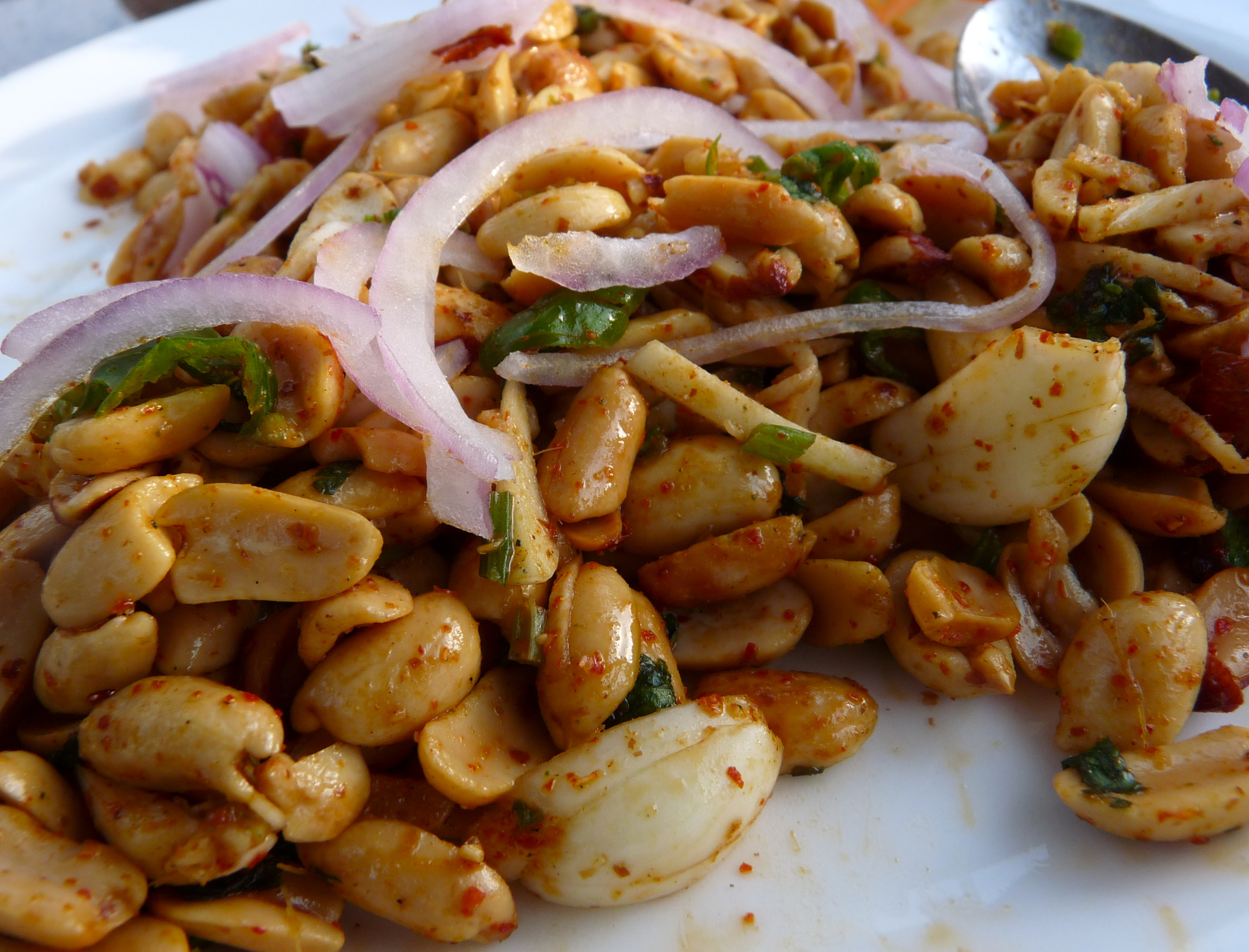
Returned to the hotel, picked up a couple more items from their gift shop, carefully stuffed new purchases into already bulging luggage which was then moved into the lobby, and retired, for the final time, to the garden to join Laura for two luxurious hours of conversation and spiced peanuts. Fabulously interesting girl, that Laura.
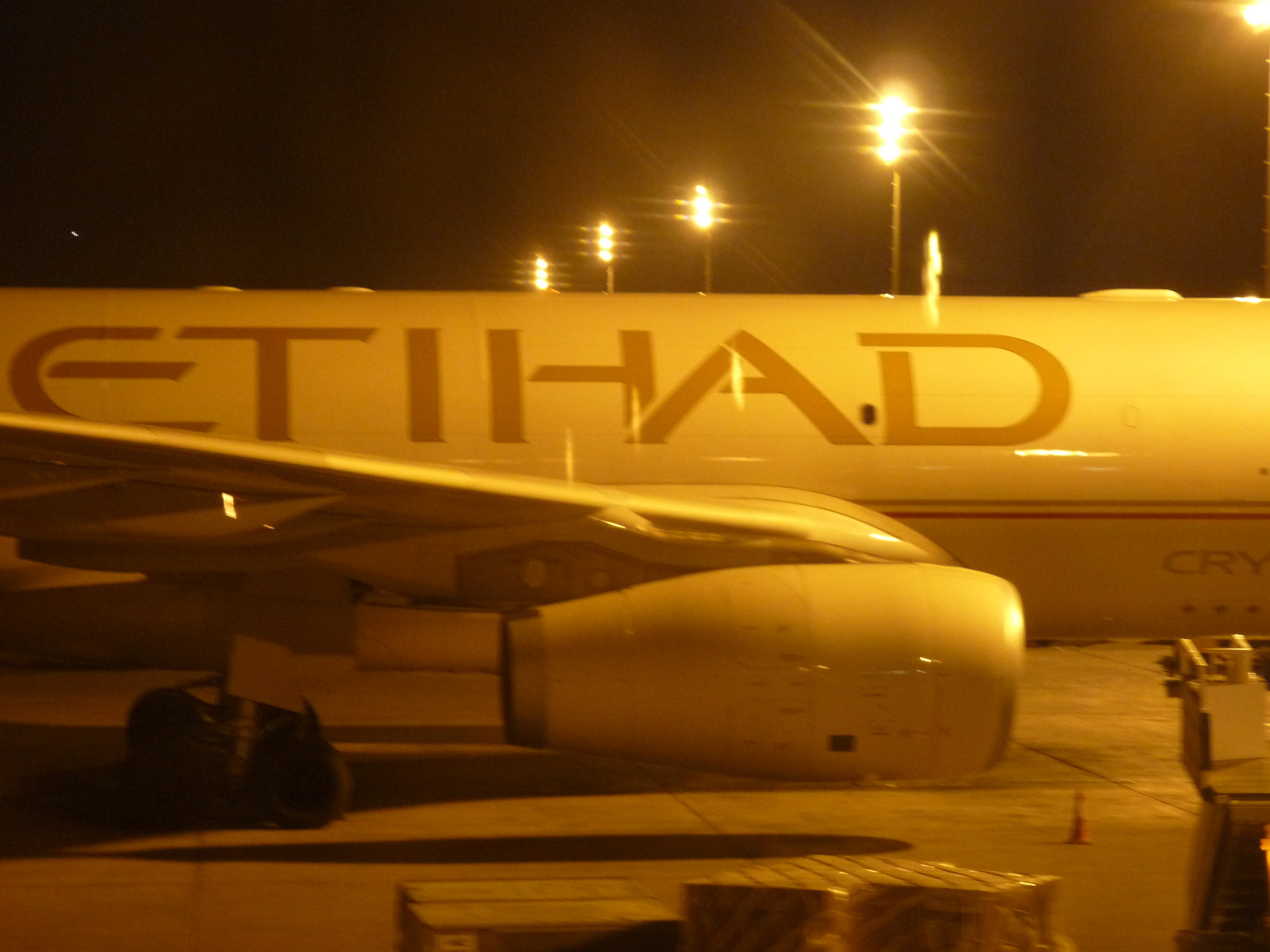
Finally, we were shuttled to the Kathmandu airport for a late afternoon flight to Abu Dhabi. We boarded Etihad (with no additional baggage fees, wow) and settled into the finest airplane seats I’d ever sat (and lain) upon!
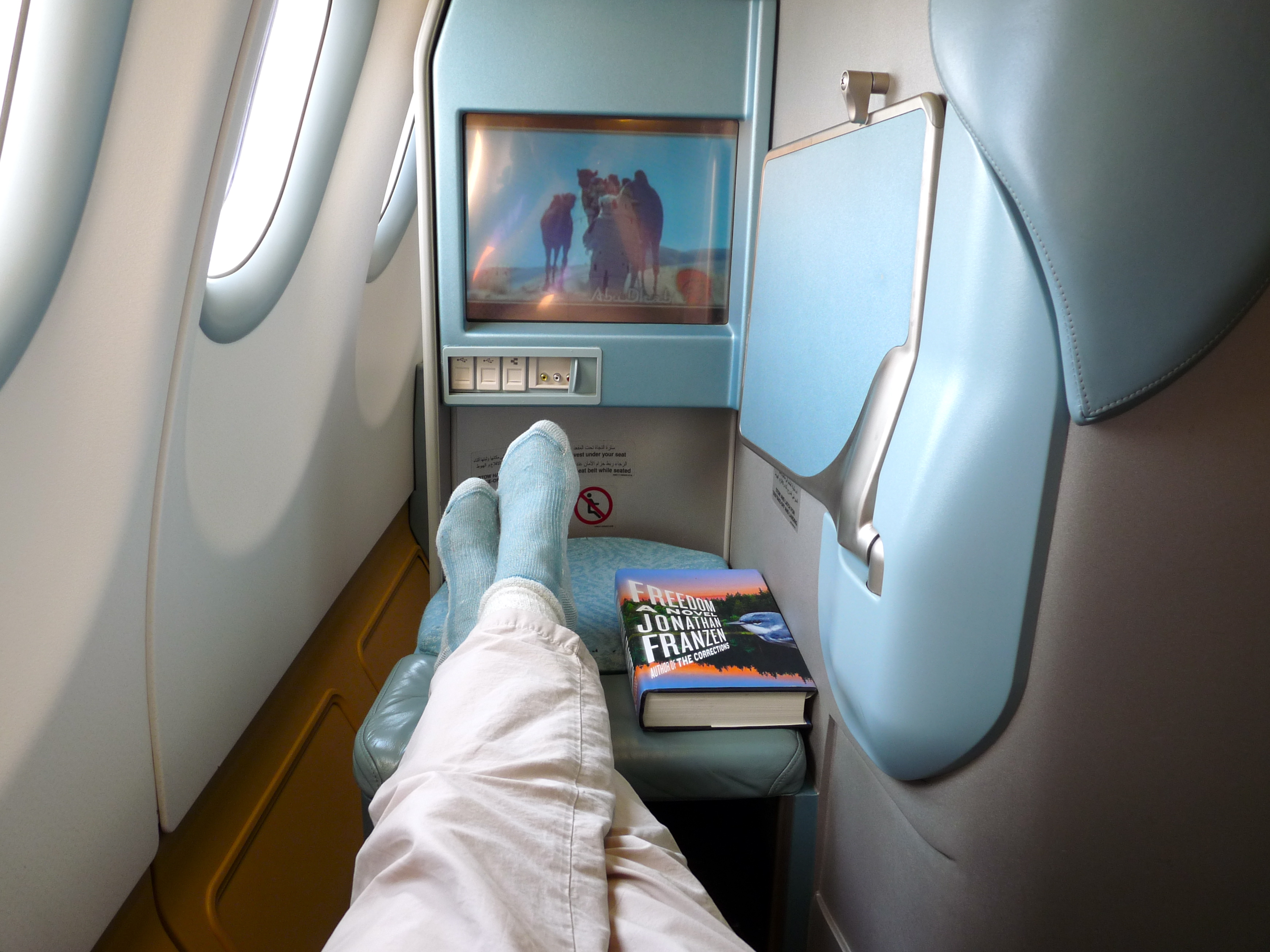
Note that my private little cubby here has seats that, when fully extended, create a bed.
The flight could not be long enough.
I did manage to get vertical long enough to shoot a couple parting shots of Kathmandu and Nepal before the sun set.
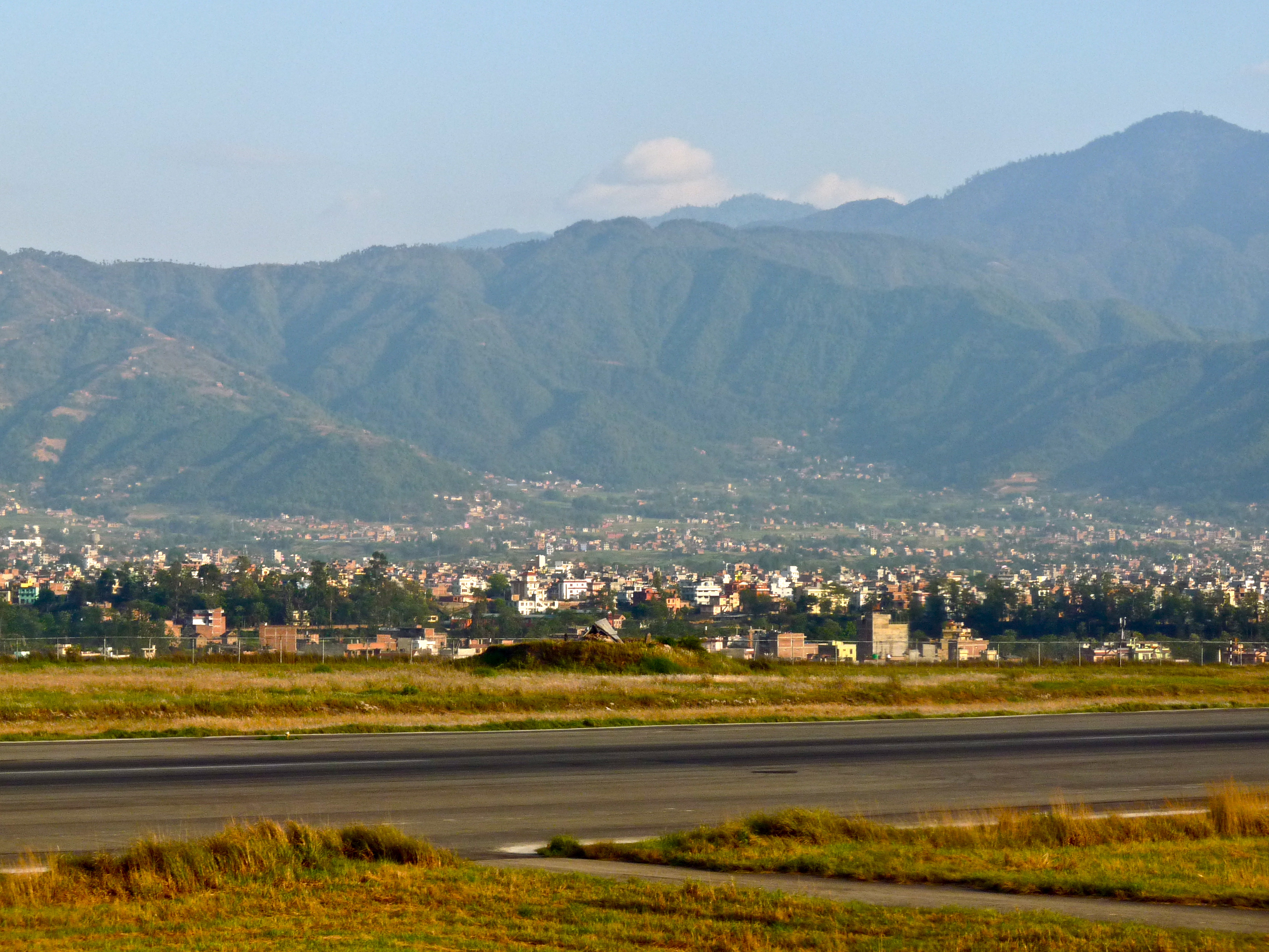
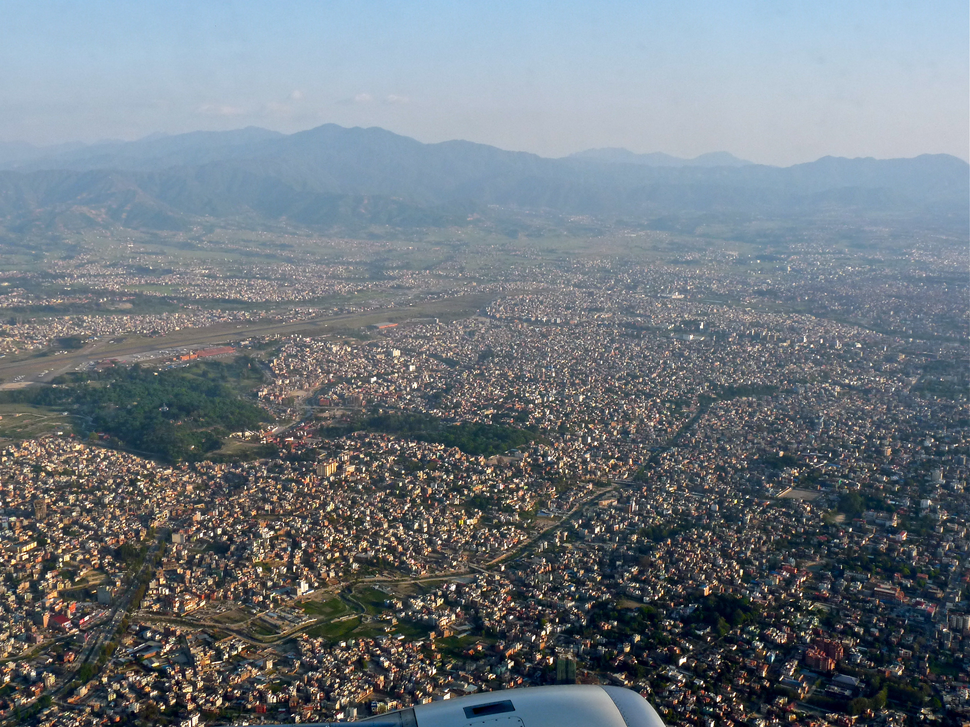
And with that, the Nepal portion of our trip was over.
The five-hour flight landed in Abu Dhabi at about 9:00pm local time (there is a one-hour and forty-five minute time difference between Nepal and the UAE). Perfect for getting a good night’s sleep before our final day of adventure. Here’s a shot of our airplane on the runway:
Kathmandu: Hari’s House
April 19, 2011
Trip Day #21
We woke up this day on our own; nobody to serve us with a pre-dawn delivery of hot tea! It looked like a sunny, warm day. We were excited at the prospect of nothing to do and fabulous city to do it in.
First, we’d have breakfast, then spend some time in a local internet cafe, then maybe do some shopping. We had been invited to join Hari Thapa for lunch at his home, which sounded like a wonderful opportunity.
Laura, Leslie and I decided we’d go, so after a few hours of poking around town, we met back at the hotel at 11:00 to grab a taxi. The taxi driver chatted with Hari on the hotel phone in order to get directions. They seemed complicated. The drive to Hari’s neighborhood was very convoluted; quite a knotty warren of roadways–some boulevards, some dirt–and there were cars, bikes, scooters, animals, and people every whichway. But it was fun tour of greater Kathmandu.
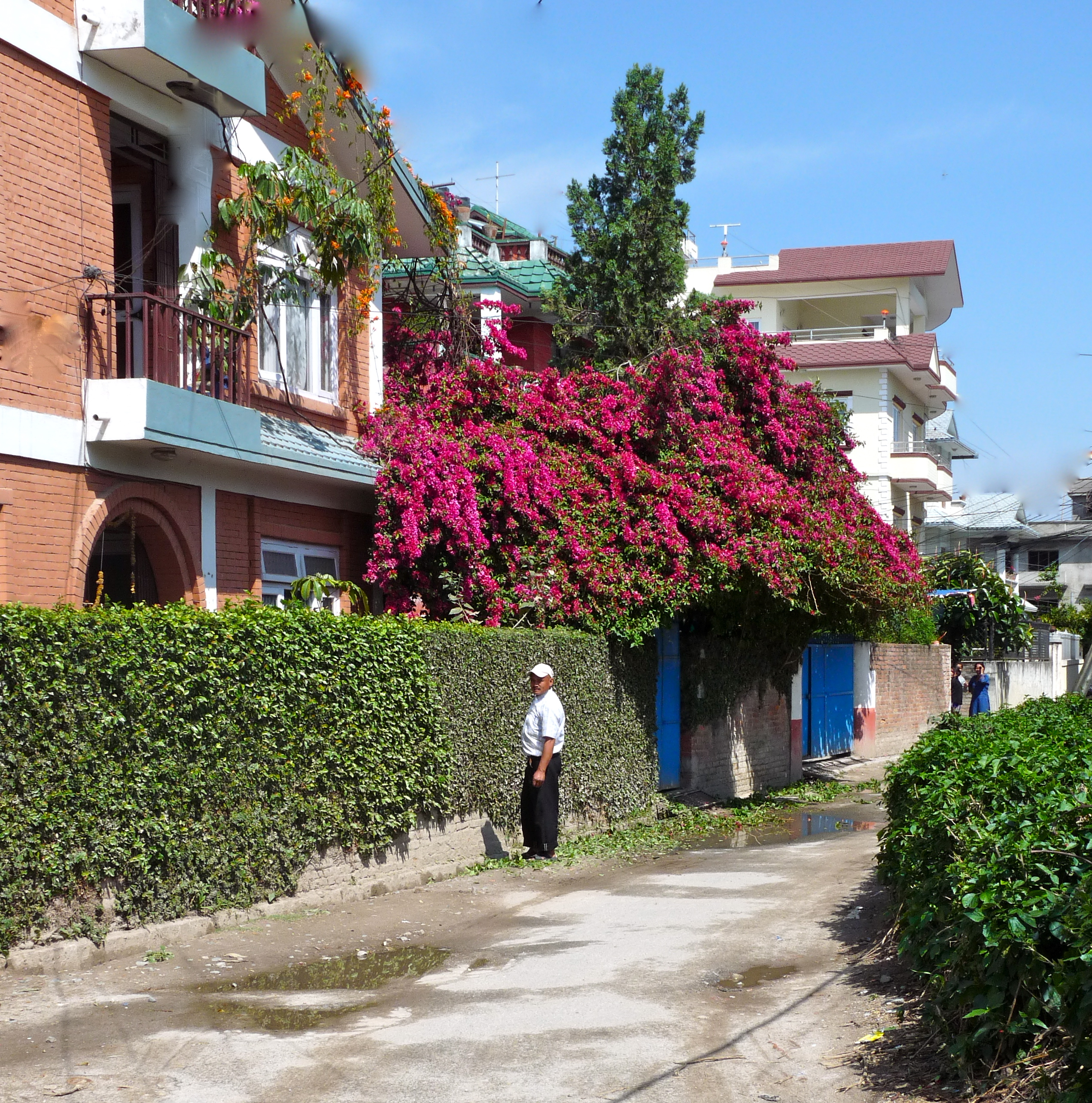
The taxi driver let us out at a pre-arranged corner on a fairly quiet residential street. Hari met us there and guided us deeper and deeper into his neighborhood, past this guy pruning the vines on his front wall, past neighborhood women in conversation…
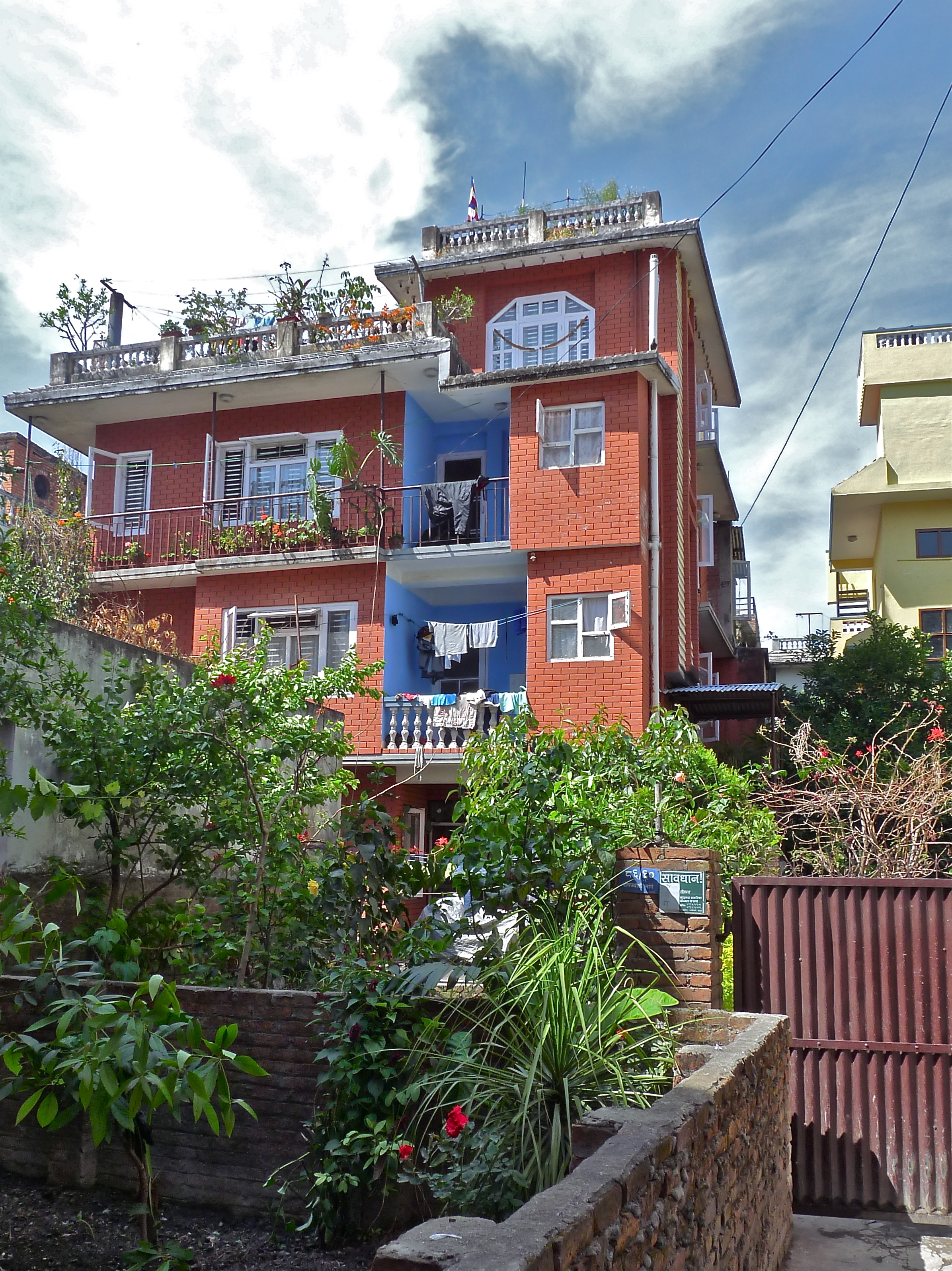
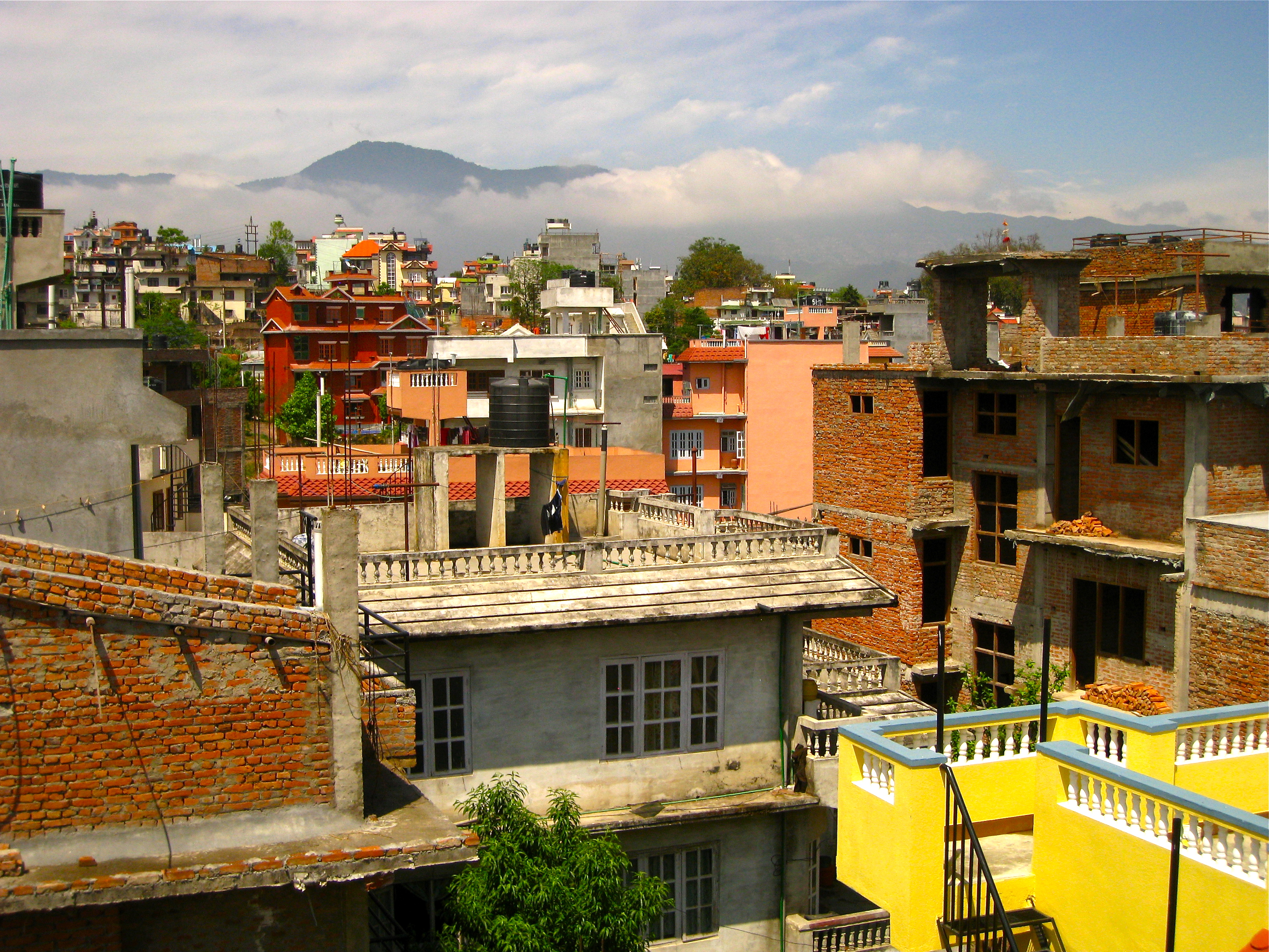
…and finally to his house. His is this 4-story, red brick house. It was nice to see what life was like in an established, middle class neighborhood on the outskirts of downtown.
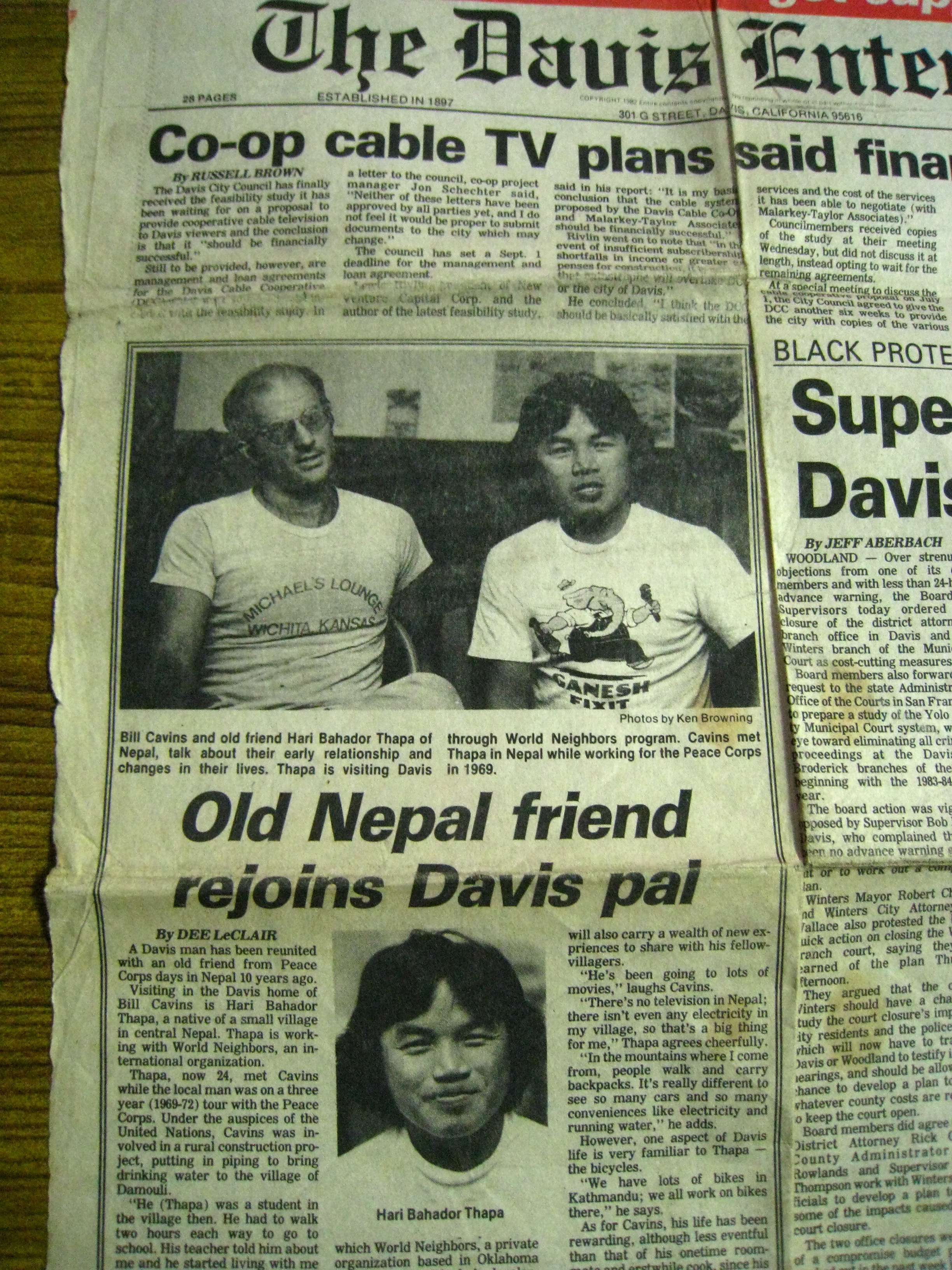
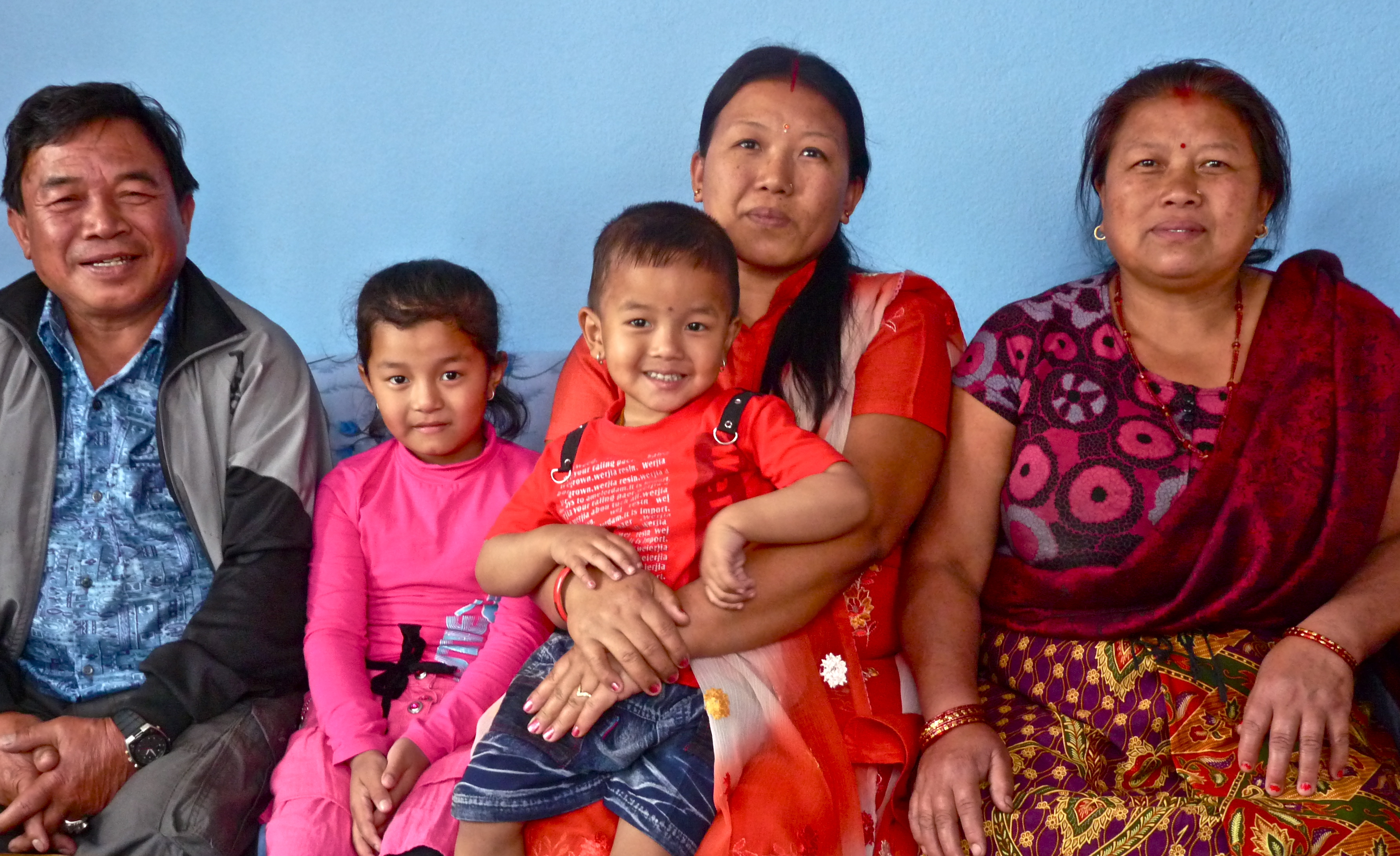
He showed us around his house and introduced us to his wife. There was an older daughter and some grandkids (and perhaps a cousin or friend), as well. We sat and talked a lot about his life, work, relationship to my friend Bill (who was in the Peace Corps in Nepal in the late 60s) and his travels to visit Bill in the U.S. He showed us a 1982 newspaper article, from the Davis Enterprise (!), that was written about his first visit to Davis. And such an amazing coincidence, that very same front page included an article about the launching of the Davis Community Cable Coop, the nation’s first urban cable company operated as a co-op, and my eventual and 23-year employer.
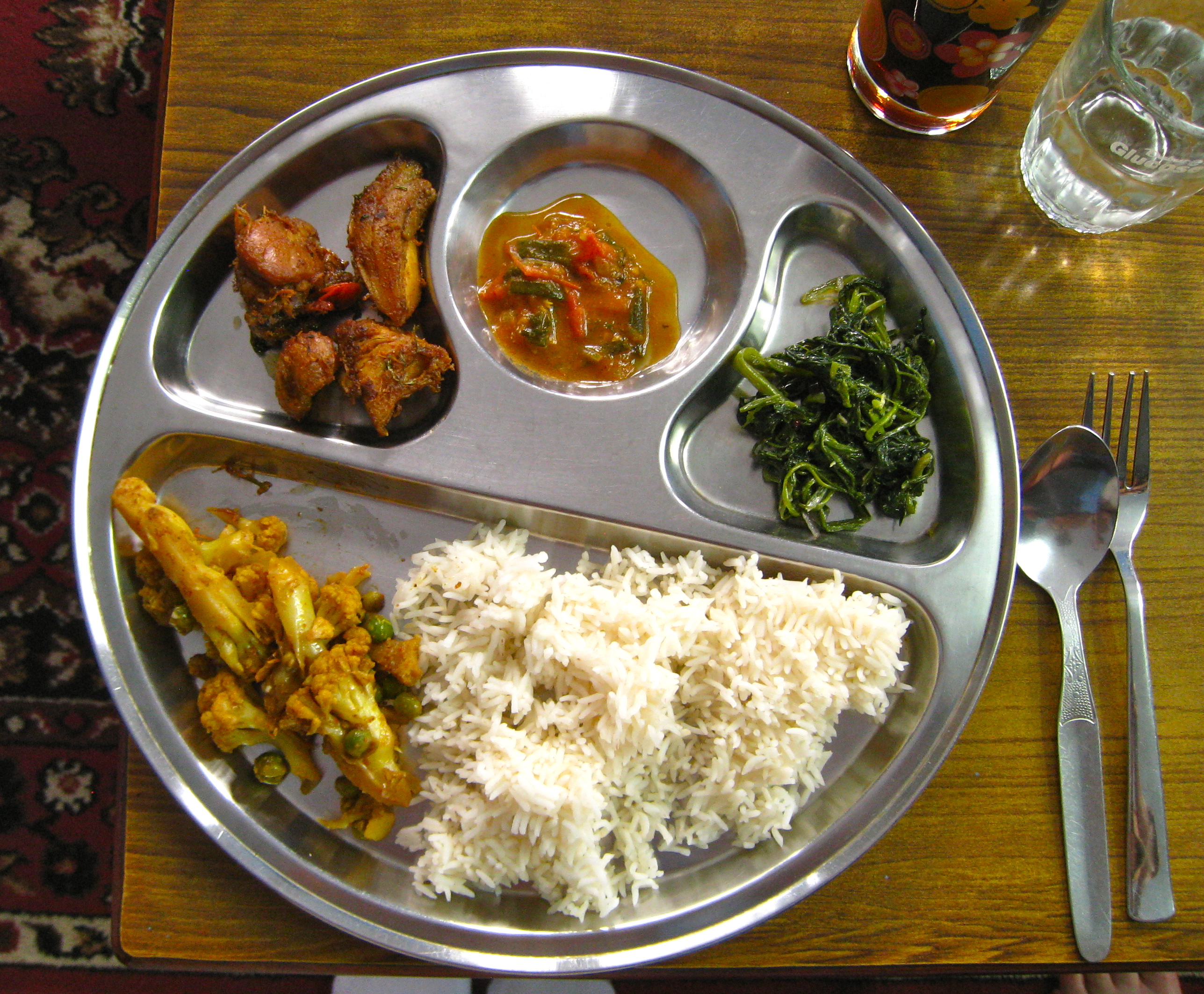
Hari’s wife and daughter prepared a fantastic lunch:
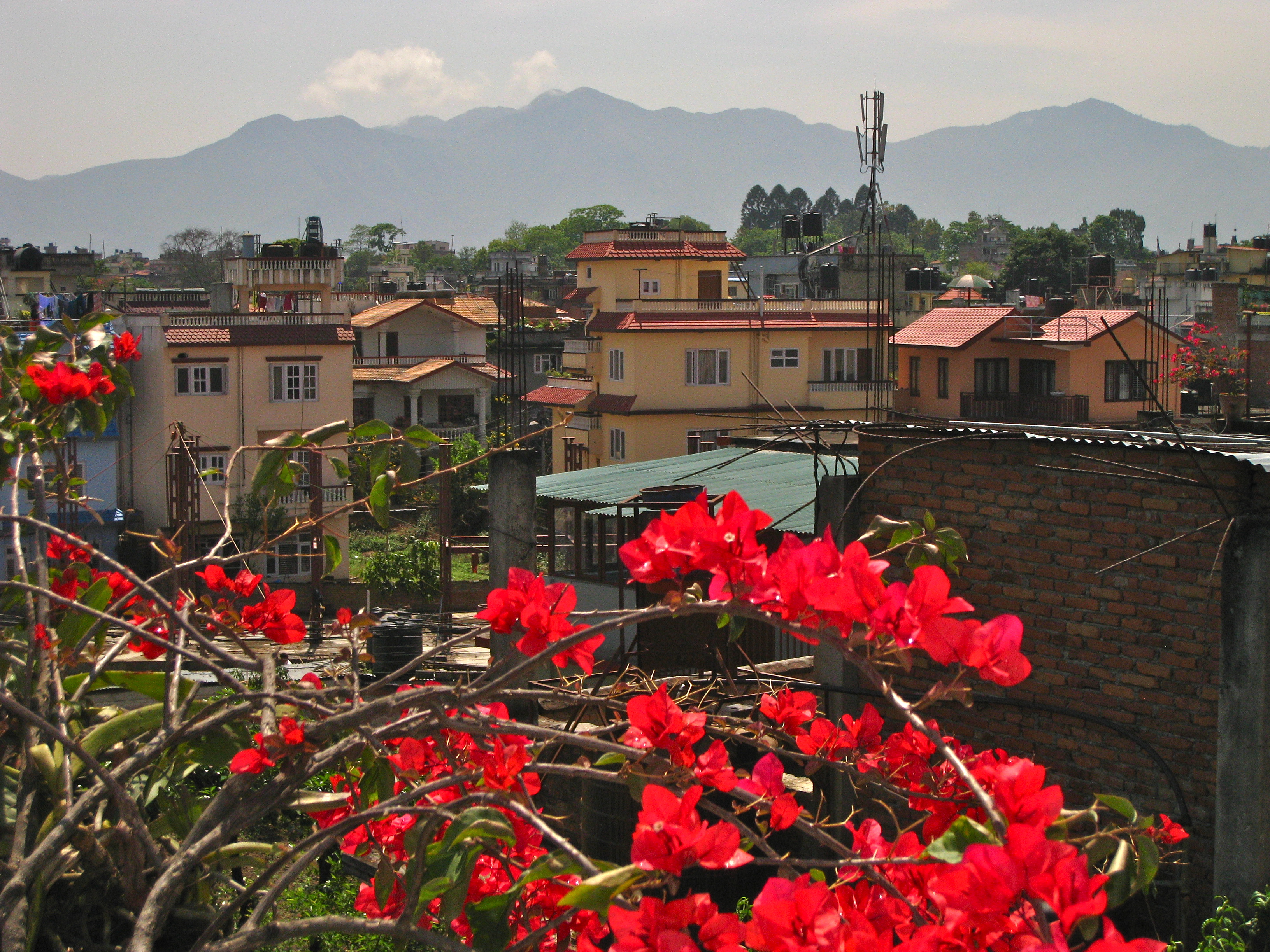
After lunch, we went up to the roof where the family maintains an enormous garden:
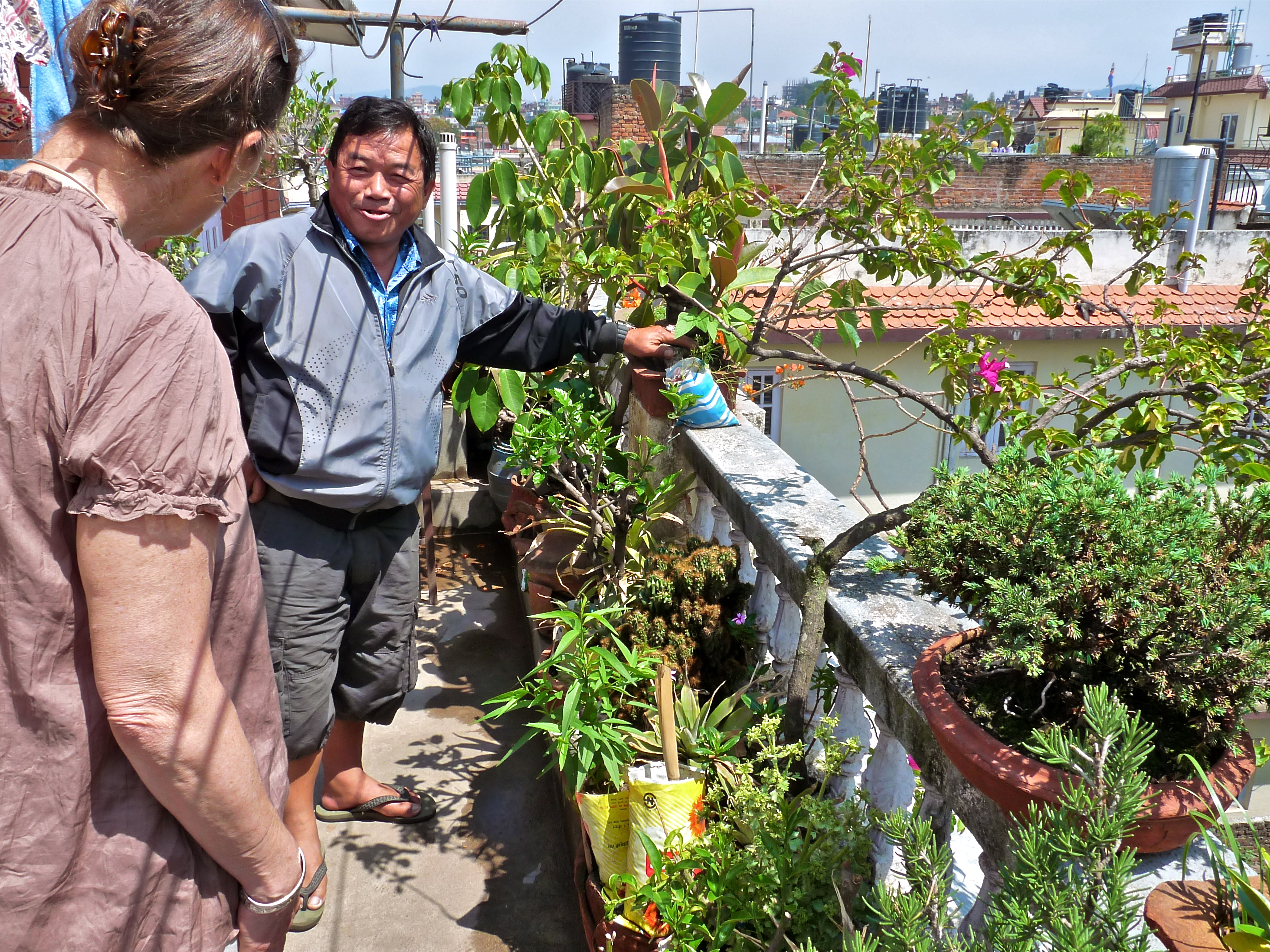
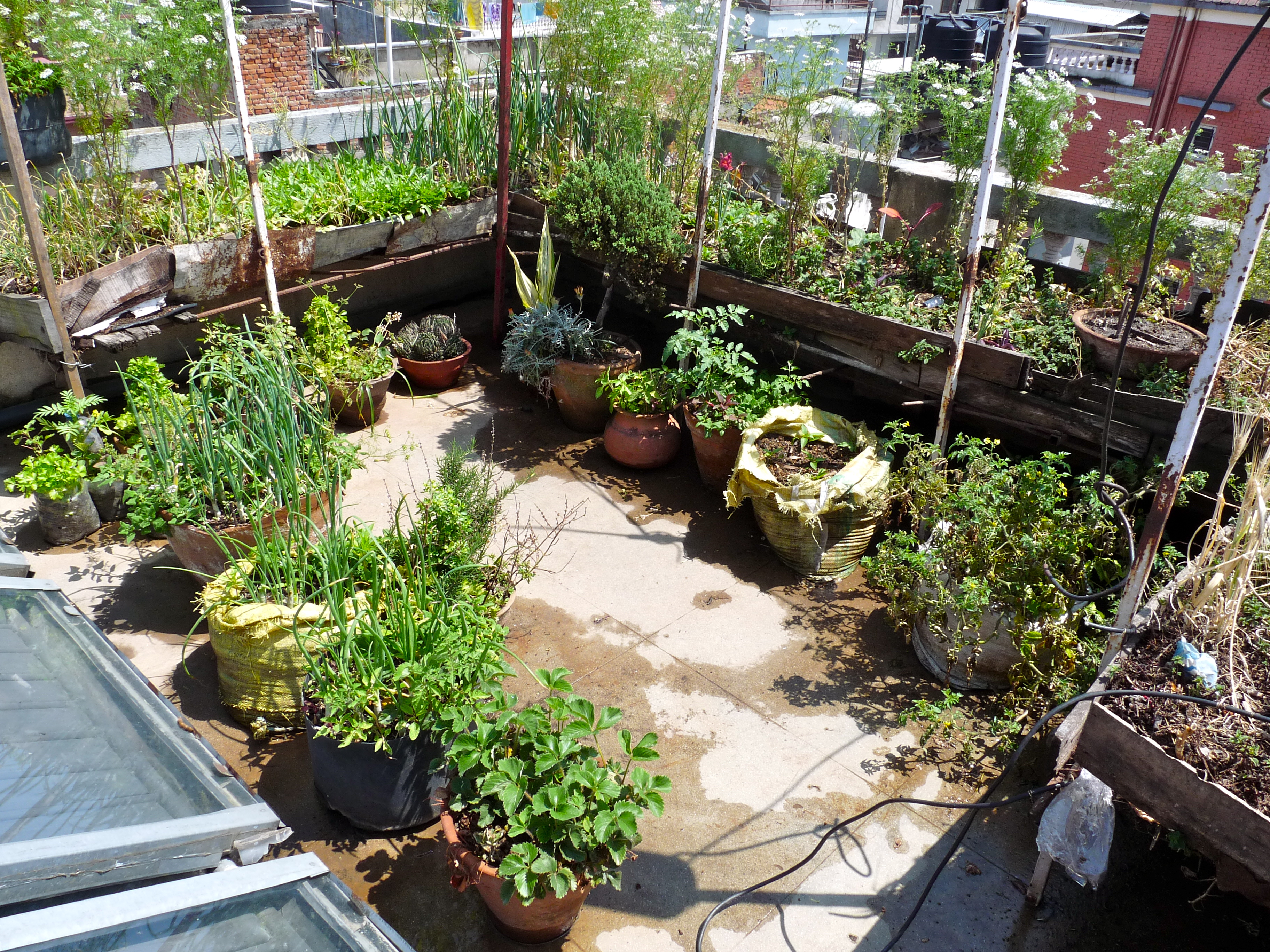
The view of all the neighborhood rooftops was wonderful. The peaceful rooftop community is a whole other fascinating side of Kathmandu that we were fortunate to see. Huge gardens and sitting areas everywhere, high above the noise of the city.
Before we left, Hari presented us with some gifts–beautiful handbags for us and some other items to take back to Davis for Bill and his family. He was an extremely kind and gracias host. We were so glad we had the time to spend an afternoon with him. We took some pictures of the family, then took a taxi back to our hotel.
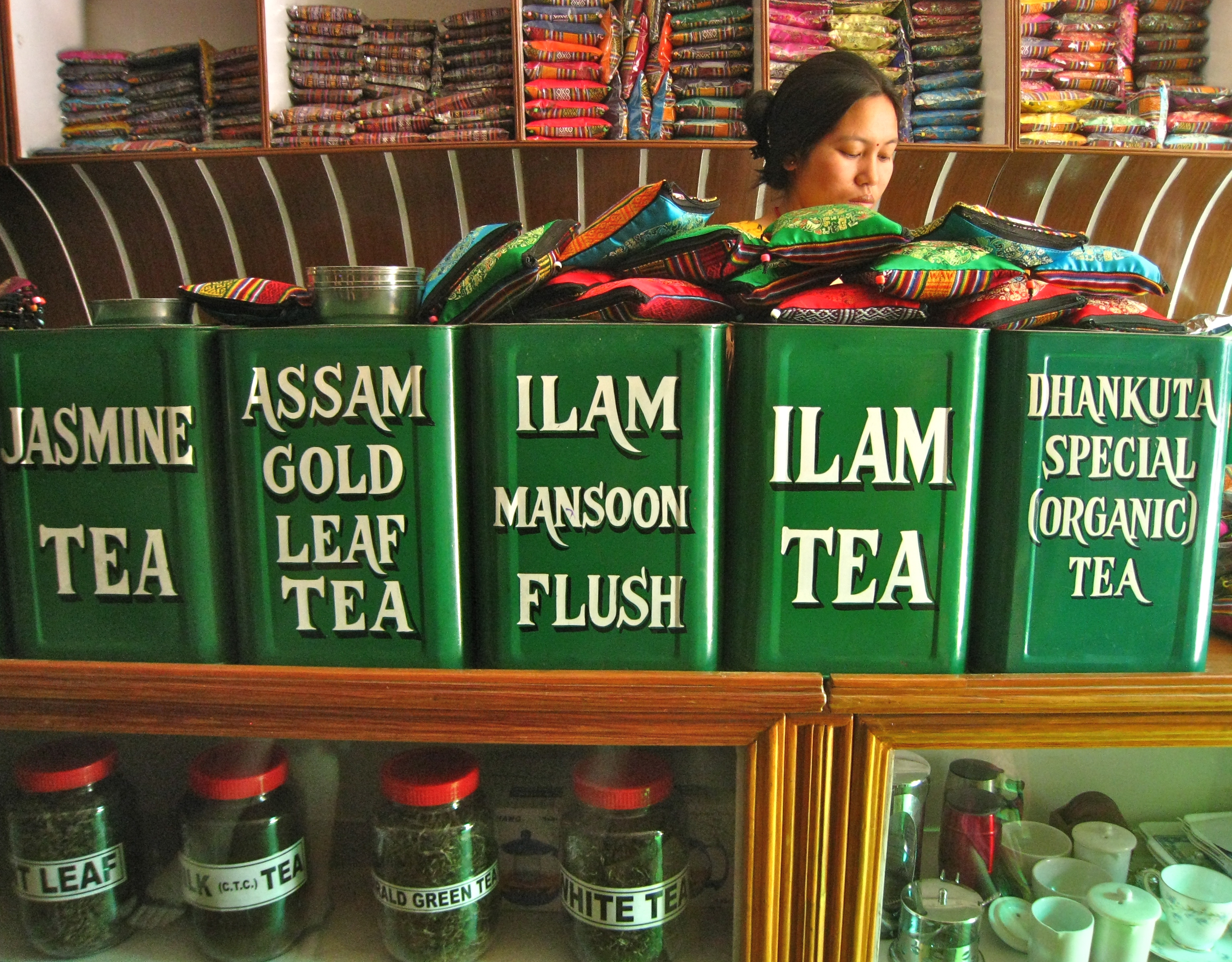
We had time for a little more shopping… here is a very nice tea shop Karen and Leslie found. They offered flights of tea for tasting.
We met up with Reggy again, and hung out a little more in the garden, drinking tea, cappuccinos, wine, and eating more peanuts masala (the spicy peanuts we couldn’t get enough of). We sat under cover because it was raining, but it was warm and luscious. A lovely time.
Our final dinner in Nepal was at an Indian restaurant down the street.. great food, especially the paneer dishes. A mellow, pleasant Kathmandu day.
Leaving Lukla
April 18, 2011
Trip Day #20, Trek Day #14
Our last day in the high country started with tea brought to our room by both Pradip and Homnath. Nice touch, guys, much appreciated. We packed our duffles for the last time and Pemba, Masaman and Rinche collected them and walked them over to the airport, a very short walk. And with that, their obligation to our five-person, most thankful group was complete. Many sadnesses this day.
After finishing out tea, we made our way up to the dining room (an evil flight of stairs if I ever saw one). Drank more tea and ate some mediocre cinnamon rolls. We got a final gander at the photos of Dian Feinstein [sic] and Bill Clinton hanging in the hall then headed to the Tenzing Hillary Airport, where we joined what looked like maybe a hundred other hopeful travelers. You just never know with this crazy Himalayan weather… would we fly out or not?
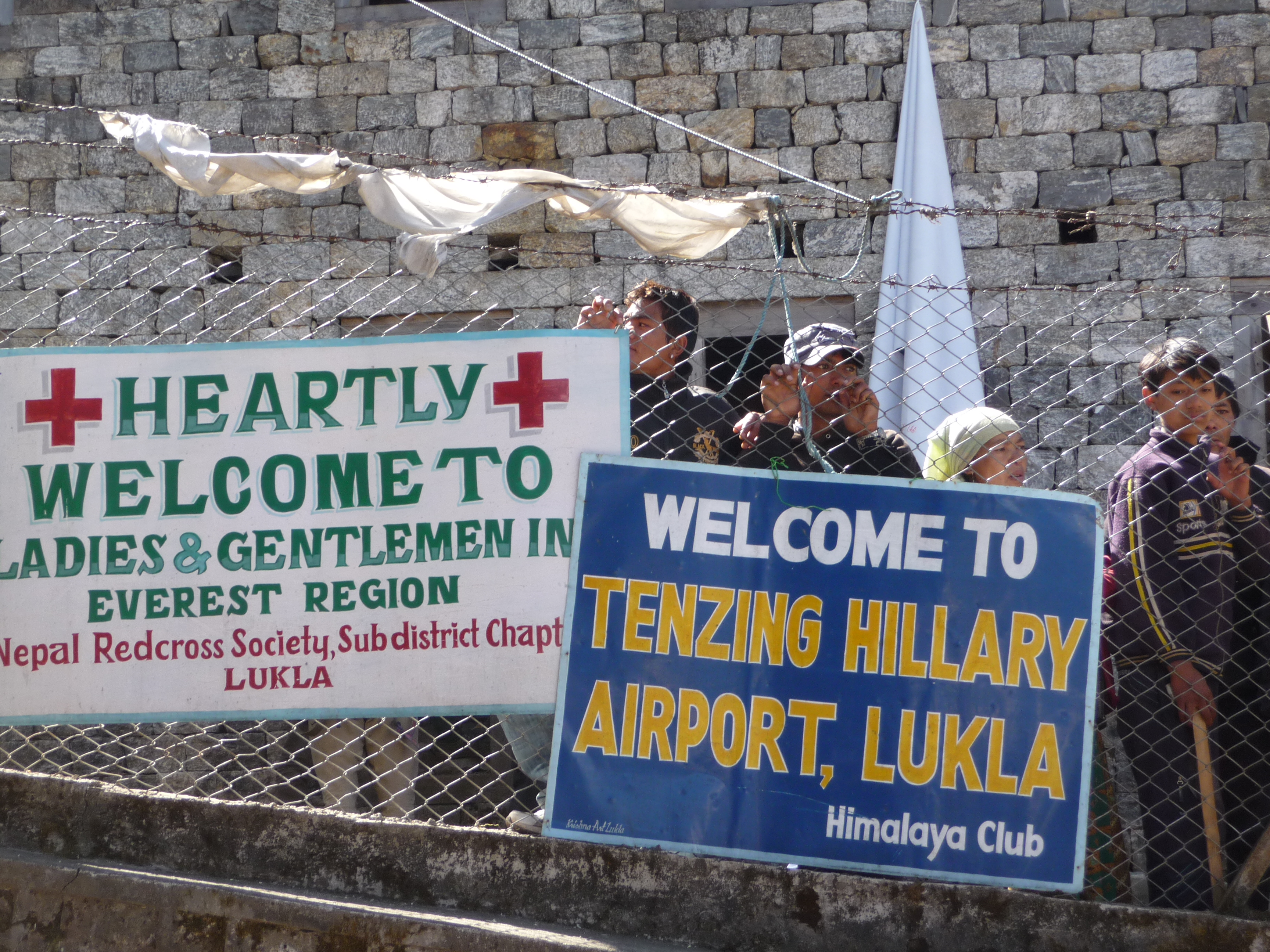
We sat, wandered and waited with fingers crossed. Sort of… the prospect of hanging for another day in Lukla didn’t bother me at all. The idea of hiking out of these mountains–like some actually do–did, on the other hand, distress me greatly!
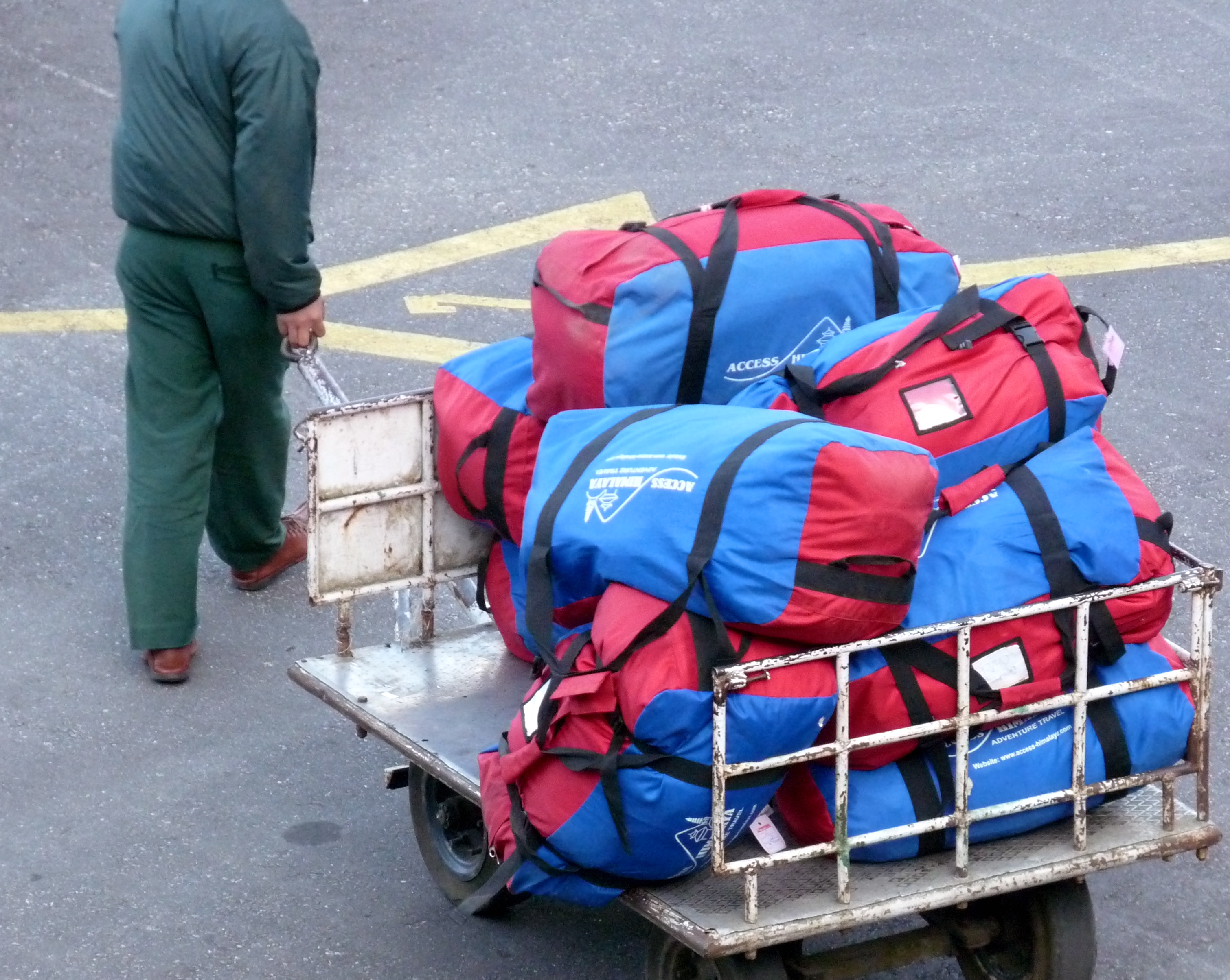
We ate lots of Pringles and gummies (not sure why) and watched planes come and go, and come and go, and come and go. It was thoroughly fascinating to watch the process. Each plane would drop off 20 folks (mostly trekkers), load 20 more on, and head out, without turning off the engine. Here’s a load of trekker duffles sitting on the runway, awaiting loading:
As I’m sure I mentioned in the Trek Day #1 post, the runway, the setting, and the altitude all make for one big adrenaline rush. Here is one plane taking off:
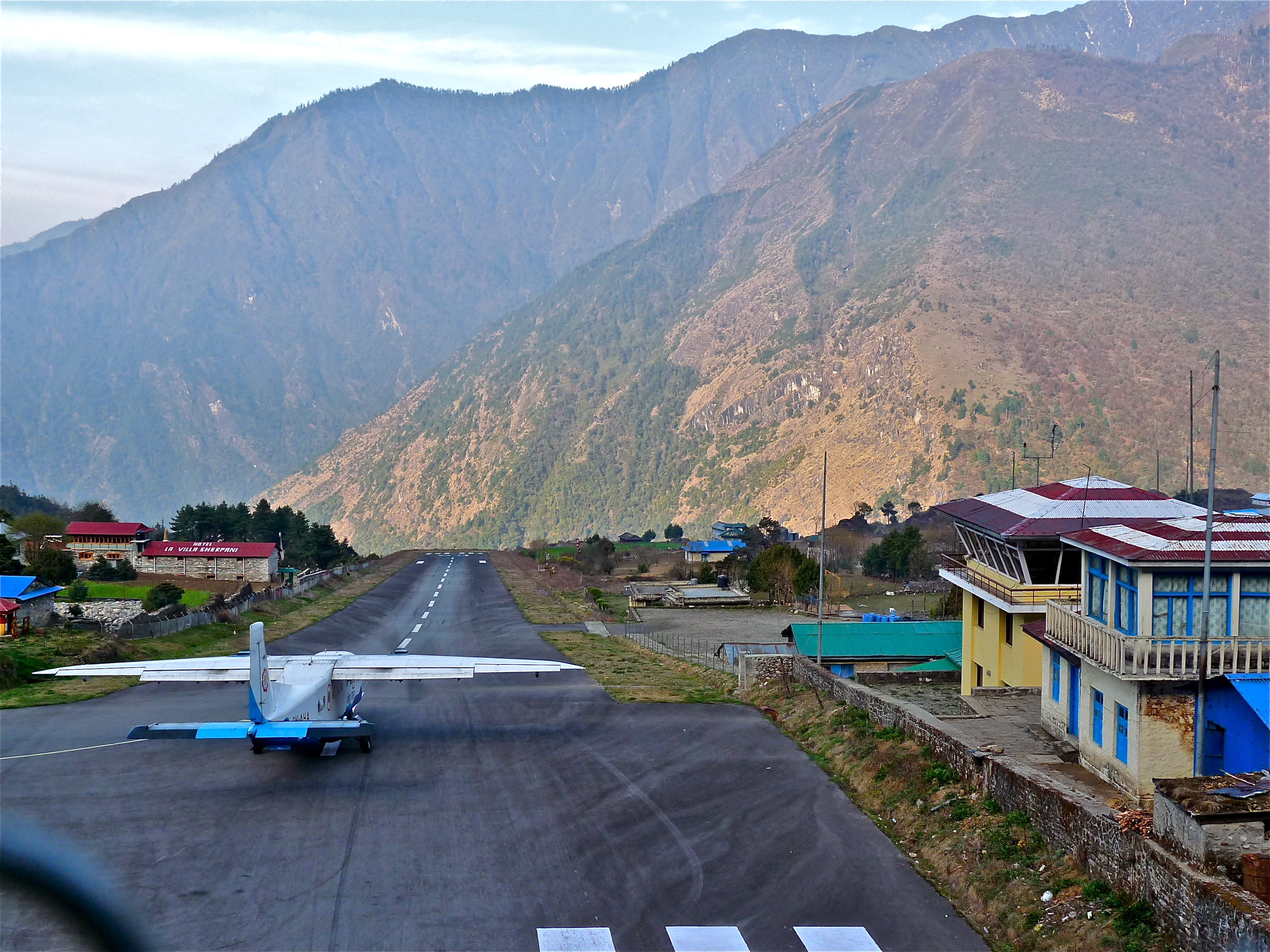
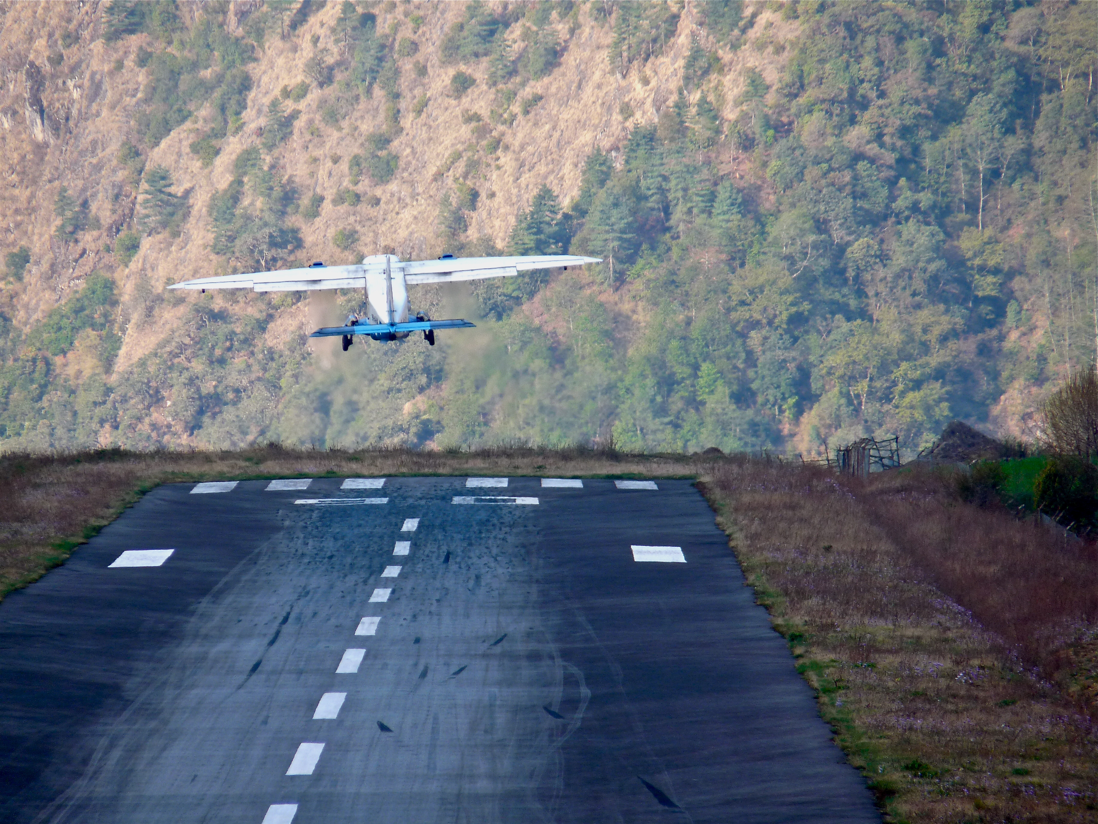
And, yeah, that’s about a 3000′ drop just off the end of that (very short) runway.
Many planes full of trekkers left Lukla before us, the source of consternation for some in our group, but eventually, after three hours, our turn came and off we went. As the hours had worn on, it had gotten increasingly cloudy. We think we were the last flight of the day.
The flight out of the Himalayas was less thrilling than the flight into the Himalayas, for obvious reasons. It was hard not to think back on what was going through my mind two weeks prior, what I didn’t know then about what was to come, the excitement, anxiety… and what I now knew. And for the millionth time, the thought that went through my head was, Wow, we did it. Again, I reflected on the long list of potential snafus. It so could have gone either way on any number of fronts. But nothing bad happened.
More significant, though, were the positives.. the challenges, the accomplishments, the experiences, the mountains, their scale, the views, the company, the introduction to a culture, Buddhism and a way of life I knew little about… those will fill me up for years to come, a lifetime.
Just wow. That’s what was going through my head.
Our flight into Kathmandu was uneventful (not the case for our Australian friends, however, who landed in a remote field on the way to Kat and sat for a few hours.. a story we heard about later). In Kathmandu, we collected our bags at the baggage claim…
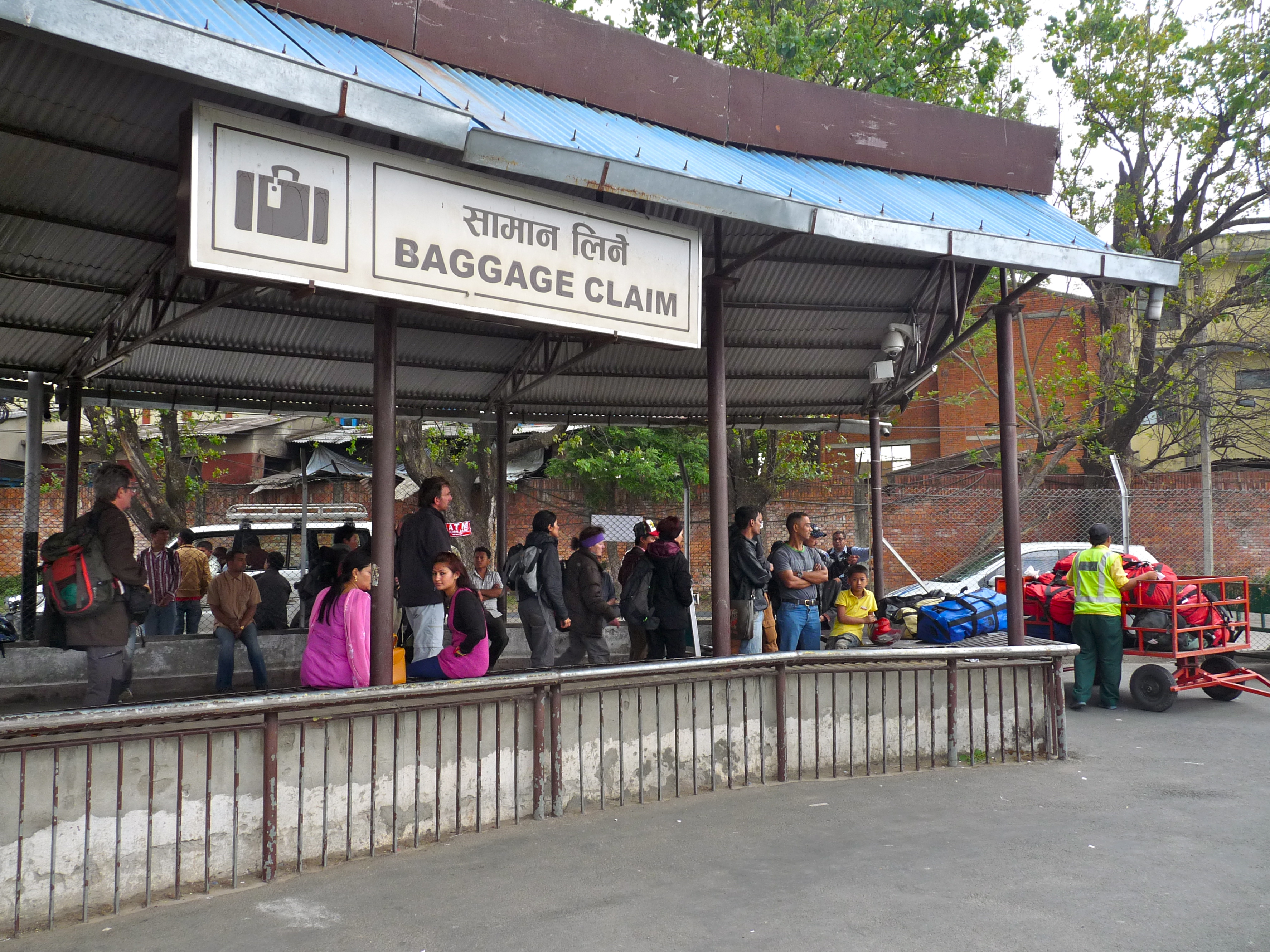
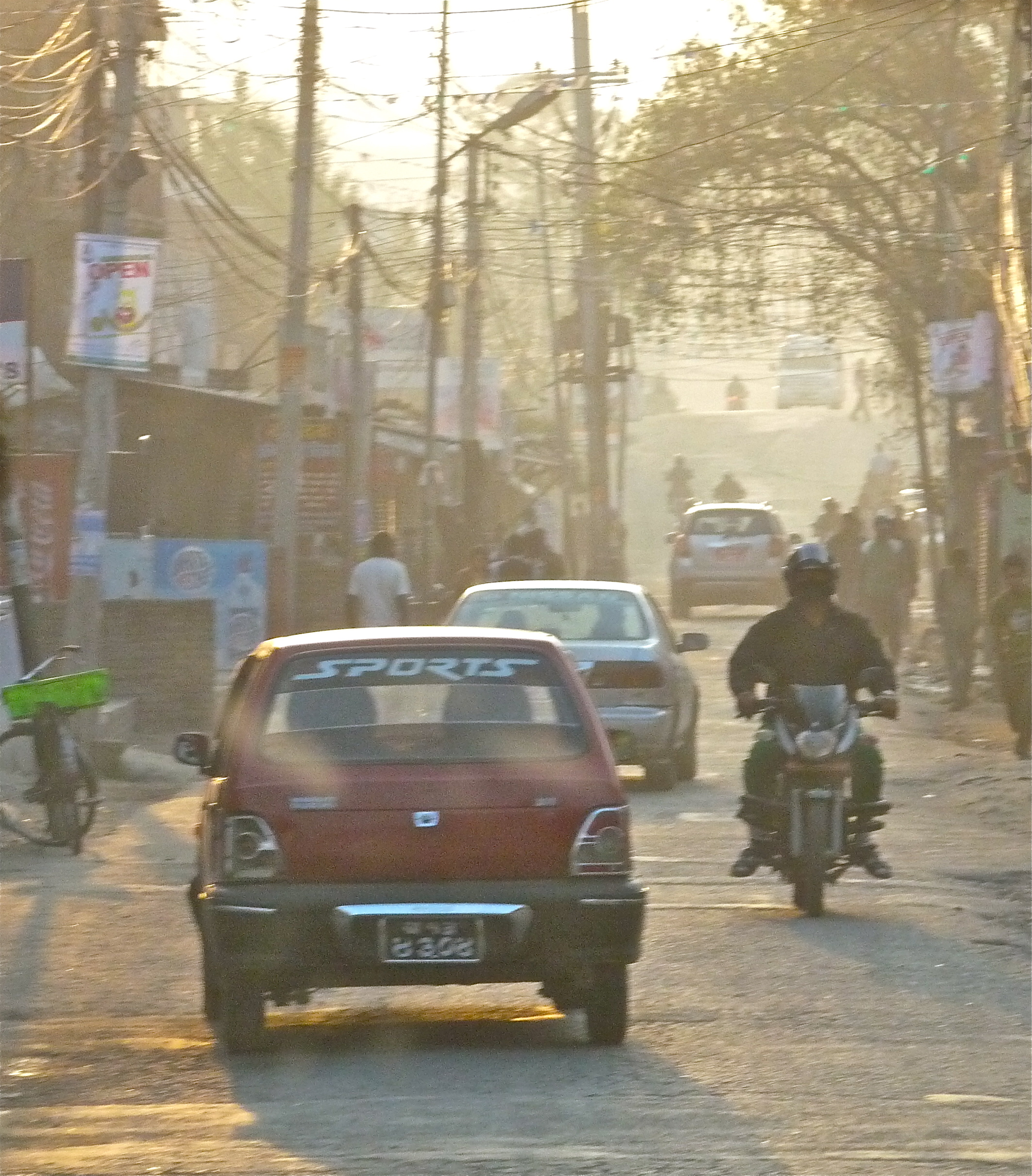
.. and took off driving through the bustling streets of the heavily populated capital city (look, CARS!)…
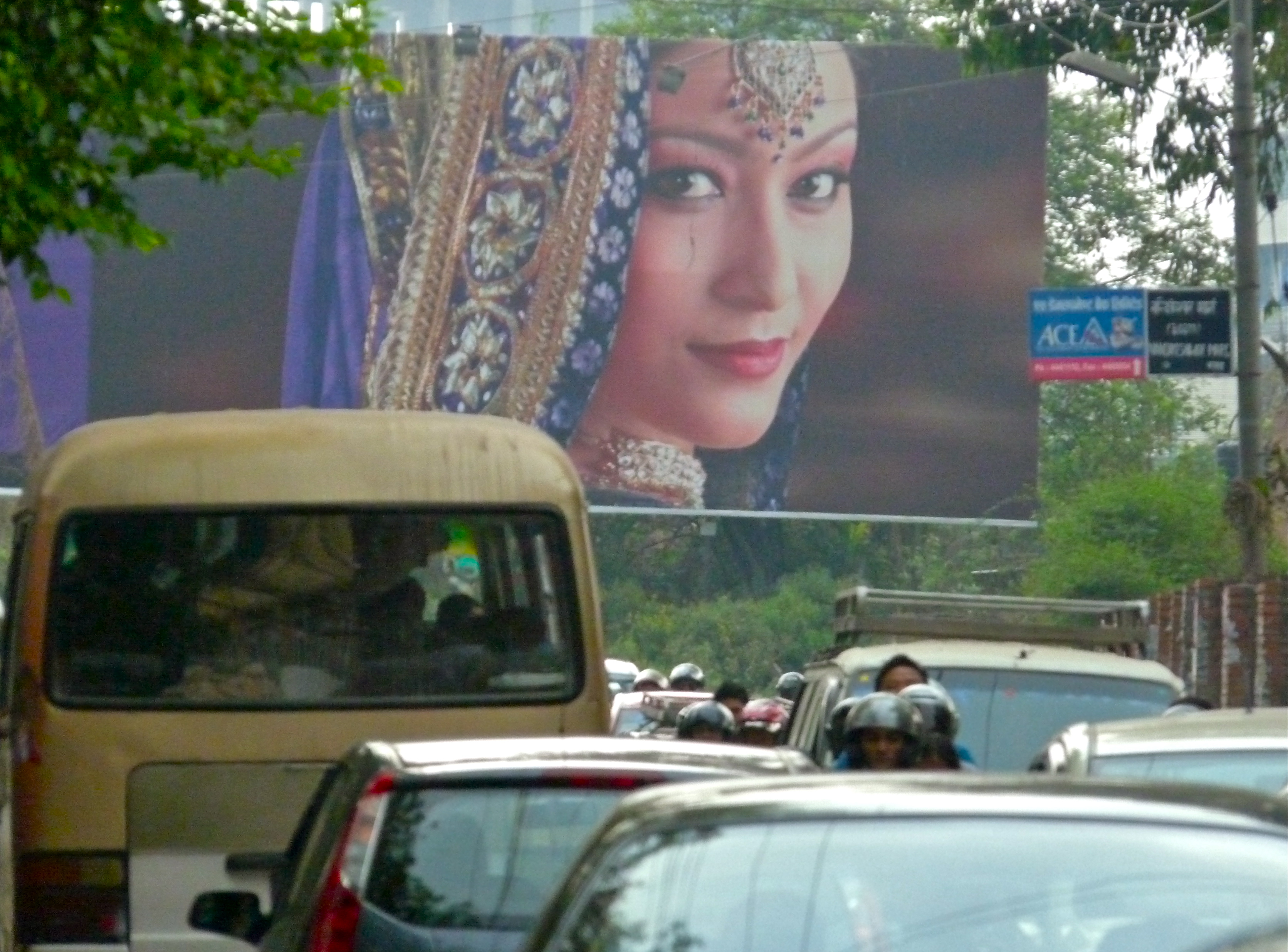
… and motorbikes, and people, and animals, and noise everywhere.
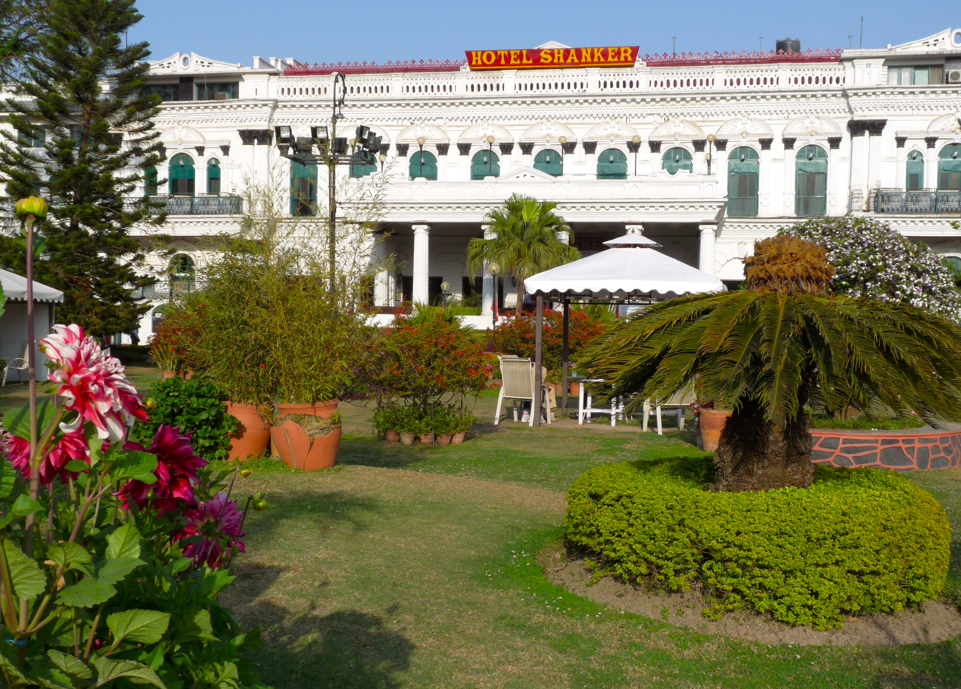
Then arrived back at the familiar and wonderful Hotel Shankar.
We checked into our rooms and the first thing Leslie and I did was make an appointment for a massage. We headed down the street to a nearby spa and had one of the more unusual massages I’d ever had. First of all, it was a tandem massage, meaning we were lying next to each other on tables in the same room, each of us with our own massage therapist, doing, as far as I could tell, the same exact thing… mostly, my eyes were closed. Secondly, they massaged parts that are not usually massaged. Not those parts, but parts like the stomach. Weird, but interesting.
Fully, fully relaxed, we returned to our hotel and joined the others in the garden for some of these… amazing spiced peanuts, and beer. So, so good.
That evening, Homnath took the five of us to a restaurant in Thamel (the geographical center of central Kathmandu and a tourist mecca, full of shops, restaurants, bars, cheap hotels, street vendors, and people) called Rum Doodle, sort of a Kathmandu/Thamel, post-trek institution (the greatest place ever, or the worst, depending on which review you read). We were joined by the managing director of Himalayan Glacier Trekking, Narayan Regmi, who was very interested in hearing all about our experiences. Speeches were made! Narayan was very generous and kind and we ended up having a fun time and a wonderful dinner.
Afterward, Leslie, Rick and I headed out for an evening of Thamel nightlife. We found our way to, I believe, the Shisha Terrace Cafe and Bar–live entertainment and hookahs. We met up with our German friend Reggy there and spent some time debriefing our respective treks and growing increasingly tired (me). My notes say we also went to an Irish Pub, but I cannot remember that (I do not believe my lack of memory had anything to do with hookahs). After walking around and dropping Reggy at her hotel, many tears were shed (Rick), and a taxi was flagged (our hotel was just on the outskirts of Thamel but finding our way out of the maze of streets, tired as we were, justified a taxi).
Back to the Hotel Shankar, to our nice rooms and linen-clad beds… clean, warm and tired. The perfect trifecta.
Namche Bazaar to Lukla
April 17, 2011
Trip Day #19, Trek Day #13
Today we will complete the Everest Base Camp loop. From Namche, we’ll drop about 2800 feet to our day’s low elevation in Phakding (8563′)–the village where we spent our first night–and then climb another 800 feet back to Lukla, where, fifteen miles later, our trek will end. Those funny trail designers–ending on an uphill. (Of course, this has nothing at all to do with masochistic trail designers, and everything to do with the location of villages, mountain ridges and river flow, but still.) It will feel like a long day, mostly because our legs are weary (mine are) and the downhill will feel crushing on stressed knees.
Believe it or not, as tired as I was, I’d had a fitful night; I was too hot under my electric blanket (but, damn, I was going to use it) and too conflicted about the trip’s end. As pooped as I was, and as eager as I was to punctuate the sentence “I trekked to the base of Mt. Everest and back” with a huge and definitive exclamation point, I was extraordinarily sad to be leaving, to be ending this amazing, life-changing adventure. I didn’t even know how life-changing it was (yet), but I knew the experience had penetrated. I knew it was going to be one huge, key reference point for any number of things that I would experience hereafter.
It was a remote corner of the world that, in two weeks, I couldn’t possibly begin to fully understand, nor would I be back any time soon, and I had a strong and anxious sense that I wasn’t ready to be done with it. It was bigger, vaster, and more primitive than anything I’d ever experienced. Two weeks in the Solo-Khumbu region of Nepal was not enough. And photos and words could not begin to capture enough of the experience. I didn’t have the capacity–intellectual, emotional–to really take it all in. And now I was leaving, and I was quite bummed.
I felt deeply committed to returning, this time focusing on the culture, people, and what inspired them about buddhism and prayer and meditation. For sure I was missing certain modern comforts, but I was also drawn to a simpler, subsistent life.
I was also desperate to bring Peter and Jim to these mountains. Peter’s long-time obsession with Everest brought me to tears so many times, as I thought about how well he knew the facts of Everest and the Himalayan range, and really, really needed to experience it first hand. And here I was, while he was home.
Sigh. Many thoughts swirling.
Nevertheless, we got up early, packed quickly (we really had this drill down) and headed to breakfast in that very cozy dining room, overseen by that very calm, competent and gracias proprietress.
At breakfast we heard the full story of the Malaysian man who’d been airlifted out, whose HACE was a little more under control, but whose blood ox was still only 70%. We had shaken our heads at the numerous stories we’d heard about evacuations, hearing and/or seeing helicopters flying up and down the canyons daily. You really gotta wonder.. not as easy as it all seems, this trekking at high altitude. A mere 75-100 miles is the total distance we covered, over 14 days–hardly challenging by Sierra standards. But add ten thousand feet of net elevation gain and loss (and gain and loss dozens and dozens of times throughout the days and weeks), gnarly terrain, sub-freezing temperatures and thin air, and it becomes a more rigorous affair. Pro tip: do your training.
So we got off at about 8:00, early enough to enjoy a quiet Sunday morning in Namche Bazaar. Here are a few shots of folks in town, doing what they do on Sunday mornings.
Women gabbing and enjoying tea before the first shoppers…

kids playing…

and shops opening all over town..

Here’s a shot Leslie took of Laura meandering down (and down) narrow, cobbled streets on the way out of town:

Before we got too far into our day’s journey, we stopped again at the army/police gate on Namche’s outskirts and spent 300 rupees on “Achievement Certificates.” Kind of hokey, but for a good cause. That is, the money raised by the folks issuing these very non-official “Achievement Certificates” gets routed back into the region to help maintain the Sagarmatha National Park, its historical and religious sites, and generally the standards of living for those who live there.
And then the downhill began with a vengeance. The trail between Namche and the Hillary Bridge was far more intense going down than it had been going up (of course). I wanted to take advantage of freshness and gravity and took off quickly. There is nothing to explain this, but I’d decided not to bother with poles. Fatal error, but I just wanted to hike fast and unencumbered, and figured, heck, it’s the last day and I’m not saving my legs for anything now.
I also wanted to hike alone, as I had a severe case of melancholy. My impulse was to turn right around and head back into the mountains. And at the same time, I was missing Peter and Jim and ready to tell them a million stories. I was emotionally committed to returning to the Everest region with them.. (and physically committed to training more!).

I have no idea where all the people went, but I saw nearly nobody for the next hour. In fact, I wondered if, in my enthusiasm for the river and warmth and solitude, I’d somehow missed the trail, which made for some interesting thoughts.. but, I hadn’t, of course, and soon came upon a village where I stopped to pee. Found a nice shack (with a window feature!) and a bark-covered hole-in-the-ground. I had become quite the connoisseur of pee spots in the Solo-Khumbu.
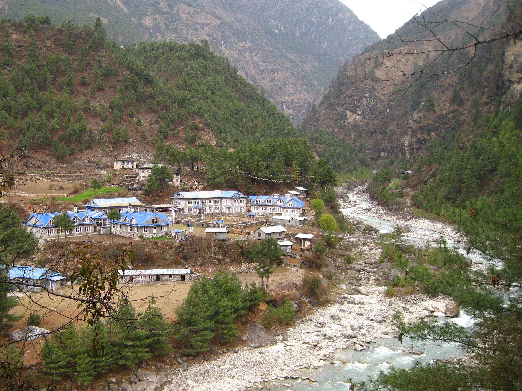
This was that village.. it’s either Larja Dobhan or Jorsale. It was very picturesque.
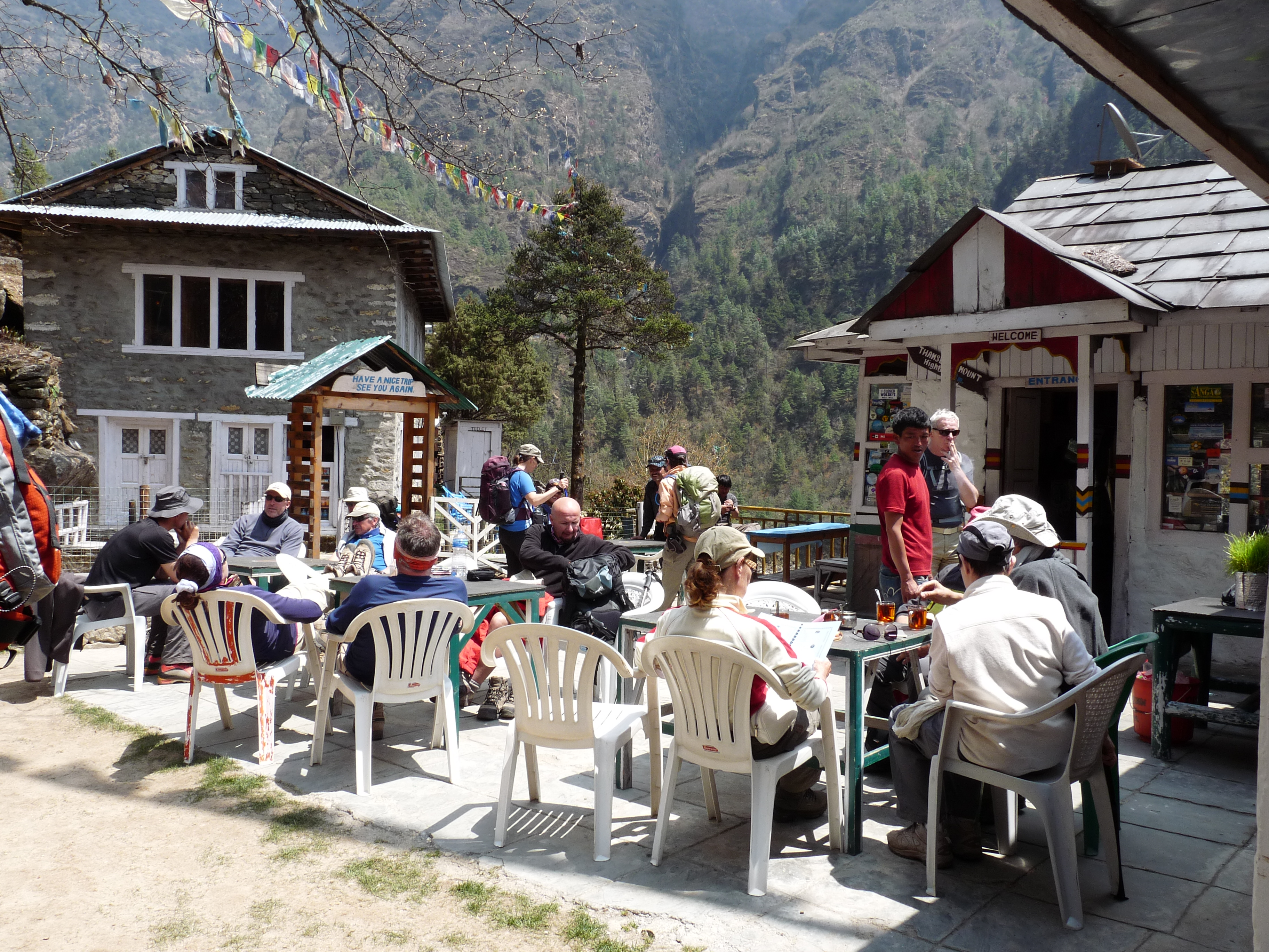
After another long while I caught up to Rick and Hom, who were waiting at the official entrance point to Sagarmatha National Park, whereupon Rick took off again and Hom and I waited for the others. It was quite the international fest.. suddenly, there were dozens of international trekkers in shorts and sleeveless tops, applying sunscreen, talking eagerly about citing Everest. Felt like culture shock after a couple weeks of feeling like we were on some other planet. Maybe a half an hour later, the others rolled in, and shortly after that I moved out, wanting to take advantage of whatever energy I had left, which wasn’t much. Everyone (minus Rick) managed to reconvene for lunch in Benkar, at the restaurant we’d stopped at to pee when we’d passed through this area the first time (second day of our trek). We were only an hour out of Phakding and, according to Hom, would have only four more hours to go after lunch.
That’s great, because we were pooped.
The deck was sunny and we sat near some French trekkers. So strange.. the warmer temps, the bustle of people, the flowers, greenery.. things were feeling so.. civilized the closer we got to the starting line.
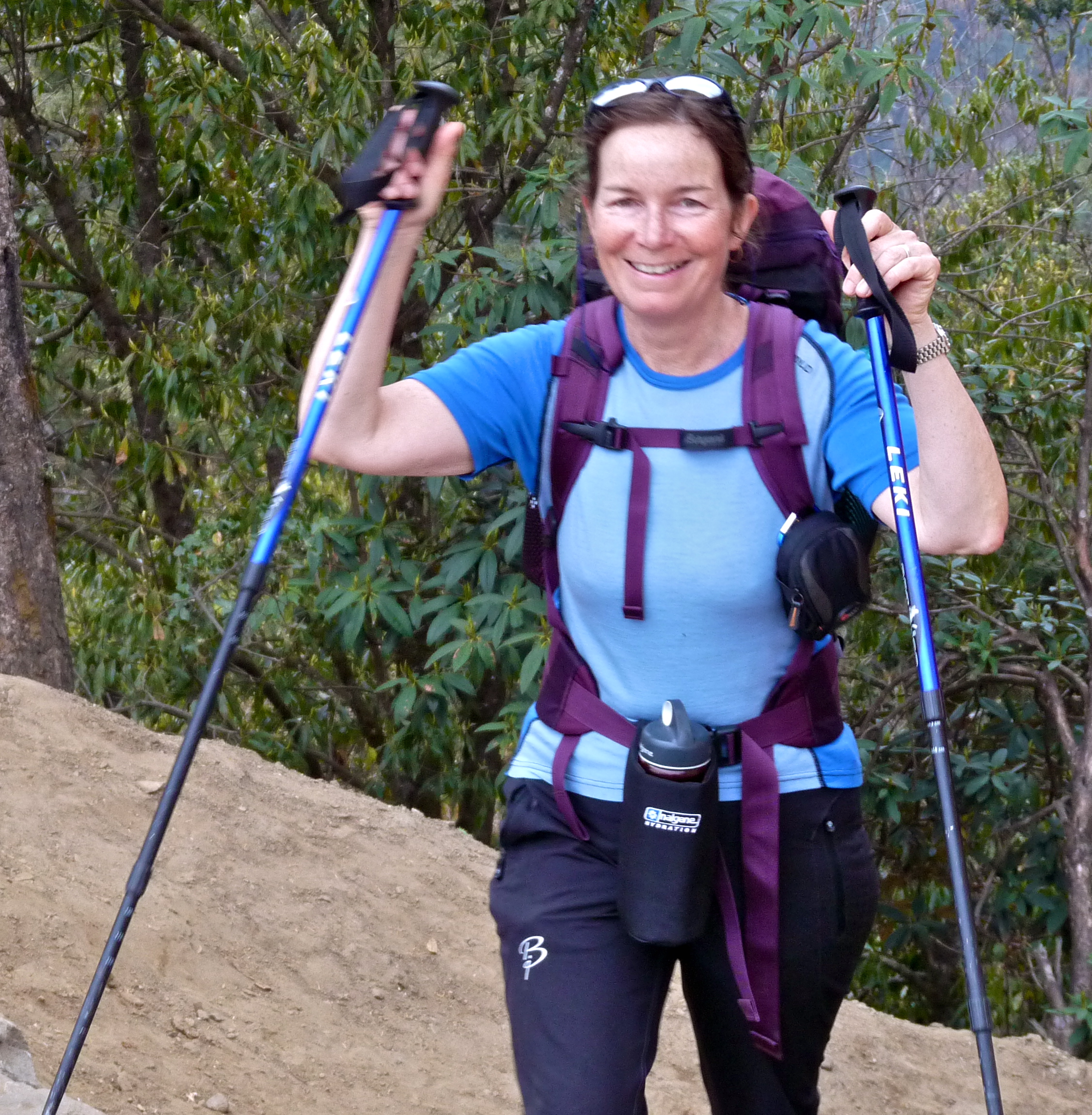
Again, in an effort to make hay while the sun shone, I bolted. I hiked mostly alone, and a bit with Leslie. Looking pretty spry here… must have been the dal bhat!

At one point, I met up with a Nepalese lawyer, who’d been up at Khumjung (the town way above Namche) for a couple days. He was part of a group meeting to discuss hydro-electric power options for the region. His english was good enough to communicate all that, but barely. He told me that this was his first trip into the Everest region and his first time seeing Mt. Everest. He said, typically, the only Nepali people who ever get to see Everest are trekking and climbing guides, that most Nepali folks never get into these mountains, nor see the mountain for which they are famous. It struck me, too, that here was a professional, educated man who was taking two days to walk to a meeting, and two days to walk out. I imagine he could have hired a helicopter, but it didn’t even come up in our conversation. He was wearing street shoes (!) and carrying a camera around his neck. He did have a backpack, and I suppose his briefcase was in there. I was able to introduce him to Hom and hoped that maybe they could establish a mutually beneficial relationship.
At another point, I met up with a young girl, maybe six, who was carrying a broken glass in her hand. I tried to explain to her that this wasn’t safe. She seemed fascinated, but didn’t get at all what I was trying to say. I was sure her mom would have appreciated it, wherever she was; we were not near any homes or a village at this moment. This area, however–lower and warmer–is far more populated, with more frequent settlements and villages. I think people who graze their animals over the summer at the higher elevations, or otherwise live and conduct business in villages at high elevation, come down to the lower elevations during the winter.
By and by, I passed through Phakding, and later the place where we’d had lunch on our first day, two weeks earlier. It was so interesting to retrace steps. I was seeing things in a completely different way–different views of course, and, actually a completely different perspective. It was only two weeks, but we knew a whole lot more about the life and people of the region, and things we’d seen on our first day were now seen in a wholly different context. And there was just a whole lot of it that seemed new; stuff I’d not observed the first time through. Plus, after two weeks, and it being the middle of April, it had become very springlike. Lots of flowers, new growth and lots of green.
But, here’s the thing: I was now really hurting. I was totally, totally spent. My achilles tendons ached like crazy, my toes were seriously jammed from all the downhill in very light boots, and my knees were shot. It turned into a very grueling finish for me. It was a 15-mile day–challenging enough under normal circumstances–brutal on tired, hurt legs. We were covering a distance in one day, that had taken two on the front end of the trip. I had to summon a lot of will to walk with purpose, to keep moving. I realized I had no other option; if I sat down, I’d probably not get up. I just needed to grit it out. I walked with Hom for a while, and Leslie, then fell behind. It was a grind!
Nearly the entire day was spent on stone trails, with lots and lots of stairs as we passed through villages. Lots of hard, uneven and unforgiving surfaces along the way, on top of fatigue and soreness. Ouch.
A bit hard to make out, but check out this trail! Steep, cobbled, full of pack animals. Brutal.
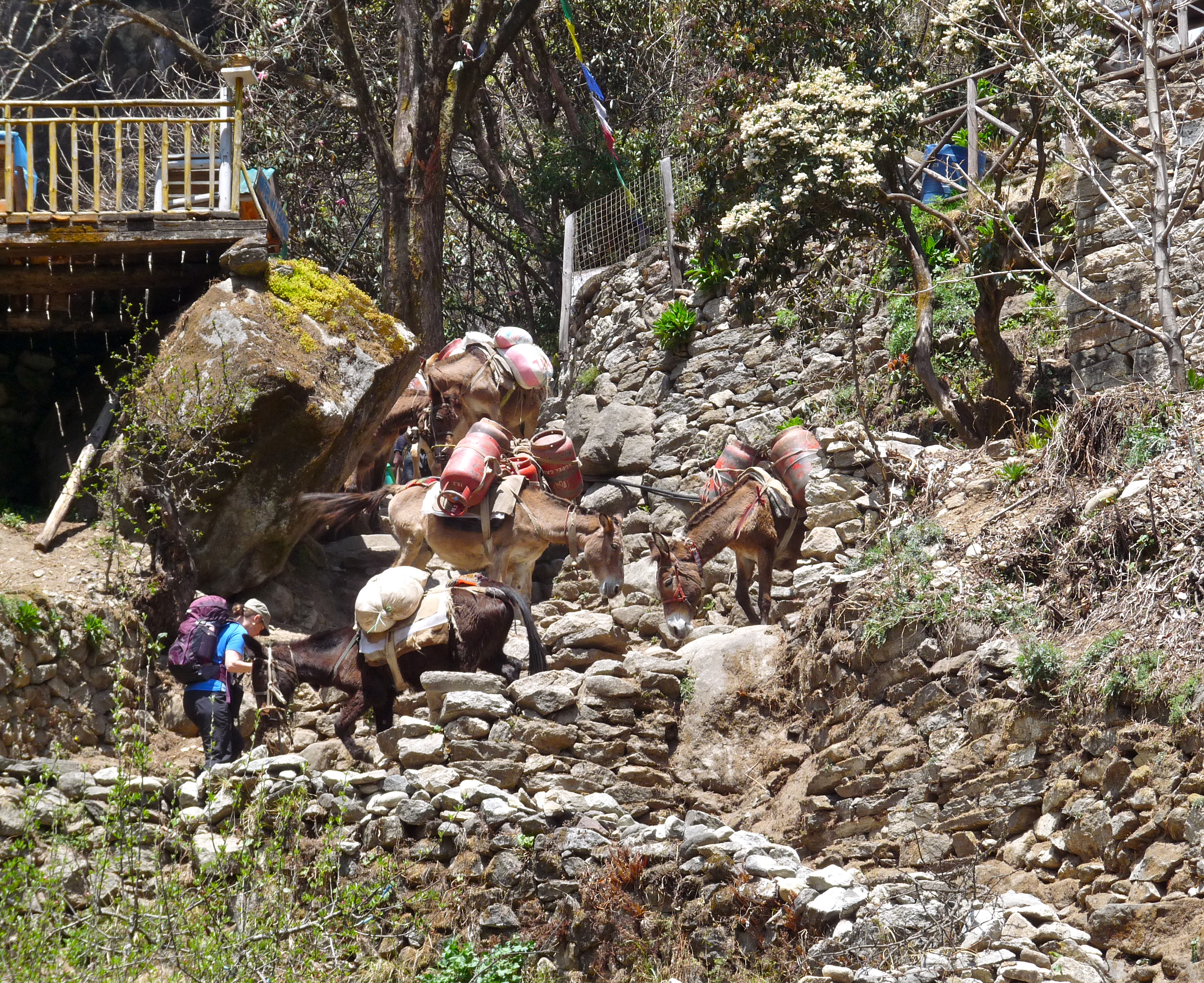

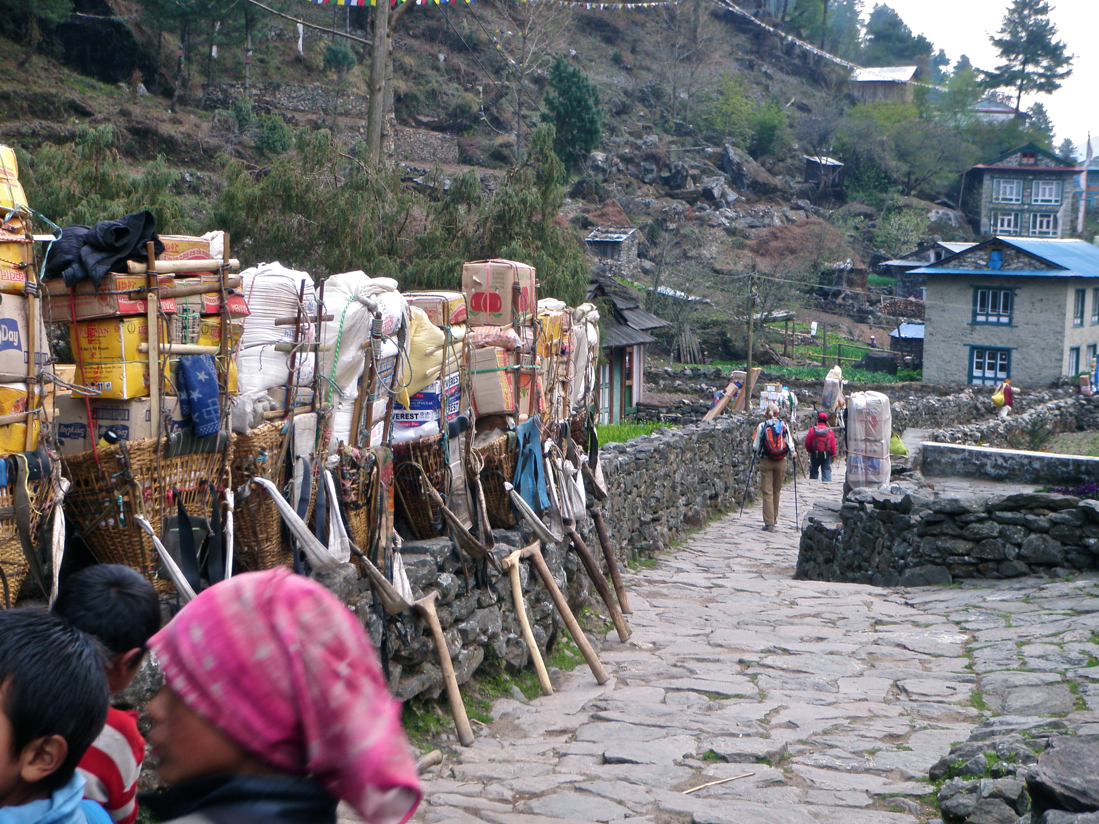
I experienced my only real ankle twist of the whole trip on this day when I took my eye off the road for just a moment, and while I didn’t tear anything, it hurt like hell. Sigh. Just tired, I guess.
At the end, I actually did catch up to Leslie, and she and I finished together. Steady, gentle uphill for the last three miles or so! She felt great, like she could have gone much longer. I think that’s the training difference right there. So after seven hours of hiking and an hour for lunch, we both passed through the Lukla gate at 4:00pm. And shortly, Hom came along! Hugs and tears. It felt exhilarating and sad.

(Hardly the worse for wear, huh?)
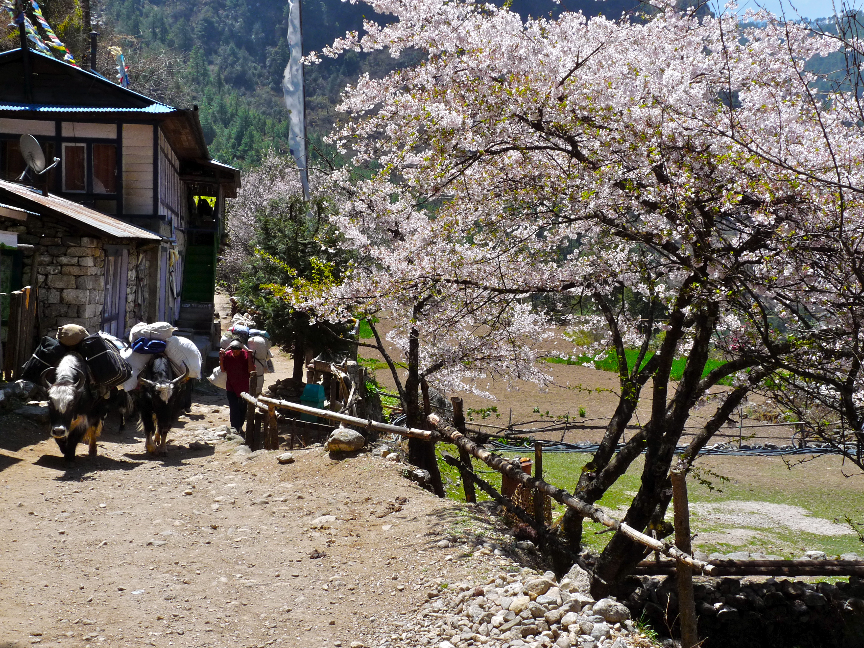
We hobbled (well, I hobbled) through Lukla, which was bustling–yaks, people, open shops, music everywhere. We even passed a Starbucks (yes, a Starbucks).

It’s still all very primitive, truly, but there are signs of modern life. We decided to just get to our tea house (The North Face Resort, they called it, which was, yes, an overstatement) and get settled. We saw Rick and Reggy sitting on a wall talking. He’d probably been there for at least a couple hours, and I’m not sure when Reggy arrived, but it was nice to see her.
Leslie and I were roommates that night. We moved into what was a beautiful, if smelly (mold), room, with an incredible shower! We got cleaned up and then had our last-night-of-the-trek celebration dinner (there would be yet another celebration dinner once we were back in Kathmandu). Here’s the entire gang, left to right: Hom, Pradip, Karen, Laura, Leslie, me, Rick, Pemba, Rincha and Asaman.
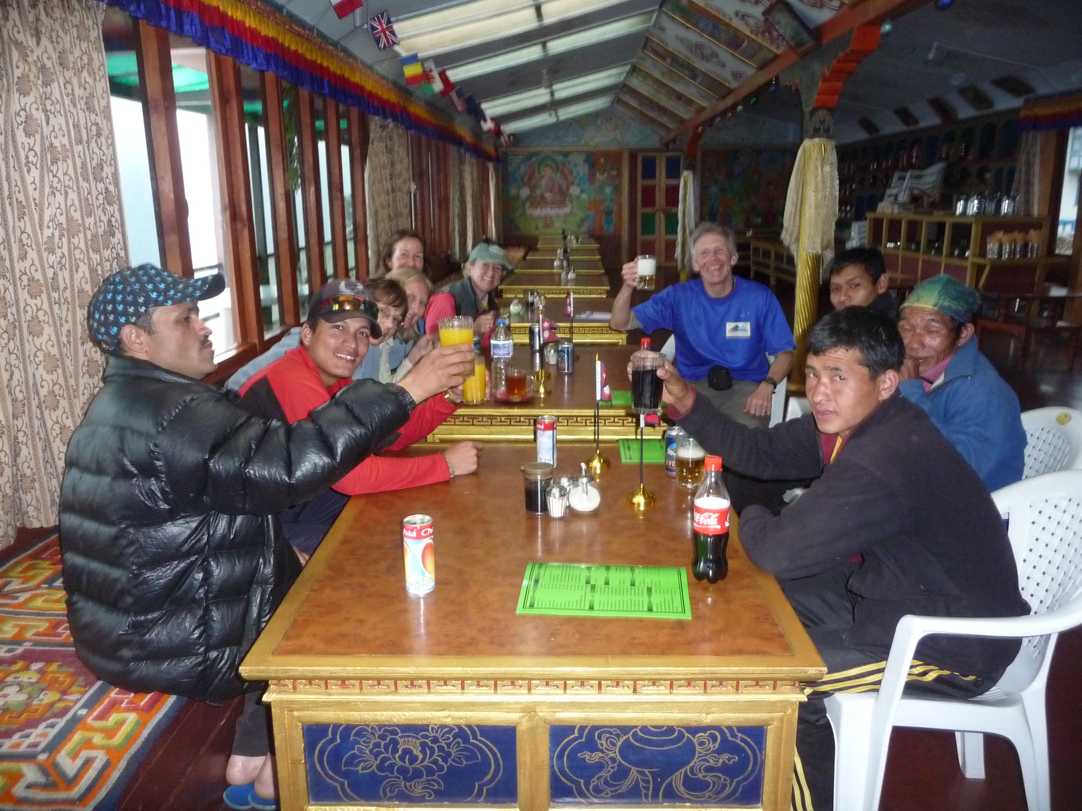
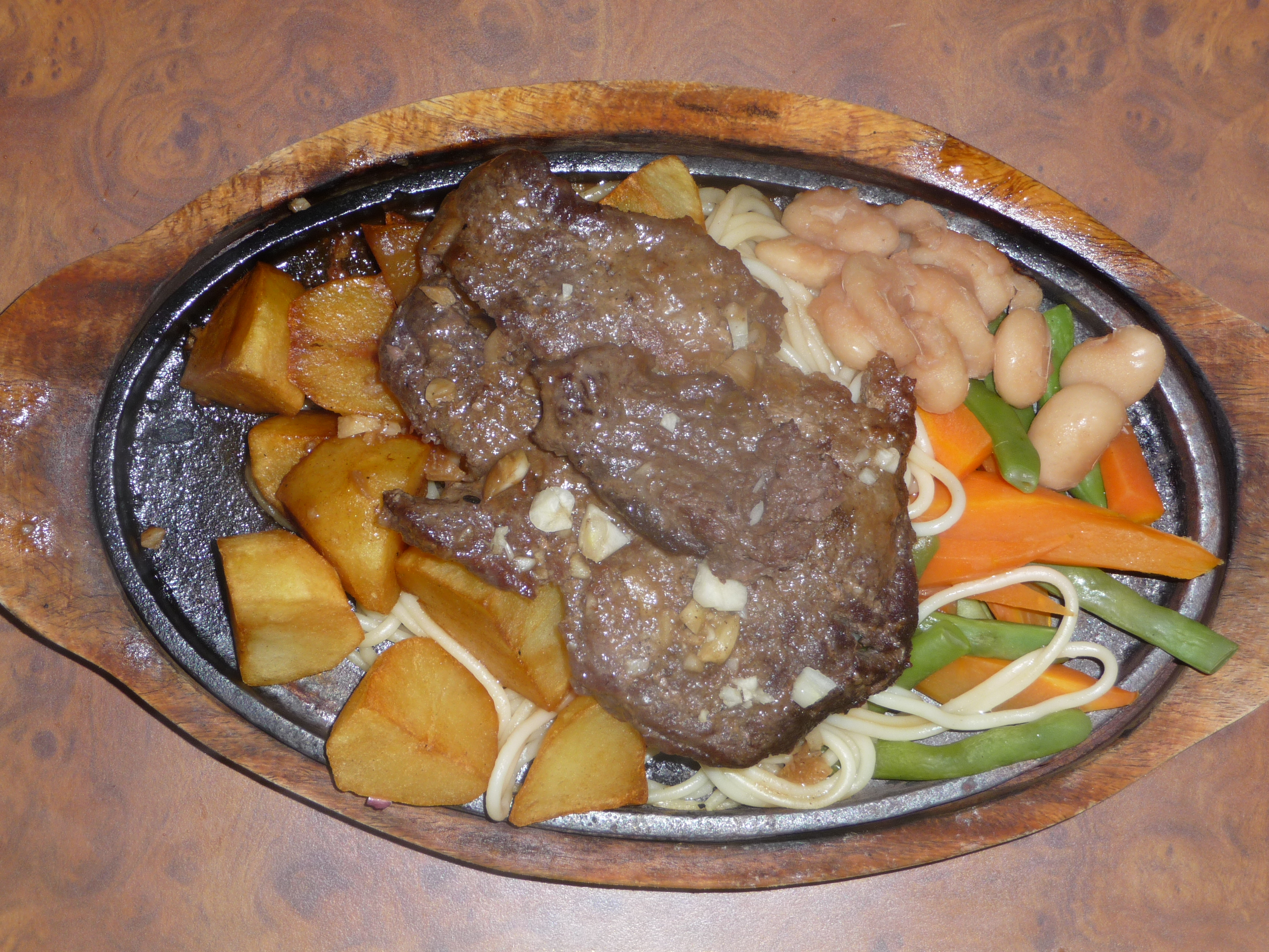
Rick got out his Nepal flags, and we drank beer and ate pretty heartily (that’s a yak steak).
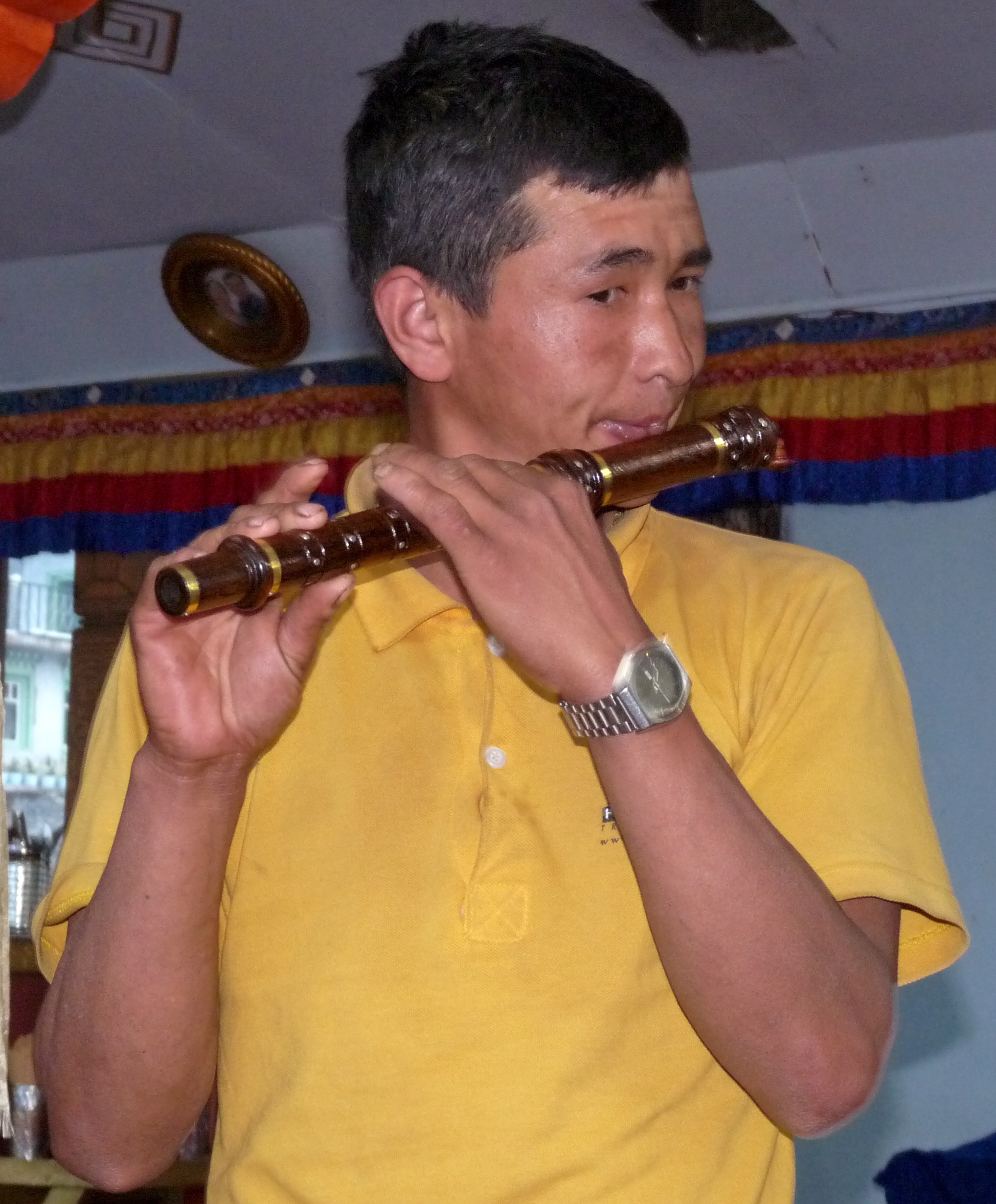
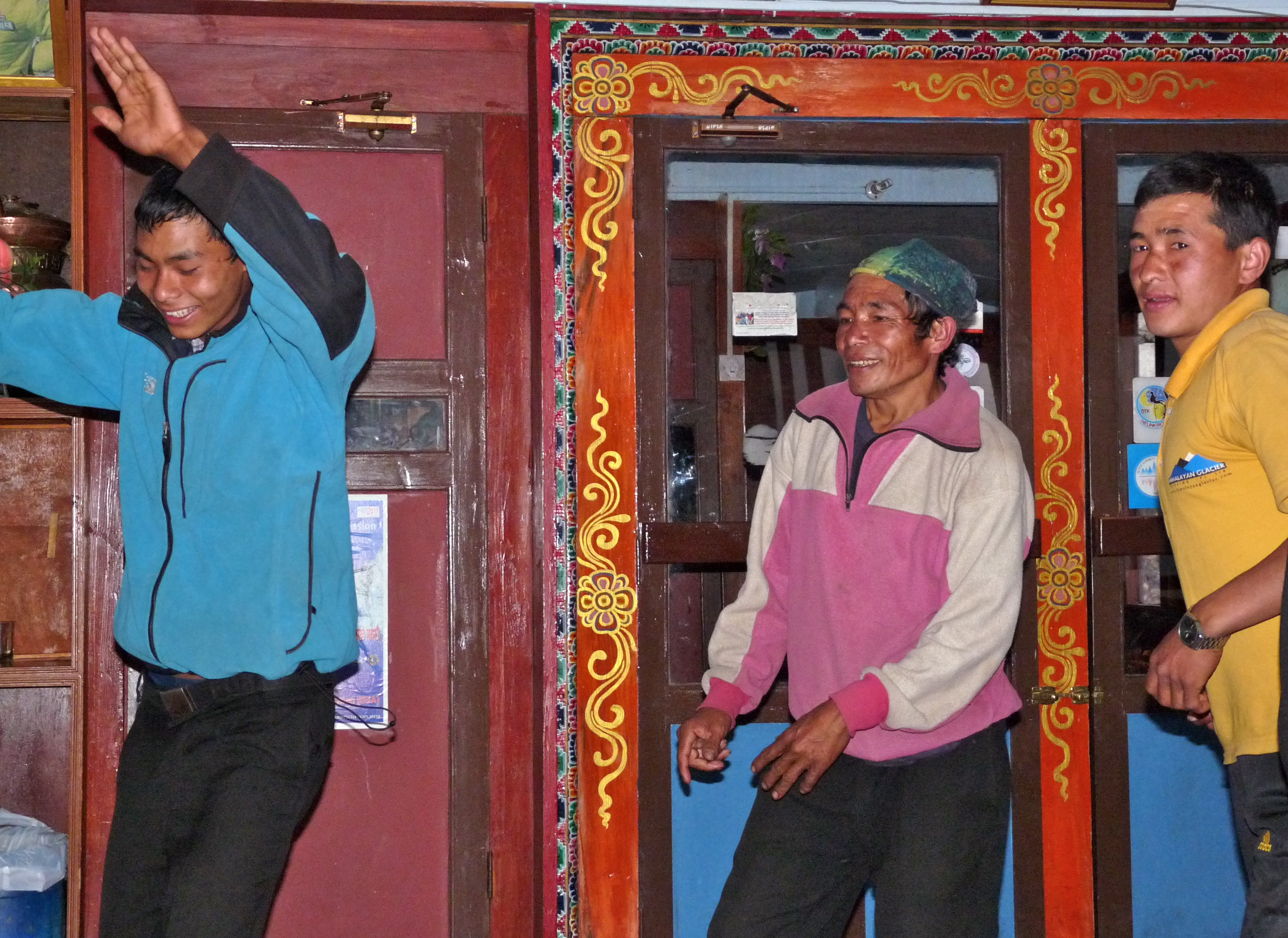
Somebody, I think Rick, had a collection of music that we were able to play on the restaurant’s sound system, and then those who could play instruments played, while we all danced (if you can believe that) The videos of this are great. Thanks, Rick!
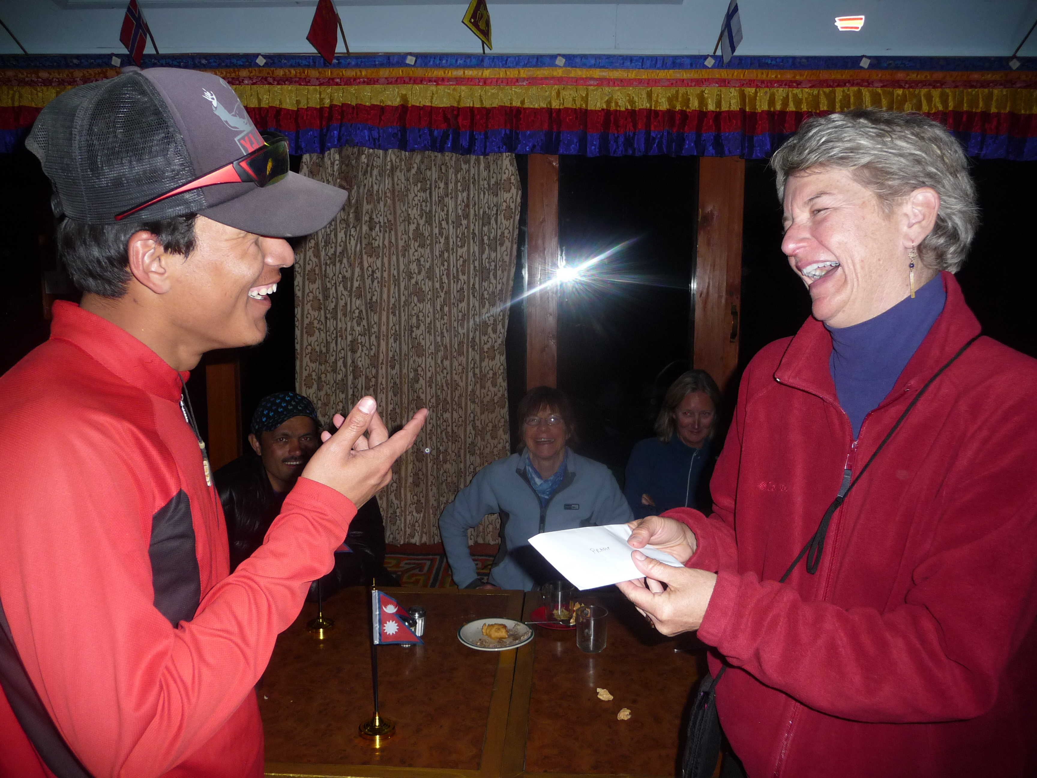
Earlier, we had figured out how much we wanted to tip Hom, Pradip and our porters, so after dinner we presented the tips with spontaneous ceremonial speeches (which I delivered, funnily enough).
And then we crashed.
Pangboche to Namche Bazaar via Tengboche
April 16, 2011
Trip Day #18, Trek Day #12
It’s hard to describe what it’s like to awaken to sun streaming through the windows, warming up the room like some kind of California summer day, a dog sleeping at your front door and a pony in the yard. It was a glorious morning with eye-popping views of towering, snow-covered mountains against clear, deep blue skies.
Rick shot this one out his window.

The resident dog relocated to a sunny spot on the deck, and why not?

After tea and packing, we met in the very charming dining room and had fried eggs on toast and more toast with peanut butter and honey (well, that was my breakfast). And more steamy hot tea. We were all so happy and warm and loving life. Pangboche felt like heaven on earth.
The hike out was great, too. Here are Karen and Laura, setting out for the day. It’s still mid-April at 12,894 feet, and probably in the 30s this early morning, but sunshine and plants are making it feel tropical; note the lighter set of clothes:

We meandered through the outskirts of Pangboche, looking down the mountainside at green fields surrounded by stone walls, grazing animals, the river raging far below. Lots of flowers and trees.

Looking behind us, I finally got a clear, close-up shot of the iconic twin peaks of Ama Dablam:

We came upon this pack of animals, best guess: the Himalayan Tahr. (related to the wild goat). We scrambled around this slope and watched them eat and eventually, and skillfully, descend out of view:

We passed a mom and her child in colorful woolens:

And came upon a beautifully located stupa; looked back to see it dwarfed by Ama Dablam. Our trail is visible on the hillside, left of the stupa. Nice, huh?


Then we headed down to cross the river and climb the steep canyon wall on the other side, making our way to Tengboche Monastery. Here’s Leslie’s shot of the bridge far below. Note the water has that glacial run-off color:

And here’s where we’re headed on the other side… a couple of my favorite faraway shots of Tengboche. The setting is breathtaking, surrounded by views of Tawache (20,884), Thamsurku (21,675), Ama Dablam (22,493), Nuptse (25,801), Lhotse (27,940) and Everest (29,029). Tengboche sits on a hill 2000′ above the confluence of the Imja Khola and Dudh Kosi rivers (well, a Himalayan hill):


So, first down a thousand or two, then up a couple thousand. Pretty soon we hit a shaded trail. This was a very nice ascent, not an insignificant climb, but pleasant through the trees.

Here are a few other sights along the way to Tengboche Monastery. Here’s a farm Leslie shot:

Rick’s shot of grazing horses:

My favorite yak shot.

Passed homes, barns..

Passing people coming home from the Friday market… here are Leslie and Laura (note shirt sleeves; no down or soft shell parkas):

Nice packaging for the eggs.

Here’s a guy hauling sacks of grain, light enough, but unweildy:

It was just a beautiful day and the countryside was full of vegetation, life and color. We finally got to Tengboche.
Tengboche (also called Thyangboche) is a Tibetan Buddhist monastery. It isn’t a particularly old monastery, initially built in 1916, but its gompa was destroyed by an earthquake in 1939, rebuilt, and destroyed again in a fire in 1989. It was again rebuilt and reopened in 1993. It’s a sacred site for meditation & prayer, and at least one large annual festival.
Leslie got a shot of the grounds:

Monks are everywhere, in Patagonia down sweaters, no less:

Here are a few shots of the outside and inside of the gompa:


Then, time to head to Namche Bazaar! Here’s Karen (note mani stones):

The trail back down to the river, another 2000′, was very steep, brutal and unrelenting. But just beautiful. Surprisingly lovely to be in trees again. Leslie took this one of me:

Rick took this of a sherpa hauling a stack of boards up to Tengboche which also gives a sense of the terrain. You had to watch your step so carefully; the ground was packed and dense (usually), but embedded stones were trip hazards and kept you from really hauling out (as if your knees weren’t the limiting factor). Also, thank goodness for sticks.

The Rhododendrons were in full bloom at this elevation (approximately 11-12,000′) and views of Kantega (21,932′) were spectacular. Kantega means “horse saddle.”


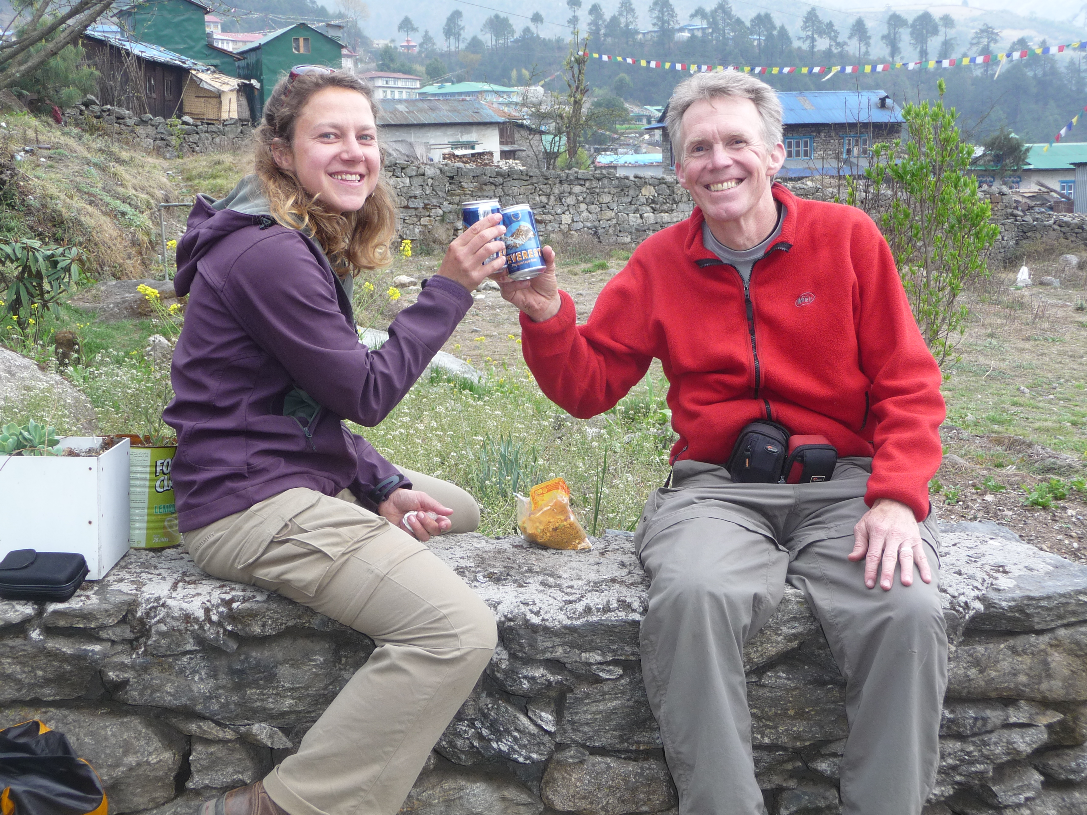
After two miles and 2000 steep feet, we arrived at Phunki Tenga for a sunny, warm lunch at riverside. We were thrilled to run into Rie and Emily whom we’d last seen leaving Namche eight days earlier.

We heard stories of their misadventures: they’d all suffered some degree of altitude sickness, Rie had been evacuated by horse at one point in their journey, Emily was dealing with very impaired knees, and David had been treated for severe diarrhea in Pheriche. David was ultimately the only one to summit Island Peak and was a day behind them. Still, many smiles and many excellent stories to tell their Australian friends back home.
Here’s a nice group shot outside the restaurant: Karen, Laura, Leslie and me:

Rick had forgone lunch and taken off ahead in order to get to Namche in time to see the Saturday market, which he did and said it was interesting enough, though not what he’d expected.
After lunch, we crossed the river on a wood and stone bridge (the old one had washed out in the 2007 floods, the remains of which could still be seen) and headed once again up (and up and up) to the other side of the canyon. We passed charming villages like this..

..and, once far enough above the river, contoured and wended our way back to Namche on a very beautiful, relatively flat trail. Here’s one that Karen took:

And here are a couple that Leslie took (for sure that’s a huge drop, but the trail was wide and never felt too exposed):


I’d also separated early from the group and hiked alone for a while, then with Hom. We hiked quickly and I felt just great. I really enjoyed the views and conversation. It was fun, a few hours later, to finally reach the crossroads–the point where our group had gone north up to the Gokyo Lakes region eight days before, while other groups had continued northeast along the main EBC trail (which we were now on)–and retrace our way back into the hillside village of Namche.
Hom pointed out that there was a lot of traffic on the trail out of Namche and that most of the travelers were women carrying supplies purchased at the large, weekly Namche market (eggs, meat, household goods). Interesting to reflect on life in the car-less, mountainous Solo-Khumbu region of Nepal. Life’s pretty simple there.
In Kenjoma, about two miles outside of Namche, we saw a group huddled around a man who’d been seated just off trail and covered with blankets. Hom moved into the circle of people to assess the situation. The man looked to be in his 40s or 50s, fairly heavy, and just sat motionless, seeming lethargic and dull. Turns out, he was a Malaysian trekker, also in a Himalayan Glacier Trekking group, who was suffering from HACE (high altitude cerebral edema), which is very life threatening. His blood oxygen level was 60%! He was ultimately carried by sherpas and porters back to Namche and treated with oxygen. The next morning, Pradip and Homnath were among those who carried him to the heliport where he was evacuated by helicopter back to Kathmandu. He survived, we hear, but it was touch and go. In addition to the survival issues, he’d not obtained evacuation insurance, something that was absolutely required for this trek. We were all to have both the insurance and cash sufficient for the helicopter pilot in the event of an unplanned evacuation. I am not sure how financial matters resolved for this gentleman.
We rounded a broad corner and Namche finally came back into view. Wow, what a setting for a town. Impressed all over again by the vastness of the deep river canyons surrounding Namche and the sweeping panoramas that rise up and loom over the village. It is so incredibly dramatic and picturesque.

We meandered our way down, down, down and back to the Namche Hotel. The steep stone walkways and stairs seemed unkind to worn legs (and I wondered how that 3000 foot descent the next day was going to feel..) I took off to shop for souvenirs–mostly stuff for Peter, like a t-shirt with the route to EBC on it, a scarf of the seven summits (on seven continents), a singing bowl, a yak bell. I updated Facebook while sitting in a nearby sweet smelling bakery and took a shower (not as heavenly as I’d hoped due to a problem with the hot water heater). We all met for a celebratory dinner, joined by Rie and Emily, with lots of salty, spicy snacks and beer. So very, very, very perfect.
Rick had yak steak:

We again reflected on a great trip with no debilitating issues: no boot problems, no clothing failures, no altitude sickness, no achilles ruptures (me)… Again, it was all so smooth and enjoyable, challenging and rewarding. (And yeah, we were obsessed with these potential obstacles, so yeah, we celebrated, often, the fact we’d avoided them.)
And we were back in Namche, with showers and electric blankets. Fluffy hair, clean clothes and moisturized skin. And probably high on oxygen. What bitter cold? What penetrating wind? What rugged terrain? What thin air? It was all fantastic and immensely, deeply, satisfying. Here is a shot Karen took out our window of the full moon that night. Really, all of that AND a full moon on a crisp, clear night.

An incredibly beautiful, fabulous day. One day on the trail to go…
Gorak Shep to Pangboche
April 15, 2011
Trip Day #17, Trek Day #11
It is all, mostly, downhill from here.
Today’s plan:
– For those with energy and super human fortitude, a short, pre-dawn climb to the top of Kala Patthar for a sunrise view of one of the most astonishing panoramas on earth. Kala Patthar is the 1000′ hill that looms over Gorak Shep, the trailhead of which is just steps from our tea house.
– A leisurely and late breakfast for the others of us.
– A 5-6-mile hike to Tokla (sometimes called Dughla, sometimes Thukla) for lunch
– Another 3-4-mile hike to Periche, maybe for the night.
– But, if we still have the energy, we’ll press on another 3-4 miles to Pangboche.
In all, if we get to Pangboche, we’ll have covered 12-14 miles and dropped an impressive 4200′, through and into completely different climate zones. And we’ll do it all fueled by super high-performance, oxygen-rich blood. And eggs and toast and oatmeal. And tea.
But first, back to last night..
So, how cold was our highest-elevation-ever (17,100′) night’s sleep? So cold that I wore on top: one medium- and one heavy-weight thermal, a thin pile vest, a down vest and a down sweater. On the bottom I wore: one light- and one heavy-weight pair of thermals, shell pants, 2 pairs of socks and down booties. I also wore a fleece hat and fuzzy gloves. I stuffed my silk cocoon inside a heavy down bag and covered all of that with a heavy blanket. I was warm, if somewhat restricted in movement.
And bonus: these were also the clothes I’d trek in–for the third straight day, minus the down booties. So dressing was a snap.
Slept great (don’t know why at this altitude) and woke up starving (good sign). But, unfortunately, I was way too spent to imagine a 4:00am ascent of Kala Patthar, even to see what is considered the best close up view of Mt. Everest and surrounding monster mountains. Disappointed about that, but just couldn’t do it. The note in my journal said my “go up” muscles were completely shot. I should also mention here that the achilles tendonitis that I went into the trip with did not seem to bother me much, if at all. I was so grateful for that! And advice to self: future trips to Everest Base Camp (umm..) shall include more than the month of rain-interrupted training that I got.
Karen and Laura also slept in, while Leslie and Rick opted to go for it. So glad at least a couple people in our party made it!
It took them two or three hours to get to the top (both said it was a slow slog) and here they are, smiling into the rising sun, at 18,176′!!

Here’s Leslie’s shot of Pumo Ri (23,507′), the prominent mountain to the north. Tibet is on the other side of that.

Here’s Rick’s shot looking east to the granddaddy of all mountains, Mt. Everest. They say sunset gives one, perhaps, a better view of this range, because the sun’s behind you and you get a nice alpin glow, but sunrise, even looking into the sun, is not bad!

And here’s Leslie’s version of that stunning eastern view. The most prominent mountains are: Changtse (24,770′); Everest’s unnamed west shoulder; Mt. Everest (29,028′); and Nuptse (25,850′), which looks highest, but of course it’s not. The peak barely discernible between Everest and Nuptse on the backmost edge, is Lhotse (27,890′), the fourth highest mountain in the world. Below all that, you can sort of see the Khumbu Glacier wending its way down the valley, the northmost edge of which we’d been to the day before (the site of EBC).

Our heroes returned at about 8:30, we all had breakfast and planned to take off at about 9:00, retracing our steps to Lobuche, and then on to a new trail from there.
And, suddenly, I was moved by the fact we were headed back. We were about to say good bye to life above the tree line, to the thin, piercingly cold air, to the thrill of these astonishingly high elevations, and to the magnificence and nearness of earth’s highest mountains. As we were mobilizing outside the teahouse, I saw a sherpa silhouetted against a typical Himalayan mountain-scape and thought, wow, it’s been a remarkable couple of weeks. Lots more to see and experience, thankfully, but we’re definitely on the down part of the journey. It was a little sad.

Here’s a shot Leslie took as we started our trip down. Trekking at cloud level… And I’d guess the temperature is about 15 degrees fahrenheit.

We actually climbed a hill before we dropped down to the trail along the moraine of the Khumbu Glacier, and as we did, we could look back at Gorak Shep. The hill that rises out of the dry lake bed on the left is Kala Patthar; you can see the trail etched into the side. Three or so miles as the crow flies, just barely hidden by the clouds, is Mt. Everest, and surrounding mountains Lhotse, Lingtren, Khumbutse, Changtse and Nuptse. I wouldn’t say we got blase about seeing Everest, but we definitely grew comfortable being in the shadow of these mammoth peaks for two weeks, the scale of which was just mind boggling.

The weather started to worsen on the two-hour hike down to Lobuche. Between the bitter cold, the grey skies, the tedious, gravelly terrain, and the post-Everest anti-climax, I was feeling some let down. Lobuche, like Gorak Shep is pretty ramshackle, which I think I was too tired and nauseous to notice when we arrived two days before. I was glad we just used Lobuche as a pit stop, opting to continue on to Tokla (Dughla) for lunch.
Things got much better after leaving Lobouche, even though we were still retracing this bit of old ground. We passed a base camp for those who are planning an ascent of the east peak of Lobuche (the mountain, 20,075′), which is a good warm up for Everest. We could also see what we’d missed coming off of Cho La Pass two days before: Ama Dablam, one of the most striking of Himalayan mountains for its distinctive twin peaks. We’d only get glimpses, but it was spectacular so close up (better picture coming in tomorrow’s blog).
Finally, we got to the point in the trail where, for the next two days, we’d be on new (to us) ground–the main EBC trail. We were able to look across the canyon and get a good look at the trail we’d been on at the end of our Cho La Pass day.. looks like a piece of cake, no? The part you see here certainly was a manageable, river grade ascent, if a precariously narrow trail. The drop is not trivial either.. probably a couple hundred feet from trail to river at this point on the trail (higher down river).

Shortly after this we came upon a remarkable sight–a hilltop covered in stone memorials.

There were, perhaps, 100 memorials of varying sizes and designs.

They included this one, below, a tribute to Scott Fischer, the famous American mountain guide who died in the disastrous May 10, 1996 snowstorm on Everest, the worst tragedy in Everest history, documented in Jon Krakauer’s book, “Into Thin Air” (and numerous movies).


The largest memorial was in honor of local Babu Chhiri Sherpa, who summited Everest 10 times, but died after falling into a crevasse on his 11th attempt in 2001. He has numerous crazy records, like: summited twice in a two-week period in 1995; spent 21 hours at the summit without oxygen; summited faster than anyone in 16 hours and 56 minutes.
Interestingly, shortly after we’d begun our descent off this memorial hill, Homnath and Karen, who were hiking together at that moment, ran into a man named Apa Sherpa. Hom knows Apa and introduced Karen which was a huge thrill, because Apa is the world famous Nepalese sherpa known for having more Everest ascents than anyone in the world. He was on his way up to base camp and a few weeks later would climb Everest for the 21st time! While I didn’t get a chance to meet him on the trail (bummer!), I did meet him in San Francisco 6 months later at a fundraiser for the American Himalayan Foundation, which I wrote about here. (Which includes a good photo of him in a business suit!)
Then we came upon the lovely little settlement, Tokla (or Dughla or Thukla..):

With the longest string of prayer flags strung across the canyon we’d seen yet:

And ate here:

I had a grilled peanut butter and jelly sandwich which was just about the best thing I’d ever eaten. The place was one of the sweeter places we stopped, a very lovely interior in a beautiful setting. We were definitely feeling high on oxygen, having dropped already 2000′ but having oxygen-filled red blood cells enough for 17,000!
I left the restaurant a little before the others, wanting to spend some time alone on the trail. Hom caught up after about a half an hour and we ambled briskly down the giant grassy face of a huge hill with no discreet trail. We descended about 900′ in a very short distance, talking all about Hom’s family, life outside of leading treks and other things. It was really fun.
Here, we’re almost to the bottom. Again the scale is totally deceiving. That mountain directly in front of us rises 3500′ from that valley floor and there’s another mountain, just out of the picture, that rises another 3000′ above that. Everything is so incredibly massive and imposing.

Once at the bottom of our hill, we found ourselves on a huge, vast valley floor, in the middle of which is the Khumba Khola river, and hiked about an hour–2 1/2 to 3 miles–to Pheriche. The area seemed rich for grazing and maybe farming. It’s about 14,000′. Here are some shots of that area:
Looking down the valley, Pheriche is far in the distance:

We passed many dozens of walled off farms and/or pastures. Note the stone craft.

Here’s a stone house, though I saw no people anywhere…

Here’s Rick with a bunch of dzopkios & yaks in pursuit; they were roaming free down there. It is incredibly cold (15-20 degree fahrenheit?) and windy. I read that Pheriche is known for being notoriously cold; the wind howls up the valley. We had to walk fast to stay warm, while avoiding endless networks of surprise hillocks and streamlets. Easy to twist an ankle, but nobody did.

Pheriche is a largish village with lots of tea houses and restaurants and stores. It was surprising to see so much activity–the first we’d really seen since Namche Bazaar a week before. I thought it was one of the more interesting places we passed through, but none of us managed to get a picture. Pheriche also has a medical clinic where, among other things, they specialize in altitude sickness. Lectures are given there, as they were in Machermo, for those traveling to Everest Base Camp along this main route.
We were to have stayed in Pheriche, but it was early and we still had energy, so we decided to press on to Pangboche, a couple more hours and another 3 1/2 to 4 miles.
This part of the trail was a true delight! We left Pheriche (13,911′), crossed the Khumbu Khola river and climbed and climbed up a canyon trail until we were high above the water. Eventually, the Imja Khola river joined from another canyon and we ended up following a much more raging waterway. We were following the contours of a very steep canyon wall, gently losing elevation at river grade until we reached Pangboche (12,894′).
We didn’t see very many trekkers all day long, which surprised me, as we were now on the main EBC trail. Hom posited that it was because bad weather precluded planes landing in Lukla, which meant no influx of trekkers, suggesting visitors come in waves that depend on a plane’s ability to land.
We did see local families on the trail. Hom (in center of group below) said most were on their way to Namche Bazaar for the Saturday market (next day). That explains relatively empty baskets. Part of our push on to Pangboche was to get closer to Namche in order to have time to see that market, which closes in mid afternoon. Families come from all over the Solo-Khumbu region to shop there, which can mean a multi-day trip for some.

We also saw lots of yak trains. Here Leslie is moving off trail to allow them space to pass. It’s a very steep drop-off to the left.

Along the way, we also had spectacular views of the river way below (now the enlarged Imla Khola):


Below, terraced farms framed by stone walls:

All kinds of vegetation: juniper and rhododendron (not yet in bloom), trees with great gobs of moss dripping from their branches, pussy willows and other things I couldn’t identify.


And we finally arrived to the very sweet hillside village of Pangboche, and our tea house:

The Everest View Lodge was not only charming, it was clean, the lights worked, there were colorful, clean blankets on the beds, curtains, carpet (sort of), a jaw dropping view, and a really nice bathroom (still just a hole in the ground, but a clean hole).

Plus a welcome pony:

Dinner was: fried rice with egg (me); potato pancake with chile sauce (Laura); macaroni with cabbage (Karen); dal bhat with egg (Leslie); fried noodles with egg, plus mashed potato with yak cheese (Rick).
It was amazing how different the world looked this evening, compared to where we’d started that morning. We’d covered a lot of mileage and dropped a lot of elevation. And now: vegetation! We enjoyed a great political conversation with a Danish man and his 20-something son, then went to bed early.
Lobuche to Gorak Shep via Everest Base Camp!
April 14, 2011
Trip Day #16, Trek Day #10
A huge part of the trip has been about getting to Everest Base Camp, and today was the big day.
Wait, didn’t we just cross the 17,782′ Cho La Pass the day before, and wasn’t that an incredibly long and challenging day, at the end of which I thought I’d never hike again? Yeah. Well.. there will be plenty of time for rest.. later.. in a week or two.
Today will look like this:
– Hot tea at about 7:00am, breakfast around 8:00, leave Lobuche, elev 16,100′, by 8:30.
– Climb 1000′ feet in about 2.5 to 3 miles and reach the small settlement of Gorak Shep, 17,100′, for a good, hot lunch.
– After lunch, climb another 500′ over another 2.5 to 3 miles to Everest Base Camp (17,598′), hang out, explore, take it all in!
– Return to Gorak Shep for dinner and stay the night.
(By the way, are you noticing these elevations!)
By normal hiking standards, this (7 1/2 to 9 miles) seems a reasonable day’s outing, but thin air and cold temperatures will turn it into something fairly strenuous, particularly since most of the day we’ll be walking up and down over rocky dunes and moraines. We’ll also cross a giant, dry lake bed (or sand pit)–the former Gorak Shep Lake. For most of the day, we’ll be traversing the immense and famed Khumbu Glacier, and will, in fact, drop right onto its receding, rocky slope as we ultimately pick our way to the base camp. Whew.
But let’s start at the beginning.
So. Sleeping at 16,100’… I adjusted to that just fine. Up in the middle of the night to go to the bathroom–because, you know, you have to drink like a fish to stay hydrated and keep altitude sickness at bay–with temperatures, say, around 5-15 degrees fahrenheit? That was never an easy adjustment.
Here’s a shot of said bathroom down the hall. Rick took this during daylight hours (because at night, with only a headlamp for illumination, photos don’t come out well). There is no bucket of rinse water in this one (which would be frozen anyway) because there is no basin, just a hole in the ground. And note the open-air window. Fresh. And those are pee-soaked boards, made slick by the below-freezing temps. No comment.

This was a particularly cold Thursday morning. Here’s a shot Rick took of some porters warming up around a fire. They had likely slept in tents outside the teahouse. Teahouses along the main EBC trail are far more crowded than what we’d seen during our days spent on the alternative route to the Gokyo Lakes region (so recommended).

Following a great breakfast, we hiked for about an hour and soon arrived at one of many makeshift memorials to climbers who’ve died on Everest.


And then proceded to climb a very significant hill…

…(those black dots at the bottom are people) and pretty soon, on the left side of this picture, our right, we’re getting a good look at the Khumbu Glacier, which is “gurgling and moaning under a blanket of ground-up rocks and gravel.” Lonely Planet goes on to say:
“As a result of global warming, the glacier is shrinking away from the moraine wall at an alarming rate. The route of the path changes regularly as the edge of the moraine tumbles onto the glacier. This enormous tongue of ice marches down the slopes of Everest at a rate of up to a meter per day, breaking off into brittle seracs–towers of ice–at the Khumbu Icefall.”
Here’s a shot Rick took of an icefall cascading off of Nuptse (25,801′ and the 20th highest mountain in the world. Ho hum.) and feeding into the Khumbu Glacier (note cairns marking the ever-shifting trail). You just can’t appreciate the scale of the formations in any of these shots…

You could actually see Everest Base Camp from here, though it was still about another four miles away. In this picture, you cannot make out the tents, but they are clustered, a couple hundred of them, mostly yellow, at the left side of the picture, at the edge of the Khumbu Icefall. Again, the scale is humbling. The peak to our immediate right, Nuptse, rises 8,300′ (from glacier floor to peak) straight up. Really, you’re standing right next to a mountain that towers 8,300′ above you! This is Rick’s shot:

After another hour or so we arrived in Gorak Shep. This is a fantastic picture that Leslie took (actually, the following morning from atop the 18,176′ Kala Patthar). It gives a great perspective on the setting for Gorak Shep (17,100′) at the edge of dried up, dusty Gorak Shep Lake, in foreground, and the vast Khumbu Glacier between the settlement and that wall of mountains. We’ve come into GS from the far right, having traversed the glacier most of the morning.

We checked into our teahouse, the Yeti Resort (again, an overstatement), and had lunch. Karen, me and Laura in the foreground. Eating dal bhat, no doubt (dal = lentils, tomatoes, spices; bhat = rice).


I remember feeling so much better, after the previous day’s amazing Cho La Pass crossing and evening of queasiness. Bring on the food! Pretty crowded little spot. This is what rejoining the main trail is about.. lots of trekkers. I remember, in particular, a family with a couple young teens and thought, hmm…Peter might really love this! We saw very, very few youngsters on this trip (could probably count on one hand). Still.. doable with the right attitudes.
After lunch, we crossed the large sand pit, as did numerous yaks, and began to pick our way through glacial rubble:

We saw a bunch of these… they are Tibetan Snowcocks, part of the pheasant family, and are found in the high altitude regions of the Western Himalaya and Tibetan Plateau on stony ridges and pastures above tree line.

There were a fair number of trekkers on the trail and lots of yaks bringing supplies to, and removing waste from, base camp. By and by, we came upon these guys, seated high above the trail on a large boulder. Note the laptop:

On the far right is Dave Hahn, considered the world’s premiere Everest guide. Five weeks after this picture was taken, on May 20th, he successfully climbed Mt. Everest for the 13th time, the world record for a non-sherpa climber. The other two are a father and daughter from Atlanta (Bill, and Sara, 16 years old) who Dave was leading as part of a Rainier Mountaineering Inc, Expeditions trip (you, too, can book a trip with RMI and Dave for $74,000/person). Bill and Sara did not complete the climb (I learned by reading Dave’s very exciting day-by-day blog detailing the ascent, upon my return,). Dave continued on with a partner and was able to maximize a weather window and had a clear and gorgeous summit day, unlike Allie Pepper’s harrowing adventure 8 days before. Exciting and fascinating to run into so many world class climbers and guides. This was, afterall, the peak of the 2011 climbing season. And, pretty much, you only get one shot per year to ascend Everest (the vast majority of ascents take place during the spring).
We continued on.
In Rick’s shot below, you can see yellow tents in the foreground; there are many more down on the left edge of the glacier, but hard to make them out in this shot. It’s even harder to see the people on a trail that leads into base camp (feel free to click and enlarge). Again, the scale and size of this area is immense. The other thing you cannot see from EBC is Mt. Everest! It is hidden by the shoulders of mountains in the foreground. There is an EBC lookout point just off camera to the right. We are headed there..

And… we’ve made it! Our grand destination: EVEREST BASE CAMP, 17,598′ We arrived at about 2:30pm. Happy trekkers: Rick, Homnath, Leslie, Karen, Me, Pradip, Laura.

I’m holding a rock that says, “Everest Base Camp 5364” (measured in meters, of course).

This lookout point is the final destination for most. It’s another half mile or so into the camp proper. Homnath has some connections, so we’re going to head into the camp. Before heading down, we took some pictures. We could see some folks practicing ice climbing on the Khumbu Glacier to our right:


And then we headed into camp..
Says Lonely Planet:
“EBC is a semi-permanent village of brightly-colored dome tents and prayer flags wedged between rocks at the bottom of the Khumbu Icefall. The atmosphere is fascinating, with groups from dozens of different nations playing cards, gambling, eating, reading, strumming guitars and doing everything possible to fill their time while they wait for the green light to climb to the summit. The periodic groans of the seracs in the icefall only add to the tension in the air.”
Rick shot this one: you can see a few of the tents scattered at the edge of the glacier. As you go further, the numbers increase. There are tents precariously positioned in clusters of yellow everywhere, including bathroom tents, shower tents, cook tents and so on. Yaks are all over the place, too, and a very international bunch of super climbers in the best of outdoor gear. It’s an amazing scene.

Climbing parties spend a lot of time, perhaps 2-3 weeks, at EBC acclimatizing, training, testing equipment, and practicing ladder and ice work in the Khumbu. When ready, climbers leave EBC, bound for the Southeast Ridge–the most popular of Everest routes. They start by climbing up the steep Khumbu Icefall, a series of seracs (ice towers) crevasses and shifting blocks of ice that make the icefall one of the most dangerous sections of the route. In the picture above, the icefall appears as that section of slope angling up the hill to the right and continuing well out of view. After 2,200′ of precarious, dangerous ice work, climbers end up at camp 1. To continue acclimatizing, climbers will climb ahead to a camp, return to the lower camp to sleep and hang out for a few days, climb ahead again and remain at the next camp for a while, then repeat the pattern until they’re reached camp 4 at the top of the South Col, at 26,000. Summitting happens in a single shot starting from camp 4. Summiting completely depends upon when/if a weather window opens, and climbers have a maximum of 3 days to wait at the super high elevation camp 4, due to the dangers of oxygen deprivation (most start using supplemental oxygen at camp 3 or 4). The summit is 3000 more feet and will take 10-12 hours. This is the most exposed part of the ascent. After an early morning summit, they return to camp 4, and subsequently lower camps. The entire process takes many weeks. Again, a great summary of this process and a fascinating account of one person’s experience is here, written by Allie Pepper who we met on the trail.
The second major route is from the Tibet side. There are maybe 15 other lesser routes. Sir Edmond Hillary and Tenzing Norgay, the first to summit Everest in 1953, pioneered the Southeast route.
I loved learning all about Everest ascents.. though will seek life thrills elsewhere.
Anyway.
It was cold down in the base camp! Here’s a shot Karen took of some ice formations within the camp. These ice towers were all over the place and were stunning and eerie:

Homnath knows the head cook who works in the International Mountain Guides, Inc mess tent. IMG has one of the biggest operations at Everest Base Camp, as they employ lots of western and local guides for numerous summit groups. (Their Everest ascent costs $100,000/person.) Karen took this picture of their mess tent:

And here are a few shots of the inside. Note rocky dirt floor, makeshift stone dividers and counter tops. Cooks are using stoves to the right; supplies and dishwashing stations are against the back wall:

Making dal.

Lots of rice..

Us, getting warmer, drinking hot tea and eating cookies: Karen, Leslie, Rick, Laura, Hom, Pradip.

We hung out for about 45 minutes asking questions about camp life. We gave them some candy as a gesture of thanks. It was definitely one of the highlights of the trek.
After an hour and half or so at base camp, it was time to head out… here’s a shot Karen took on the way back across the moraine. This was one spectacular, vast valley. The glacier is far below.

A trek through the Himalayas is large and mind-boggling. It’s a combination of physical, cultural and spiritual experiences that are beyond anything I’ve ever encountered. It’s about a lot more than just getting to Everest Base Camp, of course.
But.. the stated goal of this trek was to get to Everest Base Camp. That was the title event, as it were, and on this day, we did that! And it was every bit the satisfying accomplishment it was billed to be and it felt great to have had it in our sights for weeks (and for some in our group, months) and to have made it! So very much could have gone wrong, from injury to weather to sickness to defeat to who knows what. But none of the bad stuff happened and we got there. And that was very, very cool.
Thaknak to Lobuche via Cho La Pass
April 13, 2011
Trip Day #15, Trek Day #9
This will be the single most challenging day of our trek. Before traveling to Nepal, this was the segment of our journey that had the scariest stories. Depending on weather (and of course one’s fitness) it can be just a hard day’s hike, or it can be a death march. I read it ALL prior to the trip and was plenty apprehensive.
I couldn’t find a simple hike profile graphic, but the hike today goes something like this:
Thaknak (15,584′) to Cho La Pass (17,782′): approx 2-3 miles
Cho La Pass (17,782′) to Dzongla (15,846′): approx 2-3 miles
Dzongla (15,846′) to Lobuche (16,109′): approx 4 miles
So, the task before us: rise before dawn, ascend about 2200′ to the pass, descend another 2000′ to Dzongla for lunch, and then, if we have anything left, press on another 4 miles or so to Lobuche and arrive in time for dinner. A 9-10 mile day with a 2000′ pass in the middle. Not outrageous by Sierra standards, but seriously challenging at elevation. Plus the cold. Plus the snow. Plus the rain, wind. And the ruggedness and slipperiness of the terrain. But, I don’t want to get ahead of myself…
We got up around 5:00am for breakfast. It was cold and very frosty outside. The yaks in the yard were again covered in ice. The sky was clear, however, so spirits were (relatively) high. We got a pretty good start on the day (around 6:00), heading up a shaded, cold, but pretty manageable canyon, a little ice and snow on the rocky ground, but firm footing. Here’s a shot Leslie took of Karen, looking back down canyon, with the sun starting to light up the mountain tops to the west. Thaknak is waay back there…

After a couple of hours, we got to a saddle. It wasn’t THE saddle, but it was an encouraging first step. It was sunny and sparkly and we sang and danced. Really. We did that. This is Homnath, striking a pose.

From here, it gets slow, as we have to scramble through snow covered rubble–boulders the size of large kitchen appliances and small cars. Very rolling, up and down numerous mini-valleys. Here’s a shot Rick took; you can make out some of us on the bottom right. In the (quite far) distance, a few more rubbly ups and downs away, you can see Cho La Pass, the low spot on the ridge. It had just come into view and was startling–it is a very steep slope we’re going to be climbing …

Here’s a closer view of the approach to the pass on the final ascent, lots of snow covering the rocks and fairly slippery. The trail is marked with cairns, otherwise, it’s faint, at best. You can see it’s clouding up. Rick shot this.

Here’s another shot that Leslie took looking back. Hard to really get a sense of the terrain, but it’s very moonscapish hereabouts:

And….. we made it! About 10:00am: From left: Rick, Karen, Leslie, Laura, Pradip, Homnath and me.

But, we have a very long way to go, and it’s getting really cold, so we ate a bunch of Mars bars (thanks, Rick!) and started down. Here’s Rick’s view down the backside, looking east, and a snow covered glacier/snow field we are going to cross.. way down there:

And a couple more of shots of the initial, somewhat treacherous, icy descent. The guides rigged a system of ropes to make it easier (and it helped a lot).


Here’s a shot that Leslie took from the snow field, looking back up. There were probably 3-4 parties that day that also crossed the pass, so the ropes helped others as well.

Me, relieved, to be past that part and ready to descend:

And now we’re on our way. It got increasingly steep after this and I actually wished I’d had crampons.. but other more snow-experienced hikers were comfortable enough. Rick shot this one:

Here are another couple of Rick’s that show the trickiness of the descent. We were dealing with a very wet snow as we came down. You can see trekkers, maybe five of us, in this pic.


For the next couple hours, we slogged through this weather. It got gentler and easier to walk, but it was still wet, and increasingly windy. There was no visibility, so we missed some of the grandest views of Ama Dablam. I think in the sunlight, it would have been a spectacular valley with walls of mountains on all sides… but we’ll just have to return for that!
Well.. I just found this image, taken by this guy. If the skies had been clear on the descent, we’d have seen this..

We finally got to Dzongla in time for lunch. Totally, totally exhausted and weather beaten. I remember having great trouble imagining we would continue another 4 miles to Lobuche. It wasn’t so much the elevation gain en route to Lobuche (none to speak of), but I just felt so tired. After eating a hot lunch, however, it seemed doable… so on we went. Rick flew ahead with Pradip to make sure we could get accommodations in Lobuche; I think they got there in 90 minutes. The rest of us took 3 hours, I think. Laura was sick. I was slightly nauseous. Not sure why… perhaps just the exhaustion. I was just eager to get where we were going. It was too bad, because the valley we were gazing out at, from a precarious and steep slope far above, was spectacular. Here’s a shot Leslie took.. may as well have been taken in black and white! You just can’t appreciate the scale here.. the valley below is probably 3000′ down.

We got to Lobuche finally. Not a terribly attractive place, but in gorgeous surroundings, of course.

Arriving in Lobuche signified our return to the main Everest Base Camp trail, which meant the end of six days of relative isolation. I was too tired to really take note of this, but it was a whole lot more crowded. The tea house was a bit spread out, the rooms were in a separate building, up some stairs (uggh!) and down a long hall. All four of us slept in one room; that was a first. (Rick bunked with somebody from another party, I believe.) Accommodations and services get pretty modest at 16,000′, though I must say, our room looks quite cozy, if freezing:

Laura was feeling awful and, as I recall, just went to bed. She did manage a smile before passing out!

Pretty soon I was feeling awful, too. I buried myself under my bag and whimpered for a while (I’m gonna guess exhaustion and elevation).
I may have felt queasy and lousy and not fit for public appearances, but I hear it was a gorgeous sunset. Rick captured these two shots before dinner, and yeah, the skies started to clear, revealing breathtaking mountains all around.


I eventually made it down to the dining room, which was packed and very lively. The walls were covered with posters and signs and pictures from countries all around the world. I wished I’d have been feeling better, but instead was just emotional. I think the others (except Laura) were doing okay. I don’t remember eating anything. Lonely Planet says, “the effects of altitude will really become apparent. Few will sleep comfortably and many people start to suffer headaches and other mild symptoms of AMS.”
The next day, we were going to be getting up early (you don’t say!) and heading for Everest Base Camp.. a couple more thousand feet up! Needed to get a good night’s sleep.
