Down Canyon
August 16, 2025
We started the day having breakfast with a darling German family… a mom, dad and two adorable blonde daughters (who spoke wonderful English). It always amazes me to encounter international visitors up in TM. Most Yosemite tourists go to the valley. The high country is a worthy destination, but far fewer people go there (a huge part of the attraction for us). It’s relatively remote and less sensationalized (the valley is worth all the sensationalizing it gets.. it’s just crowded). It tends to attract hikers and old Sierra Club tree hugger types. The typical profile is Bay Area, coming for decades, REI w/ a smidge of hippie character. We feel among friends in Tuolumne, esp the tent cabins. You typically have to make tent reservations a year in advance.. and that’s challenging for foreigners. Yet.. we do meet folks from all over the world up there and I always feel so proud of our park, feel like it’s the best the US offers.
We mobilized fairly quickly after breakfast — KT, moleskin, bandaids, knee braces, toe caps notwithstanding — and were at the Pothole Dome trailhead by 10:30. We’d decided on a hike to the closed-for-the-summer (sad) High Sierra Camp.. Glen Aulin. It’s approx 5-6 miles down to Glen Aulin. Most of it is river-grade, until you get to where the canyon walls narrow and the falls get bigger (Tuolumne Fall and White Cascade Falls). The trail drops about 600-700 feet over about a mile and a half, which makes the climb out a grunt, but not horrible.
This is a hike that we’ve done probably a dozen times (maybe more).. at least the first portion of it. It’s a much beloved area of Tuolumne Meadows for us as we used to take Peter and whichever kids were around (Ben, Matthew, Dean, Eli, Jem, Jacob, Walter, Jocelyn, Kalea… ) to the river for whole afternoons of river play. The Lyell Fork and Dana Fork combine in the main meadow to form the larger Tuolumne River, which then heads down a dramatic canyon (called the Grand Canyon of the Tuolumne). Along the way, the river has countless swimming holes and natural granite water slides and is surrounded by hop-able boulders and massive granite slabs and even a sandy beach or two.
Today the shoreline was unrecognizable and our usual play spots were difficult to find as the water level was so low. No less spectacular, just different.
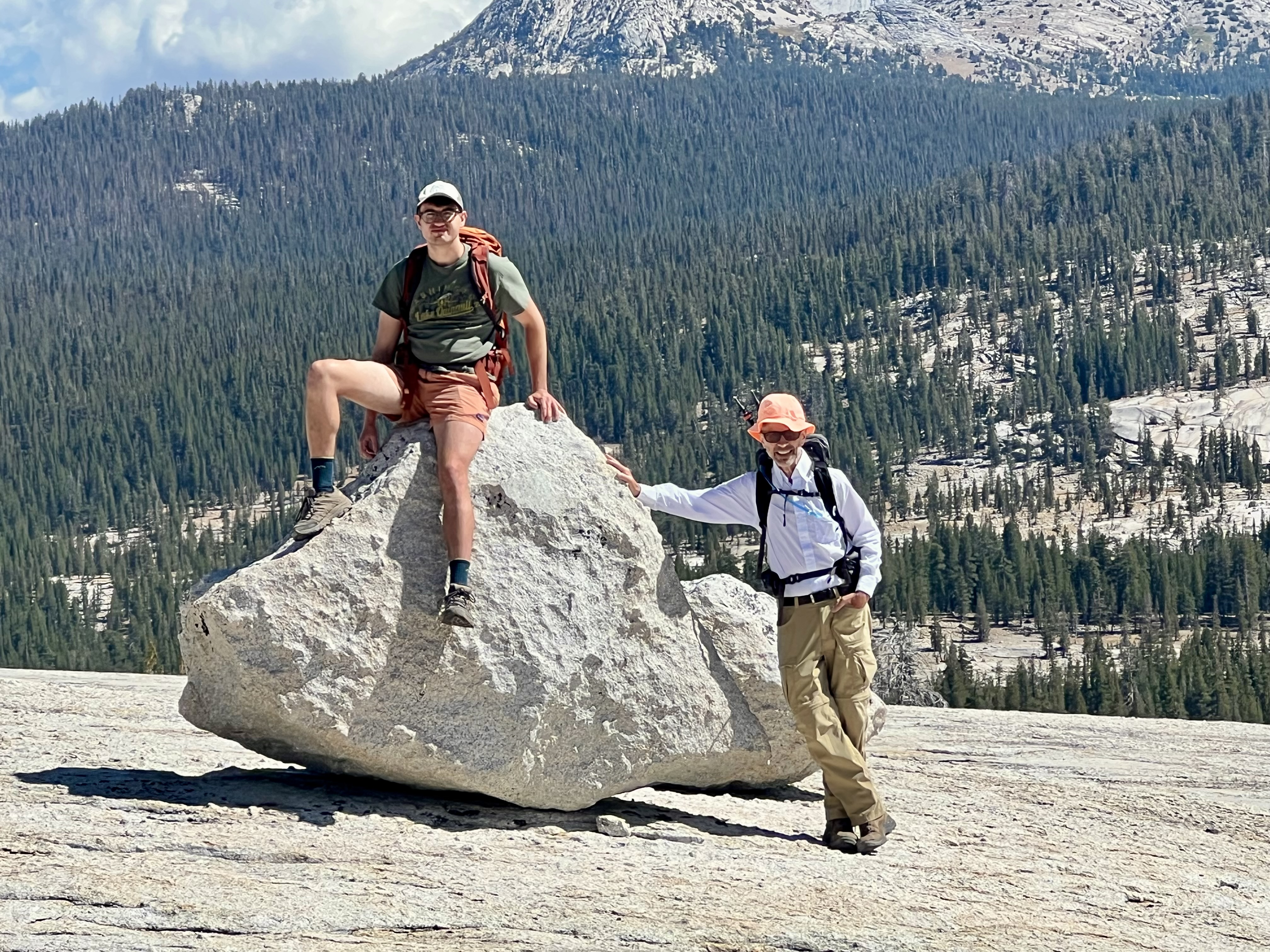
We started at Pothole Dome. Jim and Peter climbed the steep face of Pothole (as they do), I ambled around to the side and took a longer, but less exposed/steep route (as I do). We met at the top at 10:45 (it’s only about 250′ of climb).
Some shots:


At the top… (there is forever ambling up there… and other points that may be higher.. ):
With its view of the huge Tuolumne Meadow (just a snippet here) and the Tuolumne River wending its way to the canyon.


Here are a bunch of photos taken on the way down…


On this west side of the river, it’s a fisherman’s trail, not a hiking trail… so you’re up on the banks, sometimes boulder hopping, sometimes traversing giant granite slabs, climbing over downed trees, crossing meadows.. it’s never the same way twice.
Eventually you get to an area dubbed Devil’s Post Pile (not the one in Mammoth, but lots of basalt rock and definitely a different feel)… funnily, none of these show the basalt rock.. but it’s there.


We then reached the bridge, where the official Glen Aulen trail comes in. From here, it’s about a mile and a half down to the High Sierra Camp, and much steeper as the canyon narrows. From here, we’ll be on a portion of the Pacific Crest Trail, as it heads north towards Canada.

This is Tuolumne Falls, usually more dramatic, but very small in this pic. Still.. to stand there, it was plenty dramatic and thunderous.

Looking downriver…

Made it down, and had lunch at the camp, looking at White Cascade Falls… a relative trickle today. That’s one cute guy there.

After about an hour for lunch, we headed back up the trail.. (that’s the top of Tuolumne Falls in the distance):

After 4-ish miles, we got back up to where the river levels out and you see an always gorgeous view of the meadow…

Then a long amble back though a forest. In the past, we skirted most of this forest.. though it felt great to walk in deep shade and coolness.

We then reached an open part of the meadow and saw a sizeable herd of bucks — and some non-bucks, but mostly bucks (!) — bounding through the grass. Damn graceful, those.

The trail then routed us back and over a bit of Pothole… (returning this way was new for us).

And then back to the trailhead and a stunning view of a late afternoon meadow. Looking east, that’s Lembert Dome on the left.

We got back in time to shower and play a pub quiz in the lodge before dinner. The pub quizzes were a fun thing to have, if demoralizing. Dinner was with a solo hiker, Susan, 76, who’s completing the last snip of the 2,656 mile Pacific Crest Trail. Over a couple of decades, she’s been chipping away at it (says AI: Doing the PCT in sections over time is called section hiking, and it can also be referred to as a LASH, or Long Ass Section Hike). She’s got a 70-mile section left — from Tuolumne to the Sonora Pass, and will take 11 days to do that. She’s got champagne on board. She was very interesting. Also at our table was a father and son from SF, from whom we learned a lot about rent control apartments in the City.
Always a hoot.
